131:
25:
114:
90:
639:
161:
168:
138:
379:
297:. In total the glacier was 12.95 km (8.05 mi) long and 29.48 km (11.38 sq mi) in area in 1973. Its lower end is (or was) almost 400 metres lower than that of the neighbouring
406:
54:
399:
371:
365:
359:
684:
130:
392:
728:
703:
211:
723:
160:
76:
677:
415:
317:
327:
708:
204:
37:
47:
41:
33:
670:
96:(left hand in the background) and Unteraargletscher (on the right). The small blue lake left hand in front is the
552:
547:
360:
Carte du
Glacier inférieur de l'Aar, levée en 1842, d'après les directions de m.Agassiz par Jean Wild, Ingénieur
58:
265:
349:
464:
459:
718:
583:
113:
494:
89:
542:
654:
638:
593:
557:
337:
322:
298:
93:
588:
562:
384:
354:
650:
618:
613:
537:
514:
429:
282:
193:
713:
697:
474:
454:
286:
270:
578:
294:
278:
489:
469:
449:
434:
197:
304:
In the 18th and 19th centuries, it was one of the first subjects of developing
509:
499:
332:
305:
290:
226:
213:
504:
484:
444:
439:
646:
366:
Réseau trigonométrique de la carte du glacier inférieur de l'Aar (1847)
281:. It emerges from the association of the Finsteraargletscher (near the
289:) and flows for about 6 km (3.7 mi) to the east down to the
380:
Unteraargletscher in the
Topographic Atlas of Switzerland 1870–1922
479:
355:"Viatimages", Université de Lausanne/Bibliothéque nationale Suisse
88:
368:(Neuchâtel Public and University Library, cote: IGH Txt 129.6.3)
362:(Neuchâtel Public and University Library, cote: IGH Txt 129.6.3)
274:
388:
18:
374:(Neuchâtel Public and University Library, cote: BPUN Q 820 A)
658:
606:
571:
530:
523:
422:
242:
203:
189:
106:
46:but its sources remain unclear because it lacks
678:
400:
8:
273:", is the larger of the two sources of the
685:
671:
527:
407:
393:
385:
372:Carte du glacier inférieur de l'Aar (1844)
103:
167:
137:
77:Learn how and when to remove this message
285:) and the Lauteraargletscher (near the
416:Jungfrau-Aletsch (World Heritage Site)
264:
7:
635:
633:
657:. You can help Knowledge (XXG) by
14:
637:
350:Swiss glacier monitoring network
166:
159:
136:
129:
112:
23:
318:List of glaciers in Switzerland
729:Canton of Bern geography stubs
704:Glaciers of the canton of Bern
328:Retreat of glaciers since 1850
1:
266:[ˈʊntəraːrˌglɛtʃər]
745:
632:
724:Switzerland glacier stubs
250:
123:
118:Aerial view from the east
111:
32:This article includes a
150:Show map of Switzerland
61:more precise citations.
101:
16:Glacier in Switzerland
645:This article about a
465:Hinteres Fiescherhorn
92:
709:Glaciers of the Alps
460:Grosses Fiescherhorn
269:), literally "Lower
227:46.56667°N 8.21667°E
223: /
495:Grosses Wannenhorn
102:
34:list of references
666:
665:
627:
626:
602:
601:
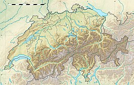
553:Upper Grindelwald
548:Lower Grindelwald
258:Unteraargletscher
254:
253:
232:46.56667; 8.21667
174:Unteraargletscher
144:Unteraargletscher
107:Unteraargletscher
87:
86:
79:
736:
687:
680:
673:
641:
634:
528:
409:
402:
395:
386:
323:List of glaciers
299:Oberaargletscher
268:
263:
238:
237:
235:
234:
233:
228:
224:
221:
220:
219:
216:
181:
180:Show map of Alps
170:
169:
163:
151:
140:
139:
133:
116:
104:
94:Oberaargletscher
82:
75:
71:
68:
62:
57:this article by
48:inline citations
27:
26:
19:
744:
743:
739:
738:
737:
735:
734:
733:
694:
693:
692:
691:
630:
628:
623:
598:
567:
519:
418:
413:
346:
314:
261:
231:
229:
225:
222:
217:
214:
212:
210:
209:
185:
184:
183:
182:
179:
178:
177:
176:
175:
171:
154:
153:
152:
149:
148:
147:
146:
145:
141:
119:
83:
72:
66:
63:
52:
38:related reading
28:
24:
17:
12:
11:
5:
742:
740:
732:
731:
726:
721:
716:
711:
706:
696:
695:
690:
689:
682:
675:
667:
664:
663:
651:canton of Bern
642:
625:
624:
622:
621:
616:
610:
608:
604:
603:
600:
599:
597:
596:
591:
586:
581:
575:
573:
569:
568:
566:
565:
560:
555:
550:
545:
540:
534:
532:
525:
521:
520:
518:
517:
512:
507:
502:
497:
492:
487:
482:
477:
472:
467:
462:
457:
452:
447:
442:
437:
432:
430:Finsteraarhorn
426:
424:
420:
419:
414:
412:
411:
404:
397:
389:
383:
382:
377:
376:
375:
369:
363:
352:
345:
344:External links
342:
341:
340:
335:
330:
325:
320:
313:
310:
283:Finsteraarhorn
252:
251:
248:
247:
244:
240:
239:
207:
201:
200:
191:
187:
186:
173:
172:
165:
164:
158:
157:
156:
155:
143:
142:
135:
134:
128:
127:
126:
125:
124:
121:
120:
117:
109:
108:
98:Triebtenseewli
85:
84:
42:external links
31:
29:
22:
15:
13:
10:
9:
6:
4:
3:
2:
741:
730:
727:
725:
722:
720:
717:
715:
712:
710:
707:
705:
702:
701:
699:
688:
683:
681:
676:
674:
669:
668:
662:
660:
656:
652:
648:
643:
640:
636:
631:
620:
617:
615:
612:
611:
609:
605:
595:
592:
590:
587:
585:
582:
580:
577:
576:
574:
570:
564:
561:
559:
556:
554:
551:
549:
546:
544:
541:
539:
536:
535:
533:
529:
526:
522:
516:
513:
511:
508:
506:
503:
501:
498:
496:
493:
491:
488:
486:
483:
481:
478:
476:
475:Gletscherhorn
473:
471:
468:
466:
463:
461:
458:
456:
455:Lauteraarhorn
453:
451:
448:
446:
443:
441:
438:
436:
433:
431:
428:
427:
425:
421:
417:
410:
405:
403:
398:
396:
391:
390:
387:
381:
378:
373:
370:
367:
364:
361:
358:
357:
356:
353:
351:
348:
347:
343:
339:
338:Rhône Glacier
336:
334:
331:
329:
326:
324:
321:
319:
316:
315:
311:
309:
307:
302:
300:
296:
292:
288:
287:Lauteraarhorn
284:
280:
277:river in the
276:
272:
267:
259:
249:
245:
241:
236:
208:
206:
202:
199:
195:
192:
188:
162:
132:
122:
115:
110:
105:
99:
95:
91:
81:
78:
70:
60:
56:
50:
49:
43:
39:
35:
30:
21:
20:
659:expanding it
644:
629:
303:
295:Grimsel Pass
279:Bernese Alps
271:Aare-Glacier
257:
255:
97:
73:
64:
53:Please help
45:
584:Oberaletsch
515:Blüemlisalp
490:Bietschhorn
450:Schreckhorn
435:Aletschhorn
230: /
205:Coordinates
198:Switzerland
59:introducing
719:Aare basin
698:Categories
572:South side
531:North side
510:Wetterhorn
500:Mittaghorn
333:Swiss Alps
306:glaciology
291:Grimselsee
614:Oeschinen
543:Tschingel
423:Mountains
293:near the
215:46°34′0″N
67:June 2018
619:Märjelen
594:Fiescher
558:Unteraar
524:Glaciers
505:Nesthorn
485:Ebnefluh
470:Grünhorn
440:Jungfrau
312:See also
218:8°13′0″E
190:Location
649:in the
647:glacier
589:Aletsch
563:Oberaar
262:German:
55:improve
538:Kander
243:Length
653:is a
607:Lakes
480:Eiger
445:Mönch
246:13 km
40:, or
714:Aare
655:stub
579:Lang
275:Aare
256:The
194:Bern
700::
308:.
301:.
196:,
44:,
36:,
686:e
679:t
672:v
661:.
408:e
401:t
394:v
260:(
100:.
80:)
74:(
69:)
65:(
51:.
Text is available under the Creative Commons Attribution-ShareAlike License. Additional terms may apply.