69:
105:
48:
1739:
373:
112:
76:
1772:
365:
415:
concerns in the 1960s led to fears that the bog could not survive as an isolated unit. It became clear that the wetlands and meadows surrounding the bog formed an essential element in the survival of the bog itself, as well as serving as a teaching tool for plant succession. In 1970 with widespread
515:
380:
During the 19th century Volo Bog was known to neighbors but not to outsiders. While the damp meadows surrounding the bog provided pasturage for a dairy farm, the bog itself was not economically used. The first field study mentioning Volo Bog was published by W.G. Waterman of
426:
Work since 1980 has concentrated on rebuilding and maintaining trails throughout the bog, increasing the accessibility of the bog and visitor center for persons with disabilities, and operating continuing ecology-education programs for adults and schoolchildren.
416:
local public support, the
University of Illinois transferred the bog to the Illinois Department of Natural Resources, and the state of Illinois began purchasing parcels of land surrounding the bog to create the current 1,150-acre (470 ha) park.
527:
334:. While the center of the bog remained a pool of open water, shallower sections of the sphagnum-moss cushion had begun to provide a substrate for the growth of woody plants, such as tamaracks and
404:, spearheaded the efforts to purchase Volo Bog for preservation. Under Mark's leadership, the Conservancy's Illinois chapter purchased the 47.5-acre (19.2 ha) bog and donated it to the
900:
765:
345:
A state-owned protective zone around the bog displays further stages of plant succession. The entire state park displays a microcosm of plant succession, from bog, through wetland, to
605:
879:
1483:
649:
1818:
750:
1823:
292:
The bog itself is 47.5 acres (19.2 ha) in size. It was originally a steep-sided lake created by the melting of a large chunk of glacial ice at the end of the
1616:
1473:
1458:
1393:
843:
1433:
1813:
1646:
1553:
1423:
1403:
1378:
1838:
1563:
1548:
1443:
1413:
740:
68:
446:
leads from the
Visitor Center into the bog itself. A 2.75-mile (4.43 km) ground trail circles through the wetlands and meadows surrounding the bog.
1568:
1528:
1523:
1498:
1488:
1408:
1353:
405:
408:
in 1958; this was the first land purchase made by the
Illinois Nature Conservancy. The university served as the bog's custodian from 1958 until 1970.
1573:
1518:
1438:
1428:
1373:
1368:
1363:
1358:
871:
598:
104:
1843:
1764:
1558:
1543:
1478:
1468:
1463:
1263:
557:
269:
216:
1503:
1493:
1333:
1323:
1318:
1313:
1175:
1107:
815:
715:
659:
622:
165:
1538:
1513:
1508:
967:
853:
805:
710:
644:
631:
1631:
1611:
1606:
1578:
1533:
1448:
1388:
1303:
1273:
1258:
735:
705:
1037:
1828:
1776:
1743:
1453:
1308:
755:
725:
591:
576:
268:
in
Illinois. The site also contains woodlands, savanna, marshes, prairie restoration areas, shrubland and old fields. Maintained by the
1833:
1720:
1712:
1671:
1621:
1588:
1418:
1343:
1228:
1167:
924:
760:
730:
700:
654:
614:
468:
1383:
1288:
1278:
1253:
1248:
1238:
783:
745:
1601:
1298:
1243:
1017:
957:
636:
498:
1808:
1656:
1636:
1072:
947:
884:
720:
664:
1398:
674:
1596:
1268:
1190:
1152:
37:
1293:
1142:
932:
516:"The Historical Roots of the Nature Conservancy in the Northwest Indiana/Chicagoland Region: From Science to Preservation"
1703:
1651:
1626:
1082:
1218:
1203:
1052:
861:
810:
1208:
1042:
987:
419:
Volo Bog was listed as a
National Natural Landmark in 1973. One of the wetland farm's original, circa-1900 dairy
1803:
1328:
1117:
1092:
1047:
1032:
1022:
894:
835:
261:
224:
1798:
1137:
1112:
1077:
1057:
1007:
982:
692:
463:
1689:
1213:
1132:
1127:
992:
962:
952:
682:
382:
293:
327:
trees. The development of a tamarack grove on the edge of the bog signaled further change in the wetland.
1750:
1198:
1122:
1067:
942:
937:
915:
889:
797:
793:
401:
300:
began to grow out into the water, playing a major role in the evolution of this geological feature from a
1157:
1147:
1012:
393:
135:
553:
1097:
1002:
972:
1102:
153:
1757:
1641:
1283:
977:
775:
281:
1087:
1062:
1027:
494:
331:
47:
572:
307:
As the sphagnum mat aged and thickened, the developing bog (already poorly drained) became
1684:
825:
277:
53:
1792:
297:
273:
143:
372:
1679:
820:
389:
335:
338:. The edges of the bog were further developing from a bog into a slightly drier
997:
316:
22:
583:
397:
346:
84:
180:
167:
443:
364:
324:
315:
levels encouraged the growth of other acid-loving plant species, such as
253:
139:
88:
1179:
412:
339:
320:
353:
439:
371:
363:
350:
423:
was renovated and reopened as the bog's visitor center in 1980.
420:
308:
301:
587:
265:
388:
As the 20th century moved forward, population growth in the
312:
376:
Pitcher plants visible from the boardwalk, taken July 2015
272:(Illinois DNR), the site is located about a mile west of
430:
A volunteer restoration team was formed in autumn 2023.
368:
The boardwalk trail through the tamarack zone to the bog
330:
By historic times Volo Bog was deep into the process of
438:
Volo Bog State
Natural Area currently offers two major
21:
Not to be confused with a bog of the same name near
1711:
1702:
1670:
1587:
1342:
1227:
1189:
1166:
923:
914:
870:
852:
834:
792:
774:
691:
673:
630:
621:
231:
222:
212:
204:
196:
159:
149:
131:
111:
91:
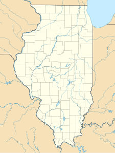
showing the location of Volo Bog State
Natural Area
75:
30:
464:"Welcome to the National Natural Landmark Program"
296:. About 6,000 years before the present, a mat of
400:, the first president of the Illinois chapter of
52:The open-water center of Volo Bog, surrounded by
119:Volo Bog State Natural Area (the United States)
844:List of National Natural Landmarks in Illinois
392:placed Volo Bog under threat from residential
599:
8:
1708:
920:
627:
606:
592:
584:
493:. Freeport, Maine: DeLorme Mapping. 1991.
27:
264:in 1973 as the only remaining open-water
1819:Protected areas of Lake County, Illinois
1765:Illinois Department of Natural Resources
558:Illinois Department of Natural Resources
270:Illinois Department of Natural Resources
217:Illinois Department of Natural Resources
1721:Local forest and conservation districts
455:
442:. An elevated 0.5-mile (0.80 km)
1824:National Natural Landmarks in Illinois
806:Abraham Lincoln National Heritage Area
1176:List of Illinois State Historic Sites
514:Smith, Stephanie; Steve Mark (2009).
230:
221:
7:
1771:
872:Wetlands of international importance
577:Illinois Nature Preserves Commission
411:Growth in public sensitivity toward
130:
1814:Protected areas established in 1970
895:Chiwaukee Illinois Beach Lake Plain
469:United States National Park Service
1839:Landforms of Lake County, Illinois
784:Midewin National Tallgrass Prairie
14:
1414:Horseshoe Lake (Alexander County)
650:Emmett Till and Mamie Till-Mobley
632:National Historic Sites and Parks
1770:
1738:
1737:
110:
103:
74:
67:
46:
40:V (protected landscape/seascape)
1844:1970 establishments in Illinois
854:National Wild and Scenic Rivers
203:
148:
225:U.S. National Natural Landmark
1:
554:"Volo Bog State Natural Area"
122:Show map of the United States
491:Illinois Atlas and Gazetteer
260:. The bog was designated a
256:, United States, preserving
1829:Nature reserves in Illinois
862:Middle Fork Vermilion River
811:Illinois and Michigan Canal
615:Protected areas of Illinois
250:Volo Bog State Natural Area
31:Volo Bog State Natural Area
16:State park in Illinois, USA
1860:
1834:Nature centers in Illinois
836:National Natural Landmarks
20:
1733:
880:Cache River-Cypress Creek
693:National Wildlife Refuges
262:National Natural Landmark
243:
239:
200:1,150 acres (470 ha)
61:
45:
35:
751:Middle Mississippi River
1809:State parks of Illinois
1484:Jim Edgar Panther Creek
897:(shared with Wisconsin)
766:Upper Mississippi River
520:The South Shore Journal
383:Northwestern University
294:Wisconsonian glaciation
252:is a nature reserve in
1647:Sand Prairie-Scrub Oak
1018:Hennepin Canal Parkway
890:Dixon Waterfowl Refuge
798:National Heritage Area
406:University of Illinois
402:The Nature Conservancy
377:
369:
319:, certain specialized
311:. The bog's changing
1617:Harry "Babe" Woodyard
1073:Mississippi Palisades
375:
367:
276:between the towns of
181:42.35167°N 88.18611°W
1182:World Heritage Site)
1168:State Historic Sites
94:Show map of Illinois
1589:State Natural Areas
1153:William G. Stratton
1038:James "Pate" Philip
885:The Emiquon Complex
213:Governing body
186:42.35167; -88.18611
177: /
154:Ingleside, Illinois
1642:Revis Hill Prairie
1632:Piney Creek Ravine
1612:Goose Lake Prairie
1607:Fults Hill Prairie
1284:North Point Marina
1264:Johnson-Sauk Trail
1143:White Pines Forest
776:National Grassland
378:
370:
282:Fox Lake, Illinois
1786:
1785:
1729:
1728:
1698:
1697:
1474:Mississippi River
1459:Mazonia/Braidwood
1394:Edward R. Madigan
1334:William W. Powers
1324:Wayne Fitzgerrell
1319:Washington County
1314:Stephen A. Forbes
1108:Rock Island Trail
1083:Morrison-Rockwood
910:
909:
901:Upper Mississippi
637:national monument
530:on April 16, 2013
323:, and coniferous
247:
246:
150:Nearest city
1851:
1804:Bogs of Illinois
1774:
1773:
1741:
1740:
1713:County Districts
1709:
1622:Illinois Caverns
1434:Kishwaukee River
1231:Recreation Areas
1148:Wildlife Prairie
1053:Lake Murphysboro
921:
660:New Philadelphia
628:
608:
601:
594:
585:
580:
568:
566:
564:
540:
539:
537:
535:
526:. Archived from
511:
505:
504:
487:
481:
480:
478:
476:
460:
332:plant succession
192:
191:
189:
188:
187:
182:
178:
175:
174:
173:
170:
123:
114:
113:
107:
95:
78:
77:
71:
50:
28:
1859:
1858:
1854:
1853:
1852:
1850:
1849:
1848:
1799:IUCN Category V
1789:
1788:
1787:
1782:
1725:
1694:
1666:
1652:Sielbeck Forest
1583:
1554:Snakeden Hollow
1424:Kaskaskia River
1419:Iroquois County
1404:Hamilton County
1379:Crawford County
1345:
1338:
1304:Randolph County
1274:Lake Le-Aqua-Na
1259:Golconda Marina
1230:
1223:
1185:
1162:
1043:Jubilee College
988:Donnelley/Depue
906:
866:
848:
830:
816:Lewis and Clark
794:National Trails
788:
770:
687:
675:National Forest
669:
645:Chicago Portage
634:
617:
612:
571:
562:
560:
552:
549:
544:
543:
533:
531:
513:
512:
508:
501:
489:
488:
484:
474:
472:
462:
461:
457:
452:
436:
362:
290:
227:
185:
183:
179:
176:
171:
168:
166:
164:
163:
127:
126:
125:
124:
121:
120:
117:
116:
115:
98:
97:
96:
93:
92:
81:
80:
79:
57:
41:
26:
17:
12:
11:
5:
1857:
1855:
1847:
1846:
1841:
1836:
1831:
1826:
1821:
1816:
1811:
1806:
1801:
1791:
1790:
1784:
1783:
1781:
1780:
1768:
1761:
1758:East St. Louis
1754:
1747:
1734:
1731:
1730:
1727:
1726:
1724:
1723:
1717:
1715:
1706:
1700:
1699:
1696:
1695:
1693:
1692:
1687:
1685:Trail of Tears
1682:
1676:
1674:
1668:
1667:
1665:
1664:
1659:
1654:
1649:
1644:
1639:
1634:
1629:
1624:
1619:
1614:
1609:
1604:
1602:Franklin Creek
1599:
1593:
1591:
1585:
1584:
1582:
1581:
1576:
1571:
1566:
1564:Ten Mile Creek
1561:
1556:
1551:
1549:Silver Springs
1546:
1541:
1536:
1531:
1526:
1521:
1516:
1511:
1506:
1501:
1496:
1491:
1486:
1481:
1476:
1471:
1466:
1461:
1456:
1451:
1446:
1444:Mackinaw River
1441:
1436:
1431:
1426:
1421:
1416:
1411:
1406:
1401:
1396:
1391:
1386:
1381:
1376:
1371:
1366:
1361:
1356:
1350:
1348:
1346:Wildlife Areas
1344:State Fish and
1340:
1339:
1337:
1336:
1331:
1329:Weldon Springs
1326:
1321:
1316:
1311:
1309:Sangchris Lake
1306:
1301:
1296:
1291:
1286:
1281:
1276:
1271:
1266:
1261:
1256:
1251:
1246:
1241:
1235:
1233:
1225:
1224:
1222:
1221:
1219:Trail of Tears
1216:
1211:
1206:
1204:Hidden Springs
1201:
1195:
1193:
1187:
1186:
1184:
1183:
1172:
1170:
1164:
1163:
1161:
1160:
1155:
1150:
1145:
1140:
1135:
1130:
1125:
1120:
1118:Siloam Springs
1115:
1110:
1105:
1100:
1095:
1093:Pere Marquette
1090:
1085:
1080:
1075:
1070:
1065:
1060:
1055:
1050:
1048:Kankakee River
1045:
1040:
1035:
1033:Illinois Beach
1030:
1025:
1023:Horseshoe Lake
1020:
1015:
1010:
1005:
1000:
995:
990:
985:
980:
975:
970:
965:
960:
955:
950:
945:
940:
935:
929:
927:
918:
912:
911:
908:
907:
905:
904:
898:
892:
887:
882:
876:
874:
868:
867:
865:
864:
858:
856:
850:
849:
847:
846:
840:
838:
832:
831:
829:
828:
826:Trail of Tears
823:
821:Mormon Pioneer
818:
813:
808:
802:
800:
790:
789:
787:
786:
780:
778:
772:
771:
769:
768:
763:
758:
753:
748:
743:
738:
733:
728:
723:
718:
716:Driftless Area
713:
708:
703:
697:
695:
689:
688:
686:
685:
679:
677:
671:
670:
668:
667:
662:
657:
652:
647:
641:
639:
625:
619:
618:
613:
611:
610:
603:
596:
588:
582:
581:
569:
548:
547:External links
545:
542:
541:
506:
499:
482:
454:
453:
451:
448:
435:
432:
361:
358:
289:
286:
245:
244:
241:
240:
237:
236:
233:
229:
228:
223:
220:
219:
214:
210:
209:
206:
202:
201:
198:
194:
193:
161:
157:
156:
151:
147:
146:
133:
129:
128:
118:
109:
108:
102:
101:
100:
99:
82:
73:
72:
66:
65:
64:
63:
62:
59:
58:
51:
43:
42:
36:
33:
32:
15:
13:
10:
9:
6:
4:
3:
2:
1856:
1845:
1842:
1840:
1837:
1835:
1832:
1830:
1827:
1825:
1822:
1820:
1817:
1815:
1812:
1810:
1807:
1805:
1802:
1800:
1797:
1796:
1794:
1779:
1778:
1769:
1767:
1766:
1762:
1760:
1759:
1755:
1753:
1752:
1748:
1746:
1745:
1736:
1735:
1732:
1722:
1719:
1718:
1716:
1714:
1710:
1707:
1705:
1701:
1691:
1688:
1686:
1683:
1681:
1678:
1677:
1675:
1673:
1669:
1663:
1660:
1658:
1657:Spitler Woods
1655:
1653:
1650:
1648:
1645:
1643:
1640:
1638:
1637:Prairie Ridge
1635:
1633:
1630:
1628:
1625:
1623:
1620:
1618:
1615:
1613:
1610:
1608:
1605:
1603:
1600:
1598:
1595:
1594:
1592:
1590:
1586:
1580:
1577:
1575:
1572:
1570:
1569:Turkey Bluffs
1567:
1565:
1562:
1560:
1557:
1555:
1552:
1550:
1547:
1545:
1542:
1540:
1537:
1535:
1532:
1530:
1529:Sam Dale Lake
1527:
1525:
1524:Saline County
1522:
1520:
1517:
1515:
1512:
1510:
1507:
1505:
1502:
1500:
1499:Powerton Lake
1497:
1495:
1492:
1490:
1489:Peabody River
1487:
1485:
1482:
1480:
1477:
1475:
1472:
1470:
1467:
1465:
1462:
1460:
1457:
1455:
1452:
1450:
1447:
1445:
1442:
1440:
1437:
1435:
1432:
1430:
1427:
1425:
1422:
1420:
1417:
1415:
1412:
1410:
1409:Heidecke Lake
1407:
1405:
1402:
1400:
1397:
1395:
1392:
1390:
1387:
1385:
1382:
1380:
1377:
1375:
1372:
1370:
1367:
1365:
1362:
1360:
1357:
1355:
1354:Anderson Lake
1352:
1351:
1349:
1347:
1341:
1335:
1332:
1330:
1327:
1325:
1322:
1320:
1317:
1315:
1312:
1310:
1307:
1305:
1302:
1300:
1297:
1295:
1292:
1290:
1287:
1285:
1282:
1280:
1277:
1275:
1272:
1270:
1267:
1265:
1262:
1260:
1257:
1255:
1252:
1250:
1247:
1245:
1242:
1240:
1237:
1236:
1234:
1232:
1226:
1220:
1217:
1215:
1212:
1210:
1209:Lowden-Miller
1207:
1205:
1202:
1200:
1197:
1196:
1194:
1192:
1191:State Forests
1188:
1181:
1177:
1174:
1173:
1171:
1169:
1165:
1159:
1156:
1154:
1151:
1149:
1146:
1144:
1141:
1139:
1138:Weinberg-King
1136:
1134:
1131:
1129:
1126:
1124:
1121:
1119:
1116:
1114:
1113:Shabbona Lake
1111:
1109:
1106:
1104:
1101:
1099:
1096:
1094:
1091:
1089:
1086:
1084:
1081:
1079:
1078:Moraine Hills
1076:
1074:
1071:
1069:
1066:
1064:
1061:
1059:
1058:Lincoln Trail
1056:
1054:
1051:
1049:
1046:
1044:
1041:
1039:
1036:
1034:
1031:
1029:
1026:
1024:
1021:
1019:
1016:
1014:
1011:
1009:
1008:Gebhard Woods
1006:
1004:
1001:
999:
996:
994:
991:
989:
986:
984:
983:Dixon Springs
981:
979:
976:
974:
971:
969:
968:Chain O'Lakes
966:
964:
961:
959:
956:
954:
951:
949:
946:
944:
941:
939:
936:
934:
931:
930:
928:
926:
922:
919:
917:
913:
902:
899:
896:
893:
891:
888:
886:
883:
881:
878:
877:
875:
873:
869:
863:
860:
859:
857:
855:
851:
845:
842:
841:
839:
837:
833:
827:
824:
822:
819:
817:
814:
812:
809:
807:
804:
803:
801:
799:
795:
791:
785:
782:
781:
779:
777:
773:
767:
764:
762:
759:
757:
754:
752:
749:
747:
744:
742:
739:
737:
734:
732:
729:
727:
724:
722:
719:
717:
714:
712:
711:Cypress Creek
709:
707:
704:
702:
699:
698:
696:
694:
690:
684:
681:
680:
678:
676:
672:
666:
663:
661:
658:
656:
653:
651:
648:
646:
643:
642:
640:
638:
633:
629:
626:
624:
620:
616:
609:
604:
602:
597:
595:
590:
589:
586:
578:
574:
570:
559:
555:
551:
550:
546:
529:
525:
521:
517:
510:
507:
502:
500:0-89933-213-7
496:
492:
486:
483:
471:
470:
465:
459:
456:
449:
447:
445:
441:
433:
431:
428:
424:
422:
417:
414:
409:
407:
403:
399:
395:
391:
386:
384:
374:
366:
359:
357:
355:
352:
348:
343:
341:
337:
333:
328:
326:
322:
318:
314:
310:
305:
303:
299:
298:sphagnum moss
295:
287:
285:
283:
279:
275:
274:U.S. Route 12
271:
267:
263:
259:
255:
251:
242:
238:
234:
226:
218:
215:
211:
207:
199:
195:
190:
162:
158:
155:
152:
145:
141:
137:
134:
106:
90:
86:
70:
60:
55:
49:
44:
39:
38:IUCN category
34:
29:
24:
19:
1775:
1763:
1756:
1749:
1742:
1680:Mormon Trail
1672:State Trails
1661:
1574:Union County
1519:Sahara Woods
1439:LaSalle Lake
1429:Kinkaid Lake
1374:Coffeen Lake
1369:Carlyle Lake
1364:Banner Marsh
1359:Baldwin Lake
1289:Prophetstown
1279:Moraine View
1254:Frank Holten
1249:Eldon Hazlet
1239:Clinton Lake
1178:(including,
1133:Walnut Point
1128:Starved Rock
993:Ferne Clyffe
963:Cave-in-Rock
953:Buffalo Rock
706:Crab Orchard
655:Lincoln Home
563:February 17,
561:. Retrieved
532:. Retrieved
528:the original
523:
519:
509:
490:
485:
473:. Retrieved
467:
458:
437:
429:
425:
418:
410:
390:Chicago area
387:
379:
344:
336:poison sumac
329:
306:
304:into a bog.
291:
257:
249:
248:
18:
1690:Tunnel Hill
1597:Cache River
1559:Spring Lake
1544:Shelbyville
1479:Newton Lake
1469:Middle Fork
1464:Mermet Lake
1399:Green River
1384:Des Plaines
1299:Ramsey Lake
1244:Eagle Creek
1123:South Shore
1068:Matthiessen
998:Fort Massac
958:Castle Rock
943:Beall Woods
938:Argyle Lake
933:Apple River
925:State Parks
756:Port Louisa
726:Great River
394:development
360:Bog history
317:leatherleaf
288:Bog biology
266:quaking bog
205:Established
184: /
160:Coordinates
136:Lake County
83:Map of the
23:Pinhook Bog
1793:Categories
1504:Ray Norbut
1494:Pekin Lake
1214:Sand Ridge
1158:Wolf Creek
1013:Giant City
948:Beaver Dam
761:Two Rivers
741:Mark Twain
731:Hackmatack
701:Chautauqua
573:"Volo Bog"
450:References
434:Recreation
413:ecological
398:Cyrus Mark
232:Designated
172:88°11′10″W
169:42°21′06″N
85:U.S. state
25:, Indiana.
1627:Kidd Lake
1539:Sanganois
1514:Rice Lake
1509:Rend Lake
1199:Big River
1098:Red Hills
1003:Fox Ridge
973:Channahon
746:Meredosia
534:April 16,
444:boardwalk
385:in 1921.
1744:Category
1662:Volo Bog
1579:Woodford
1534:Sam Parr
1449:Marshall
1389:Double T
1269:Kickapoo
1103:Rock Cut
903:(shared)
736:Kankakee
475:June 18,
325:tamarack
258:Volo Bog
254:Illinois
140:Illinois
132:Location
89:Illinois
54:tamarack
1777:Commons
1751:Chicago
1454:Mautino
1294:Pyramid
1180:Cahokia
978:Delabar
721:Emiquon
683:Shawnee
665:Pullman
623:Federal
340:wetland
321:orchids
1088:Nauvoo
1063:Lowden
1028:Illini
497:
440:trails
354:meadow
309:acidic
1704:Local
1229:State
916:State
421:barns
351:grass
347:sedge
56:trees
635:and
565:2024
536:2013
495:ISBN
477:2009
302:lake
280:and
278:Volo
235:1972
208:1970
197:Area
396:.
144:USA
87:of
1795::
575:.
556:.
522:.
518:.
466:.
356:.
342:.
313:pH
284:.
142:,
138:,
796:/
607:e
600:t
593:v
579:.
567:.
538:.
524:3
503:.
479:.
349:-
Text is available under the Creative Commons Attribution-ShareAlike License. Additional terms may apply.