44:
416:
435:. There were 426 households, comprising 666 males and 669 females, giving a sex ratio of 1.0 males per female. The median age was 40.4 years (compared with 37.4 years nationally), with 294 people (22.0%) aged under 15 years, 216 (16.1%) aged 15 to 29, 660 (49.3%) aged 30 to 64, and 165 (12.3%) aged 65 or older.
448:
Of those at least 15 years old, 234 (22.4%) people had a bachelor's or higher degree, and 135 (12.9%) people had no formal qualifications. The median income was $ 45,400, compared with $ 31,800 nationally. 312 people (29.9%) earned over $ 70,000 compared to 17.2% nationally. The employment status of
343:
The
Waimauku Dairy Factory was established in 1909, specialising in collecting cream from the surrounding areas. By 1951 it was converted into a bulk receiving station for cream, and closed in 1956. In 1921, St Martin's Church was established at Waimauku.
287:
for a one-year trial period commencing in July 2008. This service would include a stop at
Waimauku. A new station platform was built at Waimauku and the service commenced on 14 July 2008. The service ceased in 2009, and the platform is currently unused.
1085:
444:
Although some people chose not to answer the census's question about religious affiliation, 61.0% had no religion, 30.5% were
Christian, 1.1% were Hindu, 0.4% were Buddhist and 1.3% had other religions.
1078:
423:
Before the 2023 census, Waimauku had a significantly larger boundary, covering 5.63 km (2.17 sq mi). Using that boundary, Waimauku had a population of 1,338 at the
1071:
1453:
438:
Ethnicities were 93.7% European/Pākehā, 11.0% Māori, 3.4% Pacific peoples, 4.5% Asian, and 1.8% other ethnicities. People may identify with more than one ethnicity.
1458:
724:
352:
Waimauku covers 1.44 km (0.56 sq mi) and had an estimated population of 1,330 as of June 2023, with a population density of 924 people per km.
763:
920:
1042:
823:
61:
1463:
1023:
642:
617:
555:
449:
those at least 15 was that 588 (56.3%) people were employed full-time, 174 (16.7%) were part-time, and 18 (1.7%) were unemployed.
1448:
1298:
877:
103:
1353:
507:
697:
234:
1335:
458:
1342:
1329:
1303:
977:
526:
Waimauku School is a coeducational full primary (years 1-8) school with a roll of 709 students as at August 2024.
1157:
1095:
865:
276:
284:
93:
1278:
676:
998:
1392:
1058:
432:
428:
424:
280:
583:
1426:
1152:
759:
702:
681:
587:
515:
1358:
1348:
925:
43:
755:
492:
325:
149:
1063:
1268:
301:
264:
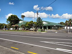
Formerly a farming and fruit-growing community, the area around
Waimauku now features a number of
1379:
1192:
485:
128:
1293:
1208:
462:
329:
831:
1228:
1038:
1019:
945:
873:
804:
638:
613:
1374:
1288:
1283:
1273:
1177:
796:
222:
172:
1409:
1308:
1253:
1218:
729:
530:
218:
108:
317:
246:
1258:
1238:
1233:
1213:
154:
1442:
1248:
1223:
320:
since at least 1400AD. Early tribal identities of the people who lived here included
313:
297:
1243:
800:
441:
The percentage of people born overseas was 22.0, compared with 27.1% nationally.
1384:
1263:
1167:
1132:
1122:
1103:
511:
481:
242:
226:
118:
17:
1324:
787:
Bellwood, Peter (1972). "Excavations at
Otakanini Pa, South Kaipara Harbour".
469:
333:
321:
269:
808:
76:
63:
1182:
1137:
1099:
1187:
1162:
1147:
1142:
465:
369:
337:
238:
504:
1127:
1117:
265:
230:
415:
332:. By the early 18th century, the major power in the area had become
414:
510:
zone. The business association which represents businesses from
484:
of
Auckland Council and is part of the Kumeu Subdivision of the
258:
1067:
578:
576:
959:
725:"Calls for rail to ease congestion in Auckland's north-west"
364:
1016:
Doing It
Themselves: the Story of Kumeu, Huapai and Taupaki
300:
near the modern settlement, and how when they flooded only
937:
1037:(4th ed.). Auckland: Longley Printing Company Ltd.
923:. Statistics New Zealand. March 2020. Waimauku (114200).
666:
Auckland
Regional Council Summary Draft Plan 2008/2009
1418:
1402:
1367:
1317:
1201:
1110:
758:; The Trustees of Te Kawerau Iwi Settlement Trust;
221:of New Zealand. It comes under the jurisdiction of
204:
196:
191:
183:
178:
168:
163:
142:
134:
124:
114:
102:
92:
34:
677:"Commuter train services to resume to Helensville"
431:, and an increase of 324 people (32.0%) since the
495:electorate. (Previously Helensville electorate.)
229:. Waimauku is approximately 4 kilometres west of
657:Wises New Zealand Guide, 7th Edition 1979. p.475
245:is 16 km to the north-west. Waimauku is a
764:"Te Kawerau ā Maki Deed of Settlement Schedule"
915:
913:
457:The local Reweti Marae is affiliated with the
427:, an increase of 165 people (14.1%) since the
1079:
872:. Auckland University Press. pp. 36–45.
296:The name Waimauku describes the banks of the
8:
921:"Statistical area 1 dataset for 2018 Census"
750:
748:
355:
789:Journal of the Royal Society of New Zealand
1086:
1072:
1064:
354:
31:
852:
480:Waimauku is part of the Local Government
472:. It features Whiti te Rā meeting house.
904:
892:
1454:Populated places in the Auckland Region
542:
190:
177:
162:
141:
91:
56:
52:
40:
584:"Population estimate tables - NZ.Stat"
550:
548:
546:
249:word which is literally translated as
1459:Populated places on the Kaipara River
1343:Helensville railway station (defunct)
824:"Pre-European History - Ngati Whatua"
203:
195:
182:
167:
133:
123:
113:
101:
7:
980:. New Zealand Ministry of Education
926:2018 Census place summary: Waimauku
635:The Geographic Atlas of New Zealand
283:rail services would be extended to
187:1.44 km (0.56 sq mi)
696:Dearnaley, Mathew (14 July 2008).
304:(cabbage trees) would be visible.
169: • Territorial Authority
25:
1393:Rodney District Council (defunct)
1336:Kumeu–Riverhead Section (defunct)
999:Education Counts: Waimauku School
870:From Tamaki-makau-rau to Auckland
237:at the junction with the road to
42:
1299:Te Korowai-o-Te-Tonga Peninsula
978:"New Zealand Schools Directory"
633:Roger Smith, GeographX (2005).
268:and an increasing suburban and
801:10.1080/03036758.1972.10421818
529:The local secondary school is
29:Place in Auckland, New Zealand
1:
698:"New commuter train services"
508:business improvement district
1354:Te Rau Pūriri Regional Park
1018:. Huapai-Kumeu Lions Club.
966:. Te Potiki National Trust.
938:"Te Kāhui Māngai directory"
608:Peter Dowling, ed. (2004).
217:is a small locality in the
1480:
1464:West Auckland, New Zealand
1330:Goldie Bush Scenic Reserve
1318:Facilities and attractions
1014:Dunsford, Deborah (2002).
822:Kawharu, Margaret (2007).
225:, and is in the council's
1033:Sheffield, C. M. (2011).
637:. Robbie Burton. map 34.
408:
382:—
316:area has been settled by
277:Auckland Regional Council
208:920/km (2,400/sq mi)
57:
53:
41:
556:"ArcGIS Web Application"
419:Waimauku Railway Station
1449:Rodney Local Board Area
1304:Upper Waitematā Harbour
1059:Waimauku School website
560:statsnz.maps.arcgis.com
503:The township is in the
425:2018 New Zealand census
279:announced in 2007 that
1427:Veronica jovellanoides
703:The New Zealand Herald
682:The New Zealand Herald
612:. Reed Books. map 11.
610:Reed New Zealand Atlas
588:Statistics New Zealand
505:North West Country Inc
459:Ngāti Whātua o Kaipara
420:
77:36.76861°S 174.49333°E
1359:West Auckland Airport
1349:Muriwai Regional Park
418:
356:Historical population
257:: varieties of small
1094:Kumeū Subdivision –
762:(22 February 2014).
493:Kaipara ki Mahurangi
205: • Density
150:Kaipara ki Mahurangi
82:-36.76861; 174.49333
1202:Geographic features
895:, pp. 241–242.
733:. 27 September 2016
491:Waimauku is in the
357:
73: /
1380:Rodney Local Board
1279:Ōpāhekeheke Island
834:on 6 February 2021
828:Helensville Museum
486:Rodney Local Board
421:
197: • Total
184: • Total
129:Rodney Local Board
1436:
1435:
1229:Kaukapakapa River
1044:978-0-473-18059-1
1035:Men Came Voyaging
855:, pp. 25–26.
756:Te Kawerau ā Maki
413:
412:
340:of Ngāti Whātua.
326:Te Kawerau ā Maki
270:lifestyle farming
212:
211:
138:Kumeū subdivision
16:(Redirected from
1471:
1419:Related articles
1375:Auckland Council
1289:Riverhead Forest
1284:Ourauwhare River
1269:Ōkiritoto Stream
1178:Waikoukou Valley
1111:Populated places
1088:
1081:
1074:
1065:
1048:
1029:
1001:
996:
990:
989:
987:
985:
974:
968:
967:
956:
950:
949:
934:
928:
924:
917:
908:
902:
896:
890:
884:
883:
862:
856:
850:
844:
843:
841:
839:
830:. Archived from
819:
813:
812:
784:
778:
777:
775:
773:
768:
752:
743:
742:
740:
738:
721:
715:
714:
712:
710:
693:
687:
686:
673:
667:
664:
658:
655:
649:
648:
630:
624:
623:
605:
599:
598:
596:
594:
580:
571:
570:
568:
566:
552:
371:
366:
358:
235:State Highway 16
223:Auckland Council
173:Auckland Council
88:
87:
85:
84:
83:
78:
74:
71:
70:
69:
66:
46:
32:
21:
1479:
1478:
1474:
1473:
1472:
1470:
1469:
1468:
1439:
1438:
1437:
1432:
1414:
1410:Kaipara College
1398:
1363:
1313:
1309:Woodhill Forest
1294:Tāhekeroa River
1254:Moturemu Island
1219:Kaipara Harbour
1209:Arapārera River
1197:
1106:
1092:
1055:
1045:
1032:
1026:
1013:
1010:
1005:
1004:
997:
993:
983:
981:
976:
975:
971:
958:
957:
953:
936:
935:
931:
919:
918:
911:
903:
899:
891:
887:
880:
866:Stone, R. C. J.
864:
863:
859:
851:
847:
837:
835:
821:
820:
816:
786:
785:
781:
771:
769:
766:
754:
753:
746:
736:
734:
723:
722:
718:
708:
706:
695:
694:
690:
685:. 27 June 2007.
675:
674:
670:
665:
661:
656:
652:
645:
632:
631:
627:
620:
607:
606:
602:
592:
590:
582:
581:
574:
564:
562:
554:
553:
544:
539:
531:Kaipara College
524:
501:
478:
455:
350:
310:
294:
219:Auckland Region
159:
125:Community board
81:
79:
75:
72:
67:
64:
62:
60:
59:
49:
48:Waimauku School
37:
30:
23:
22:
18:Waimauku School
15:
12:
11:
5:
1477:
1475:
1467:
1466:
1461:
1456:
1451:
1441:
1440:
1434:
1433:
1431:
1430:
1422:
1420:
1416:
1415:
1413:
1412:
1406:
1404:
1400:
1399:
1397:
1396:
1389:
1388:
1387:
1382:
1371:
1369:
1365:
1364:
1362:
1361:
1356:
1351:
1346:
1339:
1332:
1327:
1321:
1319:
1315:
1314:
1312:
1311:
1306:
1301:
1296:
1291:
1286:
1281:
1276:
1271:
1266:
1261:
1259:Mount Auckland
1256:
1251:
1246:
1241:
1239:Lake Kuwakatai
1236:
1231:
1226:
1221:
1216:
1211:
1205:
1203:
1199:
1198:
1196:
1195:
1190:
1185:
1180:
1175:
1170:
1165:
1160:
1155:
1150:
1145:
1140:
1135:
1130:
1125:
1120:
1114:
1112:
1108:
1107:
1093:
1091:
1090:
1083:
1076:
1068:
1062:
1061:
1054:
1053:External links
1051:
1050:
1049:
1043:
1030:
1024:
1009:
1006:
1003:
1002:
991:
969:
951:
946:Te Puni Kōkiri
929:
909:
907:, pp. 91.
897:
885:
878:
857:
853:Sheffield 2011
845:
814:
795:(3): 259–291.
779:
744:
716:
688:
668:
659:
650:
643:
625:
618:
600:
572:
541:
540:
538:
535:
523:
520:
500:
497:
477:
474:
454:
451:
411:
410:
406:
405:
402:
399:
395:
394:
391:
388:
384:
383:
380:
377:
373:
372:
367:
362:
349:
346:
309:
306:
293:
290:
210:
209:
206:
202:
201:
198:
194:
193:
189:
188:
185:
181:
180:
176:
175:
170:
166:
165:
161:
160:
158:
157:
155:Te Tai Tokerau
152:
146:
144:
140:
139:
136:
132:
131:
126:
122:
121:
116:
112:
111:
106:
100:
99:
96:
90:
89:
55:
54:
51:
50:
47:
39:
38:
35:
28:
24:
14:
13:
10:
9:
6:
4:
3:
2:
1476:
1465:
1462:
1460:
1457:
1455:
1452:
1450:
1447:
1446:
1444:
1429:
1428:
1424:
1423:
1421:
1417:
1411:
1408:
1407:
1405:
1403:Organisations
1401:
1395:
1394:
1390:
1386:
1383:
1381:
1378:
1377:
1376:
1373:
1372:
1370:
1366:
1360:
1357:
1355:
1352:
1350:
1347:
1345:
1344:
1340:
1338:
1337:
1333:
1331:
1328:
1326:
1323:
1322:
1320:
1316:
1310:
1307:
1305:
1302:
1300:
1297:
1295:
1292:
1290:
1287:
1285:
1282:
1280:
1277:
1275:
1274:Ōmaumau River
1272:
1270:
1267:
1265:
1262:
1260:
1257:
1255:
1252:
1250:
1249:Makarau River
1247:
1245:
1242:
1240:
1237:
1235:
1232:
1230:
1227:
1225:
1224:Kaipara River
1222:
1220:
1217:
1215:
1212:
1210:
1207:
1206:
1204:
1200:
1194:
1191:
1189:
1186:
1184:
1181:
1179:
1176:
1174:
1171:
1169:
1166:
1164:
1161:
1159:
1156:
1154:
1151:
1149:
1146:
1144:
1141:
1139:
1136:
1134:
1131:
1129:
1126:
1124:
1121:
1119:
1116:
1115:
1113:
1109:
1105:
1101:
1097:
1089:
1084:
1082:
1077:
1075:
1070:
1069:
1066:
1060:
1057:
1056:
1052:
1046:
1040:
1036:
1031:
1027:
1025:0-473-08969-6
1021:
1017:
1012:
1011:
1007:
1000:
995:
992:
979:
973:
970:
965:
964:maorimaps.com
961:
955:
952:
947:
943:
939:
933:
930:
927:
922:
916:
914:
910:
906:
905:Dunsford 2002
901:
898:
894:
893:Dunsford 2002
889:
886:
881:
875:
871:
867:
861:
858:
854:
849:
846:
833:
829:
825:
818:
815:
810:
806:
802:
798:
794:
790:
783:
780:
765:
761:
757:
751:
749:
745:
732:
731:
726:
720:
717:
705:
704:
699:
692:
689:
684:
683:
678:
672:
669:
663:
660:
654:
651:
646:
644:1-877333-20-4
640:
636:
629:
626:
621:
619:0-7900-0952-8
615:
611:
604:
601:
589:
585:
579:
577:
573:
561:
557:
551:
549:
547:
543:
536:
534:
532:
527:
521:
519:
517:
513:
509:
506:
498:
496:
494:
489:
487:
483:
475:
473:
471:
467:
464:
460:
452:
450:
446:
442:
439:
436:
434:
430:
426:
417:
407:
403:
400:
397:
396:
392:
389:
386:
385:
381:
378:
375:
374:
368:
363:
360:
359:
353:
347:
345:
341:
339:
336:, a distinct
335:
331:
327:
324:, Ngāti Awa,
323:
319:
315:
314:Kaipara River
307:
305:
303:
299:
298:Kaipara River
291:
289:
286:
282:
278:
273:
271:
267:
262:
260:
256:
253:: stream and
252:
248:
244:
240:
239:Muriwai Beach
236:
232:
228:
224:
220:
216:
207:
199:
186:
174:
171:
156:
153:
151:
148:
147:
145:
137:
130:
127:
120:
117:
110:
107:
105:
97:
95:
86:
58:Coordinates:
45:
33:
27:
19:
1425:
1391:
1341:
1334:
1244:Lake Rototoa
1172:
1158:Shelly Beach
1034:
1015:
1008:Bibliography
994:
984:17 September
982:. Retrieved
972:
963:
960:"Māori Maps"
954:
941:
932:
900:
888:
869:
860:
848:
836:. Retrieved
832:the original
827:
817:
792:
788:
782:
770:. Retrieved
735:. Retrieved
728:
719:
707:. Retrieved
701:
691:
680:
671:
662:
653:
634:
628:
609:
603:
591:. Retrieved
563:. Retrieved
559:
528:
525:
502:
490:
479:
463:Ngāti Whātua
456:
447:
443:
440:
437:
422:
351:
348:Demographics
342:
330:Ngāti Whātua
311:
295:
281:Western Line
274:
272:population.
263:
254:
250:
214:
213:
26:
1385:Rodney ward
1264:Oaia Island
1234:Kumeū River
1214:Hōteo River
1168:Waipatukahu
1133:Kaukapakapa
1123:Helensville
1104:New Zealand
942:tkm.govt.nz
737:11 November
512:Kaukapakapa
482:Rodney Ward
433:2006 census
429:2013 census
285:Helensville
243:Helensville
227:Rodney ward
143:Electorates
135:Subdivision
119:Rodney ward
98:New Zealand
80: /
68:174°29′36″E
1443:Categories
1368:Government
1325:Gibbs Farm
879:1869402596
838:22 January
593:25 October
537:References
476:Governance
312:The wider
192:Population
164:Government
1153:Riverhead
809:0303-6758
760:The Crown
522:Education
516:Riverhead
292:Etymology
65:36°46′7″S
1193:Woodhill
1183:Waioneke
1173:Waimauku
1100:Auckland
868:(2001).
565:28 March
409:Source:
302:tī mauku
266:wineries
215:Waimauku
109:Auckland
36:Waimauku
1188:Waitoki
1163:Taupaki
1148:Parakai
1143:Muriwai
709:14 July
499:Economy
470:Te Taoū
370:±% p.a.
334:Te Taoū
322:Ngā Oho
308:History
94:Country
1128:Huapai
1118:Glorit
1096:Rodney
1041:
1022:
876:
807:
772:10 May
641:
616:
404:+2.67%
393:+2.10%
231:Huapai
104:Region
1138:Kumeū
767:(PDF)
730:Stuff
453:Marae
401:1,338
390:1,173
379:1,014
318:Māori
259:ferns
255:mauku
247:Māori
200:1,330
1039:ISBN
1020:ISBN
986:2024
874:ISBN
840:2024
805:ISSN
774:2022
739:2018
711:2008
639:ISBN
614:ISBN
595:2023
567:2024
466:hapū
461:and
398:2018
387:2013
376:2006
365:Pop.
361:Year
338:hapū
328:and
275:The
179:Area
115:Ward
797:doi
514:to
468:of
251:wai
233:on
1445::
1102:,
1098:,
962:.
944:.
940:.
912:^
826:.
803:.
791:.
747:^
727:.
700:.
679:.
586:.
575:^
558:.
545:^
533:.
518:.
488:.
261:.
241:.
1087:e
1080:t
1073:v
1047:.
1028:.
988:.
948:.
882:.
842:.
811:.
799::
793:2
776:.
741:.
713:.
647:.
622:.
597:.
569:.
20:)
Text is available under the Creative Commons Attribution-ShareAlike License. Additional terms may apply.