84:
48:
34:
91:
55:
335:
297:
prince Umbu Dingu ordered a 16-tons stone to cover the tomb of his father Reda Ana Buni. This stone slab was manually pulled by about 400 men from the quarry to the village on tree trunk rollers. The complete process of negociations, extraction, paring, transport over some 5 kilometers (3.1 mi)
285:
of South-East Asia and commonly build megaliths such as dolmens for collective graves. About 100 megalithic tombs are still built each year (as of 2021). These tombs are more frequent in the west part of Sumba, inhabited by segmentary societies made of clans and of politically autonomous villages.
289:
Wainyapu follows the typical set-up where the dolmens are mainly within the village, many of them in front of the lineage's main house. Some dolmens are also outside the village in the fields or near the pastures.
281:
Wainyapu, a Kodi village, has some 1,400 dolmens — one of the highest concentrations on Sumba. This island is the last place on Earth where some cultures still follow the traditions of the
505:(exhibition "Megaliths here and elsewhere"; includes a short video showing a large team of people pulling along a huge limestone slab to build a dolmen) (in French). University of Geneva
403:
448:[Ethnoarchaeology of funeral practices: aspects of the management of current dolmens and collective tombs in the tribal societies of Sumba Island (Indonesia)].
541:
314:
The Kodi are one of the 24 ethnic groups that inhabit Sumba. On that island coexist nine
Austronesian languages, some of them including several dialects.
243:
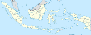
Waiyapu is on the south-west coast of Sumba, about 8 kilometers (5.0 mi) from the western tip of the island and 200 kilometers (120 mi) west of
119:
83:
47:
546:
446:"Aspects de la gestion des dolmens et des tombes collectives actuels dans les sociétés de l'île de Sumba (Indonésie)"
353:
266:
498:
248:
247:. It stands on the south side of the estuary of the Luku Lambatama river. The traditional village of
164:
253:
225:
174:
200:
499:"Des dolmens « modernes » en Indonésie : le déplacement des dalles à Wainyapu"
184:
293:
Wainyapu owns a lime quarry that provides the huge slabs needed for the dolmens. In 2008,
33:
551:
444:
Jeunesse, Christian; Bec-Drelon, Noisette; Boulestin, Bruno; Denaire, Anthony (2021).
378:
535:
526:
298:
and animal sacrifices, required some 4,000 personnes and took two years to achieve.
282:
134:
121:
294:
191:
154:
68:
445:
244:
232:
196:
485:
473:
426:
221:
235:- one of the highest concentrations of these megaliths on Sumba.
204:
354:"High-resolution map of West Sumba with contour lines"
258:
is within sight, just on the other side of the river.
190:
180:
170:
160:
150:
24:
8:
21:
19:Place in Lesser Sunda Islands, Indonesia
16:Village in East Nusa Tenggara, Indonesia
439:
437:
435:
327:
307:
189:
149:
114:
39:
30:
542:Populated places in East Nusa Tenggara
179:
169:
159:
7:
261:Administratively, it is a village (
14:
360:(made by the US Army Map service)
265:) in Kodi Balaghar district, in
90:
89:
82:
54:
53:
46:
32:
1:
450:Préhistoires méditerranéennes
135:9.630983504°S 119.00785583°E
568:
336:"Wainyapu, satellite view"
216:is a traditional village (
140:-9.630983504; 119.00785583
115:
40:
31:
267:Southwest Sumba Regency
456:(2): 165-179 (see § 8)
228:province, Indonesia.
106:Show map of Indonesia
486:Jeunesse et al. 2021
474:Jeunesse et al. 2021
427:Jeunesse et al. 2021
165:Lesser Sunda Islands
103:Wainyapu (Indonesia)
358:maps.lib.utexas.edu
131: /
547:Geography of Sumba
231:It has some 1,400
226:East Nusa Tenggara
175:East Nusa Tenggara
521:Connected article
383:voyage.alpviv.org
211:
210:
73:Show map of Sumba
559:
514:
513:
511:
510:
495:
489:
483:
477:
471:
465:
464:
462:
461:
441:
430:
424:
418:
417:
415:
414:
400:
394:
393:
391:
390:
375:
369:
368:
366:
365:
350:
344:
343:
332:
315:
312:
271:Sumba Barat Daya
257:
185:Sumba Barat Daya
146:
145:
143:
142:
141:
136:
132:
129:
128:
127:
124:
107:
93:
92:
86:
74:
57:
56:
50:
36:
22:
567:
566:
562:
561:
560:
558:
557:
556:
532:
531:
523:
518:
517:
508:
506:
497:
496:
492:
484:
480:
472:
468:
459:
457:
443:
442:
433:
425:
421:
412:
410:
402:
401:
397:
388:
386:
377:
376:
372:
363:
361:
352:
351:
347:
340:google.com/maps
334:
333:
329:
324:
319:
318:
313:
309:
304:
279:
251:
241:
139:
137:
133:
130:
125:
122:
120:
118:
117:
111:
110:
109:
108:
105:
104:
101:
100:
99:
98:
94:
77:
76:
75:
72:
71:
65:
64:
63:
62:
58:
27:
20:
17:
12:
11:
5:
565:
563:
555:
554:
549:
544:
534:
533:
530:
529:
522:
519:
516:
515:
490:
478:
466:
431:
419:
395:
370:
345:
326:
325:
323:
320:
317:
316:
306:
305:
303:
300:
278:
275:
240:
237:
209:
208:
194:
188:
187:
182:
178:
177:
172:
168:
167:
162:
158:
157:
152:
148:
147:
113:
112:
102:
96:
95:
88:
87:
81:
80:
79:
78:
66:
60:
59:
52:
51:
45:
44:
43:
42:
41:
38:
37:
29:
28:
25:
18:
15:
13:
10:
9:
6:
4:
3:
2:
564:
553:
550:
548:
545:
543:
540:
539:
537:
528:
527:Kodi language
525:
524:
520:
504:
500:
494:
491:
487:
482:
479:
475:
470:
467:
455:
452:(in French).
451:
447:
440:
438:
436:
432:
428:
423:
420:
409:
405:
399:
396:
384:
380:
374:
371:
359:
355:
349:
346:
341:
337:
331:
328:
321:
311:
308:
301:
299:
296:
291:
287:
284:
276:
274:
272:
268:
264:
259:
255:
250:
246:
238:
236:
234:
229:
227:
223:
219:
215:
206:
202:
198:
195:
193:
186:
183:
176:
173:
166:
163:
156:
153:
144:
116:Coordinates:
85:
70:
49:
35:
23:
507:. Retrieved
502:
493:
481:
469:
458:. Retrieved
453:
449:
422:
411:. Retrieved
407:
398:
387:. Retrieved
382:
373:
362:. Retrieved
357:
348:
339:
330:
310:
292:
288:
280:
270:
262:
260:
242:
230:
217:
213:
212:
67:Location in
385:(in French)
283:hill tribes
252: [
138: /
126:119°00′28″E
536:Categories
509:2024-06-16
460:2024-06-15
413:2024-06-16
389:2024-06-16
379:"Wainyapu"
364:2024-06-15
322:References
249:Ratenggaro
408:nomor.net
404:"Waiyapu"
295:Anakalang
192:Time zone
155:Indonesia
123:9°37′52″S
69:Indonesia
503:unige.ch
245:Waingapu
239:Location
224:island,
171:Province
97:Wainyapu
61:Wainyapu
26:Wainyapu
277:Dolmens
233:dolmens
214:Waiyapu
181:Regency
151:Country
488:, § 6.
476:, § 3.
429:, § 4.
161:Region
552:Sumba
302:Notes
256:]
222:Sumba
220:) on
197:UTC+8
263:desa
218:desa
201:WITA
273:).
205:UTC
538::
501:.
434:^
406:.
381:.
356:.
338:.
254:id
203:/
512:.
463:.
454:9
416:.
392:.
367:.
342:.
269:(
207:)
199:(
Text is available under the Creative Commons Attribution-ShareAlike License. Additional terms may apply.

