220:, in the upper catchment, is part of a relatively unmodified wetland on several square kilometres of the southern Garvie Mountains. It is possibly the largest such area in Australasia and is dominated by grasses, sedges and mosses, with shallow pools, small islands and clumps of low vegetation. The mire drains south via Dome Burn to the Waikaia and north via Roaring Lion Creek to the
31:
377:
231:
Highly regarded as a brown trout fishery the quality of the water in its lower reaches deteriorated in the early 21st century due to the conversion of much of the surrounding farmland to intensive dairy farming.
243:) until 2019. An application to mine at Winding Creek (east of Waikaia and scene of an 1863 gold rush) was made in 2021. Other mines, mostly also to the east of Waikaia, have worked gold derived from
194:
and then flows south for 50 kilometres (31 mi) through rugged native bush-clad hills and then from Piano Flat through farmed areas until it joins the
Mataura River at
439:
521:
735:
637:
398:
662:
352:
754:
764:
482:
728:
209:
Its tributaries include Gow Burn, Steeple Burn, Dome Burn, Winding Creek and Argyle Burn with the Dome Burn and
Steeple Burn being
190:
The moderate sized
Waikaia River rises in swamps and tussock land in the Umbrella Mountains to the east of the headwaters of the
573:
759:
721:
274:
331:
302:
202:
forest. Below Piano Flat the river meanders across a floodplain, much of it irrigated for dairy farming. Total
258:
195:
701:
247:
599:
425:
546:
265:
period, and was then washed out to the alluvial flats. By 1909 the area had 16 dredges working.
600:"Gold and associated minerals in the Waikaia placer gold mine, Northern Southland, New Zealand"
619:
478:
453:
433:
705:
611:
477:
Kent, John: “South Island Trout
Fishing Guide”. Page 346. Penguin Books, Auckland (2009).
495:
203:
191:
748:
225:
184:
115:
254:
615:
424:
A. F. Mark , P. N. Johnson , K. J. M. Dickinson & M. S. McGlone (March 1995).
236:
221:
210:
180:
100:
52:
244:
217:
199:
30:
677:
664:
623:
522:"Waikaia Gold finishes mining operations at Freshford in Northern Southland"
426:"Southern hemisphere patterned mires, with emphasis on southern New Zealand"
323:
251:
294:
262:
240:
35:
399:"DOC wants to seek international recognition for Taieri Scroll Plain"
598:
McLachlan, Christine; Negrini, Marianne; Craw, Dave (3 April 2018).
135:
95 kilometres (59 mi) including
Waikaia East River branch
709:
187:. The name is probably a corruption of Wai-o-Whakaea.
165:
24.41 cubic metres per second (862 cu ft/s)
159:
151:
139:
131:
121:
109:
99:
85:
75:
67:
58:
48:
43:
23:
574:"Company has plans for new gold mine near Waikaia"
353:"Waikaia Surface Water Zone Water Quantity Data"
547:"SWITZER'S THREE NEW RUSHES. Lake Wakatip Mail"
213:spawning streams for the Mataura River system.
206:concentration in the lower river is 0.47g/m3.
729:
604:New Zealand Journal of Geology and Geophysics
239:from beside the river at Freshford (south of
143:1,830 square kilometres (710 sq mi)
8:
438:: CS1 maint: multiple names: authors list (
638:"THE GOLDFIELDS OF NEW ZEALAND (REPORT ON)"
736:
722:
378:"Mataura Catchment Strategic Water Study"
286:
431:
20:
224:. A small part of the mire is in the
7:
697:
695:
708:. You can help Knowledge (XXG) by
324:"Place name detail: Waikaia River"
295:"Place name detail: Waikaia River"
14:
261:, after it started rising in the
198:. Much of the upper valley is in
357:Land, Air, Water Aotearoa (LAWA)
29:
572:Hooper, Laura (3 August 2021).
520:Kelly, Rachael (2 April 2019).
755:Rivers of the Southland Region
700:This article about a river in
1:
616:10.1080/00288306.2018.1454482
275:List of rivers of New Zealand
59:Physical characteristics
765:Southland Region river stubs
332:New Zealand Geographic Board
303:New Zealand Geographic Board
123: • elevation
91:1,749 metres (5,738 ft)
87: • elevation
454:"Mount Tennyson, Southland"
257:. It was eroded out of the
111: • location
77: • location
781:
694:
161: • average
642:paperspast.natlib.govt.nz
551:paperspast.natlib.govt.nz
169:
147:
95:
63:
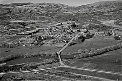
38:and Waikaia River in 1955
28:
127:120 metres (390 ft)
259:Old Man Range / Kopuwai
702:Southland, New Zealand
496:"Freshford, Southland"
760:Rivers of New Zealand
385:Environment Southland
328:New Zealand Gazetteer
299:New Zealand Gazetteer
183:, a tributary of the
16:River in New Zealand
674: /
678:45.883°S 168.800°E
717:
716:
483:978-0-14-320268-4
173:
172:
772:
738:
731:
724:
696:
689:
688:
686:
685:
684:
683:-45.883; 168.800
679:
675:
672:
671:
670:
667:
654:
653:
651:
649:
634:
628:
627:
595:
589:
588:
586:
584:
569:
563:
562:
560:
558:
553:. 26 August 1863
543:
537:
536:
534:
532:
517:
511:
510:
508:
506:
492:
486:
475:
469:
468:
466:
464:
450:
444:
443:
437:
429:
421:
415:
414:
412:
410:
395:
389:
388:
382:
374:
368:
367:
365:
363:
349:
343:
342:
340:
338:
320:
314:
313:
311:
309:
291:
162:
88:
78:
33:
21:
780:
779:
775:
774:
773:
771:
770:
769:
745:
744:
743:
742:
692:
682:
680:
676:
673:
668:
665:
663:
661:
660:
658:
657:
647:
645:
636:
635:
631:
597:
596:
592:
582:
580:
571:
570:
566:
556:
554:
545:
544:
540:
530:
528:
519:
518:
514:
504:
502:
494:
493:
489:
476:
472:
462:
460:
452:
451:
447:
430:
423:
422:
418:
408:
406:
405:. 6 August 2013
403:www.doc.govt.nz
397:
396:
392:
380:
376:
375:
371:
361:
359:
351:
350:
346:
336:
334:
322:
321:
317:
307:
305:
293:
292:
288:
283:
271:
160:
124:
112:
86:
81:Old Woman Range
76:
39:
17:
12:
11:
5:
778:
776:
768:
767:
762:
757:
747:
746:
741:
740:
733:
726:
718:
715:
714:
656:
655:
629:
610:(2): 164–179.
590:
564:
538:
512:
487:
470:
445:
416:
390:
369:
344:
315:
285:
284:
282:
279:
278:
277:
270:
267:
218:patterned mire
192:Pomahaka River
179:is a river in
171:
170:
167:
166:
163:
157:
156:
153:
149:
148:
145:
144:
141:
137:
136:
133:
129:
128:
125:
122:
119:
118:
113:
110:
107:
106:
103:
97:
96:
93:
92:
89:
83:
82:
79:
73:
72:
69:
65:
64:
61:
60:
56:
55:
50:
46:
45:
41:
40:
34:
26:
25:
15:
13:
10:
9:
6:
4:
3:
2:
777:
766:
763:
761:
758:
756:
753:
752:
750:
739:
734:
732:
727:
725:
720:
719:
713:
711:
707:
703:
698:
693:
690:
687:
643:
639:
633:
630:
625:
621:
617:
613:
609:
605:
601:
594:
591:
579:
575:
568:
565:
552:
548:
542:
539:
527:
523:
516:
513:
501:
497:
491:
488:
484:
480:
474:
471:
459:
455:
449:
446:
441:
435:
427:
420:
417:
404:
400:
394:
391:
386:
379:
373:
370:
358:
354:
348:
345:
333:
329:
325:
319:
316:
304:
300:
296:
290:
287:
280:
276:
273:
272:
268:
266:
264:
260:
256:
253:
249:
246:
242:
238:
233:
229:
227:
223:
219:
214:
212:
207:
205:
201:
197:
193:
188:
186:
185:Mataura River
182:
178:
177:Waikaia River
168:
164:
158:
154:
150:
146:
142:
138:
134:
130:
126:
120:
117:
116:Mataura River
114:
108:
104:
102:
98:
94:
90:
84:
80:
74:
70:
66:
62:
57:
54:
51:
47:
42:
37:
32:
27:
24:Waikaia River
22:
19:
710:expanding it
699:
691:
659:
646:. Retrieved
641:
632:
607:
603:
593:
581:. Retrieved
577:
567:
555:. Retrieved
550:
541:
529:. Retrieved
525:
515:
503:. Retrieved
499:
490:
473:
461:. Retrieved
457:
448:
419:
407:. Retrieved
402:
393:
384:
372:
360:. Retrieved
356:
347:
335:. Retrieved
327:
318:
306:. Retrieved
298:
289:
255:Otago Schist
250:deposits in
234:
230:
215:
208:
189:
176:
174:
18:
681: /
500:NZ Topo Map
458:NZ Topo Map
387:. May 2011.
228:catchment.
222:Nevis River
211:brown trout
181:New Zealand
53:New Zealand
749:Categories
281:References
245:Cretaceous
196:Riversdale
140:Basin size
624:0028-8306
235:Gold was
152:Discharge
669:168°48′E
434:cite web
269:See also
252:Mesozoic
248:orogenic
216:Nokomai
204:nitrogen
44:Location
666:45°53′S
648:24 July
583:24 July
557:24 July
531:24 July
505:24 July
463:23 July
409:23 July
362:24 July
337:24 July
308:12 July
263:Miocene
241:Waikaia
237:dredged
226:Nokomai
49:Country
36:Waikaia
644:. 1909
622:
481:
155:
132:Length
105:
71:
68:Source
704:is a
578:Stuff
526:Stuff
381:(PDF)
200:beech
101:Mouth
706:stub
650:2023
620:ISSN
585:2023
559:2023
533:2023
507:2023
479:ISBN
465:2023
440:link
411:2023
364:2023
339:2023
310:2009
175:The
612:doi
751::
640:.
618:.
608:61
606:.
602:.
576:.
549:.
524:.
498:.
456:.
436:}}
432:{{
401:.
383:.
355:.
330:.
326:.
301:.
297:.
737:e
730:t
723:v
712:.
652:.
626:.
614::
587:.
561:.
535:.
509:.
485:.
467:.
442:)
428:.
413:.
366:.
341:.
312:.
Text is available under the Creative Commons Attribution-ShareAlike License. Additional terms may apply.