73:
57:
80:
472:
In the CDP, the population was spread out, with 23.3% under the age of 18, 5.8% from 18 to 24, 27.0% from 25 to 44, 26.6% from 45 to 64, and 17.3% who were 65 years of age or older. The median age was 42 years. For every 100 females, there were 94.8 males. For every 100 females age 18 and over, there
468:
There were 1,721 households, out of which 30.6% had children under the age of 18 living with them, 67.3% were married couples living together, 9.6% had a female householder with no husband present, and 20.6% were non-families. 16.5% of all households were made up of individuals, and 7.9% had someone
436:
As of the census of 2000, there were 4,775 people, 1,721 households, and 1,366 families residing in the CDP. The population density was 1,996.9 inhabitants per square mile (771.0/km). There were 1,789 housing units at an average density of 748.2 per square mile (288.9/km). The racial makeup of the
976:
476:
The median income for a household in the CDP was $ 73,194, and the median income for a family was $ 75,055. Males had a median income of $ 61,635 versus $ 41,667 for females. The
981:
971:
376:, the CDP has a total area of 2.3 square miles (5.9 km), of which 2.2 square miles (5.7 km) is land and 0.08 square miles (0.2 km), or 4.12%, is water.
340:
is one of the oldest structures in the Town of Islip. The original structure, which was later expanded, was built in 1697 by New York City's first native-born mayor,
662:
812:
779:
761:
349:
740:
580:
104:
284:
681:
361:
72:
294:
501:
617:
235:
966:
555:
442:
733:
446:
469:
living alone who was 65 years of age or older. The average household size was 2.76 and the average family size was 3.11.
156:
606:
American
Institute of Architects. Long Island Chapter; Society for the Preservation of Long Island Antiquities (1992).
915:
530:
454:
373:
910:
900:
584:
410:
885:
769:
726:
322:
272:
161:
945:
890:
845:
341:
314:
47:
787:
640:
458:
905:
865:
860:
797:
686:
56:
940:
925:
880:
855:
462:
245:
870:
840:
820:
450:
438:
345:
930:
875:
850:
802:
792:
920:
835:
830:
825:
613:
477:
353:
310:
43:
895:
753:
581:"Geographic Identifiers: 2010 Demographic Profile Data (G001): West Bay Shore CDP, New York"
326:
149:
480:
for the CDP was $ 31,998. About 3.1% of families and 4.6% of the population were below the
749:
318:
337:
960:
277:
481:
607:
700:
357:
144:
17:
119:
106:
226:
718:
484:, including 2.5% of those under age 18 and 6.4% of those age 65 or over.
260:
609:
AIA Architectural Guide to Nassau and
Suffolk Counties, Long Island
252:
231:
676:
722:
329:, United States. Its population was 4,648 at the 2010 census.
29:
Hamlet and census-designated place in New York, United States
551:
583:. U.S. Census Bureau, American Factfinder. Archived from
526:
663:"Newsday | Long Island's & NYC's News Source"
977:
Census-designated places in
Suffolk County, New York
811:
778:
760:
293:
283:
271:
259:
242:
225:
217:
209:
204:
196:
188:
180:
172:
167:
155:
143:
135:
34:
348:, as local headquarters for British forces under
344:. The manor functioned for a time, during the
734:
575:
573:
8:
982:Populated coastal places in New York (state)
972:Census-designated places in New York (state)
356:used it as a stopover during a 1790 tour of
741:
727:
719:
641:"Suffolk County Government > 404 Error"
465:of any race were 4.08% of the population.
383:
31:
493:
282:
258:
224:
203:
195:
166:
134:
99:
65:
53:
677:"National Register Information System"
403:
79:
521:
519:
292:
270:
241:
216:
208:
187:
179:
171:
154:
142:
92:Location within the state of New York
7:
682:National Register of Historic Places
457:, and 1.15% from two or more races.
362:National Register of Historic Places
176:5.41 sq mi (14.00 km)
192:3.22 sq mi (8.35 km)
184:2.18 sq mi (5.65 km)
701:"Census of Population and Housing"
393:
25:
502:"ArcGIS REST Services Directory"
78:
71:
55:
556:United States Geological Survey
221:2,118.64/sq mi (817.89/km)
552:"US Board on Geographic Names"
1:
504:. United States Census Bureau
531:United States Census Bureau
374:United States Census Bureau
998:
424:
409:
402:
397:
392:
389:
350:General Sir Henry Clinton
100:
66:
54:
41:
36:West Bay Shore, New York
432:Demographics of the CDP
342:Stephanus Van Cortlandt
315:census-designated place
48:census-designated place
967:Islip (town), New York
360:. It was added to the
687:National Park Service
643:. suffolkcountyny.gov
612:. Dover. p. 82.
527:"U.S. Census website"
425:U.S. Decennial Census
385:Historical population
244: • Summer (
200:13 ft (4 m)
120:40.71278°N 73.27528°W
587:on February 12, 2020
218: • Density
386:
346:American Revolution
125:40.71278; -73.27528
116: /
558:. October 25, 2007
384:
210: • Total
189: • Water
173: • Total
954:
953:
916:North Great River
689:. March 13, 2009.
478:per capita income
473:were 91.2 males.
429:
428:
372:According to the
354:George Washington
304:
303:
181: • Land
16:(Redirected from
989:
743:
736:
729:
720:
713:
712:
710:
708:
697:
691:
690:
673:
667:
666:
659:
653:
652:
650:
648:
637:
631:
630:
628:
626:
603:
597:
596:
594:
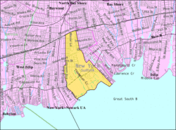
592:
577:
568:
567:
565:
563:
548:
542:
541:
539:
537:
523:
514:
513:
511:
509:
498:
443:African American
405:
400:
395:
387:
249:
131:
130:
128:
127:
126:
121:
117:
114:
113:
112:
109:
82:
81:
75:
59:
32:
21:
997:
996:
992:
991:
990:
988:
987:
986:
957:
956:
955:
950:
911:North Bay Shore
901:Lake Ronkonkoma
807:
774:
756:
747:
717:
716:
706:
704:
699:
698:
694:
675:
674:
670:
665:. May 21, 2023.
661:
660:
656:
646:
644:
639:
638:
634:
624:
622:
620:
605:
604:
600:
590:
588:
579:
578:
571:
561:
559:
550:
549:
545:
535:
533:
525:
524:
517:
507:
505:
500:
499:
495:
490:
447:Native American
437:CDP was 94.62%
434:
398:
382:
370:
335:
267:
243:
124:
122:
118:
115:
110:
107:
105:
103:
102:
96:
95:
94:
93:
90:
89:
88:
87:
83:
62:
61:U.S. Census map
50:
37:
30:
23:
22:
15:
12:
11:
5:
995:
993:
985:
984:
979:
974:
969:
959:
958:
952:
951:
949:
948:
943:
938:
936:West Bay Shore
933:
928:
923:
918:
913:
908:
903:
898:
893:
888:
883:
878:
873:
868:
863:
858:
853:
848:
843:
838:
833:
828:
823:
817:
815:
809:
808:
806:
805:
800:
795:
790:
784:
782:
776:
775:
773:
772:
766:
764:
758:
757:
748:
746:
745:
738:
731:
723:
715:
714:
692:
668:
654:
632:
618:
598:
569:
543:
515:
492:
491:
489:
486:
433:
430:
427:
426:
422:
421:
418:
416:
413:
407:
406:
401:
396:
391:
381:
378:
369:
366:
338:Sagtikos Manor
334:
331:
323:Suffolk County
307:West Bay Shore
302:
301:
298:
291:
290:
287:
281:
280:
275:
269:
268:
265:
263:
257:
256:
250:
240:
239:
229:
223:
222:
219:
215:
214:
211:
207:
206:
202:
201:
198:
194:
193:
190:
186:
185:
182:
178:
177:
174:
170:
169:
165:
164:
159:
153:
152:
147:
141:
140:
137:
133:
132:
98:
97:
91:
86:West Bay Shore
85:
84:
77:
76:
70:
69:
68:
67:
64:
63:
60:
52:
51:
42:
39:
38:
35:
28:
24:
18:West Bay Shore
14:
13:
10:
9:
6:
4:
3:
2:
994:
983:
980:
978:
975:
973:
970:
968:
965:
964:
962:
947:
946:West Sayville
944:
942:
939:
937:
934:
932:
929:
927:
924:
922:
919:
917:
914:
912:
909:
907:
904:
902:
899:
897:
894:
892:
891:Islip Terrace
889:
887:
884:
882:
879:
877:
874:
872:
869:
867:
864:
862:
859:
857:
854:
852:
849:
847:
846:Central Islip
844:
842:
839:
837:
834:
832:
829:
827:
824:
822:
819:
818:
816:
814:
810:
804:
801:
799:
796:
794:
791:
789:
786:
785:
783:
781:
777:
771:
768:
767:
765:
763:
759:
755:
751:
750:Town of Islip
744:
739:
737:
732:
730:
725:
724:
721:
702:
696:
693:
688:
684:
683:
678:
672:
669:
664:
658:
655:
642:
636:
633:
621:
619:9780486269467
615:
611:
610:
602:
599:
586:
582:
576:
574:
570:
557:
553:
547:
544:
532:
528:
522:
520:
516:
508:September 20,
503:
497:
494:
487:
485:
483:
479:
474:
470:
466:
464:
460:
456:
453:, 0.92% from
452:
448:
444:
440:
431:
423:
419:
417:
414:
412:
408:
388:
379:
377:
375:
367:
365:
363:
359:
355:
351:
347:
343:
339:
332:
330:
328:
324:
320:
319:Town of Islip
317:(CDP) in the
316:
312:
308:
299:
296:
288:
286:
279:
276:
274:
264:
262:
254:
251:
247:
237:
236:Eastern (EST)
233:
230:
228:
220:
212:
199:
191:
183:
175:
163:
160:
158:
151:
148:
146:
139:United States
138:
129:
101:Coordinates:
74:
58:
49:
45:
40:
33:
27:
19:
935:
788:Brightwaters
705:. Retrieved
703:. Census.gov
695:
680:
671:
657:
645:. Retrieved
635:
623:. Retrieved
608:
601:
589:. Retrieved
585:the original
560:. Retrieved
546:
534:. Retrieved
506:. Retrieved
496:
482:poverty line
475:
471:
467:
435:
380:Demographics
371:
336:
306:
305:
26:
906:Lonelyville
866:Great River
861:Fair Harbor
798:Ocean Beach
647:December 6,
625:December 6,
591:January 10,
562:January 31,
536:January 31,
455:other races
358:Long Island
123: /
961:Categories
941:West Islip
926:Ronkonkoma
881:Holtsville
856:East Islip
488:References
297:feature ID
205:Population
111:73°16′31″W
108:40°42′46″N
871:Hauppauge
841:Brentwood
821:Bay Shore
368:Geography
364:in 1976.
285:FIPS code
273:Area code
227:Time zone
197:Elevation
931:Sayville
876:Holbrook
851:Dunewood
803:Saltaire
793:Islandia
780:Villages
754:New York
459:Hispanic
449:, 2.20%
445:, 0.17%
441:, 0.94%
327:New York
289:36-79301
261:ZIP code
150:New York
921:Oakdale
836:Bohemia
831:Baywood
826:Bayport
813:Hamlets
770:Suffolk
707:June 4,
333:History
300:0969094
162:Suffolk
136:Country
896:Kismet
762:County
616:
463:Latino
390:Census
311:hamlet
157:County
44:Hamlet
886:Islip
451:Asian
439:White
415:4,625
309:is a
266:11706
255:(EDT)
253:UTC-4
232:UTC-5
213:4,625
145:State
709:2016
649:2014
627:2014
614:ISBN
593:2013
564:2008
538:2008
510:2022
411:2020
399:Note
394:Pop.
313:and
295:GNIS
168:Area
46:and
461:or
278:631
246:DST
963::
752:,
685:.
679:.
572:^
554:.
529:.
518:^
404:%±
352:.
325:,
321:,
742:e
735:t
728:v
711:.
651:.
629:.
595:.
566:.
540:.
512:.
420:—
248:)
238:)
234:(
20:)
Text is available under the Creative Commons Attribution-ShareAlike License. Additional terms may apply.