30:
37:
161:
The 1965 sale of the property is believed to have been the first limited-development strategy of conversation planning in the country, in that the eleven private-home lots are clustered to ensure the maximum amount of land can be protected.
153:, United States. Settled in 1717, it was farmed for almost 250 years. Covering 54 acres (22 ha), it is now owned by the Rural Land Foundation (RLF), which was formed in 1965, after the property was placed on the market.
302:
88:
165:
Abner, Benjamin and
Eliphalet lived at the firm in the 18th century. Stephen Buttrick (1772–1828), son of John, lived at the farm in the 19th century.
29:
280:
236:
312:
307:
253:
270:
226:
81:
185:
209:
272:
History of
Framingham, Massachusetts: Early Known as Danforth's Farms, 1640-1880; with a Genealogical Register
150:
56:
276:
255:
Genealogical and
Personal Memoirs Relating to the Families of Boston and Eastern Massachusetts
232:
296:
66:
104:
90:
303:
Buildings and structures in
Middlesex County, Massachusetts
190:
258:. Lewis historical publishing Company. p. 1915.
136:
128:
80:
72:
62:
52:
18:
225:Parr, James L.; Swope, Kevin A. (2009-02-01).
8:
186:"Wheeler Farm / Cemetery / Flint Fields"
214:. Land Trust Exchange. 1987. p. 4.
174:
15:
7:
180:
178:
36:
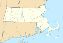
275:. town of Framingham. p. 495.
132:Rural Land Foundation (since 1965)
14:
252:Cutter, William Richard (1908).
35:
28:
269:Temple, Josiah Howard (1887).
1:
228:Framingham Legends & Lore
329:
140:54 acres (220,000 m)
47:Location in Massachusetts
23:
313:Lincoln, Massachusetts
308:Farms in Massachusetts
231:. Arcadia Publishing.
151:Lincoln, Massachusetts
149:is a historic farm in
211:Land Trusts' Exchange
105:42.42739°N 71.30144°W
110:42.42739; -71.30144
100: /
282:978-0-7884-2842-5
238:978-1-62584-263-3
144:
143:
320:
287:
286:
266:
260:
259:
249:
243:
242:
222:
216:
215:
206:
200:
199:
197:
196:
182:
124:
123:
121:
120:
119:
117:
112:
111:
106:
101:
98:
97:
96:
93:
39:
38:
32:
16:
328:
327:
323:
322:
321:
319:
318:
317:
293:
292:
291:
290:
283:
268:
267:
263:
251:
250:
246:
239:
224:
223:
219:
208:
207:
203:
194:
192:
184:
183:
176:
171:
159:
115:
113:
109:
107:
103:
102:
99:
94:
91:
89:
87:
86:
48:
45:
44:
43:
42:
41:
40:
12:
11:
5:
326:
324:
316:
315:
310:
305:
295:
294:
289:
288:
281:
261:
244:
237:
217:
201:
173:
172:
170:
167:
158:
155:
142:
141:
138:
134:
133:
130:
126:
125:
84:
78:
77:
74:
70:
69:
64:
60:
59:
54:
50:
49:
46:
34:
33:
27:
26:
25:
24:
21:
20:
13:
10:
9:
6:
4:
3:
2:
325:
314:
311:
309:
306:
304:
301:
300:
298:
284:
278:
274:
273:
265:
262:
257:
256:
248:
245:
240:
234:
230:
229:
221:
218:
213:
212:
205:
202:
191:
187:
181:
179:
175:
168:
166:
163:
156:
154:
152:
148:
139:
135:
131:
127:
122:
85:
83:
79:
76:United States
75:
71:
68:
67:Massachusetts
65:
61:
58:
55:
51:
31:
22:
17:
271:
264:
254:
247:
227:
220:
210:
204:
193:. Retrieved
189:
164:
160:
147:Wheeler Farm
146:
145:
116:Wheeler Farm
19:Wheeler Farm
108: /
82:Coordinates
297:Categories
195:2024-05-17
169:References
114: (
95:71°18′05″W
92:42°25′39″N
53:Town/City
157:History
73:Country
57:Lincoln
279:
235:
129:Owner
63:State
277:ISBN
233:ISBN
137:Area
299::
188:.
177:^
285:.
241:.
198:.
118:)
Text is available under the Creative Commons Attribution-ShareAlike License. Additional terms may apply.