615:. The town includes a residential, commercial, and industrial areas while agricultural holdings are on the outskirts of the town. The town features a library, municipal buildings, car dealerships, filling stations, lodges and hotels, churches, a mosque, a police station, and retail centers. It is a popular holiday destination for those looking to visit the Crocodile River Valley, Panorama and Lowveld Legogote Tourism Routes and the Kruger National Park. The town itself has a reputation for its arts and crafts. The Casterbridge Lifestyle Centre situated on the outskirts of the city is a popular tourist stop. Once a mango plantation, the centre now has a cinema, a vintage motor museum and restaurants and hosts art exhibitions, plays and concerts.
1630:
58:
397:
88:
636:
389:
970:
914:
41:
902:. As of 2016, Mbombela, the municipality that White River falls under, had a housing backlog of 34 000 units, impacting low income families especially hard. The persistence of Apartheid-era spatial planning means that land close to the town is expensive and privately owned. This, combined with the economic opportunities and employment, mainly in White River and
95:
65:
700:
White River is located in the low altitude subtropical
Lowveld climatic zone. Savannah and woodland scattered with granite outcrops form the indigenous habitat. Compared to other parts of South Africa, the climate is mild with good rainfall. Nevertheless, like the rest of South Africa, White River
550:
In 1923, a tiny plot of land on the edge of White River was designated as a "location" for black wage workers and their families. The rest of White River was reserved for white settlers. In the mid 1960s, the
Lowvelder newspaper reported that while the white residential areas of White River expanded
507:
pervasive in the lowveld in the 19th century meant that white settlers initially avoided year-round settlement in the White River area. Boer traders, hunters and farmers from settlements in the highveld only came down to the area in the winter. The first year round settlement in the White River area
643:
The White River area is one of the most fertile in the province and farming continues to be a central part of the local economy. After a 26 km canal to channel water from the river was built, new farmers planted fruit trees and established new cultivation methods. Today, agriculture involves
538:
to allocate land to the settlers. Lawrence became the first manager of the new settlement, with the longest street in the town still named after him. Initially, the colonial administration provided settlers with farming equipment and a weekly salary until they began to make an income from their
539:
tobacco, citrus, maize and other vegetable crops. Farmers were heavily subsidized until 1907 and the building of a 25 kilometer long irrigation canal improved prospects for some. However, the scheme largely failed and many settlers gave up farming when their contracts ended. In 1911, the
579:
in the 1960s and 1970s. In 1968, the Bantu
Affairs Department forcibly removed 3000 people from the White River location to a newly established township at Ngodini. Many people in these resettled township communities commuted daily between what became the bantustan of
516:, did white settlers begin to settle in the White River area. By claiming especially the most agriculturally productive, wettest areas with the best climates as their own, they dispossessed Africans of land that they had lived on for generations.
567:, White River was designated a white area. The aparthied state and white farmers forcibly resettled thousands of Black people living in White River and as labour tenants on surrounding farms were to African reserves and towns like
945:
The town's local newspaper, the White River Post was established in 2006 and has a distribution of 5000 copies every two weeks. Larger local papers, such as the
Lowvelder and Mpumalanga News also cover news in White River.
644:
largely the production of tropical fruits, macadamia nuts, vegetables, flowers and timber. The farms tend to be relatively small and the agriculture is intensive. Farms are irrigated by nearby dams such as
Longmere,
897:
In 2003, 6 000 hectares of land on the outskirts of White River and surrounding areas were redistributed to the
Matsafeni trust when the state purchased the land from Hall & Sons for R63 million under
701:
and its surrounding farms are being adversely impacted by climate change. The area is especially prone to frost, veld fires and droughts that pose food production threats and economic risks to farmers.
1964:
463:
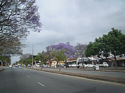
Archaeological evidence from surrounding areas suggests the land that later became White River has been occupied for thousands of years. Remains of settlements from the 6th-century point to
1500:
1088:"Phase 1 Archeological / Heritage Impact Assessment For The Proposed Establishment of Macadamia Plantations on Portion 1 of the Farm Peebles 31-JU White River, Mpumalanga Province"
1629:
551:
significantly in the following decades, the black location remained confined to just 15 hectares, although the population of the community had expanded to over 3000 people.
467:
African agricultural and livestock-keeping societies that lived in the area. The
Plaston site, east of White River, shows evidence of communities in the area from circa 620
1493:
57:
1486:
120:
612:
87:
1234:
669:
527:(British administrator of the Transvaal) demarcated land along the Emanzimhlope river for settlement by British settlers, mainly demobilised
495:. According to Surplus People Project report, White River was known as Nyavaland by Africans who lived in the area before white settlement.
362:
624:
524:
509:
543:
government sold the farms at White River for a significant loss to a syndicate that planted scale citrus farms on the land. After
1825:
1478:
1436:
475:
rock painting sites nearby are indicative of even longer human settlement. By the early 19th century, the area was inhabited by
1510:
1351:
1741:
1325:
1087:
1805:
1195:
241:
1414:
488:
1535:
899:
354:
183:
1140:
1641:
1280:
King, Brian H. (2007). "Developing KaNgwane: Geographies of
Segregation and Integration in the New South Africa".
508:
was an isolated farm only in 1873 by Bill
Sanderson a Scottish gold prospector, hunter and trader. Only after the
1675:
535:
1048:
Evers, T. M. (1977). "Plaston Early Iron Age Site, White River
District, Eastern Transvaal, South Africa".
960:
1943:
1844:
547:, the settlement scheme expanded as the land was sold at discounted rates to demobilised white soldiers.
513:
504:
476:
910:
around Rocky Drift (Msholozi and Phumlani) and other nearby areas have been established in recent years.
1912:
1897:
1887:
1877:
1838:
1548:
540:
305:
40:
639:
A view from Legogote Mountain of timber plantations, farms and indigenous bush surrounding White River
1938:
1721:
1619:
608:
263:
396:
1892:
1609:
1543:
975:
635:
588:
267:
230:
1907:
1902:
1815:
1749:
1297:
1065:
1023:
408:
1922:
1867:
1726:
1594:
1461:
1230:
623:
White River is in the Mbombela A Municipal Zone, falling under Ward 30 and is governed by the
581:
1108:
1386:
1344:"Casterbridge Lifestyle Centre. Shopping, restaurants, hotel, cinema and art in White River"
1289:
1057:
907:
1407:"Climate: White River – Climate graph, Temperature graph, Climate table – Climate-Data.org"
564:
520:
375:
327:
649:
531:
528:
435:
316:
285:
1224:
1958:
1933:
1917:
1855:
1293:
846:
568:
1343:
1785:
1706:
1659:
1654:
1649:
484:
424:
155:
1005:
1872:
1849:
1764:
1716:
1681:
1665:
645:
544:
1254:. Scotsville South Africa: University of KwaZulu-Natal Press. pp. 303–304.
913:
388:
1790:
1769:
1691:
1670:
1563:
1514:
965:
468:
439:
420:
165:
1406:
135:
122:
1927:
1882:
1833:
1779:
1686:
1573:
1568:
1553:
1373:
Maponya, Phokele; Mpandeli, Sylvester; Oduniyi, Samuel (15 September 2013).
576:
572:
560:
487:
chieftaincies. What was known as the Emanzimhlope River, a tributary of the
345:
294:
252:
1391:
1374:
1800:
1795:
1731:
1701:
1589:
1583:
1558:
1525:
903:
604:
600:
491:
flowed through the region. Emanzimhlope translates to 'White Waters' in
480:
464:
428:
416:
1301:
1861:
1759:
1754:
1711:
1604:
1599:
1578:
1069:
492:
472:
443:
1774:
1696:
689:
664:
447:
431:
350:
1061:
674:
392:
Colonial and aparthied era seal for the White River Village Council
1182:
Minutes of Evidence of the Eastern Transvaal Natives Land Committee
1810:
679:
395:
387:
1024:"Prehistory of the Nelspruit area | South African History Online"
1482:
1375:"Climate Change Awareness in Mpumalanga Province, South Africa"
955:
415:) is a small holiday and farming town situated just north of
1628:
575:. These removals accelerated especially under policies of
684:
1141:"South Africa - Surplus People Project Survey 1980-1981"
584:
to White River and other towns segregated as white.
450:. As of 2011, White River had a population of 16,639.
1965:
Populated places in the Mbombela Local Municipality
1824:
1740:
1640:
1534:
374:
361:
344:
336:
325:
314:
303:
292:
284:
276:
261:
250:
239:
228:
223:
215:
207:
202:
194:
189:
179:
171:
161:
151:
23:
591:, an infantry regiment of the South African Army.
627:(DA), South Africa's official opposition party.
1226:Forestry and Water Conservation in South Africa
900:the South African national land reform program
1494:
8:
1462:"White River Post « Local News Network"
1000:
998:
996:
994:
992:
1437:"Mpumalanga's R63m land deal is questioned"
611:. It is 15 km west-north-west of the
1501:
1487:
1479:
961:White River Artefacts Architecture Profile
20:
1390:
1265:"How the Other Half Lives: White River".
1167:The Low Veld Its Wild Life and Its People
1050:The South African Archaeological Bulletin
912:
703:
634:
988:
613:Kruger Mpumalanga International Airport
373:
360:
343:
283:
222:
201:
188:
150:
115:
49:
37:
32:
1633:Ehlanzeni District within South Africa
1109:"The African Rock Art Digital Archive"
483:, Kutswa and Pai) societies and later
1319:
1317:
1315:
1313:
1311:
1223:Bennett, Brett; Kruger, Fred (2015).
1218:
1216:
599:White River lies 20 km north of
335:
324:
313:
302:
291:
275:
260:
249:
238:
227:
214:
206:
198:60.55 km (23.38 sq mi)
193:
178:
170:
160:
7:
1135:
1133:
1131:
1129:
1081:
1079:
675:Laerskool White River Primary School
94:
64:
1509:Municipalities and communities of
1354:from the original on 29 April 2016
1165:Stevenson-Hamilton, James (1929).
670:Hoërskool Rob Ferreira High School
510:1890s African rinderpest epizootic
427:. The farms in the region produce
175:Rowan Torr (7 August 2019–present)
14:
587:White River was the base for the
400:White River Group Areas Map 1978
18:Place in Mpumalanga, South Africa
1417:from the original on 12 May 2016
1294:10.1111/j.1475-4959.2007.00228.x
1184:. Cape Town: Cape Times Limited.
1086:Van Wyk Rowe, Christine (2019).
968:
534:soldiers. Milner tasked soldier
93:
86:
63:
56:
39:
1511:Ehlanzeni District Municipality
1379:Journal of Agricultural Science
1324:Khanyisa Joint Venture (2016).
1252:Mpumalanga History and Heritage
685:Uplands Preparatory and College
607:, not far from the border with
1:
1326:"White River Precinct Plan"
1981:
710:Climate Data for Mbombela
709:
603:, and 46 km south of
1626:
1521:
1196:"White River, Mpumalanga"
116:
50:
38:
33:
1282:The Geographical Journal
1006:"Main Place White River"
107:Show map of South Africa
1180:Stubbs, Ernest (1918).
1145:www.datafirst.uct.ac.za
219:270/km (710/sq mi)
45:A street in White River
1634:
1250:Delius, Peter (2007).
918:
640:
505:animal trypanosomiasis
412:
401:
393:
77:Show map of Mpumalanga
1632:
1392:10.5539/jas.v5n10p273
917:A park in White River
916:
638:
399:
391:
1028:www.sahistory.org.za
908:informal settlements
759:Average high °C (°F)
680:Metropolitan College
609:Kruger National Park
577:separate development
224:Racial makeup (2011)
216: • Density
28:Witrivier- Afrikaans
1411:en.climate-data.org
1200:www.artefacts.co.za
1169:. Cassell & Co.
976:South Africa portal
802:Average low °C (°F)
706:
625:Democratic Alliance
589:Whiteriver Commando
519:In 1905, after the
132: /
1858: (Mapulaneng)
1782: (Mashishing)
1750:Blyde River Canyon
1635:
1348:casterbridge.co.za
956:We Are White River
919:
704:
641:
525:Lord Alfred Milner
512:, which wiped out
402:
394:
337: • Other
277: • Other
208: • Total
195: • Total
1952:
1951:
1852: (Bolla-Tau)
1841: (Matsavana)
1678: (KaMatsamo)
1236:978-1-925022-83-4
890:
889:
690:The King’s School
665:Flamboyant School
521:South African War
386:
385:
136:25.317°S 31.017°E
1972:
1662: (Emjejane)
1586: (Mbombela)
1503:
1496:
1489:
1480:
1473:
1472:
1470:
1468:
1458:
1452:
1451:
1449:
1447:
1433:
1427:
1426:
1424:
1422:
1403:
1397:
1396:
1394:
1370:
1364:
1363:
1361:
1359:
1339:
1333:
1332:
1330:
1321:
1306:
1305:
1277:
1271:
1270:
1262:
1256:
1255:
1247:
1241:
1240:
1220:
1211:
1210:
1208:
1206:
1192:
1186:
1185:
1177:
1171:
1170:
1162:
1156:
1155:
1153:
1151:
1137:
1124:
1123:
1121:
1119:
1113:www.sarada.co.za
1105:
1099:
1098:
1092:
1083:
1074:
1073:
1056:(126): 170–178.
1045:
1039:
1038:
1036:
1034:
1020:
1014:
1013:
1002:
978:
973:
972:
971:
893:Housing and Land
707:
147:
146:
144:
143:
142:
137:
133:
130:
129:
128:
125:
108:
97:
96:
90:
78:
67:
66:
60:
43:
21:
1980:
1979:
1975:
1974:
1973:
1971:
1970:
1969:
1955:
1954:
1953:
1948:
1820:
1736:
1636:
1624:
1530:
1523:District seat:
1517:
1507:
1477:
1476:
1466:
1464:
1460:
1459:
1455:
1445:
1443:
1435:
1434:
1430:
1420:
1418:
1405:
1404:
1400:
1372:
1371:
1367:
1357:
1355:
1341:
1340:
1336:
1328:
1323:
1322:
1309:
1279:
1278:
1274:
1264:
1263:
1259:
1249:
1248:
1244:
1237:
1222:
1221:
1214:
1204:
1202:
1194:
1193:
1189:
1179:
1178:
1174:
1164:
1163:
1159:
1149:
1147:
1139:
1138:
1127:
1117:
1115:
1107:
1106:
1102:
1090:
1085:
1084:
1077:
1062:10.2307/3888664
1047:
1046:
1042:
1032:
1030:
1022:
1021:
1017:
1004:
1003:
990:
985:
974:
969:
967:
952:
943:
924:
895:
698:
658:
633:
621:
597:
565:Group Areas Act
557:
514:trypanosomiasis
501:
489:Crocodile River
461:
456:
382:
370:
286:First languages
141:-25.317; 31.017
140:
138:
134:
131:
126:
123:
121:
119:
118:
112:
111:
110:
109:
106:
105:
104:
103:
102:
98:
81:
80:
79:
76:
75:
74:
73:
72:
68:
46:
29:
26:
19:
12:
11:
5:
1978:
1976:
1968:
1967:
1957:
1956:
1950:
1949:
1947:
1946:
1941:
1936:
1931:
1930: (Fayini)
1925:
1920:
1915:
1910:
1905:
1900:
1895:
1890:
1885:
1880:
1875:
1870:
1865:
1864: (Maboke)
1859:
1853:
1847:
1842:
1836:
1830:
1828:
1822:
1821:
1819:
1818:
1813:
1808:
1806:Pilgrim's Rest
1803:
1798:
1793:
1788:
1783:
1777:
1772:
1767:
1762:
1757:
1752:
1746:
1744:
1738:
1737:
1735:
1734:
1729:
1724:
1719:
1714:
1709:
1704:
1699:
1694:
1689:
1684:
1679:
1673:
1668:
1663:
1657:
1652:
1646:
1644:
1638:
1637:
1627:
1625:
1623:
1622:
1617:
1612:
1607:
1602:
1597:
1592:
1587:
1581:
1576:
1571:
1566:
1561:
1556:
1551:
1546:
1540:
1538:
1532:
1531:
1522:
1519:
1518:
1508:
1506:
1505:
1498:
1491:
1483:
1475:
1474:
1453:
1428:
1398:
1365:
1342:Casterbridge.
1334:
1307:
1272:
1269:. 10 May 1965.
1257:
1242:
1235:
1212:
1187:
1172:
1157:
1125:
1100:
1075:
1040:
1015:
987:
986:
984:
981:
980:
979:
964:
963:
958:
951:
950:External links
948:
942:
939:
938:
937:
934:
931:
928:
923:
920:
894:
891:
888:
887:
884:
881:
878:
875:
872:
869:
866:
863:
860:
857:
854:
851:
841:
840:
837:
834:
831:
828:
825:
822:
819:
816:
813:
810:
807:
804:
798:
797:
794:
791:
788:
785:
782:
779:
776:
773:
770:
767:
764:
761:
755:
754:
751:
748:
745:
742:
739:
736:
733:
730:
727:
724:
721:
718:
712:
711:
697:
694:
693:
692:
687:
682:
677:
672:
667:
662:
657:
654:
632:
629:
620:
617:
596:
593:
571:, Peinaar and
556:
553:
532:Anglo-Boer War
500:
497:
460:
457:
455:
452:
436:macadamia nuts
384:
383:
380:
378:
372:
371:
368:
366:
359:
358:
348:
342:
341:
338:
334:
333:
330:
323:
322:
319:
312:
311:
308:
301:
300:
297:
290:
289:
282:
281:
278:
274:
273:
270:
259:
258:
255:
248:
247:
244:
237:
236:
233:
226:
225:
221:
220:
217:
213:
212:
209:
205:
204:
200:
199:
196:
192:
191:
187:
186:
181:
177:
176:
173:
169:
168:
163:
159:
158:
153:
149:
148:
114:
113:
100:
99:
92:
91:
85:
84:
83:
82:
70:
69:
62:
61:
55:
54:
53:
52:
51:
48:
47:
44:
36:
35:
31:
30:
27:
24:
17:
13:
10:
9:
6:
4:
3:
2:
1977:
1966:
1963:
1962:
1960:
1945:
1942:
1940:
1937:
1935:
1934:Rooiboklaagte
1932:
1929:
1926:
1924:
1921:
1919:
1918:Okkerneutboom
1916:
1914:
1911:
1909:
1906:
1904:
1901:
1899:
1896:
1894:
1891:
1889:
1886:
1884:
1881:
1879:
1876:
1874:
1871:
1869:
1866:
1863:
1860:
1857:
1856:Bushbuckridge
1854:
1851:
1848:
1846:
1843:
1840:
1837:
1835:
1832:
1831:
1829:
1827:
1826:Bushbuckridge
1823:
1817:
1814:
1812:
1809:
1807:
1804:
1802:
1799:
1797:
1794:
1792:
1789:
1787:
1784:
1781:
1778:
1776:
1773:
1771:
1768:
1766:
1763:
1761:
1758:
1756:
1753:
1751:
1748:
1747:
1745:
1743:
1739:
1733:
1730:
1728:
1725:
1723:
1720:
1718:
1715:
1713:
1710:
1708:
1705:
1703:
1700:
1698:
1695:
1693:
1690:
1688:
1685:
1683:
1680:
1677:
1674:
1672:
1669:
1667:
1664:
1661:
1658:
1656:
1653:
1651:
1648:
1647:
1645:
1643:
1639:
1631:
1621:
1618:
1616:
1613:
1611:
1608:
1606:
1603:
1601:
1598:
1596:
1593:
1591:
1588:
1585:
1582:
1580:
1577:
1575:
1572:
1570:
1567:
1565:
1562:
1560:
1557:
1555:
1552:
1550:
1547:
1545:
1542:
1541:
1539:
1537:
1533:
1528:
1527:
1520:
1516:
1512:
1504:
1499:
1497:
1492:
1490:
1485:
1484:
1481:
1463:
1457:
1454:
1442:
1441:www.iol.co.za
1438:
1432:
1429:
1416:
1412:
1408:
1402:
1399:
1393:
1388:
1384:
1380:
1376:
1369:
1366:
1353:
1349:
1345:
1338:
1335:
1327:
1320:
1318:
1316:
1314:
1312:
1308:
1303:
1299:
1295:
1291:
1287:
1283:
1276:
1273:
1268:
1267:The Lowvelder
1261:
1258:
1253:
1246:
1243:
1238:
1232:
1229:. ANU Press.
1228:
1227:
1219:
1217:
1213:
1201:
1197:
1191:
1188:
1183:
1176:
1173:
1168:
1161:
1158:
1146:
1142:
1136:
1134:
1132:
1130:
1126:
1114:
1110:
1104:
1101:
1096:
1089:
1082:
1080:
1076:
1071:
1067:
1063:
1059:
1055:
1051:
1044:
1041:
1029:
1025:
1019:
1016:
1011:
1007:
1001:
999:
997:
995:
993:
989:
982:
977:
966:
962:
959:
957:
954:
953:
949:
947:
940:
935:
932:
929:
926:
925:
921:
915:
911:
909:
905:
901:
892:
885:
882:
879:
876:
873:
870:
867:
864:
861:
858:
855:
852:
850:
848:
847:precipitation
843:
842:
838:
835:
832:
829:
826:
823:
820:
817:
814:
811:
808:
805:
803:
800:
799:
795:
792:
789:
786:
783:
780:
777:
774:
771:
768:
765:
762:
760:
757:
756:
752:
749:
746:
743:
740:
737:
734:
731:
728:
725:
722:
719:
717:
714:
713:
708:
705:Climate Data
702:
695:
691:
688:
686:
683:
681:
678:
676:
673:
671:
668:
666:
663:
660:
659:
655:
653:
651:
647:
637:
630:
628:
626:
618:
616:
614:
610:
606:
602:
594:
592:
590:
585:
583:
578:
574:
570:
569:Bushbuckridge
566:
562:
555:Apartheid Era
554:
552:
548:
546:
542:
537:
533:
530:
526:
522:
517:
515:
511:
506:
498:
496:
494:
490:
486:
482:
478:
477:Eastern Sotho
474:
470:
466:
459:Early history
458:
453:
451:
449:
445:
441:
437:
433:
430:
426:
422:
418:
414:
410:
406:
398:
390:
379:
377:
367:
364:
356:
352:
349:
347:
339:
331:
329:
326: •
320:
318:
315: •
309:
307:
304: •
298:
296:
293: •
287:
279:
271:
269:
265:
262: •
256:
254:
251: •
245:
243:
242:Black African
240: •
234:
232:
229: •
218:
210:
197:
185:
182:
174:
167:
164:
157:
154:
145:
117:Coordinates:
89:
59:
42:
22:
16:
1786:Maartenshoop
1707:Marloth Park
1676:Schoemansdal
1660:Hectorspruit
1655:Buffelspruit
1650:Boschfontein
1614:
1524:
1465:. Retrieved
1456:
1444:. Retrieved
1440:
1431:
1419:. Retrieved
1410:
1401:
1382:
1378:
1368:
1356:. Retrieved
1347:
1337:
1288:(1): 13–25.
1285:
1281:
1275:
1266:
1260:
1251:
1245:
1225:
1203:. Retrieved
1199:
1190:
1181:
1175:
1166:
1160:
1148:. Retrieved
1144:
1116:. Retrieved
1112:
1103:
1095:sahra.org.za
1094:
1053:
1049:
1043:
1031:. Retrieved
1027:
1018:
1009:
944:
896:
844:
839:16.4 (61.5)
836:15.2 (59.4)
833:13.7 (56.7)
830:11.0 (51.8)
815:13.6 (56.5)
812:15.8 (60.4)
809:16.9 (62.4)
806:17.0 (62.6)
801:
796:27.0 (80.6)
793:26.3 (79.3)
790:26.1 (79.0)
787:24.7 (76.5)
784:23.1 (73.6)
781:21.1 (70.0)
778:21.7 (71.1)
775:23.4 (74.1)
772:25.2 (77.4)
769:26.5 (79.7)
766:27.4 (81.3)
763:27.5 (81.5)
758:
715:
699:
661:Acek Academy
642:
622:
598:
586:
558:
549:
536:Tom Lawrence
518:
503:Malaria and
502:
499:Colonial Era
462:
425:South Africa
404:
403:
180:Municipality
156:South Africa
15:
1944:Welverdiend
1873:Cunningmoor
1850:Buffelshoek
1765:Hendriksdal
1742:Thaba Chweu
1717:Schulzendal
1682:Komatipoort
1666:Jeppes Reef
1615:White River
1385:(10): 273.
1150:14 November
1010:Census 2011
883:130 (5.12)
849:mm (inches)
827:8.6 (47.5)
824:6.6 (43.9)
821:7.1 (44.8)
818:9.6 (49.3)
631:Agriculture
471:. Numerous
405:White River
363:Postal code
139: /
101:White River
71:White River
34:White River
25:White River
1845:Alexandria
1791:Mauchsberg
1770:Krugerspos
1692:Louieville
1671:Kaapmuiden
1564:Kaapsehoop
1529:(Mbombela)
1515:Mpumalanga
983:References
933:Colts Hill
906:mean that
886:150 (5.9)
859:124 (4.9)
856:156 (6.1)
853:171 (6.7)
650:Klipkoppie
619:Government
559:Under the
440:vegetables
421:Mpumalanga
203:Population
172:Councillor
166:Mpumalanga
1928:Ronaldsey
1913:Newington
1898:Lillydale
1888:Islington
1883:Hluvukani
1878:Edinburgh
1839:Agincourt
1834:Acornhoek
1780:Lydenburg
1687:Langeloop
1584:Nelspruit
1574:Kiepersol
1569:Kabokweni
1554:Emjindini
1549:Barberton
1526:Nelspruit
1467:18 August
1446:15 August
1205:15 August
1118:15 August
1033:15 August
936:Yaverland
930:Kingsview
927:Parkville
922:Districts
880:77 (3.0)
877:37 (1.5)
874:14 (0.5)
871:15 (0.6)
868:13 (0.5)
865:24 (0.9)
862:57 (2.2)
656:Education
573:Kabokweni
561:Apartheid
413:Witrivier
409:Afrikaans
346:Time zone
295:Afrikaans
1959:Category
1939:Somerset
1801:Moremela
1796:Matibidi
1732:Vlakbult
1722:Steenbok
1702:Malalane
1620:Zwelisha
1590:Ngodwana
1559:Hazyview
1536:Mbombela
1415:Archived
1352:Archived
1302:30113490
904:Mbombela
845:Average
605:Hazyview
601:Mbombela
582:KaNgwane
481:MaPulana
473:Khoe-San
465:Iron Age
429:tropical
417:Mbombela
365:(street)
253:Coloured
184:Mbombela
162:Province
1893:Kildare
1862:Casteel
1760:Graskop
1755:Bosoord
1712:Mbuzini
1642:Nkomazi
1610:Verulam
1605:Swalala
1600:Skukuza
1579:Matsulu
1544:Alkmaar
1070:3888664
696:Climate
646:Witklip
529:British
493:siSwati
454:History
444:flowers
306:English
152:Country
127:31°01′E
124:25°19′S
1908:Madras
1903:Ludlow
1816:Simile
1775:Leroro
1697:Magudu
1300:
1233:
1068:
595:Region
448:timber
432:fruits
376:PO box
328:Tsonga
288:(2011)
264:Indian
211:16,639
1923:Rolle
1868:Clare
1811:Sabie
1727:Tonga
1595:Sheba
1421:9 May
1358:9 May
1329:(PDF)
1298:JSTOR
1091:(PDF)
1066:JSTOR
941:Media
716:Month
541:Union
485:Swazi
351:UTC+2
340:10.0%
321:16.1%
317:Swazi
310:28.7%
299:42.2%
268:Asian
246:32.5%
235:60.3%
231:White
1469:2021
1448:2021
1423:2016
1360:2016
1231:ISBN
1207:2021
1152:2022
1120:2021
1035:2021
753:Dec
750:Nov
747:Oct
744:Sep
741:Aug
738:Jul
735:Jun
732:May
729:Apr
726:Mar
723:Feb
720:Jan
648:and
563:era
446:and
381:1240
369:1240
355:SAST
332:3.0%
280:0.4%
272:2.5%
257:4.3%
190:Area
1387:doi
1290:doi
1286:173
1058:doi
545:WWI
419:in
1961::
1513:,
1439:.
1413:.
1409:.
1381:.
1377:.
1350:.
1346:.
1310:^
1296:.
1284:.
1215:^
1198:.
1143:.
1128:^
1111:.
1093:.
1078:^
1064:.
1054:32
1052:.
1026:.
1008:.
991:^
652:.
523:,
469:CE
442:,
438:,
434:,
423:,
411::
1502:e
1495:t
1488:v
1471:.
1450:.
1425:.
1395:.
1389::
1383:5
1362:.
1331:.
1304:.
1292::
1239:.
1209:.
1154:.
1122:.
1097:.
1072:.
1060::
1037:.
1012:.
479:(
407:(
357:)
353:(
266:/
Text is available under the Creative Commons Attribution-ShareAlike License. Additional terms may apply.