50:
469:
485:
299:, attracted widespread technical interest in 1937 when a major slip occurred in the partly formed embankment at the north-west corner. When the embankment fill had reached 23 feet (7.0 m) a 66-foot (20 m) width had dropped 2 feet 4 inches (71 cm) and moved forward 13 feet (4.0 m). Fortunately, the dam failed before any water had been stored. Investigations were under way when a second slip occurred in December 1937. Two independent
31:
457:
249:
57:
363:
core with a selected material adjacent to the core forming a filter. The core is a maximum of 12 feet (3.7 m) wide at the base and tapers to 5 feet (1.5 m) wide at the crest. The core typically extends 3 feet (91 cm) into the London Clay to form a watertight cut off.
307:, were called in and both made recommendations. In July 1938 the MWB made important modifications to the original design. Subsequent investigations into this landslip can be regarded as the birth of modern soil mechanics in
405:
faced dry shaft that houses a 54 inches (140 cm) diameter vertical pipe, with draw-off pipes at four different levels. The lower end of the standpipe is connected to a 50 inches (130 cm) diameter steel outlet
506:
296:
1040:
49:
468:
378:
It was considered necessary to reinforce the NW corner (Ponders End) with sheet-piling which was driven, suspended from a Weldex crane (see photo) ending in 2020
1055:
92:
670:
638:
539:
797:
445:
for a large population of wildfowl during the late summer months. A total of 85 wetland species have been recorded here in recent years.
430:
763:
718:
501:
484:
828:
563:
414:
213:
1045:
843:
264:
and laid before the Royal
Commission on Water Supply (Balfour Committee) in 1893. At the time the responsible authority was the
848:
823:
265:
1050:
863:
858:
359:
The reservoir is formed by a continuous earthen embankment that encloses the basin. The embankments consist of a central
318:
and the reservoir was not finally completed until 1951, when it was officially opened on 4 September by
William Girling,
240:
to the west, and covers 334 acres (135 hectares) with a perimeter of 3.5 miles (5.6 km). There is no public access.
969:
868:
833:
818:
723:
949:
663:
456:
209:
853:
838:
758:
393:
In addition there are two 200 mm diameter inlets from the North London
Artificial Recharge borehole scheme.
269:
205:
78:
939:
728:
601:
272:, the undertakings of this and seven other companies were transferred to the Metropolitan Water Board (MWB).
934:
929:
418:
407:
253:
217:
371:
and filling material. The upper embankments slopes are 1 in 2.5 externally, whilst the lower slopes to the
291:, which were being used for the first time in British dam construction, progress was rapid. The design, by
1009:
979:
919:
904:
802:
738:
333:
999:
984:
959:
924:
894:
788:
784:
656:
633:
613:
1004:
974:
899:
326:
284:
221:
1019:
994:
914:
889:
713:
387:
212:
that supplies London with drinking water. It is named after
William Girling OBE, a chairman of the
143:
989:
964:
954:
779:
748:
136:
909:
884:
743:
698:
559:
535:
292:
529:
944:
703:
330:
237:
30:
390:
through five inlet pumps with a maximum of 600 ML/d, though normal operation is 250 ML/d.
643:
733:
693:
308:
300:
280:
150:
441:
birds, including nationally important numbers of some species. The water also forms a
1034:
368:
304:
124:
628:
248:
679:
475:
315:
225:
329:
security exercise, the reservoir was identified as suitable for the deployment of
708:
360:
353:
276:
233:
792:
288:
261:
107:
94:
753:
229:
129:
36:
576:
442:
434:
349:
319:
438:
402:
345:
137:
252:
The
Chingford Reservoirs: Looking south over the twin basins of the
311:. The reservoir was redesigned to increase its capacity by 11.3%.
247:
372:
652:
648:
260:
The reservoir was conceived as part of an overall plan for the
507:
List of Sites of
Special Scientific Interest in Greater London
352:
underlain by river terrace gravels and in turn overlying the
644:
News report on the opening of the reservoir at BBC Archive
314:
Construction was further delayed by the outbreak of the
639:
English Nature, Nature on the Map, Chingford
Reservoirs
297:
President of the
Institution of Civil Engineers 1948/49
417:
for treatment, with the facility for bulk transfer to
279:(for £682,156) was accepted. The project was led by
877:
811:
772:
686:
577:"London 2012: Major Olympic security test unveiled"
180:
172:
164:
160:
149:
135:
123:
84:
74:
23:
56:
85:
256:and the William Girling Reservoir in background
1041:Sites of Special Scientific Interest in London
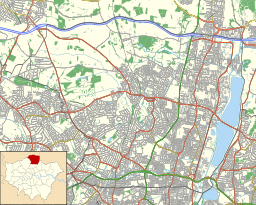
429:The water is part of the Chingford Reservoirs
664:
634:English Nature, Chingford Reservoirs citation
614:English Nature citation, Chingford Reservoirs
367:The embankment shoulders consist of zones of
8:
375:were constructed at a bank slope of 1 in 8.
287:. Due to the use of mechanical scrapers and
433:(SSSI). It is a major wintering ground for
303:experts, Dr. Herbert Chatley and Professor
224:. The storage reservoir, which is owned by
671:
657:
649:
20:
602:North london artificial recharge scheme
523:
521:
517:
452:
268:. However, under the provisions of the
275:Work began in 1936 when the tender of
18:Reservoir in London Borough of Enfield
7:
1056:Drinking water reservoirs in England
798:Thames Gateway Water Treatment Works
216:(MWB). The reservoir and the nearby
431:Site of Special Scientific Interest
322:of the MWB, and named eponymously.
764:1854 Broad Street cholera outbreak
502:London water supply infrastructure
14:
829:Coppermills Water Treatment Works
415:Coppermills Water Treatment Works
844:Crossness Sewage Treatment Works
483:
467:
455:
55:
48:
29:
849:Deephams Sewage Treatment Works
401:The outlet tower consists of a
179:
171:
163:
824:Beckton Sewage Treatment Works
534:. Thomas Telford. p. 70.
462:Weldex crane below embankment.
266:East London Waterworks Company
220:are known collectively as the
1:
864:Mogden Sewage Treatment Works
859:Hampton Water Treatment Works
490:View west towards Ponders End
413:The water is conveyed to the
293:Sir Jonathan Roberts Davidson
73:
970:Queen Elizabeth II Reservoir
869:Walton water treatment works
531:London and the Thames Valley
478:work NW corner of reservoir.
834:Cricklewood Pumping Station
819:Abbey Mills Pumping Station
724:Metropolitan Board of Works
604:Retrieved 12 September 2008
1072:
950:Lee Valley Reservoir Chain
616:Retrieved 21 December 2007
556:Civil Engineering Heritage
210:Lee Valley Reservoir Chain
35:The reservoir viewed from
1015:William Girling Reservoir
854:Greenwich pumping station
839:Crossness Pumping Station
386:Water is pumped from the
270:Metropolis Water Act 1902
206:London Borough of Enfield
202:William Girling Reservoir
79:London Borough of Enfield
63:William Girling Reservoir
43:
28:
24:William Girling Reservoir
940:King George VI Reservoir
729:Metropolitan Water Board
566:Retrieved 2 January 2007
214:Metropolitan Water Board
176:12.5 m (41 ft)
1046:Thames Water reservoirs
935:King George V Reservoir
930:Kempton Park Reservoirs
419:Essex and Suffolk Water
334:surface-to-air missiles
254:King George V Reservoir
218:King George V Reservoir
168:135 ha (330 acres)
1010:West Warwick Reservoir
1005:Walthamstow Reservoirs
980:Queen Mother Reservoir
920:High Maynard Reservoir
905:East Warwick Reservoir
803:Thames Water Ring Main
739:William Chadwell Mylne
257:
1000:Tilehurst Water Tower
985:Stain Hill Reservoirs
960:Low Maynard Reservoir
925:Island Barn Reservoir
895:Bessborough Reservoir
789:Thames Tideway Tunnel
785:Thames Tideway Scheme
629:Reservoir Information
528:Smith, Denis (2001).
251:
1051:Reservoirs in London
975:Queen Mary Reservoir
900:Chingford Reservoirs
474:Weldex carrying out
327:2012 Summer Olympics
285:Robert Wynne-Edwards
222:Chingford Reservoirs
1020:Wraysbury Reservoir
995:Sunnyside Reservoir
915:Grimsbury Reservoir
890:Bath Road Reservoir
719:London water supply
714:London sewer system
388:River Lee Diversion
208:and is part of the
194: imp gal)
144:River Lee Diversion
104: /
990:Staines Reservoirs
965:Molesey Reservoirs
955:Lockwood Reservoir
780:Abingdon Reservoir
258:
204:is located in the
108:51.6316°N 0.0244°W
1028:
1027:
910:Farmoor Reservoir
885:Banbury Reservoir
744:New River Company
699:Joseph Bazalgette
541:978-0-7277-2876-0
228:, is bordered by
198:
197:
184:16.5 Gl (3.6
1063:
945:Knight Reservoir
704:Edmund Colthurst
673:
666:
659:
650:
617:
611:
605:
599:
593:
592:
590:
588:
573:
567:
552:
546:
545:
525:
487:
471:
459:
316:Second World War
232:to the east and
190:
189:
139:
119:
118:
116:
115:
114:
113:51.6316; -0.0244
109:
105:
102:
101:
100:
97:
87:
59:
58:
52:
33:
21:
1071:
1070:
1066:
1065:
1064:
1062:
1061:
1060:
1031:
1030:
1029:
1024:
873:
807:
768:
759:William Webster
682:
677:
625:
620:
612:
608:
600:
596:
586:
584:
583:. 30 April 2012
575:
574:
570:
553:
549:
542:
527:
526:
519:
515:
498:
491:
488:
479:
472:
463:
460:
451:
427:
399:
384:
348:of the site is
342:
325:As part of the
246:
187:
185:
153: countries
138:Primary inflows
112:
110:
106:
103:
98:
95:
93:
91:
90:
70:
69:
68:
67:
66:
65:
64:
60:
39:
19:
12:
11:
5:
1069:
1067:
1059:
1058:
1053:
1048:
1043:
1033:
1032:
1026:
1025:
1023:
1022:
1017:
1012:
1007:
1002:
997:
992:
987:
982:
977:
972:
967:
962:
957:
952:
947:
942:
937:
932:
927:
922:
917:
912:
907:
902:
897:
892:
887:
881:
879:
875:
874:
872:
871:
866:
861:
856:
851:
846:
841:
836:
831:
826:
821:
815:
813:
812:Infrastructure
809:
808:
806:
805:
800:
795:
782:
776:
774:
773:Major projects
770:
769:
767:
766:
761:
756:
751:
746:
741:
736:
734:Hugh Myddelton
731:
726:
721:
716:
711:
706:
701:
696:
694:John Backhouse
690:
688:
684:
683:
678:
676:
675:
668:
661:
653:
647:
646:
641:
636:
631:
624:
623:External links
621:
619:
618:
606:
594:
568:
547:
540:
516:
514:
511:
510:
509:
504:
497:
494:
493:
492:
489:
482:
480:
473:
466:
464:
461:
454:
450:
447:
426:
423:
398:
395:
383:
380:
341:
338:
301:soil mechanics
281:civil engineer
245:
242:
196:
195:
182:
178:
177:
174:
170:
169:
166:
162:
161:
158:
157:
156:United Kingdom
154:
147:
146:
141:
133:
132:
127:
121:
120:
88:
82:
81:
76:
72:
71:
62:
61:
54:
53:
47:
46:
45:
44:
41:
40:
34:
26:
25:
17:
13:
10:
9:
6:
4:
3:
2:
1068:
1057:
1054:
1052:
1049:
1047:
1044:
1042:
1039:
1038:
1036:
1021:
1018:
1016:
1013:
1011:
1008:
1006:
1003:
1001:
998:
996:
993:
991:
988:
986:
983:
981:
978:
976:
973:
971:
968:
966:
963:
961:
958:
956:
953:
951:
948:
946:
943:
941:
938:
936:
933:
931:
928:
926:
923:
921:
918:
916:
913:
911:
908:
906:
903:
901:
898:
896:
893:
891:
888:
886:
883:
882:
880:
876:
870:
867:
865:
862:
860:
857:
855:
852:
850:
847:
845:
842:
840:
837:
835:
832:
830:
827:
825:
822:
820:
817:
816:
814:
810:
804:
801:
799:
796:
794:
790:
786:
783:
781:
778:
777:
775:
771:
765:
762:
760:
757:
755:
752:
750:
747:
745:
742:
740:
737:
735:
732:
730:
727:
725:
722:
720:
717:
715:
712:
710:
707:
705:
702:
700:
697:
695:
692:
691:
689:
685:
681:
674:
669:
667:
662:
660:
655:
654:
651:
645:
642:
640:
637:
635:
632:
630:
627:
626:
622:
615:
610:
607:
603:
598:
595:
582:
578:
572:
569:
565:
564:0-7277-2876-8
561:
557:
551:
548:
543:
537:
533:
532:
524:
522:
518:
512:
508:
505:
503:
500:
499:
495:
486:
481:
477:
470:
465:
458:
453:
448:
446:
444:
440:
436:
432:
424:
422:
420:
416:
411:
409:
404:
396:
394:
391:
389:
381:
379:
376:
374:
370:
365:
362:
357:
355:
351:
347:
339:
337:
335:
332:
328:
323:
321:
317:
312:
310:
306:
305:Karl Terzaghi
302:
298:
294:
290:
286:
282:
278:
273:
271:
267:
263:
255:
250:
243:
241:
239:
235:
231:
227:
223:
219:
215:
211:
207:
203:
193:
183:
175:
167:
159:
155:
152:
148:
145:
142:
140:
134:
131:
128:
126:
122:
117:
89:
83:
80:
77:
51:
42:
38:
32:
27:
22:
16:
1014:
787:, including
680:Thames Water
609:
597:
585:. Retrieved
580:
571:
558:p.74 (2001)
555:
550:
530:
476:sheet piling
443:moult refuge
428:
412:
400:
392:
385:
377:
366:
358:
343:
324:
313:
274:
259:
226:Thames Water
201:
199:
191:
181:Water volume
165:Surface area
15:
709:Great Stink
361:puddle clay
356:formation.
354:London Clay
340:Description
277:John Mowlem
234:Ponders End
111: /
86:Coordinates
1035:Categories
878:Reservoirs
793:Lee Tunnel
513:References
289:bulldozers
262:Lea Valley
173:Max. depth
96:51°37′54″N
754:John Snow
749:New River
230:Chingford
130:reservoir
99:0°01′28″W
37:Chingford
581:BBC News
554:Smith.D
496:See also
435:wildfowl
350:alluvium
320:Chairman
238:Edmonton
75:Location
687:History
449:Gallery
439:wetland
425:Ecology
408:conduit
403:granite
397:Outflow
369:ballast
346:geology
309:Britain
244:History
562:
538:
382:Inflow
331:Rapier
587:4 May
151:Basin
791:and
589:2012
560:ISBN
536:ISBN
437:and
373:berm
344:The
236:and
200:The
125:Type
1037::
579:.
520:^
421:.
410:.
336:.
295:,
283:,
188:10
672:e
665:t
658:v
591:.
544:.
192:^
186:×
Text is available under the Creative Commons Attribution-ShareAlike License. Additional terms may apply.