112:
119:
225:
in
Bayburt, the area was covered by snow on January 16. As the temperature there was −5 °C (23 °F) at 21:00 local time on that day, it dropped to −15 °C (5 °F) the next day, resulting in formation of surface crusts. During the daytime of January 17, the temperature rose up and the
205:
The top of the hill at the backside of the village is 3,193 m (10,476 ft) high Amsl. Unlike the northern slopes of the mountains in that region, which are densely covered with forest, the south facing part, where the village is located, has almost no trees.
242:, and struck the village at around 07:45 local time. The snow masses destroyed a total of 72 houses and buried more than 70 people and a great number of animals. The natural disaster caused the life losses of 59 people and 650
249:
As a result of the disaster and the future avalanche risk at the location, Üzengili village, comprising 116 houses, has been relocated to another place in a safe zone. In 1997, the settlement counted 166 inhabitants.
230:
by refreezing with the dropping temperature. Freshly precipitated snow in the night of
January 17 and in the early hours of the next day covered the melt-crust surface.
186:Üzengili is a mountain village situated at an elevation of 2,025 m (6,644 ft) on the southern edge of the Soğanlı Mountains within the
514:
509:
499:
218:
78:
445:
111:
414:
519:
312:
494:
396:
270:
392:
314:
Eastern
Anatolia Project Master Plan-Current Situation and Analysis-Local Characteristics, Settlements, General Evaluation
71:
504:
187:
489:
350:
Naaimi, Mohamed; Gürer, İbrahim (1998). "Two-phase
Numerical Model of Powder Avalanche-Theory and Application".
476:", 2. Avalanche Dynamics Workshop, 3–8 October 1993, Innsbruck, Austria 15 p, (presented in the workshop).
41:
167:
56:
367:
226:
snow pack melted at the surface. In the late hours of that day, the snow pack's surface formed a
320:. Vol. IV. State Planning Organization Undersecretariat. 2000. p. 144. Archived from
227:
238:
The avalanche flowed 4,150 m (13,620 ft) downwards at an average slope angle of 17
449:
359:
191:
171:
60:
421:
222:
239:
483:
371:
321:
385:
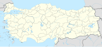
281:
363:
93:
80:
243:
420:(in Turkish). Devlet Meteoroloji İşleri Genel Müdürlüğü. Archived from
199:
474:
18 Ocak 1993 de Kuzey Doğu Bölgesinde
Bayburt-Üzengili'de Çığ Olayları
175:
64:
162:
occurred on
January 18, 1993, at around 07:45 local time (05:45
280:(in Turkish). 4-5-6 (420–421–422). İMO: 147–154. Archived from
271:"Türkiye'de Yerleşim Yerlerine Yönelik Kar ve Çığ Problemleri"
163:
45:
178:. It killed 59 people and injured 21, destroying 72 houses.
136:
70:
52:
36:
21:
202:close to the Bayburt-Trabzon provincial border.
198:). It is 36 km (22 mi) north-east of
209:In 1990, the village had a population of 355.
448:(in Turkish). Bayburt Köyleri. Archived from
8:
16:
246:. 21 people were injured at the incident.
15:
118:
258:
345:
343:
341:
307:
305:
303:
301:
7:
402:from the original on 31 August 2021.
264:
262:
219:Turkish State Meteorological Service
14:
117:
110:
358:(2). Kluwer Academic: 129–145.
217:According to the data from the
188:Eastern Blacksea Mountain Range
160:1993 Bayburt Üzengili avalanche
17:1993 Bayburt Üzengili avalanche
1:
515:January 1993 events in Turkey
472:Gürer, I., Naaim, M. (1993) "
446:"Bayburt ve İlçeleri Tanıtım"
393:Turkish Statistical Institute
278:Türkiye Mühendislik Haberleri
510:Natural disasters in Turkey
500:History of Bayburt Province
536:
25:January 18, 1993
151:
146:
141:
520:1993 disasters in Turkey
413:Taştekin, Ahmet Tolga.
364:10.1023/a:1008002203275
269:Gürer, İbrahim (2002).
495:1993 natural disasters
196:Doğu Karadeniz Dağları
195:
386:"1990 General Census"
415:"Meteoroloji ve Çığ"
182:Location and terrain
94:40.4985°N 40.3851°E
90: /
18:
505:Avalanches in Asia
221:, recorded at the
213:Weather conditions
152:650 livestock loss
228:melt-freeze crust
156:
155:
125:Üzengili, Bayburt
527:
490:1990s avalanches
461:
460:
458:
457:
442:
436:
435:
433:
432:
426:
419:
410:
404:
403:
401:
390:
382:
376:
375:
347:
336:
335:
333:
332:
326:
319:
309:
296:
295:
293:
292:
286:
275:
266:
174:in northeastern
172:Bayburt Province
121:
120:
114:
105:
104:
102:
101:
100:
99:40.4985; 40.3851
95:
91:
88:
87:
86:
83:
61:Bayburt Province
32:
30:
19:
535:
534:
530:
529:
528:
526:
525:
524:
480:
479:
469:
467:Further reading
464:
455:
453:
444:
443:
439:
430:
428:
424:
417:
412:
411:
407:
399:
388:
384:
383:
379:
352:Natural Hazards
349:
348:
339:
330:
328:
324:
317:
311:
310:
299:
290:
288:
284:
273:
268:
267:
260:
256:
236:
223:weather station
215:
184:
170:, a village of
132:
131:
130:
129:
128:
127:
126:
122:
98:
96:
92:
89:
84:
81:
79:
77:
76:
28:
26:
12:
11:
5:
533:
531:
523:
522:
517:
512:
507:
502:
497:
492:
482:
481:
478:
477:
468:
465:
463:
462:
437:
405:
391:(in Turkish).
377:
337:
297:
257:
255:
252:
235:
232:
214:
211:
183:
180:
154:
153:
149:
148:
144:
143:
139:
138:
134:
133:
124:
123:
116:
115:
109:
108:
107:
106:
74:
68:
67:
54:
50:
49:
38:
34:
33:
23:
13:
10:
9:
6:
4:
3:
2:
532:
521:
518:
516:
513:
511:
508:
506:
503:
501:
498:
496:
493:
491:
488:
487:
485:
475:
471:
470:
466:
452:on 2011-07-08
451:
447:
441:
438:
427:on 2011-10-08
423:
416:
409:
406:
398:
394:
387:
381:
378:
373:
369:
365:
361:
357:
353:
346:
344:
342:
338:
327:on 2010-03-07
323:
316:
315:
308:
306:
304:
302:
298:
287:on 2012-03-13
283:
279:
272:
265:
263:
259:
253:
251:
247:
245:
241:
233:
231:
229:
224:
220:
212:
210:
207:
203:
201:
197:
193:
189:
181:
179:
177:
173:
169:
165:
161:
150:
145:
140:
135:
113:
103:
75:
73:
69:
66:
62:
58:
55:
51:
47:
43:
39:
35:
24:
20:
473:
454:. Retrieved
450:the original
440:
429:. Retrieved
422:the original
408:
380:
355:
351:
329:. Retrieved
322:the original
313:
289:. Retrieved
282:the original
277:
248:
237:
216:
208:
204:
185:
159:
157:
97: /
72:Coordinates
484:Categories
456:2010-10-15
431:2010-10-13
331:2010-10-15
291:2010-10-13
254:References
147:21 injured
137:Casualties
85:40°23′06″E
82:40°29′55″N
29:1993-01-18
372:128580018
244:livestock
397:Archived
395:. 1991.
234:Disaster
168:Üzengili
57:Üzengili
53:Location
240:degrees
200:Bayburt
192:Turkish
142:59 dead
44:(05:15
27: (
370:
176:Turkey
65:Turkey
40:07:45
425:(PDF)
418:(PDF)
400:(PDF)
389:(PDF)
368:S2CID
325:(PDF)
318:(PDF)
285:(PDF)
274:(PDF)
166:) in
158:The
37:Time
22:Date
360:doi
164:UTC
46:UTC
42:EET
486::
366:.
356:17
354:.
340:^
300:^
276:.
261:^
194::
63:,
59:,
459:.
434:.
374:.
362::
334:.
294:.
190:(
48:)
31:)
Text is available under the Creative Commons Attribution-ShareAlike License. Additional terms may apply.