409:). Most walking guidebooks recommend climbing Baosbheinn along with Beinn an Eoin, this calls for the ascent of Beinn an Eoin first, however a direct ascent of Baosbheinn is possible although the crossing of the river, the Abhainn a’ Gharbh Choire can be difficult in spate conditions. The walk goes SE on the track which leads to Loch na h-Oidhche, the early part of the track goes through a recently sown plantation just to the East of Loch Bad na Sgalag where over 1 million trees of native species have been planted. The original trees in this area were cut down in the 16th and 17th centuries to feed the ironworks on the shore of
162:
155:
28:
386:
in Great
Britain. The rampart is situated at the NW end of the ridge below the crags of Creag an Fithich at a height of around 450 m (1,480 ft). It formed in post-glacial times when a massive rockslide or series of rockslides involving failure of approximately 200,000 m³ of rock over-rode a
378:
maps. The ridge continues for two km to reach the NW top (801 m (2,628 ft)) before descending to Creag an
Fithich (738 m (2,421 ft)) at the northern end of the ridge. Baosbheinn has three north facing corries, An Rèidh-choire is the largest and lives up to its name of Smooth
285:. It is a long elongated mountain with a NW-SE orientation, its summit ridge is impressive, barely dropping below the 700 m (2,300 ft) contour in its 3 kilometres (1.9 miles) length. Its SW slopes drops away steeply and rockily towards
353:
which translates as face or forehead. In conclusion, although the translated name is usually given as Wizard's Hill, the alternatives of Hill of the Face, Hunting Hill or Hill of the Hag (or Wicked Person) may have stronger supporting evidence.
603:
362:
Baosbheinn summit ridge is made up of five prominent high points, starting at the SE end of the ridge is the outlying shoulder of Ceann Beag (705 m (2,313 ft)) after a short descent to a
593:
588:
210:
349:
in the morning light, the hill resembles the appearance of a human head. This is supported by older spellings of the name which use derivations of
90:
387:
former snowbed and accumulated as a boulder ridge. The north west end of
Baosbheinn where the protalus rampart is situated has been designated a
405:
154:
388:
559:
496:
444:
413:. The track is left after 3 km (1.9 mi) and the ridge of Baosbheinn can be attained by crossing pathless moorland.
583:
204:
379:
corrie, being quite open and grassy while the smaller Coire Beag and Coire Mor are more compact and are lined by crags.
83:
535:
294:
57:
382:
Baosbheinn has one noteworthy geological feature: it being the site of the largest and most impressive
301:
and gives a demanding circular walk of 21 km (13 mi) which takes between six and nine hours.
286:
289:
while its NE slopes are less precipitous, throwing out a series of spurs which produces three craggy
254:
197:
27:
472:
488:
345:
refer to the hill as “mountain of the face”, this is explained by the fact that when viewed from
278:
67:
374:
805 metres (2,641 feet) before continuing to the main summit (875 metres), named Sgorr Dubh on
598:
578:
555:
492:
298:
508:
383:
262:
72:
520:
539:
448:
429:
375:
310:
230:
223:
218:
325:
is the usual word for a wizard. Scholars have put forward alternatives, one of these is
282:
190:
76:
572:
363:
33:
441:
313:
language is usually given by guidebooks as “Wizard’s hill” this comes from the word
460:
399:
The usual ascent of
Baosbheinn starts at a parking place at the Red Barn on the
342:
274:
258:
174:
410:
105:
92:
400:
330:
532:
346:
250:
246:
178:
293:. Strong hill walkers can climb Baosbheinn with the adjacent Corbett of
370:
620 metres (2,030 feet) the ridge rises steeply over an unnamed top of
277:
reaches a height of 875 metres (2,871 feet) making it the 56th highest
604:
Sites of
Special Scientific Interest in South Wester Ross and Cromarty
290:
47:
333:
language which translates as hunting hill, with the Norse
509:
http://www.landforms.eu/cairngorms/protalus%20rampart.htm
317:
but strictly speaking this translates as a hag or bitch.
257:. It stands in a remote area within the Flowerdale
217:
203:
189:
142:
134:
126:
121:
82:
66:
56:
46:
41:
20:
594:Mountains and hills of Highland (council area)
589:Mountains and hills of the Northwest Highlands
8:
17:
562:, page 184, Gives ascent route details.
552:"The Corbetts And Other Scottish Hills"
451:Gives list of Marilyns in height order.
432:Gives list of Corbetts in height order.
422:
309:The translation of Baosbheinn from the
473:Lexilogos Scottish Gaelic Dictionary.
7:
521:Joint Nature Conservation Committee.
499:, page 36, Gives etymology details.
389:Site of Special Scientific Interest
523:Gives details of protalus rampart.
161:
14:
542:Gives details of native pinewood.
554:, Scottish Mountaineering Club,
463:Gives some details for overview.
160:
153:
26:
391:over an area of 39,000,000 m².
273:Baosbheinn which is made up of
442:The Relative Hills Of Britain.
1:
371:
367:
337:later changed to the Gaelic
620:
485:"The Call Of The Corbetts"
475:Gives Gaelic translations.
62:443 m (1,453 ft)
52:875 m (2,871 ft)
249:mountain situated in the
147:
25:
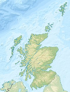
261:some 39 km NNE of
36:, four km to the south.
281:and the 277th highest
358:Geography and geology
341:. Local residents of
584:Marilyns of Scotland
297:which stands across
255:Northwest Highlands
198:Northwest Highlands
127:English translation
102: /
538:2012-05-16 at the
489:Irvine Butterfield
447:2010-08-22 at the
430:Walking Highlands.
275:Torridon Sandstone
130:Various (see text)
106:57.6278°N 5.5665°W
42:Highest point
299:Loch na h-Oidhche
287:Loch a’ Ghobhainn
240:
239:
611:
563:
549:
543:
530:
524:
518:
512:
511:protalus rampart
506:
500:
482:
476:
470:
464:
458:
452:
439:
433:
427:
408:
384:protalus rampart
373:
369:
263:Kyle of Lochalsh
213:
193:
164:
163:
157:
117:
116:
114:
113:
112:
111:57.6278; -5.5665
107:
103:
100:
99:
98:
95:
30:
18:
619:
618:
614:
613:
612:
610:
609:
608:
569:
568:
567:
566:
550:
546:
540:Wayback Machine
531:
527:
519:
515:
507:
503:
483:
479:
471:
467:
459:
455:
449:Wayback Machine
440:
436:
428:
424:
419:
404:
397:
360:
311:Scottish Gaelic
307:
271:
209:
191:
185:
184:
183:
182:
181:
172:
171:
170:
169:
165:
110:
108:
104:
101:
96:
93:
91:
89:
88:
37:
12:
11:
5:
617:
615:
607:
606:
601:
596:
591:
586:
581:
571:
570:
565:
564:
544:
533:Nar Fir Chlis.
525:
513:
501:
477:
465:
453:
434:
421:
420:
418:
415:
396:
393:
359:
356:
306:
303:
270:
267:
238:
237:
221:
215:
214:
207:
201:
200:
195:
187:
186:
173:
167:
166:
159:
158:
152:
151:
150:
149:
148:
145:
144:
140:
139:
136:
132:
131:
128:
124:
123:
119:
118:
86:
80:
79:
70:
64:
63:
60:
54:
53:
50:
44:
43:
39:
38:
31:
23:
22:
13:
10:
9:
6:
4:
3:
2:
616:
605:
602:
600:
597:
595:
592:
590:
587:
585:
582:
580:
577:
576:
574:
561:
560:0-907521-29-0
557:
553:
548:
545:
541:
537:
534:
529:
526:
522:
517:
514:
510:
505:
502:
498:
497:0-7153-2754-2
494:
490:
486:
481:
478:
474:
469:
466:
462:
457:
454:
450:
446:
443:
438:
435:
431:
426:
423:
416:
414:
412:
407:
402:
394:
392:
390:
385:
380:
377:
365:
357:
355:
352:
348:
344:
340:
336:
332:
328:
327:beidhis-fjall
324:
320:
316:
312:
304:
302:
300:
296:
295:Beinn an Eoin
292:
288:
284:
280:
276:
268:
266:
264:
260:
256:
252:
248:
244:
235:
232:
228:
225:
222:
220:
216:
212:
208:
206:
202:
199:
196:
194:
188:
180:
176:
156:
146:
141:
137:
135:Pronunciation
133:
129:
125:
120:
115:
87:
85:
81:
78:
74:
71:
69:
65:
61:
59:
55:
51:
49:
45:
40:
35:
34:Beinn Alligin
29:
24:
19:
16:
551:
547:
528:
516:
504:
484:
480:
468:
461:Munro Magic.
456:
437:
425:
398:
381:
361:
350:
338:
334:
326:
322:
318:
314:
308:
272:
253:area of the
242:
241:
233:
226:
192:Parent range
15:
343:Wester Ross
259:deer forest
175:Wester Ross
109: /
84:Coordinates
573:Categories
417:References
411:Loch Maree
243:Baosbheinn
227:Landranger
168:Baosbheinn
94:57°37′40″N
58:Prominence
32:Seen from
21:Baosbheinn
401:A832 road
331:Old Norse
329:from the
323:fiosaiche
305:Etymology
143:Geography
138:Boe-shvyn
97:5°33′59″W
48:Elevation
599:Torridon
579:Corbetts
536:Archived
445:Archived
406:NG856720
347:Gairloch
319:Buidsear
269:Overview
251:Torridon
247:Scottish
234:Explorer
219:Topo map
211:NG870654
179:Scotland
395:Ascents
351:bathais
291:corries
283:Marilyn
279:Corbett
205:OS grid
77:Marilyn
73:Corbett
68:Listing
558:
495:
339:bheinn
122:Naming
335:fjall
315:baobh
245:is a
556:ISBN
493:ISBN
366:at
229:19,
364:col
321:or
236:433
575::
491:,
487:,
376:OS
372:c.
368:c.
265:.
231:OS
224:OS
177:,
75:,
403:(
Text is available under the Creative Commons Attribution-ShareAlike License. Additional terms may apply.