108:
755:, a new, straight vehicular highway was built before the railroad was abandoned, along the railroad right-of-way. As large businesses in the United States grew, they passed the shrinking Crisfield by until the late 20th century. Fast-food restaurants began to slowly find business in the city, starting in the late 1990s, alongside the many seafood restaurants already in town. A large supermarket had been in city plans for a decade, though it wasn't until April 2010 that it opened for business. Crisfield has also been a target for large waterfront properties, with several large condominiums being built in the mid-2000s in the downtown area, along with other places flanking Crisfield's harbors. A "strategic revitalization plan" has been in the works since 2006 to address future growing needs and beautification of the city.
2089:
provides access to City Hall, the post office, police department, the library, and many of the businesses in the city, and also intersects
Somerset Avenue at the only stoplight in the city. Main Street merges with Maryland Route 413 near the Crisfield Fire Department, becoming a four-lane boulevard. Broadway Avenue, running parallel to Main Street one block south, was once a major business center in the city as well, fronted by many businesses and churches and passed directly through the city's marina; however, it no longer reaches the marina, and a large number of the stores and warehouses along it have closed.
3858:
627:
1799:
60:
271:
813:
1807:
669:. He patented a 300-acre (1.21 km) parcel of land, which he named "Emmessex". He later patented another 200 acres (0.81 km) of land on September 23, 1683, naming it "Musketa Hummock". Both of these plots of land are located in the present-day Crisfield Election District. Another plot of land, named "Little Worth" and totalling 100 acres (0.40 km), was also patented in Annemessex. These three plots of land would eventually come to be known collectively as Somers Cove.
85:
125:
75:
2200:
158:
2029:. Proponents state that a high-speed ferry link will reduce travel times to adjacent points on the western shore by as much as two and a half hours as the Bay Bridges are far from one another, spurring tourism and economic growth on both sides. The most recent proposal came in the 2000s; however, it was deemed that a ferry would not be economically feasible. Money earmarked for the ferry service was released to the city for an upgrade of the city dock.
233:
1974:− Originally known as just Crisfield High School, this building is located on North Somerset Avenue between the intersections of Potomac Street and Mercury Drive, and serves grades 8−12. Before consolidation, it handled grades 9−12. The school is the first educational facility built beyond the original Crisfield Academy, and has existed in four different buildings on three different sites, all located close to or on Somerset Avenue.
1871:
1948:
1902:
549:
251:
1578:
2038:
4149:
827:, the city has a total area of 3.06 square miles (7.93 km), of which 1.62 square miles (4.20 km) (53.0%) is land and 1.44 square miles (3.73 km) (47.0%) is water. As one of the southern points on the Delmarva Peninsula and one very close to the Chesapeake Bay, the city is extremely flat, with the elevation never rising above 3 feet (0.91 m).
165:
132:
1754:
to head law enforcement in the city. Since then, crime rates have been on a steady decline, generally halving between 2006 and 2008. The most prevalent crime in the city is property crime, down from a high of 180 in 2006 to 92 in 2008. Theft is also very common. Violent crimes, such as murder and
746:
Crisfield's prosperity began to decline along with the health of the
Chesapeake Bay. Oyster populations declined to the point where the watermen could no longer fully support themselves on their daily catches. Some businesses began to move out of Crisfield, while others shut down. On April 1, 1976,
605:
Crisfield began to slip into decline along with the declining health of the
Chesapeake Bay, prompting a "strategic revitalization plan" to address the city's future needs. Currently, Crisfield is largely a tourist destination. It hosts many annual events and festivals, the most prominent of which is
1845:
Crisfield's largest event is the annual
National Hard Crab Derby & Fair, held every Labor Day weekend, which began in 1947. Major highlights of the Crab Derby include a parade through Main Street, the Little Miss, Little Mr. and Miss Crustacean Pageants, the Boat Docking Contest (which began in
1778:
In the past, the economy was centered on the watermen and seafood. About 150 seafood processing and packing plants were located within the city in its heyday. As the health of the
Chesapeake Bay began to decline, so did the numbers for the blue crab catch, which have fallen by 70% since the 1990s.
1730:
In the city, the age distribution of the population shows 27.8% under the age of 18, 8.3% from 18 to 24, 24.5% from 25 to 44, 21.2% from 45 to 64, and 18.1% who were 65 years of age or older. The median age was 37 years. For every 100 females, there were 75.6 males. For every 100 females age 18 and
2088:
Major streets not maintained by the state are
Somerset Avenue, which is located at the northern edge of town and travels south, paralleling the eastern city boundary and fronted mostly by homes; all of the public schools in the city are located down this corridor. There is also Main Street, which
1967:
Carter G. Woodson
Elementary School − This school is located on South Somerset Avenue and currently serves grades K−5. This was changed from 2004, where it was the middle school, serving grades 6−8; school consolidation in the county changed the school and gave it a renovation. Much earlier than
2097:
As part of expansion of bicycle infrastructure across the state of
Maryland, MD 413 inside the city limits received bicycle lanes for almost its full length in 2017. There is also a proposal to convert the abandoned Crisfield Secondary Branch alongside MD 413 to a Crisfield–Westover Rail Trail.
1933:
is a large marshy island made of almost completely undeveloped land, and is colonized by various birds and marine life. It offers fishing, swimming beaches, picnicking, camping, a playground, and has about thirty miles of water trails which can be accessed by canoe. The beaches allow swimming as
1673:
There were 1,113 households, of which 33.6% had children under the age of 18 living with them, 30.1% were married couples living together, 25.8% had a female householder with no husband present, 4.0% had a male householder with no wife present, and 40.1% were non-families. 35.4% of all households
1641:
As of the census of 2010, there were 2,726 people, 1,113 households, and 667 families residing in the city. The population density was 1,682.7 inhabitants per square mile (649.7/km). There were 1,531 housing units at an average density of 945.1 per square mile (364.9/km). The racial makeup of the
702:
system, to the Somers Cove seaport. The
Crisfield Secondary Branch of the railroad opened on November 6 of that year. The town was formally incorporated in 1872 as a city, and renamed Crisfield in honor of the attorney's efforts. The railroad bolstered the economy of the new city and Crisfield
1690:
of 2000, there were 2,723 people, 1,172 households, and 723 families residing in the city. The population density was 1,674.9 inhabitants per square mile (646.7/km). There were 1,357 housing units at an average density of 834.7 per square mile (322.3/km). The racial makeup of the city was 58.54%
2151:
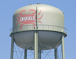
Crisfield possesses three water towers and a public sewer system; both provide municipal services as far north as
Plantation Road in Hopewell. The most recent water tower was installed in the early 2000s. It also has a sewage water treatment plant, which is notably overburdened and obsolete.
1726:
There were 1,172 households, out of which 30.3% had children under the age of 18 living with them, 32.9% were married couples living together, 25.4% had a female householder with no husband present, and 38.3% were non-families. 34.3% of all households were made up of individuals, and 18.9% had
1925:
Wellington Beach and Park was open with life guards and concession stand in the 1980s, but closed. However, through Program Open Space, Crisfield received funding to build and reopen it. Crisfield's public Wellington Beach and Park reopened in early 2012 as Brick Kiln Beach. However, after
2003:. The city dock pavilion is a popular site for public events. The county dock, located one block west at the end of Broad Street, is largely used for freight, and was rehabilitated in the mid-2000s. The Little Boat Harbor, located on Brick Kiln Road is utilized mostly by smaller workboats.
1677:
The median age in the city was 38.4 years. 27.8% of residents were under the age of 18; 8.3% were between the ages of 18 and 24; 21.5% were from 25 to 44; 24.6% were from 45 to 64; and 17.7% were 65 years of age or older. The gender makeup of the city was 44.0% male and 56.0% female.
730:
The success of the city's seafood industry filled the city with train soot and large quantities of oyster shells. Around the turn of the 20th century, businessmen would buy plots of land at the southwest edge of the city and discard the shells and soot into the salt marshes. This
2016:
Throughout Crisfield's history, there has been discussion of a high-speed ferry link between Crisfield and the Western Shore, with large vessels that can accommodate large numbers of vehicles and tractor-trailers. The proposed site for a Western Shore landing has ranged from
1909:
Crisfield is said to have a mayor–council–manager government. Administration is handled by the City Manager, who is appointed by the mayor and city council. The mayor is elected by the citizens of Crisfield, and the council members are as well. All serve four-year terms.
710:
Seafood was soon being shipped all over the United States, and Crisfield became known as the "Seafood Capital of the World", a nickname still carried by the city. An industrial boom followed. By 1904, the City of Crisfield was the second largest city in Maryland, after
1926:
Hurricane Sandy hit later that year, the beach required major reconstruction. The beach was renamed and reopened to the public on June 2, 2013 at 1:00 PM. The park has a play area, a gazebo, and bathrooms during the summer months. It also is a popular crabbing spot.
1763:
Crisfield's economy is centered largely around retail, health care, and automotive. Seafood is also an important part of Crisfield's economy, just as it has been for most of its existence, with several packing plants existing within the city. In 1997, the company
742:
The city experienced several fires, the most well-known of which is known as the Great Fire of 1928. It began on March 29 at the Crisfield Opera House and quickly spread to the downtown area, completely destroying it and causing over $ 1 million in damages.
2271:
was mostly filmed in Crisfield in winter 2010−2011 and was released in 2013. Crisfield is the hometown of most of the cast and crew members and is called "Hometown, Maryland" in the movie. The film is currently available on Amazon and YouTube.
735:
eventually grew to become a peninsula roughly a half-mile long. Downtown Crisfield was built atop this new land, and this leads to the common statement that Crisfield was so prosperous that it is "literally built on top of oyster shells".
107:
883:, with hot, humid summers and cool to mild winters. Its proximity to water, as well as a common trend on the Delmarva Peninsula, means that the city does not see much snowfall in the winters; meaning Crisfield as well as
2110:, which provides the commuter bus service for the lower Eastern Shore. Both routes travel along Somerset Avenue and MD 413, and Cove Street, and stop at McCready Memorial Hospital. All buses provide access to the
1834:
Since 1986, Crisfield has hosted the Scorchy Tawes Pro-Am Fishing Tournament. The 3-day tournament features cash prizes for different fishing categories, and nightly block-parties at Side Street Restaurant.
1755:
forcible rape, are rare, though the numbers for those are on the decline as well. In January 2010, it was reported that Crisfield experienced an 81% decrease in crime rates of all kinds since 2007.
1790:. Additionally, a new industrial park, slated for construction as early as September 2013 just north of Crisfield, near Carvel Hall and along MD 413, will expand Crisfield's corporate limits.
2862:
1991:
Crisfield has two public docks. The city dock is located at the end of Main Street (MD 413). The city dock is the landing for mail ships, large commercial ships, and passenger ferries to
2223:. McCready Hospital is located on the Annemessex River, and is flanked by the Alice Byrd Tawes Nursing Home, which was built in 1968 and was replaced by a new four-story building in 2010.
2171:, located downtown on Seventh Street. This was removed around the time of the decommissioning of the rail line, as the railroad once ended there; power is now tapped from a substation in
4385:
739:
James Reed, an African American native to North Carolina was lynched by a mob of whites in Crisfield, Maryland on July 28, 1907. He was thought to have killed the local police chief.
3250:
3684:
3486:
3399:
1734:
The median income for a household in the city was $ 17,979, and the median income for a family was $ 23,929. Males had a median income of $ 30,078 versus $ 20,670 for females. The
4095:
3794:
1674:
were made up of individuals, and 15.4% had someone living alone who was 65 years of age or older. The average household size was 2.38 and the average family size was 3.06.
3198:
2407:
2013:
built in Crisfield in the 1960s, is currently owned by the State of Maryland. The marina hosts many of the city's large events, such as the National Hard Crab Derby.
762:, and it abounds with restaurants, seafood packing houses, and seafood distribution companies. Several seafood restaurants across the country carry the city's name.
598:
to Crisfield, and the quiet fishing town grew. Crisfield is now known as the "Seafood Capital of the World". The city's success was so great that the train soot and
3431:
1786:
Most of the labor force in Crisfield works outside of the city and elsewhere on the peninsula—the largest seafood employer in Somerset County is located nearby in
2525:
Vernon L. Skinner & F. Edward Wright, Colonial Families of the Eastern Shore of Maryland, Volume 18, p. 165 (Summers Family of Somerset County). Retrieved
4375:
2448:
3008:
2985:
2962:
4360:
4088:
193:
2041:
West Main Street (MD 413) in downtown Crisfield. The four-lane section of the highway within Crisfield's limits is known as "The Strip" among locals.
602:
prompted the extension of the city's land into the marshes. City residents often claim that the downtown area is literally built atop oyster shells.
4390:
4370:
510:
2831:
2134:
The main access road to the airport is on Plantation Road in Hopewell, south of the MD 667 intersection there; from Crisfield it is accessible via
3787:
851:
Crisfield is the southernmost city in the state of Maryland; the point farthest south is geographically located at Ape Hole. Regardless of this,
687:
In 1854, a survey of the Chesapeake Bay revealed that the area was a lucrative fishing location, with extensive oyster beds around Somers Cove.
2540:
The Art and Mystery of Shipbuilding: An Archaeological Study of Shipyards, Shipwrights and Shipbuilding in Somerset County, Maryland 1660–1900
2700:
2641:
3457:
3258:
4380:
4081:
3367:
2812:
801:
84:
3490:
3658:
3406:
3970:
3223:
2131:
1787:
715:, with the population topping off at about 25,000 at that time. The city's seafood industry attracted new residents from as far away as
520:
157:
3780:
1858:
Crisfield has several museums: the J. Millard Tawes Historical Museum, the Ward Brothers Workshop, and the J. Millard Tawes Library.
781:
1838:
The annual J. Millard Tawes Crab and Clam Bake takes place in September each year. The event, which began in 1976, is named for the
834:
and was built on a floodplain. The downtown is especially prone to flooding during large storms and hurricanes. On October 29, 2012,
3635:
3547:
3330:
3082:
2216:
1971:
124:
2349:
2756:
1771:
The largest employer inside Crisfield's limits is the McCready Memorial Hospital. The second largest employer in the city is the
74:
2723:
2378:
1727:
someone living alone who was 65 years of age or older. The average household size was 2.30 and the average family size was 2.92.
860:
797:
59:
2782:
672:
Somers Cove soon became a major East Coast distribution center for seafood. The town grew faster than other settlements on the
3016:
2993:
2970:
2604:
2026:
2890:
2664:
2203:
The newly constructed nursing home in Crisfield, with the original one in front of it. The original has since been demolished.
3772:
1956:
1708:
1696:
1647:
3599:
2414:
2916:
2164:
1919:
1700:
1651:
1598:
748:
724:
3724:
4355:
3435:
662:
263:
3625:
4365:
4118:
4104:
3923:
3061:
3036:
2835:
2324:
2127:
1751:
1712:
1606:
824:
777:
576:
3512:
2553:
626:
4138:
3568:
3306:
1626:
1622:
1618:
2455:
4334:
4133:
4123:
4025:
3804:
3318:
3314:
3254:
2054:
1614:
1610:
1602:
1556:
1541:
1526:
1511:
1496:
1481:
1466:
1451:
1436:
1421:
1406:
1391:
1376:
1361:
1346:
880:
856:
793:
572:
560:
275:
3762:
2207:
Crisfield is currently home to the only hospital in Somerset County: McCready Memorial Hospital, accessible by
630:
John W. Crisfield was president of the Eastern Shore Railroad and brought the railroad to what is now Crisfield.
4319:
3990:
3005:
2982:
2959:
2307:
2018:
2000:
1988:
As Crisfield's heritage is on the water, it has many points of access to the Tangier Sound and Chesapeake Bay.
720:
704:
615:
498:
225:
607:
1814:
Due to Crisfield being the main access point to Smith Island, it is an area with many speakers of the unique
4314:
4309:
4234:
4128:
4053:
3975:
3938:
3903:
3888:
3878:
3826:
2172:
2115:
2111:
2066:
1930:
1798:
695:
677:
313:
812:
4015:
4005:
3933:
3928:
2313:
2176:
1992:
1815:
1716:
1663:
872:
839:
611:
503:
2839:
2631:
838:'s storm surge left most of the city underwater. Ongoing local concerns about flooding and the impact of
4244:
4201:
3908:
2817:
2082:
2078:
699:
639:
595:
282:
1806:
1765:
2690:
647:
646:, were indigenous to the region. Their small fishing village was known as Annemessex Neck. The nearby
4324:
4304:
4299:
4196:
4186:
4060:
1720:
1667:
471:
4329:
4289:
4284:
4264:
4224:
4181:
4163:
4010:
3960:
3948:
3918:
2867:
2220:
2199:
2180:
2022:
1996:
1704:
1692:
1655:
1643:
1630:
844:
712:
681:
30:
1918:
The city once had a minor league baseball team: the Crisfield Crabbers, who played in now-defunct
4040:
4020:
4000:
3980:
3720:
3461:
3322:
3172:
2302:
2244:
2212:
2208:
2135:
2074:
2070:
2062:
2058:
2050:
2046:
2006:
1960:
1847:
1659:
759:
752:
673:
3374:
2938:
3368:"BOARD OF PUBLIC WORKS - AFTER MEETING AGENDA SUMMARY Meeting Date: Wednesday, August 05, 2009"
1750:
Crisfield gained a new police chief in 2007—Chief Michael L. Tabor, who retired from the
4269:
4206:
4191:
3985:
3662:
3631:
3543:
3326:
3280:
3087:
2696:
2637:
1819:
1738:
for the city was $ 12,387. About 30.5% of families and 34.2% of the population were below the
1735:
891:
852:
691:
591:
461:
2729:. The Pennsylvania Railroad Technical & Historical Society. November 2005. Archived from
723:. The city also had a baseball team before long: the Crisfield Crabbers, who played in the
4294:
4274:
4259:
4254:
4239:
4229:
4035:
4030:
3995:
3898:
3227:
2319:
2238:
1839:
1772:
789:
773:
3224:"Governor O'Malley Visits Crisfield Rubberset Plant, Continues "Jobs Across Maryland" Tour"
2106:
The two bus routes serving Crisfield, Route 706 North and Route 706 South, are operated by
1577:
4279:
3965:
3400:"Analysis of the FY 2010 Maryland Executive Budget, 2009: Community Parks and Playgrounds"
3146:
3117:
3012:
2989:
2966:
2579:
835:
817:
766:
643:
579:. Crisfield has the distinction of being the southernmost incorporated city in Maryland.
50:
2310:, a nearby community which also prospered due to the railroad and went into decline later
2353:
3913:
2760:
2188:
2156:
1780:
1775:
plant (formerly Rubberset company), which manufactures paintbrushes and roller covers.
895:
568:
2730:
1947:
1870:
4349:
2261:
2232:
2107:
1823:
1235:
658:
564:
3346:
2608:
2526:
2511:
2894:
2183:
was installed along the length of MD 413, improving internet service. A prominent
1901:
1739:
884:
698:
attorney, was instrumental in bringing the Eastern Shore Railroad, a branch of the
548:
1922:. Several little league baseball and high school sports teams remain in the city.
1842:
born in Crisfield, and attracts many politicians from across the state each year.
590:, after Benjamin Summers. When the business potential for seafood was discovered,
3819:
2168:
716:
2485:
2049:(the main route through the city and is known colloquially as "The Strip") and
2037:
703:
prospered greatly, as did other towns and settlements along its route, such as
4073:
3729:
831:
785:
635:
243:
2247:, American university administrator, educator, athlete, coach, and politician
478:
457:
208:
195:
2184:
1846:
1971), the Crab Picking contest, and the Crab Bowl. The Crab Bowl turns the
1779:
Regulations have been placed on harvest of female crabs in order to control
887:
823:
Crisfield is a very compact city, with little vacant land. According to the
666:
654:
452:
4148:
2077:(Byrdtown Road and Main Street Extension) lead to the Crisfield suburbs of
1742:, including 46.8% of those under age 18 and 30.2% of those age 65 or over.
582:
The site of today's Crisfield was initially a small fishing village called
3516:
2557:
2098:
Part of this plan included the bike lanes already installed in Crisfield.
2585:. The Pennsylvania Railroad Technical & Historical Society. June 2004
2297:
876:
486:
308:
256:
17:
3708:
3572:
2256:
Crisfield and its environs are the setting for most of the books in the
3734:
3310:
2329:
747:
the railroad that had brought prosperity to Crisfield was abandoned as
442:
3685:"Somerset Priority Letter for Recommended Transportation Improvements"
2167:
also serves the city's outskirts. In the past, Crisfield possessed a
3006:
COMBINED STATISTICAL AREAS AND COMPONENT CORE BASED STATISTICAL AREAS
2160:
2010:
1850:
into fairgrounds with rides, concerts, vendor stands, and fireworks.
1687:
732:
599:
535:
2510:, Volume 18, p. 164 (Summers Family of Somerset County). Retrieved
3757:
3600:"ECONOMIC IMPACT OF THE PROPOSED REEDVILLE-CRISFIELD FERRY SERVICE"
3458:"Maryland Department of Natural Resources: Janes Island State Park"
2891:"Maps and facts about real estate in Saint Mary's County, Maryland"
2118:; thus riders can get access to other points on the Eastern Shore.
2198:
2085:; this area is commonly referred to by the locals as "Down Neck".
2036:
1946:
1900:
1805:
1797:
1576:
811:
625:
334:
2807:
863:
are sometimes claimed to be the southernmost point of the state.
3868:
3837:
2045:
The city of Crisfield is accessible by two main state highways:
4077:
3776:
3173:"Crisfield Police Department January 2010 City Council Meeting"
2783:"Effects Of Hurricane Sandy Linger In Small-Town Crisfield, Md"
3767:
1865:
1581:
Location of the Salisbury-Ocean Pines CSA and its components:
769:
affected the town as many businesses and homes were flooded.
29:"Crisfield" redirects here. For people with the surname, see
3856:
3752:
2605:"Come Visit Somerset County, Maryland: Location − Crisfield"
2282:, portrayed by Brooke Langton, is from Crisfield, Maryland
2757:"City of Crisfield, Maryland Strategic Revitalization Plan"
855:
is an official region of the state not associated with the
3147:"Offenses Known to Law Enforcement by State by City, 2008"
3118:"Offenses Known to Law Enforcement by State by City, 2006"
2917:"Monthly Weather Forecast for Crisfield, Maryland (21817)"
2175:
via subtransmission line. The main telephone provider is
577:
Salisbury, Maryland-Delaware Metropolitan Statistical Area
3057:
3032:
2073:(Hall Highway) is the main access point to the hospital.
3569:"High-Speed Ferry for Southern Maryland Under Study. . "
1768:
began selling seafood online, caught by local watermen.
3405:. Department of Natural Resources. 2009. Archived from
2138:. The airport has been a recent target for expansion.
1968:
that, the school was the Crisfield Colored High School.
1882:
653:
On February 10, 1663, Benjamin Summers, a settler from
3513:"Tangier Island Cruises, Inc. Cross Bay Ferry Service"
3594:
3592:
3590:
3432:"Restoration Complete: New Crisfield Beach To Reopen"
1625:), which had a combined population of 155,934 at the
112:
Location in Somerset County and the state of Maryland
3763:
Website for McCready Hospital and Tawes Nursing Home
3487:"Crisfield's Handy building razed for dock upgrades"
3226:. Annapolis, Maryland. July 21, 2010. Archived from
2863:"Crisfield, Md., beats back a rising Chesapeake Bay"
4215:
4172:
4156:
4111:
3947:
3887:
3867:
3836:
2402:
2400:
2398:
2396:
2163:, and a large substation is located north of town.
530:
519:
509:
497:
485:
468:
451:
440:
432:
424:
419:
411:
403:
395:
387:
379:
374:
343:
332:
324:
319:
307:
299:
291:
281:
262:
242:
224:
41:
2508:Colonial Families of the Eastern Shore of Maryland
1810:View of one of the crab races, nearing completion.
3563:
3561:
3559:
2408:"City of Crisfield, Maryland: Comprehensive Plan"
758:Crisfield is known for its seafood, particularly
3373:. Annapolis, Maryland. p. 8. Archived from
3251:"Crisfield industrial park is on the fast track"
4386:Maryland populated places on the Chesapeake Bay
2521:
2519:
1955:Crisfield's two public schools are part of the
1905:A view of Crisfield City Hall from Main Street.
1592: Ocean Pines Micropolitan Statistical Area
3281:"The North Carolina Language and Life Project"
3083:"City police major to head force in Crisfield"
2542:. Florida: Florida State University Libraries.
2235:, famous wooden-carved, wildfowl, decoy makers
4089:
3788:
3347:"Welcome to Crisfield, Maryland – Government"
2983:MICROPOLITAN STATISTICAL AREAS AND COMPONENTS
2960:METROPOLITAN STATISTICAL AREAS AND COMPONENTS
2755:Peter Johnston & Associates, LLC (2007).
2443:
2441:
2439:
2437:
2435:
1586: Salisbury Metropolitan Statistical Area
586:During European colonization, it was renamed
8:
3481:
3479:
3141:
3139:
3112:
3110:
3108:
3106:
2665:"Archives of Maryland (Biographical Series)"
2155:The main electrical provider in the city is
894:on the Atlantic Barrier Island are the only
2480:
2478:
2476:
2057:, the main north−south thoroughfare of the
4096:
4082:
4074:
3795:
3781:
3773:
3758:Crisfield Area Chamber of Commerce website
3730:"Hookman 2 Full Length Horror/Comedy Film"
2692:Somerset County, Maryland: A Brief History
2633:Somerset County, Maryland: A Brief History
2506:Vernon L. Skinner & F. Edward Wright,
2486:"A Short History of the City of Crisfield"
1723:of any race were 1.65% of the population.
1319:
901:
38:
1670:of any race were 3.7% of the population.
676:, with over 100 buildings in 1804, while
2065:(Jacksonville Road) leads to the nearby
547:
355:LaVerne Johnson (Council Vice President)
3768:Website for Crisfield Police Department
3199:"They Blazed A Trail for Online Retail"
3091:. Baltimore, Maryland. February 7, 2007
2341:
830:The city of Crisfield is surrounded by
610:. Crisfield is also a major gateway to
529:
508:
484:
450:
418:
410:
402:
373:
353:
318:
280:
223:
188:
116:
104:
96:
68:
56:
3659:"Maryland Greenways – Somerset County"
3027:
3025:
2861:Montgomery, David (October 24, 2013).
2808:"National Register Information System"
1339:
3434:. Crisfield, Maryland. Archived from
2114:transfer hub with limited service to
905:Climate data for Crisfield, Maryland
518:
496:
467:
439:
431:
423:
394:
386:
378:
342:
331:
323:
306:
298:
290:
261:
241:
144:Location within the state of Maryland
7:
2813:National Register of Historic Places
2187:was also installed in the center of
1959:district, which is headquartered in
1715:, and 2.68% from two or more races.
802:National Register of Historic Places
552:Crisfield's waterfront and town pier
4376:Cities in Somerset County, Maryland
3019:, 2007-05-11. Accessed 2008-08-01.
2996:, 2007-05-11. Accessed 2008-08-01.
2973:, 2007-05-11. Accessed 2008-08-01.
2211:and by Byrd Road from the north on
2053:. Both routes connect directly to
1662:, and 2.3% from two or more races.
1633:is the principal city of this CSA.
571:. The population was 2,515 at the
399:1.44 sq mi (3.72 km)
391:1.74 sq mi (4.49 km)
383:3.17 sq mi (8.22 km)
344: • Crisfield City Council
3803:Municipalities and communities of
2939:"Census of Population and Housing"
2449:"Crisfield, Md. Community Profile"
1329:
782:Cullen Homestead Historic District
25:
3489:. August 27, 2013. Archived from
3197:Walker, Leslie (August 2, 2001).
2454:. 2008. p. 5. Archived from
2217:Peninsula Regional Medical Center
1972:Crisfield Academy and High School
164:
131:
4361:Crabbing communities in Maryland
4147:
3249:Holland, Liz (August 13, 2010).
1869:
563:, United States, located on the
269:
249:
231:
163:
156:
130:
123:
106:
100:The Seafood Capital of the World
83:
73:
58:
4391:1872 establishments in Maryland
4371:Fishing communities in Maryland
3017:Office of Management and Budget
2994:Office of Management and Budget
2971:Office of Management and Budget
2352:. July 28, 2010. Archived from
2215:. The next closest hospital is
2027:Northumberland County, Virginia
436:1,425.69/sq mi (550.61/km)
36:City in Maryland, United States
3571:. July 3, 2000. Archived from
1957:Somerset County Public Schools
1826:, in many of its restaurants.
1:
2381:. United States Census Bureau
2165:Choptank Electric Cooperative
1920:Eastern Shore Baseball League
1802:National Hard Crab Derby Fair
1731:over, there were 71.3 males.
1619:Ocean Pines micropolitan area
798:Ward Brothers' House and Shop
725:Eastern Shore Baseball League
180:Show map of the United States
177:Crisfield (the United States)
3627:Crisfield: The First Century
3540:Crisfield: The First Century
871:Crisfield's location on the
663:Northampton County, Virginia
4381:Salisbury metropolitan area
4105:Salisbury metropolitan area
3062:United States Census Bureau
3037:United States Census Bureau
2836:United States Census Bureau
2379:"2020 U.S. Gazetteer Files"
2325:Crisfield Historic District
2241:, 54th Governor of Maryland
2128:Crisfield Municipal Airport
1752:Baltimore Police Department
1607:Salisbury metropolitan area
1094:Mean daily minimum °F (°C)
1024:Mean daily maximum °F (°C)
825:United States Census Bureau
778:Crisfield Historic District
684:had 40 and 4 respectively.
4407:
3307:Charleston, South Carolina
3151:Uniform Crime Report, 2009
3122:Uniform Crime Report, 2006
1307:
904:
751:was established. However,
650:is also named after them.
28:
4145:
4049:
3854:
3817:
3806:Somerset County, Maryland
3753:http://www.crisfield.com/
3319:San Francisco, California
3315:Portsmouth, New Hampshire
3255:The Salisbury Daily Times
2832:"US Gazetteer files 2010"
1605:(CSA) which includes the
1603:combined statistical area
1599:Salisbury-Ocean Pines CSA
1597:Crisfield is part of the
1570:
1555:
1540:
1525:
1510:
1495:
1480:
1465:
1450:
1435:
1420:
1405:
1390:
1375:
1360:
1345:
1338:
1333:
1328:
1325:
1233:
1163:
1093:
1023:
953:
948:
945:
942:
939:
936:
933:
930:
927:
924:
921:
918:
915:
912:
909:
898:8a examples in Maryland.
881:humid subtropical climate
794:Capt. Leonard Tawes House
575:. It is included in the
561:Somerset County, Maryland
189:
117:
105:
97:
69:
57:
48:
3303:National Hard Crab Derby
2308:Marion Station, Maryland
2093:Bicycles and pedestrians
2019:Point Lookout State Park
721:Midwestern United States
661:, England, arrived from
608:National Hard Crab Derby
3709:Hookman 2 (2013) – IMDb
2179:. In the mid-2000s, a
2067:Janes Island State Park
1931:Janes Island State Park
314:John Woodland Crisfield
3861:
3624:Rhodes, Jason (2006).
3538:Rhodes, Jason (2006).
3301:Rhodes, Jason (2006).
3011:June 29, 2007, at the
2988:June 29, 2007, at the
2689:Rhodes, Jason (2007).
2630:Rhodes, Jason (2007).
2554:"History of Crisfield"
2413:. 2007. Archived from
2314:Tulls Corner, Maryland
2204:
2191:to the north in 2010.
2177:Verizon Communications
2042:
1952:
1906:
1811:
1803:
1594:
873:Atlantic Coastal Plain
820:
631:
553:
3860:
3058:"U.S. Census website"
3033:"U.S. Census website"
2965:May 26, 2007, at the
2919:. The Weather Channel
2818:National Park Service
2724:"PRR CHRONOLOGY 1976"
2580:"PRR CHRONOLOGY 1866"
2538:Moser, Jason (2011).
2316:, a nearby ghost town
2202:
2102:Public transportation
2040:
1951:Crisfield High School
1950:
1914:Sports and recreation
1904:
1809:
1801:
1580:
1571:U.S. Decennial Census
1321:Historical population
815:
700:Pennsylvania Railroad
640:Native American tribe
629:
596:Pennsylvania Railroad
594:decided to bring the
551:
470: • Summer (
412:Lowest elevation
328:Mayor–council–manager
209:37.98417°N 75.85222°W
64:Crisfield water tower
4062:United States portal
3438:on September 6, 2013
1308:Source: Weather.com
954:Record high °F (°C)
890:, and the border of
433: • Density
415:0 ft (0 m)
407:3 ft (1 m)
147:Show map of Maryland
4356:Crisfield, Maryland
3665:on October 11, 2013
3542:. pp. 37, 38.
3203:The Washington Post
2868:The Washington Post
2842:on January 25, 2012
2488:. City of Crisfield
1997:Reedville, Virginia
1816:Smith Island accent
1322:
1164:Record low °F (°C)
861:Saint Mary's County
845:The Washington Post
538:.cityofcrisfield-md
214:37.98417; -75.85222
205: /
43:Crisfield, Maryland
31:Crisfield (surname)
4366:Cities in Maryland
3862:
3519:on August 19, 2013
3323:Arcadia Publishing
2695:. pp. 67–69.
2636:. pp. 7, 10.
2303:Janes Island Light
2276:Samantha Reilly, a
2252:In popular culture
2245:Harry Clifton Byrd
2205:
2075:Maryland Route 380
2071:Maryland Route 460
2063:Maryland Route 358
2059:Delmarva Peninsula
2051:Maryland Route 667
2047:Maryland Route 413
2043:
2007:Somers Cove Marina
1953:
1907:
1881:. You can help by
1848:Somers Cove Marina
1818:. It also serves
1812:
1804:
1617:counties) and the
1595:
1320:
821:
800:are listed on the
760:Atlantic blue crab
753:Maryland Route 413
674:Delmarva Peninsula
632:
554:
425: • Total
396: • Water
380: • Total
4343:
4342:
4071:
4070:
3924:Frenchtown-Rumbly
3464:on April 21, 2010
3412:on March 18, 2011
3088:The Baltimore Sun
2702:978-0-7385-4239-3
2643:978-0-7385-4239-3
2611:on August 7, 2010
2213:Jacksonville Road
2181:fiber-optic cable
2136:Jacksonville Road
2061:. Additionally,
1899:
1898:
1820:Smith Island cake
1736:per capita income
1575:
1574:
1312:
1311:
892:Assateague Island
853:Southern Maryland
848:in October 2013.
842:were featured in
692:John W. Crisfield
592:John W. Crisfield
546:
545:
388: • Land
325: • Type
16:(Redirected from
4398:
4151:
4098:
4091:
4084:
4075:
4063:
4056:
3953:
3891:
3871:
3859:
3840:
3829:
3822:
3812:
3807:
3797:
3790:
3783:
3774:
3740:
3739:
3717:
3711:
3706:
3700:
3699:
3697:
3695:
3689:
3681:
3675:
3674:
3672:
3670:
3661:. Archived from
3655:
3649:
3648:
3646:
3644:
3621:
3615:
3614:
3612:
3610:
3605:. August 1, 2006
3604:
3596:
3585:
3584:
3582:
3580:
3565:
3554:
3553:
3535:
3529:
3528:
3526:
3524:
3515:. Archived from
3509:
3503:
3502:
3500:
3498:
3483:
3474:
3473:
3471:
3469:
3460:. Archived from
3454:
3448:
3447:
3445:
3443:
3428:
3422:
3421:
3419:
3417:
3411:
3404:
3396:
3390:
3389:
3387:
3385:
3380:on June 10, 2011
3379:
3372:
3364:
3358:
3357:
3355:
3353:
3343:
3337:
3336:
3298:
3292:
3291:
3289:
3287:
3277:
3271:
3270:
3268:
3266:
3257:. Archived from
3246:
3240:
3239:
3237:
3235:
3230:on July 25, 2010
3220:
3214:
3213:
3211:
3209:
3194:
3188:
3187:
3185:
3183:
3177:
3169:
3163:
3162:
3160:
3158:
3153:. September 2009
3143:
3134:
3133:
3131:
3129:
3124:. September 2007
3114:
3101:
3100:
3098:
3096:
3079:
3073:
3072:
3070:
3068:
3054:
3048:
3047:
3045:
3043:
3029:
3020:
3003:
2997:
2980:
2974:
2957:
2951:
2950:
2948:
2946:
2935:
2929:
2928:
2926:
2924:
2913:
2907:
2906:
2904:
2902:
2893:. Archived from
2886:
2880:
2879:
2877:
2875:
2858:
2852:
2851:
2849:
2847:
2838:. Archived from
2828:
2822:
2821:
2804:
2798:
2797:
2795:
2793:
2779:
2773:
2772:
2770:
2768:
2763:on July 15, 2011
2759:. Archived from
2752:
2746:
2745:
2743:
2741:
2735:
2728:
2720:
2714:
2713:
2711:
2709:
2686:
2680:
2679:
2677:
2675:
2661:
2655:
2654:
2652:
2650:
2627:
2621:
2620:
2618:
2616:
2607:. Archived from
2601:
2595:
2594:
2592:
2590:
2584:
2576:
2570:
2569:
2567:
2565:
2556:. Archived from
2550:
2544:
2543:
2535:
2529:
2523:
2514:
2504:
2498:
2497:
2495:
2493:
2482:
2471:
2470:
2468:
2466:
2461:on June 13, 2011
2460:
2453:
2445:
2430:
2429:
2427:
2425:
2420:on June 29, 2014
2419:
2412:
2404:
2391:
2390:
2388:
2386:
2375:
2369:
2368:
2366:
2364:
2359:on March 6, 2012
2358:
2346:
2320:Crisfield Armory
2239:J. Millard Tawes
2147:Public utilities
2130:is located near
1894:
1891:
1873:
1866:
1773:Sherwin-Williams
1709:Pacific Islander
1697:African American
1648:African American
1623:Worcester County
1591:
1585:
1341:
1336:
1331:
1323:
902:
790:Nelson Homestead
774:Crisfield Armory
648:Annemessex River
584:Annemessex Neck.
567:, an arm of the
542:
539:
537:
475:
303:Benjamin Summers
274:
273:
272:
255:
253:
252:
237:
235:
234:
220:
219:
217:
216:
215:
210:
206:
203:
202:
201:
198:
181:
167:
166:
160:
148:
134:
133:
127:
110:
87:
77:
62:
39:
21:
4406:
4405:
4401:
4400:
4399:
4397:
4396:
4395:
4346:
4345:
4344:
4339:
4335:West Ocean City
4217:
4211:
4174:
4168:
4152:
4143:
4107:
4102:
4072:
4067:
4061:
4055:Maryland portal
4054:
4045:
4026:Upper Fairmount
3951:
3949:
3943:
3889:
3883:
3869:
3863:
3857:
3852:
3838:
3832:
3827:
3820:
3813:
3810:
3805:
3801:
3749:
3744:
3743:
3728:
3725:Wayback Machine
3718:
3714:
3707:
3703:
3693:
3691:
3687:
3683:
3682:
3678:
3668:
3666:
3657:
3656:
3652:
3642:
3640:
3638:
3623:
3622:
3618:
3608:
3606:
3602:
3598:
3597:
3588:
3578:
3576:
3575:on May 16, 2011
3567:
3566:
3557:
3550:
3537:
3536:
3532:
3522:
3520:
3511:
3510:
3506:
3496:
3494:
3493:on July 2, 2014
3485:
3484:
3477:
3467:
3465:
3456:
3455:
3451:
3441:
3439:
3430:
3429:
3425:
3415:
3413:
3409:
3402:
3398:
3397:
3393:
3383:
3381:
3377:
3370:
3366:
3365:
3361:
3351:
3349:
3345:
3344:
3340:
3333:
3300:
3299:
3295:
3285:
3283:
3279:
3278:
3274:
3264:
3262:
3261:on July 2, 2014
3248:
3247:
3243:
3233:
3231:
3222:
3221:
3217:
3207:
3205:
3196:
3195:
3191:
3181:
3179:
3175:
3171:
3170:
3166:
3156:
3154:
3145:
3144:
3137:
3127:
3125:
3116:
3115:
3104:
3094:
3092:
3081:
3080:
3076:
3066:
3064:
3056:
3055:
3051:
3041:
3039:
3031:
3030:
3023:
3013:Wayback Machine
3004:
3000:
2990:Wayback Machine
2981:
2977:
2967:Wayback Machine
2958:
2954:
2944:
2942:
2937:
2936:
2932:
2922:
2920:
2915:
2914:
2910:
2900:
2898:
2897:on June 8, 2010
2888:
2887:
2883:
2873:
2871:
2860:
2859:
2855:
2845:
2843:
2830:
2829:
2825:
2820:. July 9, 2010.
2806:
2805:
2801:
2791:
2789:
2781:
2780:
2776:
2766:
2764:
2754:
2753:
2749:
2739:
2737:
2736:on June 3, 2011
2733:
2726:
2722:
2721:
2717:
2707:
2705:
2703:
2688:
2687:
2683:
2673:
2671:
2663:
2662:
2658:
2648:
2646:
2644:
2629:
2628:
2624:
2614:
2612:
2603:
2602:
2598:
2588:
2586:
2582:
2578:
2577:
2573:
2563:
2561:
2552:
2551:
2547:
2537:
2536:
2532:
2524:
2517:
2505:
2501:
2491:
2489:
2484:
2483:
2474:
2464:
2462:
2458:
2451:
2447:
2446:
2433:
2423:
2421:
2417:
2410:
2406:
2405:
2394:
2384:
2382:
2377:
2376:
2372:
2362:
2360:
2356:
2348:
2347:
2343:
2338:
2294:
2288:
2285:
2258:Tillerman Cycle
2254:
2229:
2197:
2185:cellphone tower
2149:
2144:
2124:
2104:
2095:
2035:
2021:in Maryland to
1986:
1984:Travel by water
1981:
1945:
1940:
1916:
1895:
1889:
1886:
1879:needs expansion
1864:
1856:
1840:former governor
1832:
1822:, the Maryland
1796:
1761:
1748:
1701:Native American
1684:
1652:Native American
1642:city was 59.0%
1639:
1593:
1589:
1587:
1583:
1334:
1318:
1313:
1302:
1297:
1292:
1287:
1282:
1277:
1272:
1267:
1262:
1257:
1252:
1247:
1242:
1228:
1223:
1218:
1213:
1208:
1203:
1198:
1193:
1188:
1183:
1178:
1173:
1168:
1158:
1153:
1148:
1143:
1138:
1133:
1128:
1123:
1118:
1113:
1108:
1103:
1098:
1088:
1083:
1078:
1073:
1068:
1063:
1058:
1053:
1048:
1043:
1038:
1033:
1028:
1018:
1013:
1008:
1003:
998:
993:
988:
983:
978:
973:
968:
963:
958:
869:
859:, and areas of
836:Hurricane Sandy
818:Hurricane Sandy
810:
767:Hurricane Sandy
644:Pocomoke people
642:related to the
624:
534:
493:
469:
370:
367:Nelson Sheppard
352:
351:
350:Council members
270:
268:
250:
248:
232:
230:
213:
211:
207:
204:
199:
196:
194:
192:
191:
185:
184:
183:
182:
179:
178:
175:
174:
173:
172:
168:
151:
150:
149:
146:
145:
142:
141:
140:
139:
135:
113:
101:
98:Nickname:
93:
92:
91:
90:
81:
80:
65:
53:
44:
37:
34:
23:
22:
15:
12:
11:
5:
4404:
4402:
4394:
4393:
4388:
4383:
4378:
4373:
4368:
4363:
4358:
4348:
4347:
4341:
4340:
4338:
4337:
4332:
4327:
4322:
4320:Rehoboth Beach
4317:
4312:
4307:
4302:
4297:
4292:
4287:
4282:
4277:
4272:
4267:
4262:
4257:
4252:
4247:
4242:
4237:
4232:
4227:
4221:
4219:
4213:
4212:
4210:
4209:
4204:
4199:
4194:
4189:
4184:
4178:
4176:
4170:
4169:
4167:
4166:
4160:
4158:
4157:Principal city
4154:
4153:
4146:
4144:
4142:
4141:
4136:
4131:
4126:
4121:
4115:
4113:
4109:
4108:
4103:
4101:
4100:
4093:
4086:
4078:
4069:
4068:
4066:
4065:
4058:
4050:
4047:
4046:
4044:
4043:
4038:
4033:
4028:
4023:
4018:
4013:
4008:
4003:
3998:
3993:
3991:Marion Station
3988:
3983:
3978:
3973:
3968:
3963:
3957:
3955:
3945:
3944:
3942:
3941:
3936:
3931:
3926:
3921:
3916:
3911:
3906:
3901:
3895:
3893:
3885:
3884:
3882:
3881:
3875:
3873:
3865:
3864:
3855:
3853:
3851:
3850:
3844:
3842:
3834:
3833:
3818:
3815:
3814:
3802:
3800:
3799:
3792:
3785:
3777:
3771:
3770:
3765:
3760:
3755:
3748:
3747:External links
3745:
3742:
3741:
3712:
3701:
3676:
3650:
3636:
3630:. p. 48.
3616:
3586:
3555:
3548:
3530:
3504:
3475:
3449:
3423:
3391:
3359:
3338:
3331:
3293:
3272:
3241:
3215:
3189:
3164:
3135:
3102:
3074:
3049:
3021:
2998:
2975:
2952:
2930:
2908:
2889:Harley, Lenn.
2881:
2853:
2823:
2799:
2774:
2747:
2715:
2701:
2681:
2656:
2642:
2622:
2596:
2571:
2560:on May 5, 2009
2545:
2530:
2515:
2499:
2472:
2431:
2392:
2370:
2340:
2339:
2337:
2334:
2333:
2332:
2327:
2322:
2317:
2311:
2305:
2300:
2293:
2290:
2253:
2250:
2249:
2248:
2242:
2236:
2228:
2227:Notable people
2225:
2196:
2193:
2189:Marion Station
2157:Delmarva Power
2148:
2145:
2143:
2142:Infrastructure
2140:
2123:
2120:
2103:
2100:
2094:
2091:
2034:
2031:
2001:Tangier Island
1985:
1982:
1980:
1979:Transportation
1977:
1976:
1975:
1969:
1944:
1943:Public schools
1941:
1939:
1936:
1915:
1912:
1897:
1896:
1890:September 2010
1876:
1874:
1863:
1860:
1855:
1852:
1831:
1828:
1795:
1792:
1781:overharvesting
1760:
1757:
1747:
1744:
1683:
1680:
1638:
1635:
1588:
1582:
1573:
1572:
1568:
1567:
1564:
1562:
1559:
1553:
1552:
1549:
1547:
1544:
1538:
1537:
1534:
1532:
1529:
1523:
1522:
1519:
1517:
1514:
1508:
1507:
1504:
1502:
1499:
1493:
1492:
1489:
1487:
1484:
1478:
1477:
1474:
1472:
1469:
1463:
1462:
1459:
1457:
1454:
1448:
1447:
1444:
1442:
1439:
1433:
1432:
1429:
1427:
1424:
1418:
1417:
1414:
1412:
1409:
1403:
1402:
1399:
1397:
1394:
1388:
1387:
1384:
1382:
1379:
1373:
1372:
1369:
1367:
1364:
1358:
1357:
1354:
1352:
1349:
1343:
1342:
1337:
1332:
1327:
1317:
1314:
1310:
1309:
1305:
1304:
1299:
1294:
1289:
1284:
1279:
1274:
1269:
1264:
1259:
1254:
1249:
1244:
1239:
1231:
1230:
1225:
1220:
1215:
1210:
1205:
1200:
1195:
1190:
1185:
1180:
1175:
1170:
1165:
1161:
1160:
1155:
1150:
1145:
1140:
1135:
1130:
1125:
1120:
1115:
1110:
1105:
1100:
1095:
1091:
1090:
1085:
1080:
1075:
1070:
1065:
1060:
1055:
1050:
1045:
1040:
1035:
1030:
1025:
1021:
1020:
1015:
1010:
1005:
1000:
995:
990:
985:
980:
975:
970:
965:
960:
955:
951:
950:
947:
944:
941:
938:
935:
932:
929:
926:
923:
920:
917:
914:
911:
907:
906:
900:
896:hardiness zone
868:
865:
840:sea level rise
816:Flooding from
809:
806:
707:to the north.
705:Marion Station
623:
620:
616:Tangier Island
569:Chesapeake Bay
544:
543:
532:
528:
527:
524:
517:
516:
513:
507:
506:
501:
495:
494:
491:
489:
483:
482:
476:
466:
465:
455:
449:
448:
445:
438:
437:
434:
430:
429:
426:
422:
421:
417:
416:
413:
409:
408:
405:
401:
400:
397:
393:
392:
389:
385:
384:
381:
377:
376:
372:
371:
369:
368:
365:
362:
361:James Ford Jr.
359:
356:
349:
348:
347:
345:
341:
340:
339:Darlene Taylor
337:
330:
329:
326:
322:
321:
317:
316:
311:
305:
304:
301:
297:
296:
293:
289:
288:
285:
279:
278:
266:
260:
259:
246:
240:
239:
228:
222:
221:
187:
186:
176:
170:
169:
162:
161:
155:
154:
153:
152:
143:
137:
136:
129:
128:
122:
121:
120:
119:
118:
115:
114:
111:
103:
102:
99:
95:
94:
88:
82:
78:
72:
71:
70:
67:
66:
63:
55:
54:
49:
46:
45:
42:
35:
24:
14:
13:
10:
9:
6:
4:
3:
2:
4403:
4392:
4389:
4387:
4384:
4382:
4379:
4377:
4374:
4372:
4369:
4367:
4364:
4362:
4359:
4357:
4354:
4353:
4351:
4336:
4333:
4331:
4328:
4326:
4323:
4321:
4318:
4316:
4315:Princess Anne
4313:
4311:
4310:Pocomoke City
4308:
4306:
4303:
4301:
4298:
4296:
4293:
4291:
4288:
4286:
4283:
4281:
4278:
4276:
4273:
4271:
4268:
4266:
4263:
4261:
4258:
4256:
4253:
4251:
4248:
4246:
4243:
4241:
4238:
4236:
4235:Bethany Beach
4233:
4231:
4228:
4226:
4223:
4222:
4220:
4214:
4208:
4205:
4203:
4200:
4198:
4195:
4193:
4190:
4188:
4185:
4183:
4180:
4179:
4177:
4171:
4165:
4162:
4161:
4159:
4155:
4150:
4140:
4137:
4135:
4132:
4130:
4127:
4125:
4122:
4120:
4117:
4116:
4114:
4110:
4106:
4099:
4094:
4092:
4087:
4085:
4080:
4079:
4076:
4064:
4059:
4057:
4052:
4051:
4048:
4042:
4039:
4037:
4034:
4032:
4029:
4027:
4024:
4022:
4019:
4017:
4014:
4012:
4009:
4007:
4004:
4002:
3999:
3997:
3994:
3992:
3989:
3987:
3984:
3982:
3979:
3977:
3976:Hudson Corner
3974:
3972:
3969:
3967:
3964:
3962:
3959:
3958:
3956:
3954:
3946:
3940:
3939:West Pocomoke
3937:
3935:
3932:
3930:
3927:
3925:
3922:
3920:
3917:
3915:
3912:
3910:
3907:
3905:
3904:Dames Quarter
3902:
3900:
3897:
3896:
3894:
3892:
3886:
3880:
3879:Princess Anne
3877:
3876:
3874:
3872:
3866:
3849:
3846:
3845:
3843:
3841:
3835:
3831:
3830:
3828:Princess Anne
3823:
3816:
3811:United States
3808:
3798:
3793:
3791:
3786:
3784:
3779:
3778:
3775:
3769:
3766:
3764:
3761:
3759:
3756:
3754:
3751:
3750:
3746:
3737:
3736:
3731:
3726:
3722:
3716:
3713:
3710:
3705:
3702:
3686:
3680:
3677:
3664:
3660:
3654:
3651:
3643:September 12,
3639:
3637:0-7385-4239-3
3633:
3629:
3628:
3620:
3617:
3601:
3595:
3593:
3591:
3587:
3574:
3570:
3564:
3562:
3560:
3556:
3551:
3549:0-7385-4239-3
3545:
3541:
3534:
3531:
3518:
3514:
3508:
3505:
3492:
3488:
3482:
3480:
3476:
3463:
3459:
3453:
3450:
3437:
3433:
3427:
3424:
3408:
3401:
3395:
3392:
3376:
3369:
3363:
3360:
3348:
3342:
3339:
3334:
3332:0-7385-4253-9
3328:
3325:. p. 8.
3324:
3320:
3316:
3312:
3308:
3304:
3297:
3294:
3282:
3276:
3273:
3260:
3256:
3252:
3245:
3242:
3229:
3225:
3219:
3216:
3204:
3200:
3193:
3190:
3182:September 11,
3174:
3168:
3165:
3152:
3148:
3142:
3140:
3136:
3123:
3119:
3113:
3111:
3109:
3107:
3103:
3090:
3089:
3084:
3078:
3075:
3063:
3059:
3053:
3050:
3038:
3034:
3028:
3026:
3022:
3018:
3014:
3010:
3007:
3002:
2999:
2995:
2991:
2987:
2984:
2979:
2976:
2972:
2968:
2964:
2961:
2956:
2953:
2940:
2934:
2931:
2923:September 11,
2918:
2912:
2909:
2896:
2892:
2885:
2882:
2870:
2869:
2864:
2857:
2854:
2841:
2837:
2833:
2827:
2824:
2819:
2815:
2814:
2809:
2803:
2800:
2788:
2784:
2778:
2775:
2762:
2758:
2751:
2748:
2732:
2725:
2719:
2716:
2704:
2698:
2694:
2693:
2685:
2682:
2670:
2666:
2660:
2657:
2645:
2639:
2635:
2634:
2626:
2623:
2610:
2606:
2600:
2597:
2581:
2575:
2572:
2559:
2555:
2549:
2546:
2541:
2534:
2531:
2528:
2522:
2520:
2516:
2513:
2509:
2503:
2500:
2487:
2481:
2479:
2477:
2473:
2457:
2450:
2444:
2442:
2440:
2438:
2436:
2432:
2416:
2409:
2403:
2401:
2399:
2397:
2393:
2380:
2374:
2371:
2355:
2351:
2345:
2342:
2335:
2331:
2328:
2326:
2323:
2321:
2318:
2315:
2312:
2309:
2306:
2304:
2301:
2299:
2296:
2295:
2291:
2289:
2286:
2283:
2281:
2280:Melrose Place
2278:character on
2277:
2273:
2270:
2265:
2263:
2262:Cynthia Voigt
2259:
2251:
2246:
2243:
2240:
2237:
2234:
2233:Ward Brothers
2231:
2230:
2226:
2224:
2222:
2218:
2214:
2210:
2201:
2194:
2192:
2190:
2186:
2182:
2178:
2174:
2173:Princess Anne
2170:
2166:
2162:
2158:
2153:
2146:
2141:
2139:
2137:
2133:
2129:
2121:
2119:
2117:
2113:
2112:Princess Anne
2109:
2108:Shore Transit
2101:
2099:
2092:
2090:
2086:
2084:
2080:
2076:
2072:
2068:
2064:
2060:
2056:
2055:U.S. Route 13
2052:
2048:
2039:
2032:
2030:
2028:
2024:
2020:
2014:
2012:
2008:
2004:
2002:
1998:
1994:
1989:
1983:
1978:
1973:
1970:
1966:
1965:
1964:
1962:
1958:
1949:
1942:
1937:
1935:
1932:
1927:
1923:
1921:
1913:
1911:
1903:
1893:
1884:
1880:
1877:This section
1875:
1872:
1868:
1867:
1861:
1859:
1853:
1851:
1849:
1843:
1841:
1836:
1830:Annual events
1829:
1827:
1825:
1824:state dessert
1821:
1817:
1808:
1800:
1793:
1791:
1789:
1784:
1782:
1776:
1774:
1769:
1767:
1766:CrabPlace.com
1758:
1756:
1753:
1745:
1743:
1741:
1737:
1732:
1728:
1724:
1722:
1718:
1714:
1711:, 0.37% from
1710:
1706:
1702:
1698:
1694:
1689:
1681:
1679:
1675:
1671:
1669:
1665:
1661:
1657:
1653:
1649:
1645:
1636:
1634:
1632:
1628:
1624:
1620:
1616:
1612:
1608:
1604:
1600:
1579:
1569:
1565:
1563:
1560:
1558:
1554:
1550:
1548:
1545:
1543:
1539:
1535:
1533:
1530:
1528:
1524:
1520:
1518:
1515:
1513:
1509:
1505:
1503:
1500:
1498:
1494:
1490:
1488:
1485:
1483:
1479:
1475:
1473:
1470:
1468:
1464:
1460:
1458:
1455:
1453:
1449:
1445:
1443:
1440:
1438:
1434:
1430:
1428:
1425:
1423:
1419:
1415:
1413:
1410:
1408:
1404:
1400:
1398:
1395:
1393:
1389:
1385:
1383:
1380:
1378:
1374:
1370:
1368:
1365:
1363:
1359:
1355:
1353:
1350:
1348:
1344:
1324:
1315:
1306:
1300:
1295:
1290:
1285:
1280:
1275:
1270:
1265:
1260:
1255:
1250:
1245:
1240:
1237:
1236:precipitation
1232:
1226:
1221:
1216:
1211:
1206:
1201:
1196:
1191:
1186:
1181:
1176:
1171:
1166:
1162:
1156:
1151:
1146:
1141:
1136:
1131:
1126:
1121:
1116:
1111:
1106:
1101:
1096:
1092:
1086:
1081:
1076:
1071:
1066:
1061:
1056:
1051:
1046:
1041:
1036:
1031:
1026:
1022:
1016:
1011:
1006:
1001:
996:
991:
986:
981:
976:
971:
966:
961:
956:
952:
908:
903:
899:
897:
893:
889:
886:
882:
878:
874:
866:
864:
862:
858:
857:Eastern Shore
854:
849:
847:
846:
841:
837:
833:
828:
826:
819:
814:
807:
805:
803:
799:
795:
791:
787:
783:
779:
775:
770:
768:
763:
761:
756:
754:
750:
744:
740:
737:
734:
728:
726:
722:
718:
714:
708:
706:
701:
697:
696:Princess Anne
693:
688:
685:
683:
679:
678:Princess Anne
675:
670:
668:
665:to claim his
664:
660:
659:Hertfordshire
656:
651:
649:
645:
641:
637:
628:
621:
619:
617:
613:
609:
603:
601:
600:oyster shells
597:
593:
589:
585:
580:
578:
574:
570:
566:
565:Tangier Sound
562:
559:is a city in
558:
550:
541:
533:
525:
522:
514:
512:
505:
502:
500:
490:
488:
480:
477:
473:
463:
462:Eastern (EST)
459:
456:
454:
446:
444:
441: •
435:
427:
414:
406:
398:
390:
382:
366:
364:Gail Lankford
363:
360:
357:
354:
346:
338:
336:
333: •
327:
315:
312:
310:
302:
294:
292:Incorporation
286:
284:
277:
267:
265:
258:
247:
245:
238:United States
229:
227:
218:
190:Coordinates:
159:
126:
109:
86:
76:
61:
52:
47:
40:
32:
27:
19:
4249:
4016:Tulls Corner
4006:Rhodes Point
3934:Smith Island
3929:Mount Vernon
3847:
3825:
3733:
3721:Ghostarchive
3719:Archived at
3715:
3704:
3692:. Retrieved
3679:
3667:. Retrieved
3663:the original
3653:
3641:. Retrieved
3626:
3619:
3609:February 28,
3607:. Retrieved
3579:February 27,
3577:. Retrieved
3573:the original
3539:
3533:
3521:. Retrieved
3517:the original
3507:
3495:. Retrieved
3491:the original
3466:. Retrieved
3462:the original
3452:
3440:. Retrieved
3436:the original
3426:
3416:September 6,
3414:. Retrieved
3407:the original
3394:
3384:September 6,
3382:. Retrieved
3375:the original
3362:
3352:September 6,
3350:. Retrieved
3341:
3302:
3296:
3286:September 5,
3284:. Retrieved
3275:
3265:September 6,
3263:. Retrieved
3259:the original
3244:
3234:September 5,
3232:. Retrieved
3228:the original
3218:
3206:. Retrieved
3202:
3192:
3180:. Retrieved
3167:
3157:February 11,
3155:. Retrieved
3150:
3128:February 11,
3126:. Retrieved
3121:
3095:September 5,
3093:. Retrieved
3086:
3077:
3065:. Retrieved
3052:
3040:. Retrieved
3001:
2978:
2955:
2943:. Retrieved
2941:. Census.gov
2933:
2921:. Retrieved
2911:
2899:. Retrieved
2895:the original
2884:
2872:. Retrieved
2866:
2856:
2844:. Retrieved
2840:the original
2826:
2811:
2802:
2790:. Retrieved
2786:
2777:
2765:. Retrieved
2761:the original
2750:
2738:. Retrieved
2731:the original
2718:
2708:November 24,
2706:. Retrieved
2691:
2684:
2672:. Retrieved
2668:
2659:
2649:November 24,
2647:. Retrieved
2632:
2625:
2615:September 7,
2613:. Retrieved
2609:the original
2599:
2589:September 6,
2587:. Retrieved
2574:
2564:December 17,
2562:. Retrieved
2558:the original
2548:
2539:
2533:
2507:
2502:
2490:. Retrieved
2465:September 6,
2463:. Retrieved
2456:the original
2422:. Retrieved
2415:the original
2383:. Retrieved
2373:
2363:September 6,
2361:. Retrieved
2354:the original
2344:
2287:
2284:
2279:
2275:
2274:
2268:
2266:
2257:
2255:
2209:Hall Highway
2206:
2154:
2150:
2125:
2105:
2096:
2087:
2044:
2015:
2005:
1993:Smith Island
1990:
1987:
1954:
1928:
1924:
1917:
1908:
1887:
1883:adding to it
1878:
1857:
1844:
1837:
1833:
1813:
1785:
1777:
1770:
1762:
1749:
1740:poverty line
1733:
1729:
1725:
1685:
1676:
1672:
1658:, 1.3% from
1640:
1596:
1316:Demographics
1238:inches (mm)
885:Inner Harbor
870:
850:
843:
832:salt marshes
829:
822:
771:
764:
757:
745:
741:
738:
733:shell midden
729:
709:
689:
686:
671:
652:
633:
612:Smith Island
604:
587:
583:
581:
556:
555:
499:Area code(s)
358:Barbara Ward
26:
4245:Bridgeville
4202:Ocean Pines
3952:communities
3909:Deal Island
3821:County seat
3690:. July 2013
3669:February 1,
3067:January 25,
3042:January 31,
2901:October 22,
2874:October 27,
2846:January 25,
2767:October 22,
2195:Health care
2169:power plant
2159:, owned by
2033:Major roads
1713:other races
1682:2000 census
1660:other races
1637:2010 census
1627:2000 census
879:gives it a
717:New England
588:Somers Cove
573:2020 census
447:Crisfielder
212: /
4350:Categories
4325:Selbyville
4305:Pittsville
4300:Ocean View
4260:Delmar, MD
4255:Delmar, DE
4197:Ocean City
4187:Georgetown
4119:Dorchester
3523:August 27,
3497:August 27,
2669:James Reed
2424:August 13,
2336:References
2267:The movie
2260:series by
2009:, a large
1862:Government
1686:As of the
786:Make Peace
636:Annamessex
523:feature ID
420:Population
320:Government
300:Founded by
4330:Snow Hill
4290:Millsboro
4285:Long Neck
4265:Fruitland
4250:Crisfield
4225:Algonquin
4182:Cambridge
4164:Salisbury
4139:Worcester
4011:Shelltown
3961:Cokesbury
3919:Fairmount
3848:Crisfield
3694:March 22,
3468:April 21,
2740:March 25,
2492:March 25,
2385:April 26,
2350:"MINUTES"
2269:Hookman 2
2221:Salisbury
2132:Hopewell.
2116:Salisbury
2023:Reedville
1938:Education
1695:, 37.46%
1631:Salisbury
888:Baltimore
808:Geography
765:In 2012,
713:Baltimore
690:In 1866,
682:Salisbury
667:headright
655:Yorkshire
557:Crisfield
511:FIPS code
453:Time zone
404:Elevation
309:Named for
200:75°51′8″W
197:37°59′3″N
171:Crisfield
138:Crisfield
18:Crisfield
4134:Wicomico
4124:Somerset
4112:Counties
4041:Westover
4021:Tylerton
4001:Rehobeth
3981:Kingston
3971:Hopewell
3723:and the
3009:Archived
2986:Archived
2963:Archived
2674:July 20,
2298:Eshelman
2292:See also
2122:Airports
2083:Byrdtown
2079:Lawsonia
1961:Westover
1788:Hopewell
1717:Hispanic
1707:, 0.04%
1703:, 0.51%
1699:, 0.40%
1664:Hispanic
1646:, 36.4%
1615:Wicomico
1611:Somerset
1234:Average
877:Maryland
719:and the
515:24-20775
504:410, 443
487:ZIP code
276:Somerset
257:Maryland
4270:Hurlock
4207:Seaford
4192:Milford
3986:Manokin
3735:YouTube
3442:June 2,
3311:Chicago
2945:June 4,
2792:May 23,
2330:WBEY-FM
1929:Nearby
1854:Museums
1794:Culture
1759:Economy
1654:, 0.5%
1650:, 0.6%
867:Climate
749:Conrail
622:History
531:Website
526:0583972
443:Demonym
283:Founded
226:Country
4295:Milton
4275:Laurel
4240:Blades
4230:Berlin
4216:Places
4175:5k–20k
4173:Places
4129:Sussex
4036:Wenona
4031:Venton
3996:Oriole
3899:Chance
3634:
3546:
3329:
3208:May 1,
3178:. 2010
2699:
2640:
2161:Exelon
2069:, and
2011:marina
1934:well.
1721:Latino
1688:census
1668:Latino
1590:
1584:
1491:−13.1%
1386:102.2%
1326:Census
1303:(976)
1278:(105)
1273:(105)
1253:(109)
1229:(−18)
1224:(−14)
1179:(−12)
1174:(−16)
1169:(−18)
910:Month
796:, and
264:County
254:
236:
4280:Lewes
4218:1k–5k
3966:Ewell
3950:Other
3688:(PDF)
3603:(PDF)
3410:(PDF)
3403:(PDF)
3378:(PDF)
3371:(PDF)
3176:(DOC)
2734:(PDF)
2727:(PDF)
2583:(PDF)
2459:(PDF)
2452:(PDF)
2418:(PDF)
2411:(PDF)
2357:(DOC)
1746:Crime
1705:Asian
1693:White
1656:Asian
1644:White
1566:−9.2%
1561:2,475
1546:2,726
1536:−5.5%
1531:2,723
1521:−1.5%
1516:2,880
1506:−5.0%
1501:2,924
1486:3,078
1476:−4.0%
1471:3,540
1461:−5.6%
1456:3,688
1441:3,908
1431:−6.5%
1426:3,850
1416:18.7%
1411:4,116
1396:3,468
1381:3,165
1371:58.7%
1366:1,565
1301:38.44
1298:(64)
1293:(71)
1288:(71)
1283:(70)
1268:(72)
1263:(79)
1258:(71)
1248:(76)
1243:(83)
1219:(−6)
1214:(−1)
1204:(10)
1199:(11)
1184:(−3)
1159:(10)
1144:(12)
1139:(18)
1134:(22)
1129:(22)
1124:(19)
1119:(14)
1104:(−1)
1099:(−1)
1089:(19)
1079:(14)
1074:(21)
1069:(26)
1064:(29)
1059:(31)
1054:(28)
1049:(23)
1044:(18)
1039:(13)
1019:(37)
1014:(22)
1009:(26)
1004:(32)
999:(33)
994:(37)
989:(37)
984:(33)
979:(33)
974:(31)
969:(25)
964:(21)
959:(18)
949:Year
492:21817
481:(EDT)
479:UTC−4
458:UTC−5
428:2,475
335:Mayor
244:State
3914:Eden
3890:CDPs
3870:Town
3839:City
3696:2014
3671:2014
3645:2010
3632:ISBN
3611:2010
3581:2010
3544:ISBN
3525:2013
3499:2013
3470:2010
3444:2012
3418:2010
3386:2010
3354:2010
3327:ISBN
3288:2010
3267:2010
3236:2010
3210:2020
3184:2010
3159:2012
3130:2012
3097:2010
3069:2013
3044:2008
2947:2015
2925:2010
2903:2009
2876:2013
2848:2013
2794:2023
2787:WAMU
2769:2009
2742:2009
2710:2009
2697:ISBN
2676:2015
2651:2009
2638:ISBN
2617:2010
2591:2010
2566:2009
2527:here
2512:here
2494:2009
2467:2010
2426:2010
2387:2022
2365:2010
2126:The
2081:and
1999:via
1995:and
1613:and
1601:, a
1557:2020
1551:0.1%
1542:2010
1527:2000
1512:1990
1497:1980
1482:1970
1467:1960
1452:1950
1446:1.5%
1437:1940
1422:1930
1407:1920
1401:9.6%
1392:1910
1377:1900
1362:1890
1347:1880
1335:Note
1330:Pop.
1296:2.51
1291:2.80
1286:2.78
1281:2.76
1276:4.15
1271:4.14
1266:2.83
1261:3.12
1256:2.81
1251:4.29
1246:3.00
1241:3.25
1209:(7)
1194:(8)
1189:(3)
1154:(1)
1149:(6)
1114:(9)
1109:(3)
1084:(9)
1034:(8)
1029:(7)
946:Dec
943:Nov
940:Oct
937:Sep
934:Aug
931:Jul
928:Jun
925:May
922:Apr
919:Mar
916:Feb
913:Jan
772:The
694:, a
680:and
638:, a
634:The
614:and
606:the
540:.gov
521:GNIS
375:Area
295:1872
287:1663
89:Seal
79:Flag
51:City
2219:in
2025:in
1885:.
1719:or
1666:or
1351:986
875:in
657:or
536:www
472:DST
4352::
3824::
3809:,
3732:.
3727::
3589:^
3558:^
3478:^
3321::
3317:;
3313:;
3309:;
3305:.
3253:.
3201:.
3149:.
3138:^
3120:.
3105:^
3085:.
3060:.
3035:.
3024:^
3015:,
2992:,
2969:,
2865:.
2834:.
2816:.
2810:.
2785:.
2667:.
2518:^
2475:^
2434:^
2395:^
2264:.
1963:.
1783:.
1629:.
1340:%±
1227:−1
1217:22
1212:30
1207:45
1202:50
1197:51
1192:46
1187:38
1182:27
1177:10
1167:−1
1157:51
1152:34
1147:43
1142:53
1137:64
1132:71
1127:71
1122:66
1117:57
1112:48
1107:38
1102:31
1097:30
1087:66
1082:49
1077:58
1072:69
1067:79
1062:85
1057:87
1052:82
1047:74
1042:65
1037:55
1032:47
1027:44
1017:99
1012:71
1007:78
1002:90
997:92
992:98
987:99
982:92
977:91
972:87
967:77
962:69
957:64
804:.
792:,
788:,
784:,
780:,
776:,
727:.
618:.
4097:e
4090:t
4083:v
3796:e
3789:t
3782:v
3738:.
3698:.
3673:.
3647:.
3613:.
3583:.
3552:.
3527:.
3501:.
3472:.
3446:.
3420:.
3388:.
3356:.
3335:.
3290:.
3269:.
3238:.
3212:.
3186:.
3161:.
3132:.
3099:.
3071:.
3046:.
2949:.
2927:.
2905:.
2878:.
2850:.
2796:.
2771:.
2744:.
2712:.
2678:.
2653:.
2619:.
2593:.
2568:.
2496:.
2469:.
2428:.
2389:.
2367:.
1892:)
1888:(
1621:(
1609:(
1356:—
1222:7
1172:3
474:)
464:)
460:(
33:.
20:)
Text is available under the Creative Commons Attribution-ShareAlike License. Additional terms may apply.