124:
67:
108:
823:
93:
695:
927:
83:
668:
323:
771:
131:
430:) characterized by warm summers and cool winters with light to no snowfall. The average annual temperature in Kitamoto is 14.6 °C. The average annual rainfall is 1353 mm with September as the wettest month. The temperatures are highest on average in August, at around 26.6 °C, and lowest in January, at around 3.6 °C.
66:
601:
hamlets to form the village of Ishito within
Kitaadachi District, Saitama. On February 11, 1943, Ishito was merged with neighboring Nakamaru to form Kitamotojuku Village. On November 3, 1959, the village was elevated to town status, becoming Kitamoto Town. Kitamoto attained city status on November 3, 1971.
600:
highway until 1602, when it was relocated north; the original location was renamed
Motojuku, and later, Kitamotojuku, which is the origin of the name of the modern city. With the establishment of the modern municipalities system on April 1, 1889, Kitamotojuku was merged with several neighboring
71:
Top left: Ishidokaba Cherry blossom in Toko Temple, Top right: A fountain in
Kitamoto General Park, Center: Konosu Traditional Inn, Nakasen Road in Edo period, Bottom left: Kitamoto Station, Bottom right: Tenjinchigi
653:
Kitamoto has eight public elementary schools and four public middle schools operated by the city government, and one public high school operated by the
Saitama Prefectural Board of Education.
123:
107:
152:
822:
731:
617:
city council of 20 members. Kitamoto contributes one member to the
Saitama Prefectural Assembly. In terms of national politics, the city is part of
1369:
1350:
1281:
812:
622:
1320:
92:
926:
790:
1269:
775:
82:
1374:
1332:
1173:
840:
423:
1298:
1178:
196:
184:
1247:
963:
698:
438:
Per
Japanese census data, the population of Kitamoto has recently plateaued after a long period of growth.
1313:
1205:
1092:
867:
1137:
805:
379:
370:
of 3300 persons per km. The total area of the city is 19.82 square kilometres (7.65 sq mi).
935:
902:
872:
618:
208:
1286:
981:
263:
1325:
1157:
948:
907:
892:
887:
882:
826:
390:
367:
355:
213:
28:
744:
401:
1308:
1303:
1257:
1235:
1220:
1215:
1210:
1188:
1127:
1062:
1042:
1022:
1012:
971:
912:
897:
638:
406:
1252:
1240:
1142:
1102:
1057:
943:
877:
798:
681:
642:
411:
396:
1291:
1230:
1198:
1183:
1152:
1147:
1107:
1052:
1047:
1027:
1017:
351:
57:
589:
201:
1337:
1262:
1225:
1193:
1122:
1112:
1097:
1067:
1007:
859:
850:
835:
710:
755:
1363:
1132:
1087:
1072:
675:
626:
610:
284:
1274:
597:
322:
641:
with a high percentage of its population commuting to either
Saitama City or the
614:
378:
In east-central
Saitama Prefecture, Kitamoto is on the central reaches of the
363:
167:
154:
953:
667:
254:
1082:
770:
1037:
1032:
976:
17:
986:
782:
671:
593:
312:
1117:
274:
259:
359:
321:
189:
1002:
455:
794:
450:
362:. As of 1 January 2021, the city had an estimated
613:
form of government with a directly elected mayor and a
382:, and is within commuting distance of downtown Tokyo.
1166:
995:
962:
934:
858:
849:
306:
298:
290:
280:
270:
253:
245:
237:
232:
224:
219:
207:
195:
183:
39:
302:1–111 Honmachi, Kitamoto-shi, Saitama-ken 364-8633
27:"Kitamoto" redirects here. For the surname, see
341:
637:Due to this location, Kitamoto is primarily a
335:
45:
806:
8:
441:
855:
813:
799:
791:
440:
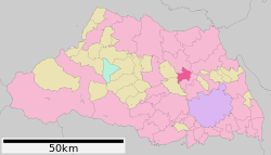
112:Location of Kitamoto in Saitama Prefecture
36:
723:
305:
289:
252:
231:
218:
182:
147:
116:
104:
76:
63:
1351:List of mergers in Saitama Prefecture
297:
279:
269:
244:
236:
223:
206:
194:
7:
228:19.82 km (7.65 sq mi)
732:"Kitamoto city official statistics"
25:
925:
821:
769:
693:
666:
130:
129:
122:
106:
91:
81:
65:
756:Kitamoto population statistics
1:
1370:Cities in Saitama Prefecture
342:
249:3,300/km (8,600/sq mi)
1391:
705:Noted people from Kitamoto
386:Surrounding municipalities
26:
1348:
923:
833:
468:—
424:humid subtropical climate
336:
148:
117:
105:
77:
64:
55:
46:
168:36.026889°N 139.530194°E
43:
1282:Kitakatsushika District
1321:Minamisaitama District
699:National Route 17
327:
778:at Wikimedia Commons
745:Kitamoto climate data
734:(in Japanese). Japan.
442:Historical population
325:
173:36.026889; 139.530194
619:Saitama 6th district
246: • Density
34:City in Kantō, Japan
1270:Kitaadachi District
443:
264:Japan Standard Time
164: /
827:Saitama Prefecture
391:Saitama Prefecture
368:population density
356:Saitama Prefecture
328:
326:Kitamoto City Hall
238: • Total
225: • Total
29:Kitamoto (surname)
1375:Kitamoto, Saitama
1357:
1356:
1174:Chichibu District
921:
920:
844:
776:Kitamoto, Saitama
774:Media related to
639:bedroom community
582:
581:
320:
319:
291:Phone number
16:(Redirected from
1382:
1058:Higashimatsuyama
929:
856:
838:
825:
815:
808:
801:
792:
787:
783:Official Website
773:
758:
753:
747:
742:
736:
735:
728:
697:
696:
670:
643:Tokyo metropolis
457:
452:
444:
366:of 66,022 and a
349:
348:
345:
339:
338:
316:
315:
313:Official website
179:
178:
176:
175:
174:
169:
165:
162:
161:
160:
157:
133:
132:
126:
110:
95:
85:
69:
50:
49:
48:
37:
21:
1390:
1389:
1385:
1384:
1383:
1381:
1380:
1379:
1360:
1359:
1358:
1353:
1344:
1299:Kodama District
1179:Higashichichibu
1162:
991:
958:
930:
917:
845:
829:
819:
785:
767:
762:
761:
754:
750:
743:
739:
730:
729:
725:
720:
707:
694:
690:
664:
659:
651:
635:
609:Kitamoto has a
607:
592:was one of the
587:
436:
422:Kitamoto has a
420:
388:
376:
346:
333:
311:
310:
172:
170:
166:
163:
158:
155:
153:
151:
150:
144:
143:
142:
141:
140:
139:
138:
134:
113:
101:
100:
99:
98:
89:
88:
73:
60:
51:
44:
42:
35:
32:
23:
22:
15:
12:
11:
5:
1388:
1386:
1378:
1377:
1372:
1362:
1361:
1355:
1354:
1349:
1346:
1345:
1343:
1342:
1341:
1340:
1333:Ōsato District
1330:
1329:
1328:
1318:
1317:
1316:
1311:
1306:
1296:
1295:
1294:
1289:
1279:
1278:
1277:
1267:
1266:
1265:
1260:
1255:
1248:Iruma District
1245:
1244:
1243:
1238:
1233:
1228:
1223:
1218:
1213:
1203:
1202:
1201:
1196:
1191:
1186:
1181:
1170:
1168:
1164:
1163:
1161:
1160:
1155:
1150:
1145:
1140:
1135:
1130:
1125:
1120:
1115:
1110:
1105:
1100:
1095:
1090:
1085:
1080:
1075:
1070:
1065:
1060:
1055:
1050:
1045:
1040:
1035:
1030:
1025:
1020:
1015:
1010:
1005:
999:
997:
993:
992:
990:
989:
984:
979:
974:
968:
966:
964:Special cities
960:
959:
957:
956:
951:
946:
940:
938:
932:
931:
924:
922:
919:
918:
916:
915:
910:
905:
900:
895:
890:
885:
880:
875:
870:
864:
862:
853:
847:
846:
834:
831:
830:
820:
818:
817:
810:
803:
795:
789:
788:
766:
765:External links
763:
760:
759:
748:
737:
722:
721:
719:
716:
715:
714:
711:Atsushi Oshima
706:
703:
702:
701:
689:
686:
685:
684:
663:
660:
658:
657:Transportation
655:
650:
647:
634:
631:
606:
603:
586:
583:
580:
579:
576:
573:
569:
568:
565:
562:
558:
557:
554:
551:
547:
546:
543:
540:
536:
535:
532:
529:
525:
524:
521:
518:
514:
513:
510:
507:
503:
502:
499:
496:
492:
491:
488:
485:
481:
480:
477:
474:
470:
469:
466:
463:
459:
458:
453:
448:
435:
432:
419:
416:
415:
414:
409:
404:
399:
387:
384:
375:
372:
318:
317:
308:
304:
303:
300:
296:
295:
292:
288:
287:
282:
278:
277:
272:
268:
267:
257:
251:
250:
247:
243:
242:
239:
235:
234:
230:
229:
226:
222:
221:
217:
216:
211:
205:
204:
199:
193:
192:
187:
181:
180:
146:
145:
136:
135:
128:
127:
121:
120:
119:
118:
115:
114:
111:
103:
102:
96:
90:
86:
80:
79:
78:
75:
74:
70:
62:
61:
56:
53:
52:
40:
33:
24:
14:
13:
10:
9:
6:
4:
3:
2:
1387:
1376:
1373:
1371:
1368:
1367:
1365:
1352:
1347:
1339:
1336:
1335:
1334:
1331:
1327:
1324:
1323:
1322:
1319:
1315:
1312:
1310:
1307:
1305:
1302:
1301:
1300:
1297:
1293:
1290:
1288:
1285:
1284:
1283:
1280:
1276:
1273:
1272:
1271:
1268:
1264:
1261:
1259:
1256:
1254:
1251:
1250:
1249:
1246:
1242:
1239:
1237:
1234:
1232:
1229:
1227:
1224:
1222:
1219:
1217:
1214:
1212:
1209:
1208:
1207:
1206:Hiki District
1204:
1200:
1197:
1195:
1192:
1190:
1187:
1185:
1182:
1180:
1177:
1176:
1175:
1172:
1171:
1169:
1165:
1159:
1156:
1154:
1151:
1149:
1146:
1144:
1141:
1139:
1136:
1134:
1131:
1129:
1126:
1124:
1121:
1119:
1116:
1114:
1111:
1109:
1106:
1104:
1101:
1099:
1096:
1094:
1091:
1089:
1086:
1084:
1081:
1079:
1076:
1074:
1071:
1069:
1066:
1064:
1061:
1059:
1056:
1054:
1051:
1049:
1046:
1044:
1041:
1039:
1036:
1034:
1031:
1029:
1026:
1024:
1021:
1019:
1016:
1014:
1011:
1009:
1006:
1004:
1001:
1000:
998:
994:
988:
985:
983:
980:
978:
975:
973:
970:
969:
967:
965:
961:
955:
952:
950:
947:
945:
942:
941:
939:
937:
933:
928:
914:
911:
909:
906:
904:
901:
899:
896:
894:
891:
889:
886:
884:
881:
879:
876:
874:
871:
869:
866:
865:
863:
861:
857:
854:
852:
848:
842:
837:
832:
828:
824:
816:
811:
809:
804:
802:
797:
796:
793:
786:(in Japanese)
784:
781:
780:
779:
777:
772:
764:
757:
752:
749:
746:
741:
738:
733:
727:
724:
717:
712:
709:
708:
704:
700:
692:
691:
687:
683:
680:
679:
678:
677:
676:Takasaki Line
673:
669:
661:
656:
654:
648:
646:
644:
640:
632:
630:
628:
627:Diet of Japan
624:
620:
616:
612:
611:mayor-council
604:
602:
599:
595:
594:post stations
591:
584:
577:
574:
571:
570:
566:
563:
560:
559:
555:
552:
549:
548:
544:
541:
538:
537:
533:
530:
527:
526:
522:
519:
516:
515:
511:
508:
505:
504:
500:
497:
494:
493:
489:
486:
483:
482:
478:
475:
472:
471:
467:
464:
461:
460:
454:
449:
446:
445:
439:
433:
431:
429:
425:
417:
413:
410:
408:
405:
403:
400:
398:
395:
394:
393:
392:
385:
383:
381:
380:Arakawa River
373:
371:
369:
365:
361:
357:
353:
344:
332:
324:
314:
309:
301:
293:
286:
285:Chrysanthemum
283:
276:
273:
265:
261:
258:
256:
248:
240:
227:
215:
212:
210:
203:
200:
198:
191:
188:
186:
177:
159:139°31′48.7″E
149:Coordinates:
125:
109:
94:
84:
68:
59:
54:
38:
30:
19:
1138:Tsurugashima
1077:
768:
751:
740:
726:
713:, politician
665:
652:
636:
608:
590:Kōnosu-shuku
588:
437:
434:Demographics
427:
421:
389:
377:
343:Kitamoto-shi
330:
329:
294:048-591-1111
936:Core cities
623:lower house
171: /
156:36°1′36.8″N
1364:Categories
1287:Matsubushi
982:Tokorozawa
718:References
645:for work.
615:unicameral
605:Government
364:population
233:Population
209:Prefecture
1326:Miyashiro
1167:Districts
1158:Yoshikawa
954:Koshigaya
949:Kawaguchi
649:Education
598:Nakasendō
374:Geography
255:Time zone
1309:Kamisato
1304:Kamikawa
1258:Moroyama
1236:Tokigawa
1221:Namegawa
1216:Kawajima
1211:Hatoyama
1189:Nagatoro
1128:Shiraoka
1078:Kitamoto
1023:Fujimino
1013:Chichibu
977:Kumagaya
972:Kasukabe
873:Iwatsuki
682:Kitamoto
426:(Köppen
407:Kawajima
331:Kitamoto
281:– Flower
137:Kitamoto
41:Kitamoto
18:Kitamoto
1253:Miyoshi
1241:Yoshimi
1103:Okegawa
944:Kawagoe
851:Saitama
841:capital
836:Saitama
688:Highway
672:JR East
662:Railway
633:Economy
625:of the
621:of the
596:on the
585:History
523:+104.7%
418:Climate
412:Yoshimi
397:Okegawa
307:Website
299:Address
214:Saitama
185:Country
1314:Misato
1292:Sugito
1231:Ranzan
1199:Yokoze
1184:Minano
1153:Yashio
1148:Warabi
1118:Sayama
1108:Sakado
1093:Misato
1083:Kōnosu
1053:Hidaka
1048:Hasuda
1028:Fukaya
1018:Fujimi
996:Cities
908:Sakura
893:Minuma
888:Minami
883:Midori
575:65,201
564:68,888
553:69,524
545:+25.6%
542:63,929
534:+60.5%
531:50,888
520:31,699
512:+15.1%
509:15,483
501:+60.9%
498:13,457
402:Kōnosu
275:Sakura
271:– Tree
241:66,022
197:Region
72:Shrine
1338:Yorii
1263:Ogose
1226:Ogawa
1194:Ogano
1123:Shiki
1113:Satte
1098:Niiza
1068:Iruma
1063:Honjō
1043:Hanyū
1038:Hannō
1033:Gyōda
1008:Asaka
913:Urawa
903:Ōmiya
898:Nishi
860:Wards
578:−5.4%
572:2020
567:−0.9%
561:2010
556:+8.8%
550:2000
539:1990
528:1980
517:1970
506:1960
495:1950
490:+3.9%
487:8,366
484:1940
479:+5.5%
476:8,054
473:1930
465:7,633
462:1920
360:Japan
350:is a
260:UTC+9
202:Kantō
190:Japan
1143:Wakō
1133:Toda
1088:Kuki
1073:Kazo
1003:Ageo
987:Sōka
878:Kita
868:Chūō
451:Pop.
447:Year
352:city
220:Area
97:Seal
87:Flag
58:City
1275:Ina
428:Cfa
354:in
337:北本市
47:北本市
1366::
674:–
629:.
456:±%
358:,
340:,
843:)
839:(
814:e
807:t
800:v
347:)
334:(
266:)
262:(
31:.
20:)
Text is available under the Creative Commons Attribution-ShareAlike License. Additional terms may apply.