40:
56:
63:
215:
Longfields was mostly built in the early 1990s during a period of major expansion. Barrhaven's most recent high school, Longfields-Davidson
Heights Secondary School, is located in this neighbourhood. Also, a
39:
221:
84:
55:
319:
228:
There are also plans for major development south of
Longfields with a large employment zone as well as a possible expansion of the
217:
241:
223:
209:
205:
304:
246:
201:
177:
275:
220:
in the transitway corridor (also named
Longfields) was built and opened in the Spring of 2011
189:
313:
265:
Population calculated by combining Census Tracts 5050141.11, 5050141.10, 5050141.05
212:
to the east, the CNR railway on the northwest and
Fallowfield Road to the north.
99:
86:
229:
204:
in the city's southwest and is bordered by
Greenbank Road to the west,
197:
193:
200:. This recent neighbourhood is located within the growing suburb of
44:
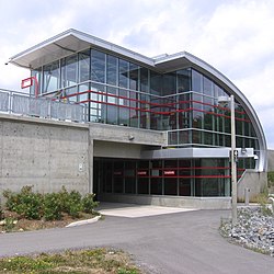
Longfields
Transit Station Barrhaven, soon after it opened in 2012
173:
165:
157:
152:
144:
139:
131:
123:
115:
23:
8:
20:
18:Neighbourhood in Barrhaven, Ottawa, Canada
258:
151:
138:
114:
79:
48:
36:
172:
164:
156:
148:4.609 km (1.780 sq mi)
143:
130:
122:
7:
62:
14:
232:north-south light rail project.
61:
54:
38:
282:. February 24, 1990. p. I1
1:
305:South Nepean Development Plan
242:List of Ottawa neighbourhoods
169:4,300/km (11,000/sq mi)
276:"The South Urban Community"
336:
80:
49:
37:
30:
320:Neighbourhoods in Ottawa
188:is a neighbourhood in
100:45.28750°N 75.73333°W
166: • Density
105:45.28750; -75.73333
96: /
178:Canada 2016 Census
158: • Total
145: • Total
183:
182:
327:
292:
291:
289:
287:
272:
266:
263:
210:Woodroffe Avenue
206:Strandherd Drive
111:
110:
108:
107:
106:
101:
97:
94:
93:
92:
89:
65:
64:
58:
42:
21:
335:
334:
330:
329:
328:
326:
325:
324:
310:
309:
301:
296:
295:
285:
283:
274:
273:
269:
264:
260:
255:
238:
104:
102:
98:
95:
90:
87:
85:
83:
82:
76:
75:
74:
73:
72:
71:
70:
66:
45:
33:
26:
19:
12:
11:
5:
333:
331:
323:
322:
312:
311:
308:
307:
300:
299:External links
297:
294:
293:
280:Ottawa Citizen
267:
257:
256:
254:
251:
250:
249:
244:
237:
234:
208:to the south,
190:Barrhaven Ward
181:
180:
175:
171:
170:
167:
163:
162:
159:
155:
154:
150:
149:
146:
142:
141:
137:
136:
133:
129:
128:
125:
121:
120:
117:
113:
112:
78:
77:
68:
67:
60:
59:
53:
52:
51:
50:
47:
46:
43:
35:
34:
31:
28:
27:
24:
17:
13:
10:
9:
6:
4:
3:
2:
332:
321:
318:
317:
315:
306:
303:
302:
298:
281:
277:
271:
268:
262:
259:
252:
248:
245:
243:
240:
239:
235:
233:
231:
226:
224:
222:
219:
213:
211:
207:
203:
199:
195:
191:
187:
179:
176:
168:
160:
147:
134:
126:
118:
109:
81:Coordinates:
57:
41:
32:Neighbourhood
29:
22:
16:
284:. Retrieved
279:
270:
261:
227:
214:
185:
184:
15:
103: /
253:References
186:Longfields
153:Population
91:75°44′00″W
88:45°17′15″N
69:Longfields
25:Longfields
247:Barrhaven
202:Barrhaven
135:Barrhaven
314:Category
236:See also
286:May 23,
230:O-Train
218:station
198:Ontario
116:Country
194:Ottawa
174:
161:19,763
127:Ottawa
119:Canada
288:2020
140:Area
132:Ward
124:City
192:in
316::
278:.
225:.
196:,
290:.
Text is available under the Creative Commons Attribution-ShareAlike License. Additional terms may apply.