206:
179:
886:
54:
805:
278:(UBOS) estimated the population at 21,400. In 2011, UBOS estimated the mid-year population at 22,200. In 2014, the national population census put the population of the town at 103,473. In 2020 UBOS estimated the mid-population of Mubende Town at 121,600 people. The population agency calculated the annual population growth rate of Mubende at 2.8 percent, on average, from 2014 until 2020.
38:
122:
61:
538:
511:
262:, rising 213 metres (699 ft) above the surrounding terrain to a peak of 1,533 metres (5,030 ft) above sea level. The hill has a flat top where an ancient palace once stood. The shrine is visited by people paying homage to the matriarch
568:
225:. The geographical coordinates of the town are 0°33'27.0"N, 31°23'42.0"E (Latitude:0.5575; Longitude:31.3950). Mubende Town sits at an average elevation of 1,408 metres (4,619 ft) above
1046:
222:
1144:
1031:
401:
1036:
483:
793:
691:
1149:
1087:
388:
732:"The population of all Ugandan cities and towns with more than 15,000 inhabitants according to census results and latest official projections"
251:, a former Bacwezi king. The site, located about 4 kilometres (2.5 mi) outside of the town's central business district, is marked by the
1041:
434:
375:
85:
394:
205:
786:
771:
217:, the capital of Uganda and its largest city. The town is located about 145 kilometres (90 mi) east of the city of
53:
986:
736:
698:
275:
1097:
981:
414:
461:"The Population of The Regions of the Republic of Uganda And All Cities And Towns of More Than 15,000 Inhabitants"
1154:
779:
379:
1026:
1092:
619:
266:
of the
Bachwezi, believed to be semi-gods, whose dynasty ruled this region in the period prior to 1,300 AD.
702:
190:
137:
420:
9. Fliptown and
Flippers. The Fliptown Hub, Home of the youths' New Hometown World Movement in Uganda.
37:
244:
429:
252:
144:
259:
642:
132:
596:
248:
1113:
1010:
885:
809:
238:
194:
149:
17:
991:
915:
910:
665:
274:
The 2002 national census estimated the population of
Mubende to be 16,000. In 2010, the
976:
226:
1138:
1118:
944:
488:
255:. Large root buttresses, which form nooks and fissures, lie at the base of the tree.
763:
178:
1123:
1071:
949:
407:
731:
460:
954:
573:
543:
516:
218:
368:
The following points of interest lie within the town limits or near its edges:
100:
87:
121:
920:
263:
214:
213:
Mubende is approximately 150 kilometres (93 mi), by road, west of
928:
900:
193:. It is the main municipal, administrative, and commercial center of
125:
204:
177:
295:
775:
290:
182:
The
Nakayima tree found in Mubende Hill at Nakayima Shrine.
692:"Estimated Population of Mubende In 2002, 2010 & 2011"
463:. Citypopulation.de Quoting Uganda Bureau of Statistics
764:
Mubende Town
Council Leaders Push for Municipal Status
1106:
1080:
1055:
1019:
1003:
969:
937:
893:
826:
597:"Elevation of Mubende Town, Central Region, Uganda"
378:, a regional referral hospital administered by the
168:
163:
155:
143:
131:
116:
28:
569:"Location of Mubende Town, Central Region, Uganda"
393:5. The headquarters of the Tiger Battalion of the
706:(Archived from the original on 19 January 2013)
539:"Road Distance Between Fort Portal And Mubende"
512:"Distance Between Kampala And Mubende With Map"
197:and the location of the district headquarters.
459:Uganda Bureau of Statistics (27 August 2014).
787:
8:
730:Uganda Bureau of Statistics (14 June 2020).
484:"Municipal Status Excites Mubende Residents"
281:
1145:Populated places in Central Region, Uganda
1047:Mubende–Kyegegwa–Kyenjojo–Fort Portal Road
794:
780:
772:
397:, located in the western part of the town
280:
223:Mubende–Kyegegwa–Kyenjojo–Fort Portal Road
25:
23:Place in Central Region of Uganda, Uganda
1088:Kalama Armoured Warfare Training School
446:
371:1. The offices of Mubende Town Council
162:
154:
115:
80:
46:
34:
725:
723:
685:
683:
454:
452:
450:
209:Camping in front of a hotel in Mubende
410:, in the hills northwest of the town
167:
142:
130:
7:
1098:Mubende Campus of Muteesa University
1032:Mubende–Kakumiro–Kibaale–Kagadi Road
690:Uganda Bureau of Statistics (2012).
563:
561:
402:Mubende–Kakumiro–Kibaale–Kagadi Road
1037:Myanzi–Kassanda–Bukuya–Kiboga Road
1011:Mubende Regional Referral Hospital
482:Mayengo, Godfrey (1 August 2015).
435:List of cities and towns in Uganda
376:Mubende Regional Referral Hospital
14:
884:
803:
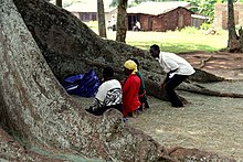
258:The shrine is located on top of
120:
59:
52:
36:
1150:Cities in the Great Rift Valley
60:
1:
395:Uganda People's Defence Force
389:National Social Security Fund
247:, said to hold the spirit of
668:. Uganda Travel Bureau (UTB)
595:Floodmap (23 January 2021).
159:4,619 ft (1,408 m)
987:Stanbic Bank Uganda Limited
737:Uganda Bureau of Statistics
735:(Citypopulation.de Quoting
699:Uganda Bureau of Statistics
643:"Elevation of Mubende Hill"
622:. Speedwaysafaris.com (SSC)
276:Uganda Bureau of Statistics
1171:
1042:Mityana–Bukuya–Kiboga Road
982:Equity Bank Uganda Limited
415:Muteesa I Royal University
384:3. Mubende Central Market
236:
16:For Mubende District, see
15:
882:
816:
666:"Profile of Mubende Town"
380:Uganda Ministry of Health
356:
308:—
81:
47:
35:
191:Central Region of Uganda
138:Central Region of Uganda
1093:Uganda Military Academy
400:6. The southern end of
243:Mubende is home to the
1072:Source of River Muzizi
996:Frontpage Microfinance
641:GAM (7 January 2016).
620:"Nakayima Tree Uganda"
210:
183:
42:Mubende in August 2007
664:UTB (1 August 2015).
618:SSC (1 August 2014).
413:8. Mubende Campus of
406:7. The source of the
282:Historical population
208:
181:
1027:Mityana–Mubende Road
870:Mubende Town Council
101:0.55750°N 31.39500°E
741:. Citypopulation.de
645:. Getamap.net (GAM)
430:Hospitals in Uganda
387:4. A branch of the
283:
97: /
894:Towns and villages
364:Points of interest
211:
184:
169: • Total
73:Location in Uganda
1132:
1131:
1056:Notable landmarks
361:
360:
189:is a town in the
176:
175:
106:0.55750; 31.39500
1162:
1155:Mubende District
1114:Benna Namugwanya
888:
810:Mubende District
808:
807:
806:
796:
789:
782:
773:
751:
750:
748:
746:
740:
727:
718:
717:
715:
713:
707:
701:. Archived from
696:
687:
678:
677:
675:
673:
661:
655:
654:
652:
650:
638:
632:
631:
629:
627:
615:
609:
608:
606:
604:
592:
586:
585:
583:
581:
565:
556:
555:
553:
551:
535:
529:
528:
526:
524:
508:
502:
501:
499:
497:
479:
473:
472:
470:
468:
456:
297:
292:
284:
239:Empire of Kitara
195:Mubende District
150:Mubende District
124:
112:
111:
109:
108:
107:
102:
98:
95:
94:
93:
90:
63:
62:
56:
40:
26:
18:Mubende District
1170:
1169:
1165:
1164:
1163:
1161:
1160:
1159:
1135:
1134:
1133:
1128:
1102:
1076:
1065:Nakayima Shrine
1051:
1015:
999:
992:PostBank Uganda
965:
933:
889:
880:
822:
812:
804:
802:
800:
769:
760:
755:
754:
744:
742:
734:
729:
728:
721:
711:
709:
705:
694:
689:
688:
681:
671:
669:
663:
662:
658:
648:
646:
640:
639:
635:
625:
623:
617:
616:
612:
602:
600:
594:
593:
589:
579:
577:
567:
566:
559:
549:
547:
537:
536:
532:
522:
520:
510:
509:
505:
495:
493:
481:
480:
476:
466:
464:
458:
457:
448:
443:
426:
366:
272:
245:Nakayima Shrine
241:
235:
203:
105:
103:
99:
96:
91:
88:
86:
84:
83:
77:
76:
75:
74:
71:
70:
69:
68:
64:
43:
31:
24:
21:
12:
11:
5:
1168:
1166:
1158:
1157:
1152:
1147:
1137:
1136:
1130:
1129:
1127:
1126:
1121:
1116:
1110:
1108:
1107:Notable people
1104:
1103:
1101:
1100:
1095:
1090:
1084:
1082:
1078:
1077:
1075:
1074:
1069:
1066:
1063:
1059:
1057:
1053:
1052:
1050:
1049:
1044:
1039:
1034:
1029:
1023:
1021:
1017:
1016:
1014:
1013:
1007:
1005:
1001:
1000:
998:
997:
994:
989:
984:
979:
977:Centenary Bank
973:
971:
967:
966:
964:
963:
962:Nabakazi River
960:
957:
952:
947:
941:
939:
935:
934:
932:
931:
926:
923:
918:
913:
908:
903:
897:
895:
891:
890:
883:
881:
879:
878:
875:
872:
867:
864:
861:
858:
855:
852:
849:
846:
843:
840:
837:
834:
830:
828:
824:
823:
817:
814:
813:
801:
799:
798:
791:
784:
776:
767:
766:
759:
758:External links
756:
753:
752:
719:
679:
656:
633:
610:
599:. Floodmap.net
587:
557:
530:
503:
474:
445:
444:
442:
439:
438:
437:
432:
425:
422:
365:
362:
359:
358:
354:
353:
350:
347:
343:
342:
339:
336:
332:
331:
328:
325:
321:
320:
317:
314:
310:
309:
306:
303:
299:
298:
293:
288:
271:
268:
234:
231:
227:mean sea level
202:
199:
174:
173:
170:
166:
165:
161:
160:
157:
153:
152:
147:
141:
140:
135:
129:
128:
118:
114:
113:
79:
78:
72:
66:
65:
58:
57:
51:
50:
49:
48:
45:
44:
41:
33:
32:
29:
22:
13:
10:
9:
6:
4:
3:
2:
1167:
1156:
1153:
1151:
1148:
1146:
1143:
1142:
1140:
1125:
1122:
1120:
1119:Thembo Nyombi
1117:
1115:
1112:
1111:
1109:
1105:
1099:
1096:
1094:
1091:
1089:
1086:
1085:
1083:
1079:
1073:
1070:
1068:Nakayima Tree
1067:
1064:
1061:
1060:
1058:
1054:
1048:
1045:
1043:
1040:
1038:
1035:
1033:
1030:
1028:
1025:
1024:
1022:
1018:
1012:
1009:
1008:
1006:
1002:
995:
993:
990:
988:
985:
983:
980:
978:
975:
974:
972:
968:
961:
958:
956:
953:
951:
948:
946:
945:Katonga River
943:
942:
940:
936:
930:
927:
924:
922:
919:
917:
914:
912:
909:
907:
904:
902:
899:
898:
896:
892:
887:
876:
873:
871:
868:
865:
862:
859:
856:
853:
850:
847:
844:
841:
838:
835:
832:
831:
829:
825:
821:
815:
811:
797:
792:
790:
785:
783:
778:
777:
774:
770:
765:
762:
761:
757:
738:
733:
726:
724:
720:
708:on 2014-07-07
704:
700:
693:
686:
684:
680:
667:
660:
657:
644:
637:
634:
621:
614:
611:
598:
591:
588:
576:
575:
570:
564:
562:
558:
546:
545:
540:
534:
531:
519:
518:
513:
507:
504:
491:
490:
489:Daily Monitor
485:
478:
475:
462:
455:
453:
451:
447:
440:
436:
433:
431:
428:
427:
423:
421:
418:
416:
411:
409:
404:
403:
398:
396:
391:
390:
385:
382:
381:
377:
372:
369:
363:
355:
351:
348:
345:
344:
340:
337:
334:
333:
329:
326:
323:
322:
318:
315:
312:
311:
307:
304:
301:
300:
294:
289:
286:
285:
279:
277:
269:
267:
265:
261:
256:
254:
253:Nakayima tree
250:
246:
240:
232:
230:
228:
224:
220:
216:
207:
200:
198:
196:
192:
188:
180:
171:
158:
151:
148:
146:
139:
136:
134:
127:
123:
119:
110:
82:Coordinates:
55:
39:
27:
19:
1124:Sarah Kiguli
1062:Mubende Hill
959:Mubende Hill
950:River Muzizi
905:
869:
819:
768:
743:. Retrieved
710:. Retrieved
703:the original
670:. Retrieved
659:
647:. Retrieved
636:
624:. Retrieved
613:
601:. Retrieved
590:
578:. Retrieved
572:
548:. Retrieved
542:
533:
521:. Retrieved
515:
506:
494:. Retrieved
487:
477:
465:. Retrieved
419:
412:
408:River Muzizi
405:
399:
392:
386:
383:
373:
370:
367:
273:
260:Mubende Hill
257:
242:
212:
186:
185:
955:Lake Wamala
697:. Kampala:
574:Google Maps
544:Google Maps
517:Google Maps
219:Fort Portal
104: /
1139:Categories
877:Nabingoola
745:23 January
712:23 January
603:23 January
580:23 January
550:23 January
523:23 January
467:23 January
441:References
270:Population
237:See also:
221:along the
164:Population
92:31°23′42″E
89:00°33′27″N
1081:Education
1020:Transport
938:Geography
839:Butoloogo
818:Capital:
649:7 January
492:. Kampala
156:Elevation
921:Kassanda
848:Kassanda
845:Kasambya
827:Parishes
672:1 August
626:1 August
496:1 August
424:See also
264:Nakayima
233:Overview
201:Location
145:District
970:Economy
925:Maduudu
911:Kabamba
906:Mubende
866:Maduudu
863:Kiyuuni
860:Kitumbi
857:Kitenga
854:Kigando
851:Kiganda
842:Kalwana
833:Bagezza
820:Mubende
571:(Map).
541:(Map).
514:(Map).
357:source:
349:121,600
341:+366.1%
338:103,473
249:Ndahura
215:Kampala
187:Mubende
172:103,473
117:Country
67:Mubende
30:Mubende
1004:Health
929:Myanzi
916:Kalagi
901:Bukuya
836:Bukuya
352:+17.5%
327:22,200
319:+31.2%
316:21,000
305:16,000
133:Region
126:Uganda
874:Mwezi
695:(PDF)
330:+5.7%
747:2021
714:2021
674:2015
651:2016
628:2015
605:2021
582:2021
552:2021
525:2021
498:2015
469:2021
346:2020
335:2014
324:2011
313:2010
302:2002
291:Pop.
287:Year
374:2.
1141::
722:^
682:^
560:^
486:.
449:^
417:.
296:±%
229:.
795:e
788:t
781:v
749:.
739:)
716:.
676:.
653:.
630:.
607:.
584:.
554:.
527:.
500:.
471:.
20:.
Text is available under the Creative Commons Attribution-ShareAlike License. Additional terms may apply.