192:
50:
57:
262:
229:
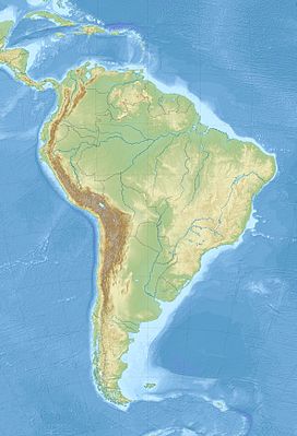
to the south. They also serve as a natural boundary in the east–west direction, where they extend 800 kilometres (500 mi) to form a border marker between Brazil and southeastern
Venezuela and between Brazil and west central Guyana.
344:
Landmarks are of special significance to indigenous people, and are intertwined with oral histories and culture. According to
Macushi cosmology, mountains and other landforms were created by mythical creator brothers when they cut down
298:
Difficulty in breaching the steep slopes has made data collection a challenge, however the relative isolation of these flat-topped mountains produces an array of endemic flora with a "great potential for high species diversity". The
437:
Reis, Nelson
Joaquim; Nadeau, Serge; Fraga, Leda Maria; Betiollo, Leandro Menezes; Faraco, Maria Telma Lins; Reece, Jimmy; Lachhman, Deokumar; Ault, Randy; Reis, Nelson Joaquim; Nadeau, Serge; Fraga, Leda Maria (January 2017).
440:"Stratigraphy of the Roraima Supergroup along the Brazil-Guyana border in the Guiana shield, Northern Amazonian Craton - results of the Brazil-Guyana Geology and Geodiversity Mapping Project"
289:
The
Pacaraimas are mostly forested, with occasional savannas especially at the base of Roraima and on the Brazilian side of the range. The savannas are made up of grasses and the occasional
242:
marine strata that arose in post-cretaceous time. Erosion of the sandstone (the
Roraima Supergroup) results in dramatic escarpments, the individual remnants of which are called
269:
Numerous rivers originate in these mountains and on their way down they plunge spectacularly to form some picturesque waterfalls. A beautiful example of this is the
49:
637:
740:
349:, the "tree of life". These brothers transformed people, animals, and other things into rock formations, thus giving them special mythological origins.
802:
341:
The
Macushi village of Tipuru is considered the oldest village in the South Pakaraima Mountains. It has the oldest church and school in the region.
792:
421:
822:
817:
704:"The tales and trails of a tuwama: Makushi perceptions of land use and disputes over resources in the South Pakaraima Mountains, Guyana"
787:
782:
363:
812:
191:
295:
trees below 6500 ft. These areas are prone to fire, either man-made for agriculture or cattle ranching or during times of drought.
807:
315:
797:
358:
621:
411:
388:
703:
368:
291:
152:
602:
563:
94:
206:
The range extends from west to east for over 800 kilometres (500 mi). Its highest peak is
723:
681:
594:
555:
513:
505:
461:
417:
222:
715:
673:
547:
495:
451:
303:
family is one of the most commonly represented of flowering plants amid the tepui plateaus.
160:
331:
251:
176:
623:
Timehri: The
Journal of the Royal Agricultural and Commercial Society of British Guiana
274:
270:
261:
255:
218:
168:
776:
660:
HENKEL, TERRY W.; AIME, M. CATHERINE; CHIN, MIMI; ANDREW, CHRISTOPHER (August 2004).
247:
207:
195:
99:
226:
456:
439:
311:
Logging and mining interests pose a threat to the biodiversity of the
Pacaraimas.
300:
278:
239:
719:
661:
225:.The mountains form the divide between the Orinoco Valley to the north and the
677:
500:
483:
755:
742:
727:
685:
598:
559:
509:
465:
620:
Thurn, Sir
Everard Ferdinand Im; Quelch, John Joseph; Rodway, James (1889).
180:
135:
77:
517:
17:
606:
582:
567:
535:
335:
319:
172:
131:
127:
73:
69:
551:
583:"Remarks on the Montane Flora and Vegetation Types of the Guianas"
260:
243:
211:
199:
238:
The
Pacaraimas are a sandstone plateau underlain by a horizonal
536:"Savannah and Forest Vegetation of the Interior Guiana Plateau"
484:"Systematic Data in Biodiversity Studies: Use It or Lose It"
410:
Ollier, Cliff; Ollier, Clifford David; Pain, C. F. (2000).
639:
Unidade de Conservação: Parque Nacional do Monte Roraima
214:
surrounded by cliffs 300 metres (980 ft) high.
210:at 2,810 metres (9,220 ft) above sea level, a
123:
118:
110:
105:
93:
88:
32:
642:(in Portuguese), MMA: Ministério do Meio Ambiente
482:Funk, V. A.; Richardson, K. S. (1 March 2002).
8:
56:
258:are some of the more well-known examples.
29:
499:
455:
330:The mountains are a traditional home to
190:
380:
708:The Extractive Industries and Society
702:Grund, Lisa Katharina (1 July 2016).
697:
695:
314:The 116,748 hectares (288,490 acres)
7:
529:
527:
477:
475:
581:De Granville, Jean-Jacques (1991).
221:and biogeographically part of the
25:
273:in Guyana. The headwaters of the
416:. Psychology Press. p. 21.
55:
48:
281:are sourced in the Pacaraimas.
217:It is geologically part of the
27:Mountain range in South America
662:"Edible mushrooms from Guyana"
318:protects part of the range in
1:
457:10.1590/2317-4889201720160139
803:Mountains of Bolívar (state)
793:Mountain ranges of Venezuela
444:Brazilian Journal of Geology
316:Monte Roraima National Park
202:of the Pacaraima Mountains.
839:
720:10.1016/j.exis.2016.01.001
171:primarily in southwestern
788:Mountain ranges of Guyana
783:Mountain ranges of Brazil
678:10.1017/s0269915x04003027
501:10.1080/10635150252899789
391:. Encyclopædia Britannica
364:Mountain ranges of Guyana
114:800 km (500 mi)
42:
37:
359:Guayana Highlands topics
823:Guyana–Venezuela border
818:Brazil–Venezuela border
413:The Origin of Mountains
266:
203:
164:
156:
534:Myers, J. G. (1936).
389:"Pacaraima Mountains"
264:
194:
813:Brazil–Guyana border
808:Landforms of Roraima
752: /
369:Geography of Guyana
292:Curatella americana
165:Sierra de Pacaraima
149:Pakaraima Mountains
63:Pacaraima Mountains
38:Pakaraima Mountains
33:Pacaraima Mountains
540:Journal of Ecology
488:Systematic Biology
267:
204:
157:Serra de Pacaraima
89:Highest point
798:Guayana Highlands
423:978-0-415-19890-5
223:Guayana Highlands
141:
140:
16:(Redirected from
830:
767:
766:
764:
763:
762:
757:
756:5.000°N 61.000°W
753:
750:
749:
748:
745:
732:
731:
699:
690:
689:
657:
651:
650:
649:
647:
634:
628:
627:
617:
611:
610:
593:(1/2): 201–205.
578:
572:
571:
531:
522:
521:
503:
479:
470:
469:
459:
434:
428:
427:
407:
401:
400:
398:
396:
385:
59:
58:
52:
30:
21:
838:
837:
833:
832:
831:
829:
828:
827:
773:
772:
771:
760:
758:
754:
751:
746:
743:
741:
739:
738:
736:
735:
701:
700:
693:
659:
658:
654:
645:
643:
636:
635:
631:
619:
618:
614:
580:
579:
575:
552:10.2307/2256273
533:
532:
525:
481:
480:
473:
436:
435:
431:
424:
409:
408:
404:
394:
392:
387:
386:
382:
377:
355:
328:
309:
287:
252:Mount Ayanganna
236:
189:
177:northern Brazil
84:
83:
82:
81:
80:
67:
66:
65:
64:
60:
28:
23:
22:
15:
12:
11:
5:
836:
834:
826:
825:
820:
815:
810:
805:
800:
795:
790:
785:
775:
774:
761:5.000; -61.000
734:
733:
714:(3): 669–675.
691:
672:(3): 104–111.
652:
629:
612:
573:
546:(1): 172–182.
523:
494:(2): 303–316.
471:
429:
422:
402:
379:
378:
376:
373:
372:
371:
366:
361:
354:
351:
327:
324:
308:
305:
286:
283:
275:Mazaruni River
271:Kaieteur Falls
265:Kaieteur Falls
256:Mount Wokomung
235:
232:
219:Guayana Shield
188:
185:
169:mountain range
139:
138:
125:
121:
120:
116:
115:
112:
108:
107:
103:
102:
97:
91:
90:
86:
85:
68:
62:
61:
54:
53:
47:
46:
45:
44:
43:
40:
39:
35:
34:
26:
24:
14:
13:
10:
9:
6:
4:
3:
2:
835:
824:
821:
819:
816:
814:
811:
809:
806:
804:
801:
799:
796:
794:
791:
789:
786:
784:
781:
780:
778:
770:
768:
765:
729:
725:
721:
717:
713:
709:
705:
698:
696:
692:
687:
683:
679:
675:
671:
667:
663:
656:
653:
641:
640:
633:
630:
626:. J. Thomson.
625:
624:
616:
613:
608:
604:
600:
596:
592:
588:
584:
577:
574:
569:
565:
561:
557:
553:
549:
545:
541:
537:
530:
528:
524:
519:
515:
511:
507:
502:
497:
493:
489:
485:
478:
476:
472:
467:
463:
458:
453:
449:
445:
441:
433:
430:
425:
419:
415:
414:
406:
403:
390:
384:
381:
374:
370:
367:
365:
362:
360:
357:
356:
352:
350:
348:
342:
339:
337:
333:
325:
323:
321:
317:
312:
306:
304:
302:
296:
294:
293:
284:
282:
280:
276:
272:
263:
259:
257:
253:
249:
248:Mount Roraima
245:
241:
233:
231:
228:
224:
220:
215:
213:
209:
208:Mount Roraima
201:
197:
196:Mount Roraima
193:
186:
184:
182:
178:
174:
170:
166:
162:
158:
154:
150:
146:
137:
133:
129:
126:
122:
117:
113:
109:
104:
101:
100:Mount Roraima
98:
96:
92:
87:
79:
75:
71:
51:
41:
36:
31:
19:
769:
737:
711:
707:
669:
665:
655:
644:, retrieved
638:
632:
622:
615:
590:
586:
576:
543:
539:
491:
487:
450:(1): 43–57.
447:
443:
432:
412:
405:
393:. Retrieved
383:
346:
343:
340:
329:
313:
310:
307:Conservation
297:
290:
288:
268:
237:
227:Amazon Basin
216:
205:
179:and eastern
148:
144:
142:
759: /
587:Willdenowia
301:Rapateaceae
279:Ireng River
240:precambrian
175:, and into
777:Categories
666:Mycologist
395:31 January
375:References
326:Settlement
322:, Brazil.
153:Portuguese
106:Dimensions
728:2214-790X
686:0269-915X
599:0511-9618
560:0022-0477
510:1063-5157
466:2317-4889
338:people.
187:Geography
181:Venezuela
145:Pacaraima
136:Venezuela
119:Geography
78:Venezuela
18:Pakaraima
518:12028734
353:See also
332:Patamona
167:) are a
124:Location
747:61°00′W
607:3996609
568:2256273
336:Macushi
320:Roraima
285:Ecology
234:Geology
161:Spanish
95:Listing
744:5°00′N
726:
684:
646:7 June
605:
597:
566:
558:
516:
508:
464:
420:
347:Wayaka
244:tepuis
173:Guyana
132:Guyana
128:Brazil
111:Length
74:Guyana
70:Brazil
603:JSTOR
564:JSTOR
212:tepui
200:tepui
724:ISSN
682:ISSN
648:2016
595:ISSN
556:ISSN
514:PMID
506:ISSN
462:ISSN
418:ISBN
397:2013
334:and
277:and
254:and
198:, a
143:The
716:doi
674:doi
548:doi
496:doi
452:doi
147:or
779::
722:.
710:.
706:.
694:^
680:.
670:18
668:.
664:.
601:.
591:21
589:.
585:.
562:.
554:.
544:24
542:.
538:.
526:^
512:.
504:.
492:51
490:.
486:.
474:^
460:.
448:47
446:.
442:.
250:,
246:.
183:.
163::
159:,
155::
134:,
130:,
76:,
72:,
730:.
718::
712:3
688:.
676::
609:.
570:.
550::
520:.
498::
468:.
454::
426:.
399:.
151:(
20:)
Text is available under the Creative Commons Attribution-ShareAlike License. Additional terms may apply.