1302:
357:, first celebrated on 9 April 1985. This festival was devised by local business people who decided to capitalise on its rural image. Taihape's association with gumboots is marked by a large sculpture of a gumboot positioned prominently on the edge of town. Local business owners commissioned the New Zealand sculptor Jeff Thomson to produce the oversized gumboot using his signature material, corrugated iron. Entertainer
283:
45:
1317:) this lodge survived until 2007. The lodge once had its own lodge rooms. The former railways house painted purple located on the highway travelling south into Taihape was once one of the two Buffaloes halls. The lodge in Taihape once boasted a large membership due in part to the numbers of Railways and Post Office staff stationed in the town.
1234:. There were 684 households, comprising 855 males and 861 females, giving a sex ratio of 0.99 males per female. The median age was 40.2 years (compared with 37.4 years nationally), with 369 people (21.5%) aged under 15 years, 297 (17.3%) aged 15 to 29, 741 (43.2%) aged 30 to 64, and 309 (18.0%) aged 65 or older.
1324:
demolished the historic
Taihape Railway Station. The Refreshment Rooms still stand on the former station platform, as do the old goods shed and locomotive depot compound at the south end of the rail yard. After a long period of fund-raising by Rotary, a loco turntable was re-purchased and installed
1282:
Of those at least 15 years old, 117 (8.7%) people had a bachelor's or higher degree, and 369 (27.4%) people had no formal qualifications. The median income was $ 27,100, compared with $ 31,800 nationally. 144 people (10.7%) earned over $ 70,000 compared to 17.2% nationally. The employment status of
349:
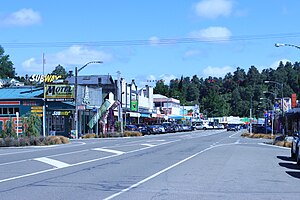
Taihape developed as a key railway and transport town, reaching its peak of population and activity during the heyday of the 1950s and 1960s. The town declined during the downturn of the 1980s and today it is largely a refreshment stop for travellers and a service point for the local farming
472:
Taihape is a rural supply town and at its peak during the 1960s, was the main railway and transport hub for the surrounding farming community. Much of its economic activity revolved around the railway and rural communities. A major decline occurred in the 1980s due to a restructure and
1158:
Taihape covers 4.93 km (1.90 sq mi) and had an estimated population of 1,800 as of June 2023, with a population density of 365 people per km. Population peaked at around 3,500 in the late 1960s, but declined in parallel with many other rural towns after that time.
521:
Taihape's climate is temperate, with mild summers and frosty winters, with an average of 31 days exceeding 25 °C (77 °F) and 45 nights dropping below 0 °C (32 °F) every year. There is significant rainfall throughout the year in
Taihape. According to the
497:
and the
Ruahine Ranges. It is surrounded by fertile high country ideal for sheep and deer farming and its location close to the mountains, rivers and lakes has made it an important service hub for hunting and outdoor tourism. The town is located at the southern edge of the
1451:
is a co-educational state area school for Year 1 to 13 students, with a roll of 245 as of August 2024. The school was established in 2005 through the amalgamation of
Taihape's primary and secondary schools due to the declining rolls at both schools.
330:. The site of the town was a small natural clearing in dense native bush, which the first settlers set about clearing. Many of the original families have descendants still living in the area. The settlement was first called
314:
The
Taihape region was originally inhabited by Māori. These iwi (tribes) still live in the area. The first record of a European to the region is William Colenso's visit in 1845. In 1884, the surveyor's party for the
492:
Taihape is near the confluence of the
Hautapu and Rangitikei rivers about 500 m (1500 ft) above sea level. It lies in a sheltered valley among the high country of the central North Island, close to the
1361:, which elects three of the eleven district councillors. The three councillors of the Taihape ward are Richard Aslett, Angus Gordon and Ruth Rainey. The mayor and councillors are all due for re-election in
505:
Transport routes in and out of
Taihape have improved over the years and what were once twisting and treacherous roads through the high country are now easy and fast deviations through the hills to
464:
to upgrade a cluster of 7 marae, including Opaea Marae and
Raketapauma Marae, creating 95 jobs. It also committed a further $ 239,367 towards Raketapauma Marae and another marae, creating 34 jobs.
1455:
St Joseph's School, also located in
Taihape, is a co-educational state-integrated Catholic primary school for Year 1 to 8 students. with a roll of 101. The school was established in 1916.
484:
has ensured its economic survival. Taihape's main claim to fame is as the "Gumboot
Capital of the World", and it attracts large numbers of people to the annual gumboot-throwing contest.
341:, from where it was exported. Until the establishment of roads and railways in the early 1900s, Taihape, like other rural towns, remained largely an isolated pioneer settlement.
2178:
2709:
1924:
2326:
1848:
1852:
1898:
2171:
2622:
1761:
1378:
476:
In recent years and with the advent of major tourist attractions, Taihape is now experiencing an upturn in local commerce. Its location on the
450:
182:
1621:
1310:
59:
1309:
There were many railway houses situated along the length of Mataroa Road; now only three remain. At one time Taihape had two lodges of the
2164:
2072:
2002:
438:
1877:
428:
2319:
2228:
1433:
1417:
1406:
1402:
1394:
337:
Before the establishment of the railway, the bulk of farming produce (wool) had to be transported east by horse and bullock cart to
1797:
1506:
1283:
those at least 15 was that 684 (50.8%) people were employed full-time, 243 (18.0%) were part-time, and 24 (1.8%) were unemployed.
2671:
2273:
523:
2617:
1362:
1347:
1259:
Although some people chose not to answer the census's question about religious affiliation, 45.1% had no religion, 37.9% were
2530:
2039:
2685:- consisted of former Marton Ward, most of southern part of Hunterville Ward and partially northern part of Turakina Ward;
2480:
499:
2704:
2650:
2312:
1645:
2602:
2283:
2156:
1358:
1260:
481:
298:
210:
1778:
2293:
2248:
2213:
2207:
1390:
35:
2147:
2612:
2566:
220:
2655:
2223:
2218:
1429:
271:
111:
2064:
530:(Cfb). The average annual temperature is 11.5 °C and about 953 mm of precipitation falls annually.
2633:
2581:
2288:
2191:
2094:
2043:
2024:
1994:
1572:
1554:
1536:
1374:
1295:
1291:
1276:
1268:
1246:
1231:
1227:
1223:
477:
323:
316:
174:
537:
Climate data for Taihape, elevation 433 m (1,421 ft), (1991–2020 normals, extremes 1911–present)
2495:
2439:
1954:
1928:
1902:
1656:
1576:
1558:
1540:
461:
358:
99:
1950:
408:
404:
2576:
2500:
2348:
2278:
1573:"Subnational population estimates (urban rural), by age and sex, at 30 June 1996-2023 (2023 boundaries)"
1826:
104:
1766:
2535:
1382:
1272:
1250:
191:
2086:
1555:"Subnational population estimates (TA, SA2), by age and sex, at 30 June 1996-2023 (2023 boundaries)"
1537:"Subnational population estimates (RC, SA2), by age and sex, at 30 June 1996-2023 (2023 boundaries)"
1314:
1301:
2665:
2607:
2586:
2571:
2449:
2352:
2335:
2263:
1470:
1448:
1351:
1343:
1339:
1325:
in the station yard, so that special trains can run to Taihape and turn around for the return run.
418:
394:
338:
294:
116:
2660:
2470:
2187:
1805:
1801:
1464:
446:
442:
424:
2398:
2627:
1627:
1617:
1421:
1386:
1264:
334:
after the local river, then Otaihape ("the place of Tai the Hunchback"), and finally Taihape.
187:
301:, which runs North to South through the centre of the North Island, passes through the town.
2545:
2403:
494:
398:
2423:
2683:- consisted of former Taihape Ward and partially northern part of former Hunterville Ward;
2550:
2540:
2418:
1416:
Te Tai Hauāuru is a more unstable seat, having been held by three different parties since
527:
2490:
1242:
434:
1873:
2525:
1437:
1425:
414:
390:
1597:
2698:
2233:
2126:
1398:
454:
331:
473:
electrification of the railway system and a general downturn in the farming sector.
2304:
1671:"CliFlo -The National Climate Database (Agent number: 3671, date range: 1991–2020)"
1482:
1410:
327:
1238:
1256:
The percentage of people born overseas was 10.1, compared with 27.1% nationally.
2444:
2339:
2238:
1253:, and 1.2% other ethnicities. People may identify with more than one ethnicity.
354:
282:
44:
2393:
2243:
1476:
1321:
1692:
1631:
74:
61:
2505:
2485:
2408:
2388:
2378:
2373:
2016:
506:
362:
1611:
2475:
2268:
2203:
1298:
line, with a marshalling yard and locomotive depot until the late 1970s.
164:
2383:
2253:
1176:
510:
423:
Tamakopiri Marae and Tumakaurangi meeting house is affiliated with the
382:
297:
of the North Island of New Zealand. It serves a large rural community.
413:
Raketapauma Marae and Rangituhia meeting house is affiliated with the
2454:
1373:
Taihape, like the rest of the Rangitikei District, is located in the
1313:. One of the lodges was named Kaikoura Lodge No 226 (after the local
2687:- consisted of Bulls Ward and most of southern part of Turakina Ward
1737:"The National Climate Database - (Agent numbers:3669, 3671, 3687)"
1300:
403:
Opaea Marae and Tumakaurangi meeting house is affiliated with the
389:
Kuratahi Marae and Te Karere meeting house is affiliated with the
374:
322:
The town was founded in 1894, when European settlers arrived from
281:
2108:
1782:
2308:
2160:
433:
Winiata Marae and Tautahi meeting house is affiliated with the
378:
2087:"St Joseph's School (Taihape) Education Review Office Report"
1736:
1670:
460:
In October 2020, the Government committed $ 836,930 from the
1171:
1976:
1714:
1995:"Taihape Area School Ministry of Education School Profile"
2065:"St Joseph's School Ministry of Education School Profile"
1531:
1529:
1527:
1764:. Statistics New Zealand. March 2020. Taihape (226500).
1715:"CliFlo – National Climate Database : Taihape Rec"
2017:"Taihape Area School Education Review Office Report"
1397:
with the exception of 1978–1984 when it was held by
1357:
Taihape is the main town in the Taihape ward of the
2643:
2595:
2559:
2518:
2463:
2432:
2366:
2359:
270:
260:
252:
244:
239:
231:
226:
216:
206:
201:
173:
163:
155:
147:
139:
122:
110:
98:
90:
26:
1230:, and a decrease of 123 people (−6.7%) since the
1756:
1754:
2320:
2172:
1977:"Taihape Area School Official School Website"
1226:, an increase of 141 people (9.0%) since the
8:
2634:Wanganui and Rangitikei electorate (defunct)
2109:"St Joseph's School Official School Website"
1779:"First Taihape rail stop in over five years"
1762:"Statistical area 1 dataset for 2018 Census"
1610:Penelope Jackson and Robin Woodward (2013).
1162:
1613:Corrugations : the art of Jeff Thomson
2363:
2327:
2313:
2305:
2179:
2165:
2157:
1161:
533:
23:
1222:Taihape had a population of 1,716 at the
1616:. Tauranga, N.Z.: Tauranga Art Gallery.
319:cut a rough track through the district.
1495:
259:
238:
225:
200:
172:
146:
89:
54:
50:
41:
16:Town in Manawatū-Whanganui, New Zealand
2710:Populated places in Manawatū-Whanganui
2672:Turakina Maori Girls' College (closed)
1501:
1499:
1311:Royal Antediluvian Order of Buffaloes
1294:was an important railway stop on the
269:
251:
243:
230:
215:
205:
162:
154:
138:
121:
109:
97:
7:
2040:"Merging schools worth it - Taihape"
132:Tiikeitia ki Uta (Inland) Māori Ward
2613:Manawatū-Whanganui Regional Council
2038:Herselman, Germari (16 July 2014).
1925:"Te Tai Hauāuru Electorate Profile"
361:used Taihape as a location for his
235:4.93 km (1.90 sq mi)
1767:2018 Census place summary: Taihape
207: • Territorial Authority
14:
377:in the Taihape area, where local
1796:Wallis, Anna (14 October 2013).
1600:, 1966, A. H. McLintock (editor)
1305:Taihape Rail Stop and goods shed
1237:Ethnicities were 69.1% European/
526:, this climate is classified as
43:
1899:"Rangitīkei Electorate Profile"
1598:An Encyclopaedia of New Zealand
21:Minor urban area in New Zealand
1798:"Watson wins Rangitikei chain"
1279:and 0.9% had other religions.
353:Taihape is home of the annual
1:
1829:. Rangitikei District Council
1076:Average rainfall mm (inches)
524:Köppen climate classification
217: • Regional council
2618:Hawke's Bay Regional Council
1853:Parliamentary Counsel Office
1570:(territorial authorities);
1359:Rangitikei District Council
866:Mean daily minimum °C (°F)
726:Mean daily maximum °C (°F)
211:Rangitikei District Council
169:Shortened form of Ōtaihape.
2726:
2560:Facilities and attractions
1849:"Local Electoral Act 2001"
1145:
536:
2681:
2628:Te Tai Hauāuru electorate
2567:Bruce Park Scenic Reserve
2346:
2199:
2150:Cyclopedia of New Zealand
1215:
1189:—
1075:
1005:
935:
865:
795:
725:
655:
585:
580:
577:
574:
571:
568:
565:
562:
559:
556:
553:
550:
547:
544:
541:
221:Horizons Regional Council
55:
51:
42:
33:
1507:"ArcGIS Web Application"
2582:North Island Main Trunk
2192:North Island Main Trunk
2190:passenger train stops (
2131:All Blacks Match Centre
2095:Education Review Office
2069:educationcounts.govt.nz
2044:The Marlborough Express
2025:Education Review Office
1999:educationcounts.govt.nz
1511:statsnz.maps.arcgis.com
1389:. Rangitīkei is a safe
1329:Government and politics
1296:North Island Main Trunk
1292:Taihape Railway Station
1265:Māori religious beliefs
1224:2018 New Zealand census
478:North Island Main Trunk
317:Main Trunk railway line
256:370/km (950/sq mi)
1955:New Zealand Parliament
1929:New Zealand Parliament
1903:New Zealand Parliament
1657:Provincial Growth Fund
1577:Statistics New Zealand
1559:Statistics New Zealand
1541:Statistics New Zealand
1306:
462:Provincial Growth Fund
287:
2623:Rangitīkei electorate
2577:Kaimanawa Forest Park
2073:Ministry of Education
2003:Ministry of Education
1646:"Marae Announcements"
1552:(regional councils);
1440:of the Labour Party.
1304:
1163:Historical population
936:Mean minimum °C (°F)
656:Mean maximum °C (°F)
285:
129:Northern General Ward
2536:Mangawharariki River
1878:Electoral Commission
1874:"Find my Electorate"
1485:, rugby union player
1473:, rugby union player
586:Record high °C (°F)
253: • Density
75:39.6767°S 175.7967°E
2705:Rangitikei District
2666:Taihape Area School
2587:Ruahine Forest Park
2572:Lake Alice Hospital
2519:Geographic features
2336:Rangitikei District
2127:"Moke Belliss #226"
1931:. 30 September 2012
1905:. 30 September 2012
1653:growregions.govt.nz
1471:Nehe Milner-Skudder
1449:Taihape Area School
1403:Social Credit Party
1369:National government
1344:Mayor of Rangitikei
1340:Rangitikei District
1164:
1006:Record low °C (°F)
796:Daily mean °C (°F)
305:History and culture
295:Rangitikei District
117:Rangitikei District
71: /
2661:Rangitikei College
2113:saintjos.school.nz
1802:Wanganui Chronicle
1695:. Climate-data.org
1693:"Climate: Taihape"
1465:Douglas MacDiarmid
1375:general electorate
1307:
288:
245: • Total
232: • Total
105:Manawatū-Whanganui
80:-39.6767; 175.7967
2692:
2691:
2656:Nga Tawa Diocesan
2514:
2513:
2302:
2301:
1957:. 4 December 2015
1951:"Rurawhe, Adrian"
1659:. 9 October 2020.
1623:978-0-473-23510-9
1422:New Zealand First
1220:
1219:
1150:
1149:
509:in the south and
280:
279:
143:Taihape Community
2717:
2603:District Council
2546:Rangitikei River
2404:Papanui Junction
2364:
2360:Populated places
2329:
2322:
2315:
2306:
2274:Palmerston North
2181:
2174:
2167:
2158:
2135:
2134:
2123:
2117:
2116:
2105:
2099:
2098:
2083:
2077:
2076:
2061:
2055:
2054:
2052:
2050:
2035:
2029:
2028:
2013:
2007:
2006:
1991:
1985:
1984:
1973:
1967:
1966:
1964:
1962:
1947:
1941:
1940:
1938:
1936:
1921:
1915:
1914:
1912:
1910:
1895:
1889:
1888:
1886:
1884:
1870:
1864:
1863:
1861:
1859:
1845:
1839:
1838:
1836:
1834:
1823:
1817:
1816:
1814:
1812:
1793:
1787:
1786:
1775:
1769:
1765:
1758:
1749:
1748:
1746:
1744:
1733:
1727:
1726:
1724:
1722:
1711:
1705:
1704:
1702:
1700:
1689:
1683:
1682:
1680:
1678:
1667:
1661:
1660:
1650:
1642:
1636:
1635:
1607:
1601:
1595:
1589:
1587:
1585:
1583:
1569:
1567:
1565:
1551:
1549:
1547:
1533:
1522:
1521:
1519:
1517:
1503:
1383:Māori electorate
1178:
1173:
1165:
534:
500:volcanic plateau
495:Rangitikei River
419:Ngāti Rangituhia
409:Ngāti Tamakōpiri
405:Ngāti Tūwharetoa
395:Ngāti Rangituhia
365:comedy persona.
148:Early settlement
86:
85:
83:
82:
81:
76:
72:
69:
68:
67:
64:
47:
36:Minor urban area
24:
2725:
2724:
2720:
2719:
2718:
2716:
2715:
2714:
2695:
2694:
2693:
2688:
2686:
2684:
2677:
2639:
2591:
2555:
2551:Whangaehu River
2541:Moawhango River
2510:
2459:
2428:
2419:Taoroa Junction
2355:
2342:
2333:
2303:
2298:
2195:
2185:
2148:Taihape in the
2144:
2139:
2138:
2125:
2124:
2120:
2107:
2106:
2102:
2085:
2084:
2080:
2063:
2062:
2058:
2048:
2046:
2037:
2036:
2032:
2015:
2014:
2010:
1993:
1992:
1988:
1975:
1974:
1970:
1960:
1958:
1949:
1948:
1944:
1934:
1932:
1923:
1922:
1918:
1908:
1906:
1897:
1896:
1892:
1882:
1880:
1872:
1871:
1867:
1857:
1855:
1847:
1846:
1842:
1832:
1830:
1825:
1824:
1820:
1810:
1808:
1795:
1794:
1790:
1785:. October 2009.
1777:
1776:
1772:
1760:
1759:
1752:
1742:
1740:
1735:
1734:
1730:
1720:
1718:
1713:
1712:
1708:
1698:
1696:
1691:
1690:
1686:
1676:
1674:
1669:
1668:
1664:
1648:
1644:
1643:
1639:
1624:
1609:
1608:
1604:
1596:
1592:
1581:
1579:
1571:
1563:
1561:
1553:
1545:
1543:
1535:
1534:
1525:
1515:
1513:
1505:
1504:
1497:
1492:
1461:
1446:
1393:seat since the
1371:
1338:As part of the
1336:
1331:
1289:
1247:Pacific peoples
1156:
1151:
1140:
1135:
1130:
1125:
1120:
1115:
1110:
1105:
1100:
1095:
1090:
1085:
1080:
1070:
1065:
1060:
1055:
1050:
1045:
1040:
1035:
1030:
1025:
1020:
1015:
1010:
1000:
995:
990:
985:
980:
975:
970:
965:
960:
955:
950:
945:
940:
930:
925:
920:
915:
910:
905:
900:
895:
890:
885:
880:
875:
870:
860:
855:
850:
845:
840:
835:
830:
825:
820:
815:
810:
805:
800:
790:
785:
780:
775:
770:
765:
760:
755:
750:
745:
740:
735:
730:
720:
715:
710:
705:
700:
695:
690:
685:
680:
675:
670:
665:
660:
650:
645:
640:
635:
630:
625:
620:
615:
610:
605:
600:
595:
590:
528:oceanic climate
519:
513:to the north.
490:
482:State Highway 1
480:railway and on
470:
447:Ngāti Kahungunu
443:Ngāti Te Ngahoa
425:Ngāti Kahungunu
373:There are five
371:
347:
312:
307:
299:State Highway 1
266:
197:
135:
79:
77:
73:
70:
65:
62:
60:
58:
57:
38:
29:
22:
17:
12:
11:
5:
2723:
2721:
2713:
2712:
2707:
2697:
2696:
2690:
2689:
2682:
2679:
2678:
2676:
2675:
2668:
2663:
2658:
2653:
2647:
2645:
2641:
2640:
2638:
2637:
2630:
2625:
2620:
2615:
2610:
2605:
2599:
2597:
2593:
2592:
2590:
2589:
2584:
2579:
2574:
2569:
2563:
2561:
2557:
2556:
2554:
2553:
2548:
2543:
2538:
2533:
2528:
2526:Kawhatau River
2522:
2520:
2516:
2515:
2512:
2511:
2509:
2508:
2503:
2498:
2493:
2488:
2483:
2478:
2473:
2467:
2465:
2461:
2460:
2458:
2457:
2452:
2447:
2442:
2436:
2434:
2430:
2429:
2427:
2426:
2421:
2416:
2411:
2406:
2401:
2396:
2391:
2386:
2381:
2376:
2370:
2368:
2361:
2357:
2356:
2347:
2344:
2343:
2334:
2332:
2331:
2324:
2317:
2309:
2300:
2299:
2297:
2296:
2291:
2286:
2281:
2276:
2271:
2266:
2261:
2256:
2251:
2246:
2241:
2236:
2231:
2226:
2221:
2216:
2211:
2200:
2197:
2196:
2188:The Overlander
2186:
2184:
2183:
2176:
2169:
2161:
2155:
2154:
2143:
2142:External links
2140:
2137:
2136:
2118:
2100:
2078:
2056:
2030:
2008:
1986:
1968:
1942:
1916:
1890:
1865:
1840:
1818:
1806:nzherald.co.nz
1788:
1770:
1750:
1728:
1706:
1684:
1662:
1637:
1622:
1602:
1590:
1523:
1494:
1493:
1491:
1488:
1487:
1486:
1480:
1474:
1468:
1460:
1459:Notable people
1457:
1445:
1442:
1438:Adrian Rurawhe
1436:it is held by
1409:it is held by
1391:National Party
1387:Te Tai Hauāuru
1370:
1367:
1342:, the current
1335:
1334:Local politics
1332:
1330:
1327:
1315:Kaikoura River
1288:
1285:
1218:
1217:
1213:
1212:
1209:
1206:
1202:
1201:
1198:
1195:
1191:
1190:
1187:
1184:
1180:
1179:
1174:
1169:
1155:
1152:
1148:
1147:
1143:
1142:
1137:
1132:
1127:
1122:
1117:
1112:
1107:
1102:
1097:
1092:
1087:
1082:
1077:
1073:
1072:
1067:
1062:
1057:
1052:
1047:
1042:
1037:
1032:
1027:
1022:
1017:
1012:
1007:
1003:
1002:
997:
992:
987:
982:
977:
972:
967:
962:
957:
952:
947:
942:
937:
933:
932:
927:
922:
917:
912:
907:
902:
897:
892:
887:
882:
877:
872:
867:
863:
862:
857:
852:
847:
842:
837:
832:
827:
822:
817:
812:
807:
802:
797:
793:
792:
787:
782:
777:
772:
767:
762:
757:
752:
747:
742:
737:
732:
727:
723:
722:
717:
712:
707:
702:
697:
692:
687:
682:
677:
672:
667:
662:
657:
653:
652:
647:
642:
637:
632:
627:
622:
617:
612:
607:
602:
597:
592:
587:
583:
582:
579:
576:
573:
570:
567:
564:
561:
558:
555:
552:
549:
546:
543:
539:
538:
532:
518:
515:
489:
486:
469:
466:
458:
457:
451:Ngāti Hinemanu
439:Ngāti Hinemanu
431:
421:
411:
401:
370:
367:
346:
345:Recent history
343:
311:
308:
306:
303:
278:
277:
274:
268:
267:
264:
262:
258:
257:
254:
250:
249:
246:
242:
241:
237:
236:
233:
229:
228:
224:
223:
218:
214:
213:
208:
204:
203:
199:
198:
196:
195:
188:Te Tai Hauāuru
185:
179:
177:
171:
170:
167:
161:
160:
157:
153:
152:
149:
145:
144:
141:
137:
136:
134:
133:
130:
126:
124:
120:
119:
114:
108:
107:
102:
96:
95:
92:
88:
87:
53:
52:
49:
48:
40:
39:
34:
31:
30:
27:
20:
15:
13:
10:
9:
6:
4:
3:
2:
2722:
2711:
2708:
2706:
2703:
2702:
2700:
2680:
2674:
2673:
2669:
2667:
2664:
2662:
2659:
2657:
2654:
2652:
2649:
2648:
2646:
2642:
2636:
2635:
2631:
2629:
2626:
2624:
2621:
2619:
2616:
2614:
2611:
2609:
2606:
2604:
2601:
2600:
2598:
2594:
2588:
2585:
2583:
2580:
2578:
2575:
2573:
2570:
2568:
2565:
2564:
2562:
2558:
2552:
2549:
2547:
2544:
2542:
2539:
2537:
2534:
2532:
2529:
2527:
2524:
2523:
2521:
2517:
2507:
2504:
2502:
2499:
2497:
2494:
2492:
2489:
2487:
2484:
2482:
2479:
2477:
2474:
2472:
2469:
2468:
2466:
2464:Southern Ward
2462:
2456:
2453:
2451:
2448:
2446:
2443:
2441:
2438:
2437:
2435:
2431:
2425:
2422:
2420:
2417:
2415:
2412:
2410:
2407:
2405:
2402:
2400:
2397:
2395:
2392:
2390:
2387:
2385:
2382:
2380:
2377:
2375:
2372:
2371:
2369:
2367:Northern Ward
2365:
2362:
2358:
2354:
2350:
2345:
2341:
2337:
2330:
2325:
2323:
2318:
2316:
2311:
2310:
2307:
2295:
2292:
2290:
2287:
2285:
2282:
2280:
2277:
2275:
2272:
2270:
2267:
2265:
2262:
2260:
2257:
2255:
2252:
2250:
2249:National Park
2247:
2245:
2242:
2240:
2237:
2235:
2232:
2230:
2227:
2225:
2222:
2220:
2217:
2215:
2212:
2209:
2205:
2202:
2201:
2198:
2193:
2189:
2182:
2177:
2175:
2170:
2168:
2163:
2162:
2159:
2153:
2151:
2146:
2145:
2141:
2132:
2128:
2122:
2119:
2114:
2110:
2104:
2101:
2096:
2092:
2088:
2082:
2079:
2074:
2070:
2066:
2060:
2057:
2045:
2041:
2034:
2031:
2026:
2022:
2018:
2012:
2009:
2004:
2000:
1996:
1990:
1987:
1982:
1981:tas.school.nz
1978:
1972:
1969:
1956:
1952:
1946:
1943:
1930:
1926:
1920:
1917:
1904:
1900:
1894:
1891:
1879:
1875:
1869:
1866:
1854:
1850:
1844:
1841:
1828:
1827:"Councillors"
1822:
1819:
1807:
1803:
1799:
1792:
1789:
1784:
1780:
1774:
1771:
1768:
1763:
1757:
1755:
1751:
1738:
1732:
1729:
1716:
1710:
1707:
1694:
1688:
1685:
1672:
1666:
1663:
1658:
1654:
1647:
1641:
1638:
1633:
1629:
1625:
1619:
1615:
1614:
1606:
1603:
1599:
1594:
1591:
1588:(urban areas)
1578:
1574:
1560:
1556:
1542:
1538:
1532:
1530:
1528:
1524:
1512:
1508:
1502:
1500:
1496:
1489:
1484:
1481:
1479:, entertainer
1478:
1475:
1472:
1469:
1466:
1463:
1462:
1458:
1456:
1453:
1450:
1443:
1441:
1439:
1435:
1431:
1427:
1423:
1419:
1414:
1412:
1408:
1404:
1400:
1399:Bruce Beetham
1396:
1395:1938 election
1392:
1388:
1384:
1380:
1376:
1368:
1366:
1364:
1360:
1355:
1353:
1349:
1345:
1341:
1333:
1328:
1326:
1323:
1318:
1316:
1312:
1303:
1299:
1297:
1293:
1286:
1284:
1280:
1278:
1274:
1270:
1266:
1262:
1257:
1254:
1252:
1248:
1244:
1240:
1235:
1233:
1229:
1225:
1214:
1210:
1207:
1204:
1203:
1199:
1196:
1193:
1192:
1188:
1185:
1182:
1181:
1175:
1170:
1167:
1166:
1160:
1153:
1146:Source: NIWA
1144:
1138:
1133:
1128:
1123:
1118:
1113:
1108:
1103:
1098:
1093:
1088:
1083:
1078:
1074:
1068:
1063:
1058:
1053:
1048:
1043:
1038:
1033:
1028:
1023:
1018:
1013:
1008:
1004:
998:
993:
988:
983:
978:
973:
968:
963:
958:
953:
948:
943:
938:
934:
928:
923:
918:
913:
908:
903:
898:
893:
888:
883:
878:
873:
868:
864:
858:
853:
848:
843:
838:
833:
828:
823:
818:
813:
808:
803:
798:
794:
788:
783:
778:
773:
768:
763:
758:
753:
748:
743:
738:
733:
728:
724:
718:
713:
708:
703:
698:
693:
688:
683:
678:
673:
668:
663:
658:
654:
648:
643:
638:
633:
628:
623:
618:
613:
608:
603:
598:
593:
588:
584:
540:
535:
531:
529:
525:
516:
514:
512:
508:
503:
501:
496:
487:
485:
483:
479:
474:
467:
465:
463:
456:
452:
448:
444:
440:
436:
432:
430:
426:
422:
420:
416:
412:
410:
406:
402:
400:
399:Ngāti Parenga
396:
392:
388:
387:
386:
384:
380:
376:
368:
366:
364:
360:
356:
351:
344:
342:
340:
335:
333:
329:
325:
320:
318:
310:Early history
309:
304:
302:
300:
296:
292:
284:
275:
273:
263:
255:
247:
234:
222:
219:
212:
209:
193:
189:
186:
184:
181:
180:
178:
176:
168:
166:
158:
150:
142:
131:
128:
127:
125:
118:
115:
113:
106:
103:
101:
93:
84:
56:Coordinates:
46:
37:
32:
25:
19:
2670:
2632:
2433:Central Ward
2413:
2258:
2149:
2130:
2121:
2112:
2103:
2090:
2081:
2068:
2059:
2047:. Retrieved
2033:
2020:
2011:
1998:
1989:
1980:
1971:
1959:. Retrieved
1945:
1933:. Retrieved
1919:
1907:. Retrieved
1893:
1881:. Retrieved
1868:
1856:. Retrieved
1843:
1831:. Retrieved
1821:
1809:. Retrieved
1791:
1773:
1741:. Retrieved
1731:
1719:. Retrieved
1709:
1697:. Retrieved
1687:
1675:. Retrieved
1665:
1652:
1640:
1612:
1605:
1593:
1580:. Retrieved
1562:. Retrieved
1544:. Retrieved
1514:. Retrieved
1510:
1483:Moke Belliss
1454:
1447:
1430:Labour Party
1415:
1411:Ian McKelvie
1372:
1363:October 2016
1356:
1337:
1319:
1308:
1290:
1281:
1275:, 0.2% were
1271:, 0.5% were
1267:, 0.3% were
1258:
1255:
1236:
1221:
1157:
520:
504:
491:
475:
471:
459:
435:Ngāti Hauiti
372:
352:
348:
336:
328:South Island
321:
313:
290:
289:
151:pre-European
18:
2445:Hunterville
2340:New Zealand
2284:Paraparaumu
2091:ero.govt.nz
2021:ero.govt.nz
1426:Māori Party
1381:and in the
1352:Andy Watson
1263:, 5.4% had
1232:2006 census
1228:2013 census
415:Ngāti Rangi
391:Ngāti Rangi
359:John Clarke
355:Gumboot Day
350:community.
175:Electorates
94:New Zealand
78: /
2699:Categories
2596:Government
2531:Lake Alice
2481:Lake Alice
2394:Ngamahanga
2294:Wellington
2244:Taumarunui
2234:Ōtorohanga
2214:Middlemore
1582:25 October
1564:25 October
1546:25 October
1490:References
1477:Nash Chase
1379:Rangitīkei
1322:Tranz Rail
455:Ngāti Paki
445:, and the
429:Ngāti Tama
324:Canterbury
293:is in the
240:Population
202:Government
183:Rangitīkei
66:175°47.8′E
2506:Whangaehu
2491:Rātana Pā
2486:Parewanui
2409:Pukeokahu
2399:Ohingaiti
2389:Moawhango
2379:Mangaweka
2374:Mangamahu
2208:Britomart
1677:18 August
1632:854304631
1444:Education
1261:Christian
507:Mangaweka
488:Geography
363:Fred Dagg
286:Town hall
272:Area code
165:Named for
140:Community
63:39°40.6′S
2501:Turakina
2476:Koitiata
2269:Feilding
2239:Te Kūiti
2229:Hamilton
2224:Pukekohe
2219:Papakura
2204:Auckland
1516:10 April
1467:, artist
1432:. Since
1428:and the
1405:. Since
1320:In 1999
1287:Railways
1277:Buddhist
1241:, 47.9%
1216:Source:
449:hapū of
437:hapū of
427:hapū of
417:hapū of
407:hapū of
393:hapū of
261:Postcode
112:District
2651:Huntley
2644:Schools
2496:Santoft
2440:Crofton
2414:Taihape
2384:Mataroa
2289:Porirua
2259:Taihape
2254:Ohakune
1699:26 July
1649:(Excel)
1420:, i.e.
1401:of the
1249:, 3.7%
1245:, 4.4%
1177:±% p.a.
1141:(37.3)
1136:(3.20)
1131:(3.04)
1126:(3.64)
1121:(3.33)
1116:(3.37)
1111:(3.62)
1106:(3.46)
1101:(2.99)
1096:(3.63)
1091:(2.18)
1086:(2.15)
1081:(2.69)
1071:(15.6)
1066:(29.7)
1061:(28.0)
1056:(22.8)
1046:(21.0)
1041:(15.6)
1036:(18.5)
1031:(19.9)
1026:(25.5)
1021:(27.0)
1016:(29.7)
1011:(31.8)
1001:(22.5)
996:(37.2)
991:(32.4)
986:(30.6)
981:(27.3)
976:(25.7)
971:(23.4)
966:(24.6)
961:(27.3)
956:(30.0)
951:(34.3)
946:(38.1)
941:(37.9)
931:(42.5)
926:(49.5)
921:(44.8)
916:(42.3)
911:(39.2)
906:(35.8)
901:(34.5)
896:(35.8)
891:(38.5)
886:(42.3)
881:(46.6)
876:(50.5)
871:(50.7)
861:(52.8)
856:(59.9)
851:(55.2)
846:(51.8)
841:(48.4)
836:(44.8)
831:(43.5)
826:(44.6)
821:(48.4)
816:(52.9)
811:(58.5)
806:(62.6)
801:(62.4)
791:(62.9)
786:(70.3)
781:(65.5)
776:(61.2)
771:(57.6)
766:(54.0)
761:(52.3)
756:(53.4)
751:(58.3)
746:(63.7)
741:(70.2)
736:(74.7)
731:(74.1)
721:(85.5)
716:(79.7)
711:(75.9)
706:(70.9)
701:(66.4)
696:(61.7)
691:(61.0)
686:(62.8)
681:(67.6)
676:(73.6)
671:(79.9)
666:(83.5)
661:(83.5)
651:(92.3)
646:(86.0)
641:(86.0)
636:(77.0)
631:(75.2)
626:(70.7)
621:(67.3)
616:(75.4)
611:(73.4)
606:(78.8)
601:(86.5)
596:(91.4)
591:(92.3)
517:Climate
511:Waiouru
468:Economy
332:Hautapu
326:in the
291:Taihape
156:Taihape
91:Country
28:Taihape
2455:Porewa
2450:Marton
2353:Marton
2264:Marton
2152:, 1908
2049:18 May
1961:18 May
1935:18 May
1909:18 May
1883:18 May
1858:18 May
1833:18 May
1811:18 May
1743:4 July
1739:. NIWA
1721:20 May
1717:. NIWA
1673:. NIWA
1630:
1620:
1424:, the
1346:since
1273:Muslim
1239:Pākehā
1211:+1.73%
1200:−2.19%
1154:People
542:Month
385:meet:
339:Napier
100:Region
2608:Mayor
2471:Bulls
2424:Utiku
2279:Levin
2194:line)
1269:Hindu
1251:Asian
1243:Māori
1208:1,716
1197:1,575
1186:1,839
1139:947.7
1051:(23)
581:Year
375:marae
369:Marae
248:1,800
192:Māori
123:Wards
2349:Seat
2051:2016
1963:2016
1937:2016
1911:2016
1885:2016
1860:2016
1835:2016
1813:2016
1783:TVNZ
1745:2024
1723:2024
1701:2016
1679:2024
1628:OCLC
1618:ISBN
1584:2023
1566:2023
1548:2023
1518:2023
1434:2014
1418:1996
1407:2011
1348:2013
1205:2018
1194:2013
1183:2006
1172:Pop.
1168:Year
1134:81.4
1129:77.3
1124:92.5
1119:84.7
1114:85.5
1109:92.0
1104:88.0
1099:75.9
1094:92.2
1089:55.3
1084:54.5
1079:68.4
1069:−9.1
1064:−1.3
1059:−2.2
1054:−5.1
1044:−6.1
1039:−9.1
1034:−7.5
1029:−6.7
1024:−3.6
1019:−2.8
1014:−1.3
1009:−0.1
999:−5.3
984:−0.8
979:−2.6
974:−3.5
969:−4.8
964:−4.1
959:−2.6
954:−1.1
874:10.3
869:10.4
859:11.5
854:15.5
849:12.9
844:11.0
814:11.6
809:14.7
804:17.0
799:16.9
789:17.2
784:21.3
779:18.6
774:16.2
769:14.2
764:12.2
759:11.3
754:11.9
749:14.6
744:17.6
739:21.2
734:23.7
729:23.4
719:29.7
714:26.5
709:24.4
704:21.6
699:19.1
694:16.5
689:16.1
684:17.1
679:19.8
674:23.1
669:26.6
664:28.6
659:28.6
649:33.5
644:30.0
639:30.0
634:25.0
629:24.0
624:21.5
619:19.6
614:24.1
609:23.0
604:26.0
599:30.3
594:33.0
589:33.5
578:Dec
575:Nov
572:Oct
569:Sep
566:Aug
563:Jul
560:Jun
557:May
554:Apr
551:Mar
548:Feb
545:Jan
453:and
441:and
397:and
383:hapū
381:and
265:4720
227:Area
159:1894
1385:of
1377:of
1350:is
994:2.9
989:0.2
949:1.3
944:3.4
939:3.3
929:5.9
924:9.7
919:7.1
914:5.7
909:4.0
904:2.1
899:1.4
894:2.1
889:3.6
884:5.7
879:8.1
839:9.1
834:7.1
829:6.4
824:7.0
819:9.1
379:iwi
2701::
2351::
2338:,
2129:.
2111:.
2093:.
2089:.
2071:.
2067:.
2042:.
2023:.
2019:.
2001:.
1997:.
1979:.
1953:.
1927:.
1901:.
1876:.
1851:.
1804:–
1800:.
1781:.
1753:^
1655:.
1651:.
1626:.
1575:.
1557:.
1539:.
1526:^
1509:.
1498:^
1413:.
1365:.
1354:.
1049:−5
502:.
276:06
2328:e
2321:t
2314:v
2210:)
2206:(
2180:e
2173:t
2166:v
2133:.
2115:.
2097:.
2075:.
2053:.
2027:.
2005:.
1983:.
1965:.
1939:.
1913:.
1887:.
1862:.
1837:.
1815:.
1747:.
1725:.
1703:.
1681:.
1634:.
1586:.
1568:.
1550:.
1520:.
194:)
190:(
Text is available under the Creative Commons Attribution-ShareAlike License. Additional terms may apply.