1247:
1120:
395:, as officers in the company, reportedly became familiar faces in town. After losing $ 2.7 million in its first eighteen months of operation, TAT in October 1930 merged with Western Air Express to become Transcontinental and Western Airlines, which announced a new route from Kansas City, Kansas, by way of Tulsa, Oklahoma. This ended operations at Waynoka.
343:
were built by the railroad. Although the railroad eventually moved its maintenance operations from
Waynoka, it continued train crew changes there until 1986. At the turn of the twenty-first century, between fifty and one hundred trains still passed daily through Waynoka on Oklahoma's fastest and
683:
In the city, the population was spread out, with 22.6% under the age of 18, 7.5% from 18 to 24, 22.4% from 25 to 44, 22.2% from 45 to 64, and 25.5% who were 65 years of age or older. The median age was 43 years. For every 100 females, there were 84.2 males. For every 100 females age 18 and over,
679:
living together, 8.8% had a female householder with no husband present, and 44.2% were non-families. 42.6% of all households were made up of individuals, and 24.3% had someone living alone who was 65 years of age or older. The average household size was 2.07 and the average family size was 2.84.
53:
330:
The Santa Fe
Railway made the city a major railroad center when it built Oklahoma's largest rail yard in Waynoka. Ultimately employing a thousand machinists, boilermakers, sheet metal mechanics, fire builders, car men, switchmen, and engineers, it operated twenty-four hours a day. One of the
647:
of 2000, there were 993 people, 453 households, and 252 families residing in the city. The population density was 1,034.0 inhabitants per square mile (399.2/km). There were 582 housing units at an average density of 606.0 per square mile (234.0/km). The racial makeup of the city was 92.65%
390:
for the two overnight segments of the long trip. It was at
Waynoka that passengers would transfer from the TAT airplane to the Santa Fe train (going westbound), or conversely, from the Santa Fe train to the TAT plane (heading eastbound). Both Lindbergh and
322:. Its economy was based on the railroad and the large ranches in the area. When the Cherokee Outlet opened up for non-Indian settlement in the land run of September 16, 1893, Waynoka became the area's agricultural trade center.
711:
979:
374:
himself. TAT offered passengers coast-to-coast travel in forty-eight hours, and
Waynoka was an important stop on the pioneering route. For the service, TAT utilized not only its own
687:
The median income for a household in the city was $ 20,708, and the median income for a family was $ 28,833. Males had a median income of $ 24,063 versus $ 16,731 for females. The
318:, built a rail line through the area. Shortly thereafter, on April 10, 1888, a post office was established, having the distinction of being the first to be established in the
1175:
718:
423:
is 4 miles (6.4 km) south of the city. The park offers over 1,600 acres (6.5 km) of rideable sand dunes ranging in height from 25 to 75 feet (23 m).
1342:
707:
248:
315:
66:
1138:
1168:
802:
370:, known as "TAT", built Oklahoma's first transcontinental airport in 1929 in Waynoka, at a site five miles northeast of town selected by
258:
738:
359:
seat. The line was finished in 1920, and acquired by the Santa Fe the same year. However, the Santa Fe abandoned the line in 1982.
405:
The current
Waynoka Municipal Airport (FAA Identifier: 1K5) is one mile southeast of town, and features a paved 3532’ x 60’ runway.
348:
703:
Waynoka is the home to the
Cimarron River Stampede, a rodeo held annually since 1936. It is held on the second weekend of August.
199:
1161:
653:
367:
331:
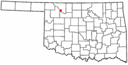
nation's largest ice plants was built to supply ice for refrigerator cars hauling perishables on Santa Fe's main line from
1153:
657:
52:
120:
1347:
781:
661:
414:
622:
607:
592:
577:
562:
547:
532:
517:
502:
487:
472:
457:
294:
286:
1139:
Illustrated Map of the Route of the
Transcontinental Air Transport, Inc. (from the David Rumsey Map Collection)
420:
236:
98:
1089:
762:
1312:
1067:
675:
There were 453 households, out of which 22.1% had children under the age of 18 living with them, 44.6% were
356:
1185:
665:
379:
274:
125:
383:
1319:
669:
209:
1281:
957:
886:
649:
1148:
909:
832:
706:
The passenger and freight railroad stations originally built by the Santa Fe remain intact. The
1045:
1299:
1294:
1231:
691:
for the city was $ 12,493. About 13.5% of families and 16.6% of the population were below the
688:
387:
371:
352:
1271:
1266:
311:
339:. In addition, a roundhouse, maintenance and repair shops, a reading room, a depot, and a
1289:
1125:
319:
314:, Waynoka was established in 1887 when the Southern Kansas Railroad, a subsidiary of the
1133:
1023:
1226:
1207:
392:
290:
282:
1336:
721:
at 1887 E. Cecil St., and the
Waynoka Telephone Exchange Building at 200 S. Main St.
375:
241:
692:
399:
340:
935:
861:
1200:
336:
910:"Encyclopedia of Oklahoma History and Culture - TRANSCONTINENTAL AIR TRANSPORT"
1115:
108:
763:
U.S. Geological Survey
Geographic Names Information System: Waynoka, Oklahoma
293:. The population, which peaked at 2,018 in 1950, was 708 at the time of the
81:
68:
190:
1144:
Oklahoma
Digital Maps: Digital Collections of Oklahoma and Indian Territory
695:, including 26.8% of those under age 18 and 9.5% of those age 65 or over.
1143:
676:
278:
224:
113:
417:, the city has a total area of 1.0 square mile (2.6 km), all land.
712:
National Register of Historic Places listings in Woods County, Oklahoma
332:
17:
644:
1001:
216:
195:
1258:
1218:
43:
1157:
363:
1245:
777:
833:"Encyclopedia of Oklahoma History and Culture - Waynoka"
1280:
1257:
1217:
257:
247:
235:
223:
206:
189:
181:
173:
168:
160:
152:
144:
136:
131:
119:
107:
97:
34:
826:
824:
822:
820:
1169:
889:. Maxine Bamburg, Oklahoma Historical Society
8:
1068:"Meet the Committee Cimarron River Stampede"
1026:. Oklahoma Tourism and Recreation Department
914:Encyclopedia of Oklahoma History and Culture
837:Encyclopedia of Oklahoma History and Culture
717:Other NRHP-listed locations in town are the
856:
854:
347:Waynoka was also the starting point of the
1176:
1162:
1154:
672:of any race were 5.14% of the population.
430:
31:
881:
879:
1246:
730:
708:Waynoka Santa Fe Depot and Harvey House
246:
222:
188:
167:
159:
130:
96:
61:
49:
1090:"Surviving Oklahoma Railroad Stations"
758:
756:
450:
772:
770:
316:Atchison, Topeka and Santa Fe Railway
256:
234:
205:
180:
172:
151:
143:
135:
118:
106:
7:
1149:Transcontinental Air Transport, Inc.
664:, and 2.52% from two or more races.
281:, United States. It is located on
156:0.00 sq mi (0.00 km)
148:1.00 sq mi (2.60 km)
140:1.00 sq mi (2.60 km)
1184:Municipalities and communities of
1046:"Census of Population and Housing"
440:
310:Founded in what was then known as
25:
349:Buffalo and Northwestern Railroad
1343:Cities in Woods County, Oklahoma
1118:
958:"Transcontinental Air Transport"
739:"ArcGIS REST Services Directory"
51:
29:City in Oklahoma, United States
368:Transcontinental Air Transport
1:
960:. Oklahoma Historical Society
936:"TAT Timetable, July 7, 1929"
916:. Oklahoma Historical Society
839:. Oklahoma Historical Society
805:. United States Census Bureau
741:. United States Census Bureau
185:705.18/sq mi (272.37/km)
57:Location of Waynoka, Oklahoma
351:, a 52-mile line linking to
782:United States Census Bureau
719:First Congregational Church
415:United States Census Bureau
362:The predecessor company of
1364:
1024:"Little Sahara State Park"
803:"Waynoka (city), Oklahoma"
164:1,493 ft (455 m)
1308:
1243:
1198:
938:. www.timetableimages.com
699:Notable places and events
636:
621:
606:
591:
576:
561:
546:
531:
516:
501:
486:
471:
456:
449:
444:
439:
436:
62:
50:
41:
1134:Little Sahara State Park
1002:"Vici Municipal Airport"
908:Bennett-Jones, Julie A.
421:Little Sahara State Park
289:, seventy miles west of
684:there were 79.3 males.
1251:
1187:Woods County, Oklahoma
862:"The Buffalo District"
831:Barker Olson, Sandra.
1249:
778:"U.S. Census website"
637:U.S. Decennial Census
432:Historical population
398:Waynoka is linked by
384:Pennsylvania Railroad
326:Transportation Center
208: • Summer (
82:36.58222°N 98.87972°W
1321:United States portal
1095:. american-rails.com
864:. AbandonedRails.com
382:sleeper cars of the
182: • Density
433:
378:aircraft, but also
344:busiest rail line.
87:36.58222; -98.87972
78: /
1348:Cities in Oklahoma
1252:
431:
174: • Total
153: • Water
137: • Total
1330:
1329:
1282:Other communities
710:is listed on the
689:per capita income
641:
640:
413:According to the
388:Santa Fe Railroad
372:Charles Lindbergh
353:Buffalo, Oklahoma
268:
267:
145: • Land
36:Waynoka, Oklahoma
16:(Redirected from
1355:
1322:
1315:
1250:Woods County map
1248:
1210:
1203:
1193:
1188:
1178:
1171:
1164:
1155:
1128:
1123:
1122:
1121:
1105:
1104:
1102:
1100:
1094:
1086:
1080:
1079:
1077:
1075:
1070:. The Rodeo News
1064:
1058:
1057:
1055:
1053:
1042:
1036:
1035:
1033:
1031:
1020:
1014:
1013:
1011:
1009:
998:
992:
991:
989:
987:
976:
970:
969:
967:
965:
954:
948:
947:
945:
943:
932:
926:
925:
923:
921:
905:
899:
898:
896:
894:
883:
874:
873:
871:
869:
858:
849:
848:
846:
844:
828:
815:
814:
812:
810:
799:
793:
792:
790:
788:
774:
765:
760:
751:
750:
748:
746:
735:
654:African American
452:
447:
442:
434:
312:Indian Territory
287:State Highway 14
283:U.S. Highway 281
213:
93:
92:
90:
89:
88:
83:
79:
76:
75:
74:
71:
55:
32:
21:
1363:
1362:
1358:
1357:
1356:
1354:
1353:
1352:
1333:
1332:
1331:
1326:
1320:
1314:Oklahoma portal
1313:
1304:
1276:
1253:
1241:
1213:
1208:
1201:
1194:
1191:
1186:
1182:
1126:Oklahoma portal
1124:
1119:
1117:
1114:
1109:
1108:
1098:
1096:
1092:
1088:
1087:
1083:
1073:
1071:
1066:
1065:
1061:
1051:
1049:
1044:
1043:
1039:
1029:
1027:
1022:
1021:
1017:
1007:
1005:
1000:
999:
995:
985:
983:
978:
977:
973:
963:
961:
956:
955:
951:
941:
939:
934:
933:
929:
919:
917:
907:
906:
902:
892:
890:
885:
884:
877:
867:
865:
860:
859:
852:
842:
840:
830:
829:
818:
808:
806:
801:
800:
796:
786:
784:
776:
775:
768:
761:
754:
744:
742:
737:
736:
732:
727:
701:
677:married couples
658:Native American
445:
429:
411:
328:
320:Cherokee Outlet
308:
303:
231:
207:
86:
84:
80:
77:
72:
69:
67:
65:
64:
58:
46:
37:
30:
23:
22:
15:
12:
11:
5:
1361:
1359:
1351:
1350:
1345:
1335:
1334:
1328:
1327:
1325:
1324:
1317:
1309:
1306:
1305:
1303:
1302:
1297:
1292:
1286:
1284:
1278:
1277:
1275:
1274:
1269:
1263:
1261:
1255:
1254:
1244:
1242:
1240:
1239:
1234:
1229:
1223:
1221:
1215:
1214:
1199:
1196:
1195:
1183:
1181:
1180:
1173:
1166:
1158:
1152:
1151:
1146:
1141:
1136:
1130:
1129:
1113:
1112:External links
1110:
1107:
1106:
1081:
1059:
1037:
1015:
993:
971:
949:
927:
900:
875:
850:
816:
794:
766:
752:
729:
728:
726:
723:
700:
697:
639:
638:
634:
633:
630:
628:
625:
619:
618:
615:
613:
610:
604:
603:
600:
598:
595:
589:
588:
585:
583:
580:
574:
573:
570:
568:
565:
559:
558:
555:
553:
550:
544:
543:
540:
538:
535:
529:
528:
525:
523:
520:
514:
513:
510:
508:
505:
499:
498:
495:
493:
490:
484:
483:
480:
478:
475:
469:
468:
465:
463:
460:
454:
453:
448:
443:
438:
428:
425:
410:
407:
393:Amelia Earhart
327:
324:
307:
306:Founding years
304:
302:
299:
266:
265:
262:
255:
254:
251:
245:
244:
239:
233:
232:
229:
227:
221:
220:
214:
204:
203:
193:
187:
186:
183:
179:
178:
175:
171:
170:
166:
165:
162:
158:
157:
154:
150:
149:
146:
142:
141:
138:
134:
133:
129:
128:
123:
117:
116:
111:
105:
104:
101:
95:
94:
60:
59:
56:
48:
47:
42:
39:
38:
35:
28:
24:
14:
13:
10:
9:
6:
4:
3:
2:
1360:
1349:
1346:
1344:
1341:
1340:
1338:
1323:
1318:
1316:
1311:
1310:
1307:
1301:
1298:
1296:
1293:
1291:
1288:
1287:
1285:
1283:
1279:
1273:
1270:
1268:
1265:
1264:
1262:
1260:
1256:
1238:
1235:
1233:
1230:
1228:
1225:
1224:
1222:
1220:
1216:
1212:
1211:
1204:
1197:
1192:United States
1189:
1179:
1174:
1172:
1167:
1165:
1160:
1159:
1156:
1150:
1147:
1145:
1142:
1140:
1137:
1135:
1132:
1131:
1127:
1116:
1111:
1091:
1085:
1082:
1069:
1063:
1060:
1047:
1041:
1038:
1025:
1019:
1016:
1003:
997:
994:
982:. Google Maps
981:
980:"Waynoka, OK"
975:
972:
959:
953:
950:
937:
931:
928:
915:
911:
904:
901:
888:
882:
880:
876:
863:
857:
855:
851:
838:
834:
827:
825:
823:
821:
817:
804:
798:
795:
783:
779:
773:
771:
767:
764:
759:
757:
753:
745:September 20,
740:
734:
731:
724:
722:
720:
715:
713:
709:
704:
698:
696:
694:
690:
685:
681:
678:
673:
671:
667:
663:
660:, 1.01% from
659:
655:
651:
646:
635:
631:
629:
626:
624:
620:
616:
614:
611:
609:
605:
601:
599:
596:
594:
590:
586:
584:
581:
579:
575:
571:
569:
566:
564:
560:
556:
554:
551:
549:
545:
541:
539:
536:
534:
530:
526:
524:
521:
519:
515:
511:
509:
506:
504:
500:
496:
494:
491:
489:
485:
481:
479:
476:
474:
470:
466:
464:
461:
459:
455:
435:
426:
424:
422:
418:
416:
408:
406:
403:
401:
396:
394:
389:
385:
381:
377:
376:Ford Trimotor
373:
369:
365:
360:
358:
357:Harper County
354:
350:
345:
342:
338:
334:
325:
323:
321:
317:
313:
305:
300:
298:
296:
292:
288:
284:
280:
276:
273:is a city in
272:
263:
260:
252:
250:
243:
240:
238:
228:
226:
218:
215:
211:
201:
200:Central (CST)
197:
194:
192:
184:
176:
163:
155:
147:
139:
127:
124:
122:
115:
112:
110:
103:United States
102:
100:
91:
63:Coordinates:
54:
45:
40:
33:
27:
19:
1236:
1206:
1099:February 14,
1097:. Retrieved
1084:
1072:. Retrieved
1062:
1050:. Retrieved
1048:. Census.gov
1040:
1028:. Retrieved
1018:
1006:. Retrieved
1004:. AirNav.com
996:
984:. Retrieved
974:
962:. Retrieved
952:
940:. Retrieved
930:
918:. Retrieved
913:
903:
893:November 15,
891:. Retrieved
868:November 15,
866:. Retrieved
841:. Retrieved
836:
807:. Retrieved
797:
785:. Retrieved
743:. Retrieved
733:
716:
705:
702:
693:poverty line
686:
682:
674:
642:
427:Demographics
419:
412:
404:
400:US Route 281
397:
361:
346:
341:Harvey House
329:
309:
275:Woods County
270:
269:
26:
1202:County seat
1030:November 1,
964:January 29,
942:January 29,
920:October 19,
787:January 31,
662:other races
337:Los Angeles
295:2020 Census
85: /
1337:Categories
1074:October 7,
1008:January 7,
986:January 7,
843:October 7,
725:References
643:As of the
261:feature ID
169:Population
73:98°52′47″W
70:36°34′56″N
887:"Buffalo"
809:April 20,
409:Geography
249:FIPS code
237:Area code
191:Time zone
161:Elevation
666:Hispanic
656:, 1.51%
652:, 2.32%
386:and the
279:Oklahoma
253:40-79350
225:ZIP code
114:Oklahoma
1300:Lookout
1295:Hopeton
1237:Waynoka
1232:Freedom
1052:June 4,
380:Pullman
333:Chicago
301:History
271:Waynoka
264:1099446
99:Country
18:Waynoka
1272:Dacoma
1267:Capron
1219:Cities
670:Latino
645:census
632:−23.6%
587:−31.2%
557:−19.5%
542:−11.1%
512:−13.9%
437:Census
355:, the
121:County
1290:Avard
1259:Towns
1093:(PDF)
650:White
617:−6.6%
572:−4.6%
567:1,377
552:1,444
537:1,794
527:27.4%
522:2,018
507:1,584
497:22.7%
492:1,840
482:29.3%
477:1,500
462:1,160
230:73860
219:(CDT)
217:UTC-5
196:UTC-6
126:Woods
109:State
1227:Alva
1209:Alva
1101:2020
1076:2018
1054:2015
1032:2018
1010:2021
988:2021
966:2019
944:2019
922:2018
895:2021
870:2021
845:2018
811:2024
789:2008
747:2022
623:2020
608:2010
602:4.9%
593:2000
578:1990
563:1980
548:1970
533:1960
518:1950
503:1940
488:1930
473:1920
458:1910
446:Note
441:Pop.
291:Enid
285:and
259:GNIS
132:Area
44:City
668:or
627:708
612:927
597:993
582:947
364:TWA
335:to
242:580
210:DST
177:708
1339::
1205::
1190:,
912:.
878:^
853:^
835:.
819:^
780:.
769:^
755:^
714:.
451:%±
402:.
366:,
297:.
277:,
1177:e
1170:t
1163:v
1103:.
1078:.
1056:.
1034:.
1012:.
990:.
968:.
946:.
924:.
897:.
872:.
847:.
813:.
791:.
749:.
467:—
212:)
202:)
198:(
20:)
Text is available under the Creative Commons Attribution-ShareAlike License. Additional terms may apply.