76:
48:
83:
55:
31:
430:
319:
from an eruption which occurred in the middle of the 6th century AD, indicating that the tumulus was built around the start of the sixth century. Although the detailed structure of the mound has not been investigated yet, it is believed that the
290:
tumuli in the area. It has a total length of 104 meters and was built in two tiers, orientated to the northwest. Unusually, the width of the rectangular portion of the mound is larger its length. The surface was originally covered in
75:
132:
353:
464:
434:
47:
474:
286:
The
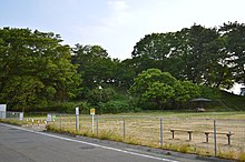
Maebashi Futagoyama Kofun is located at the eastern edge of the Maebashi Plain, and is one of Asakura / Hirose cluster of
407:
377:
312:
308:
258:
212:
469:
403:
275:
30:
246:
315:
in 1980 and in 1994, and an analysis of the soil covering the moat found that it contained
242:
106:
250:
120:
459:
321:
453:
316:
235:
190:
373:
147:
134:
429:
441:
293:
299:
254:
238:
167:
110:
311:. The remains of a 35-meter moat were discovered in an
241:
located in the
Bunkyocho neighborhood of the city of
201:
196:
186:
178:
173:
163:
126:
116:
102:
324:was opened in antiquity and has since collapsed.
274:.This tumuli appears in the poem "Futagoyama" by
261:in 1927. It is also sometimes referred to as the
82:
54:
267:
227:
400:(国指定史跡事典) National Historic Site Encyclopedia
8:
16:
343:72 meter diameter x 11 meters high, 2-tier
29:
15:
337:76 meters wide x 9.5 meters high, 2-tier
365:
354:List of Historic Sites of Japan (Gunma)
398:Isomura, Yukio; Sakai, Hideya (2012).
7:
14:
90:Maebashi Futagoyama Kofun (Japan)
428:
81:
74:
53:
46:
259:National Historic Site of Japan
213:National Historic Site of Japan
307:from this site is kept at the
1:
442:Maebashi City official guide
334:Anterior rectangular portion
65:Show map of Gunma Prefecture
465:History of Gunma Prefecture
378:Agency for Cultural Affairs
491:
340:Posterior circular portion
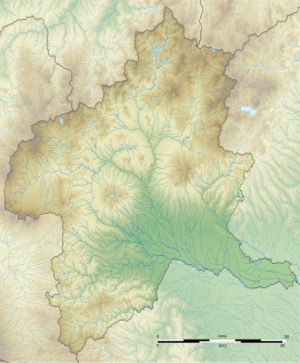
435:Maebashi Futagoyama Kofun
313:archaeological excavation
297:with rows of cylindrical
268:
228:
223:Maebashi Futagoyama Kofun
209:
62:Maebashi Futagoyama Kofun
40:
35:Maebashi Futagoyama Kofun
28:
21:
17:Maebashi Futagoyama Kofun
263:Amagawa-Futagoyama Kofun
475:Historic Sites of Japan
148:36.41139°N 139.034806°E
303:. One anthropomorphic
257:. It was designated a
437:at Wikimedia Commons
153:36.41139; 139.034806
309:University of Tokyo
144: /
18:
202:Public access
433:Media related to
276:Sakutaro Hagiwara
220:
219:
93:Show map of Japan
482:
446:
432:
417:
416:
413:
395:
389:
388:
386:
384:
370:
273:
271:
270:
249:in the northern
247:Gunma Prefecture
233:
231:
230:
182:late 6th century
159:
158:
156:
155:
154:
149:
145:
142:
141:
140:
137:
94:
85:
84:
78:
66:
57:
56:
50:
33:
19:
490:
489:
485:
484:
483:
481:
480:
479:
450:
449:
444:
426:
421:
420:
414:
410:
397:
396:
392:
382:
380:
376:(in Japanese).
372:
371:
367:
362:
350:
284:
265:
225:
216:
215:
152:
150:
146:
143:
138:
135:
133:
131:
130:
107:Maebashi, Gunma
98:
97:
96:
95:
92:
91:
88:
87:
86:
69:
68:
67:
64:
63:
60:
59:
58:
36:
24:
12:
11:
5:
488:
486:
478:
477:
472:
467:
462:
452:
451:
448:
447:
425:
424:External links
422:
419:
418:
408:
390:
364:
363:
361:
358:
357:
356:
349:
346:
345:
344:
341:
338:
335:
332:
329:
322:burial chamber
283:
280:
218:
217:
211:
210:
207:
206:
203:
199:
198:
194:
193:
188:
184:
183:
180:
176:
175:
171:
170:
165:
161:
160:
128:
124:
123:
118:
114:
113:
104:
100:
99:
89:
80:
79:
73:
72:
71:
70:
61:
52:
51:
45:
44:
43:
42:
41:
38:
37:
34:
26:
25:
22:
13:
10:
9:
6:
4:
3:
2:
487:
476:
473:
471:
468:
466:
463:
461:
458:
457:
455:
445:(in Japanese)
443:
440:
439:
438:
436:
431:
423:
415:(in Japanese)
411:
405:
401:
394:
391:
379:
375:
369:
366:
359:
355:
352:
351:
347:
342:
339:
336:
333:
330:
327:
326:
325:
323:
318:
314:
310:
306:
302:
301:
296:
295:
289:
281:
279:
277:
264:
260:
256:
252:
248:
244:
240:
237:
224:
214:
208:
204:
200:
195:
192:
189:
185:
181:
177:
172:
169:
166:
162:
157:
129:
125:
122:
119:
115:
112:
108:
105:
101:
77:
49:
39:
32:
27:
20:
427:
399:
393:
381:. Retrieved
368:
328:Total length
317:volcanic ash
304:
298:
292:
287:
285:
262:
251:Kantō region
239:burial mound
236:Kofun period
222:
221:
191:Kofun period
121:Kantō region
151: /
139:139°2′5.3″E
127:Coordinates
454:Categories
409:4311750404
383:August 20,
360:References
331:104 meters
205:Yes (Park)
197:Site notes
136:36°24′41″N
470:Maebashi
348:See also
294:fukiishi
282:Overview
243:Maebashi
103:Location
402:. 学生社.
374:"二子山古墳"
269:天川二子山古墳
229:前橋二子山古墳
187:Periods
179:Founded
174:History
23:前橋二子山古墳
406:
305:haniwa
300:haniwa
117:Region
460:Kofun
288:kofun
255:Japan
234:is a
168:kofun
111:Japan
404:ISBN
385:2020
164:Type
253:of
456::
278:.
245:,
109:,
412:.
387:.
272:)
266:(
232:)
226:(
Text is available under the Creative Commons Attribution-ShareAlike License. Additional terms may apply.