34:
221:
226:
215:
210:
1076:. A sharply projecting point on the west side of Deep Freeze Range, standing 1.5 nautical miles (2.8 km; 1.7 mi) northwest of Snowy Point and overlooking the north portion of Nansen Ice Sheet, in Victoria Land. First explored by the Northern Party of the BrAE, 1910-13, and so named by them because of large and extensive sastrugi that impeded the travel of this party in approaching the point.
41:
342:. A symmetrical mountain, 2,640 metres (8,660 ft) high, that rises above the midportion of Recoil Glacier just south of Archambault Ridge, in the Deep Freeze Range. Mapped by USGS from surveys and US. Navy air photos, 1960-64. Named by US-ACAN for Herbert W. Pollock, United States Navy, construction electrician at McMurdo Station, 1962 and 1967.
748:. A prominent mountain, 2,050 metres (6,730 ft) high, rising on the west side of Campbell Glacier, just north of the mouth of Bates Glacier, in the Deep Freeze Range. Mapped by USGS from surveys and United States Navy air photos, 1955-63. Named by US-ACAN after William B. Emison, biologist at McMurdo Station, 1964-65 and 1965-66 seasons.
1538:
1456:
824:. A sharp peak in the Deep Freeze Range, 1,420 metres (4,660 ft) high, standing along the west side of Campbell Glacier between Mount Queensland and the terminus of Bates Glacier. Mapped by USGS from surveys and United States Navy air photos, 1955-63. Named by US-ACAN for Peter J. Mills, geologist at McMurdo Station, 1965-66 season.
672:. A prominent peak in the Deep Freeze Range, between Priestley Glacier and the west part of Tourmaline Plateau. Named by US-ACAN in 1990 after Erich Bloch, Director, National Science Foundation, 1984-90. The Foundation, through its Office of Polar Programs, is responsible for the development of the United States Antarctic Program.
950:. A prominent rock ridge in the Deep Freeze Range, Victoria Land, 7 nautical miles (13 km; 8.1 mi) long and rising to 1,500 metres (4,900 ft) high, forming a divide between the Priestley and Corner Glaciers. First explored by the Northern Party of the BrAE, 1910-13, and so named by them because of its appearance.
786:. A line of east–west trending peaks at the south side of Tourmaline Plateau, extending transversely across Deep Freeze Range, in Victoria Land. Mapped by USGS from surveys and United States Navy air photos, 1955-63. Named by US-ACAN for Hugh C. Howard, cook at McMurdo Station for four summer seasons, 1963-64 to 1966-67.
502:. A bluff-type mountain, 3,720 metres (12,200 ft) high, standing 6.5 nautical miles (12.0 km; 7.5 mi) west-southwest of Mount Adamson. It was named by the southern party of NZGSAE, 1962–63, for R.W. Hewson, leader and surveyor of this party; also a surveyor for the northern party of NZGSAE, 1961-62.
912:. A peak 2,260 metres (7,410 ft) high located 5 nautical miles (9.3 km; 5.8 mi) west-southwest of Mount Queensland in the Deep Freeze Range. The feature towers high above the lower, east side of Priestley Glacier. Named by the NZ-APC for A.L. Burrows, Scientific Leader at Scott Base, 1964-65.
418:. A mountain 2,910 metres (9,550 ft) high situated 2 nautical miles (3.7 km; 2.3 mi) northeast of Mount Adamson in the Deep Freeze Range. Mapped by USGS from surveys and United States Navy air photos, 1960-64. Named by US-ACAN for Edward A. Mankinen, geologist at McMurdo Station, 1965-66.
380:. A mountain 3,140 metres (10,300 ft) high rising on the south side of Recoil Glacier in the Deep Freeze Range. Mapped by USGS from surveys and United States Navy air photos, 1960-64. Named by US-ACAN for Lieutenant Maurice E. Gibbs, United States Navy, meteorological officer at McMurdo Station, 1967.
1038:. A mountain, 1,090 metres (3,580 ft) high, rising at the east side of the terminus of Boomerang Glacier in Deep Freeze Range. Mapped by USGS from surveys and United States Navy air photos, 1955-63. Named by US-ACAN for Gerald E. Keinath, biolab administrator at McMurdo Station, 1965-66 season.
710:. An ice-covered plateau in the central part of the Deep Freeze Range, bounded by the Howard Peaks and the peaks and ridges which trend N-S from Mount Levick, in Victoria Land. So named by the Northern Party of NZGSAE, 1965-66, because of the quantities of tourmaline-granite found there.
1542:
1460:
592:. A peak, 2,820 metres (9,250 ft) high, rising just north of the head of Capsize Glacier in Deep Freeze Range. Named by the Northern Party of the NZGSAE, 1965-66, for R.J. Cavaney, geologist with that party.
1114:. A gently sloping point marking the north side of the western portal of Browning Pass in Deep Freeze Range. First explored and given this descriptive name by the Northern Party of the BrAE, 1910-13.
630:. A prominent mountain, 2,390 metres (7,840 ft) high, standing at the northwest side of Tourmaline Plateau in the Deep Freeze Range. First charted by the Northern Party of the
546:. A prominent peak, 3,600 metres (11,800 ft) high, standing 3 nautical miles (5.6 km; 3.5 mi) south of Mount Hewson. It was mapped by the USGS from surveys and
456:. A peak, 3,400 metres (11,200 ft) high, rising 6.5 nautical miles (12.0 km; 7.5 mi) |east-northeast of Mount Hewson. It was named by the northern party of
457:
550:
air photos, 1955-63. It was named by US-ACAN for
Lieutenant Cdt. Willard G. Shafer, (CEC) United States Navy, officer in charge of the nuclear power plant at
33:
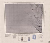
98:) is a rugged mountain range, over 80 nautical miles (150 km; 92 mi) long and about 10 nautical miles (19 km; 12 mi) wide, rising between
236:
The Deep Freeze Range extends from southeast to northwest, between
Priestley Glacier and Campbell Glacier. The narrow northwest end of the range ends in
993:
631:
1561:
1464:
54:
867:
147:
866:, 1,910 metres (6,270 ft) high, standing 7 nautical miles (13 km; 8.1 mi) north of Mount Dickason. It was discovered by the
1546:
143:
261:
1086:
1048:
1010:
960:
922:
884:
834:
796:
758:
720:
682:
644:
602:
564:
518:
474:
390:
352:
314:
70:
428:
289:
167:
115:
997:
220:
127:
634:(BrAE), and named for G. Murray Levick, surgeon with the expedition and a member of the Northern Party.
511:
194:
151:
189:
231:
Deep Freeze Range extends from southeast to northwest, between
Priestley Glacier and Campbell Glacier
225:
214:
209:
184:
1503:
547:
293:
138:
Peaks in the low and mid portions of the range were observed by early
British expeditions to the
989:
285:
249:
245:
99:
123:
103:
1487:
1471:
1519:
551:
269:
146:(USGS) from surveys and U.S. Navy air photos, 1955-63. It was named by the United States
281:
277:
265:
257:
253:
111:
874:, Australia, in recognition of the assistance given the expedition by its government.
1555:
273:
107:
1438:
179:
241:
237:
150:(US-ACAN) in recognition of the support to research provided by the U.S. Navy's
871:
119:
1101:
1088:
1063:
1050:
1025:
1012:
975:
962:
937:
924:
899:
886:
849:
836:
811:
798:
773:
760:
735:
722:
697:
684:
659:
646:
617:
604:
579:
566:
533:
520:
489:
476:
443:
430:
405:
392:
367:
354:
329:
316:
256:. To the south of this along the west of Campbell Glacier are Mount Pollock,
85:
72:
461:
988:. A prominent mountain, 2,030 metres (6,660 ft) high, at the head of
17:
863:
139:
272:, Mount Levick, the Tourmaline Plateau, Mount Emison, the Howard Peaks,
110:, Antarctica, and extending from the edge of the polar plateau to
154:
expeditions to
Antarctica for many years beginning in 1954.
1128:
1126:
870:, 1901–04, which named this mountain for the state of
1446:(2 ed.), United States Board on Geographic Names
992:. It was first mapped by the Northern Party of the
276:, Mills Peak, Mount Queensland, Mount Burrows, the
40:
458:New Zealand Geological Survey Antarctic Expedition
1180:
1168:
268:. Further south are Shafer Peak, Mount Cavaney,
1144:
1000:, Royal Navy, a member of the Northern Party.
248:lies to the west. The range extends north to
8:
1156:
304:Features, from north to south, include:
142:. The range was mapped in detail by the
1465:United States Board on Geographic Names
1420:
1408:
1396:
1384:
1372:
1360:
1348:
1336:
1324:
1312:
1300:
1288:
1276:
1264:
1252:
1240:
1228:
1216:
1204:
1192:
1132:
1122:
1524:, USGS: United States Geographic Board
1508:, USGS: United States Geographic Board
1492:, USGS: United States Geographic Board
1476:, USGS: United States Geographic Board
994:British Antarctic Expedition, 1910–13
868:British National Antarctic Expedition
632:British Antarctic Expedition, 1910–13
460:(NZGSAE), 1965–66, for R. Adamson, a
148:Advisory Committee on Antarctic Names
7:
264:, Mount Mankinen, Mount Adamson and
1545:from websites or documents of the
1463:from websites or documents of the
25:
1440:Geographic Names of the Antarctic
1562:Mountain ranges of Victoria Land
1541: This article incorporates
1536:
1459: This article incorporates
1454:
224:
219:
213:
208:
39:
32:
1547:United States Geological Survey
144:United States Geological Survey
58:Deep Freeze Range in Antarctica
1437:Alberts, Fred G., ed. (1995),
1:
296:are south of Browning Pass.
27:Mountain range in Antarctica
195:GPX (secondary coordinates)
47:Deep Freeze Range
1578:
509:
190:GPX (primary coordinates)
165:Map all coordinates using
114:. It is southwest of the
173:Download coordinates as:
116:Southern Cross Mountains
128:Prince Albert Mountains
1543:public domain material
1461:public domain material
554:, winter party 1965.
512:Shafer Peak Formation
185:GPX (all coordinates)
152:Operation Deep Freeze
122:and northeast of the
1181:Mount Melbourne USGS
1169:Mount Murchison USGS
288:, Mount Keinath and
134:Exploration and name
55:class=notpageimage|
1145:Sequence Hills USGS
1098: /
1060: /
1022: /
972: /
934: /
896: /
846: /
808: /
770: /
732: /
694: /
656: /
614: /
576: /
530: /
486: /
440: /
402: /
364: /
326: /
82: /
1243:, p. 332–333.
1102:74.617°S 163.750°E
1064:74.617°S 163.683°E
1026:74.533°S 163.950°E
976:74.400°S 163.967°E
938:74.400°S 163.600°E
900:74.300°S 163.650°E
850:74.267°S 163.933°E
812:74.233°S 163.900°E
774:74.250°S 163.700°E
736:74.200°S 163.733°E
698:74.167°S 163.450°E
676:Tourmaline Plateau
660:74.200°S 163.250°E
618:74.133°S 163.167°E
580:74.050°S 163.050°E
548:United States Navy
534:74.017°S 162.600°E
490:73.967°S 162.633°E
444:73.917°S 163.000°E
406:73.900°S 163.100°E
368:73.817°S 162.933°E
330:73.750°S 162.783°E
294:Northern Foothills
280:, Mount Dickason,
86:74.250°S 163.750°E
990:Boomerang Glacier
464:with this party.
286:Boomerang Glacier
250:Archambault Ridge
104:Campbell Glaciers
65:Deep Freeze Range
16:(Redirected from
1569:
1540:
1539:
1531:
1530:
1529:
1515:
1514:
1513:
1499:
1498:
1497:
1483:
1482:
1481:
1458:
1457:
1453:
1452:
1451:
1445:
1424:
1418:
1412:
1406:
1400:
1394:
1388:
1382:
1376:
1370:
1364:
1358:
1352:
1346:
1340:
1334:
1328:
1322:
1316:
1310:
1304:
1298:
1292:
1286:
1280:
1274:
1268:
1262:
1256:
1250:
1244:
1238:
1232:
1226:
1220:
1214:
1208:
1202:
1196:
1190:
1184:
1178:
1172:
1166:
1160:
1157:Reeves Névé USGS
1154:
1148:
1142:
1136:
1130:
1113:
1112:
1110:
1109:
1108:
1107:-74.617; 163.750
1103:
1099:
1096:
1095:
1094:
1091:
1075:
1074:
1072:
1071:
1070:
1069:-74.617; 163.683
1065:
1061:
1058:
1057:
1056:
1053:
1037:
1036:
1034:
1033:
1032:
1031:-74.533; 163.950
1027:
1023:
1020:
1019:
1018:
1015:
996:, and named for
987:
986:
984:
983:
982:
981:-74.400; 163.967
977:
973:
970:
969:
968:
965:
949:
948:
946:
945:
944:
943:-74.400; 163.600
939:
935:
932:
931:
930:
927:
911:
910:
908:
907:
906:
905:-74.300; 163.650
901:
897:
894:
893:
892:
889:
861:
860:
858:
857:
856:
855:-74.267; 163.933
851:
847:
844:
843:
842:
839:
828:Mount Queensland
823:
822:
820:
819:
818:
817:-74.233; 163.900
813:
809:
806:
805:
804:
801:
785:
784:
782:
781:
780:
779:-74.250; 163.700
775:
771:
768:
767:
766:
763:
747:
746:
744:
743:
742:
741:-74.200; 163.733
737:
733:
730:
729:
728:
725:
709:
708:
706:
705:
704:
703:-74.167; 163.450
699:
695:
692:
691:
690:
687:
671:
670:
668:
667:
666:
665:-74.200; 163.250
661:
657:
654:
653:
652:
649:
629:
628:
626:
625:
624:
623:-74.133; 163.167
619:
615:
612:
611:
610:
607:
591:
590:
588:
587:
586:
585:-74.050; 163.050
581:
577:
574:
573:
572:
569:
545:
544:
542:
541:
540:
539:-74.017; 162.600
535:
531:
528:
527:
526:
523:
501:
500:
498:
497:
496:
495:-73.967; 162.633
491:
487:
484:
483:
482:
479:
455:
454:
452:
451:
450:
449:-73.917; 163.000
445:
441:
438:
437:
436:
433:
417:
416:
414:
413:
412:
411:-73.900; 163.100
407:
403:
400:
399:
398:
395:
379:
378:
376:
375:
374:
373:-73.817; 162.933
369:
365:
362:
361:
360:
357:
341:
340:
338:
337:
336:
335:-73.750; 162.783
331:
327:
324:
323:
322:
319:
228:
223:
217:
212:
124:Eisenhower Range
97:
96:
94:
93:
92:
91:-74.250; 163.750
87:
83:
80:
79:
78:
75:
43:
42:
36:
21:
1577:
1576:
1572:
1571:
1570:
1568:
1567:
1566:
1552:
1551:
1537:
1534:
1527:
1525:
1518:
1511:
1509:
1502:
1495:
1493:
1489:Mount Murchison
1486:
1479:
1477:
1473:Mount Melbourne
1470:
1455:
1449:
1447:
1443:
1436:
1432:
1427:
1419:
1415:
1407:
1403:
1395:
1391:
1383:
1379:
1371:
1367:
1359:
1355:
1347:
1343:
1335:
1331:
1323:
1319:
1311:
1307:
1299:
1295:
1287:
1283:
1275:
1271:
1263:
1259:
1251:
1247:
1239:
1235:
1227:
1223:
1215:
1211:
1203:
1199:
1191:
1187:
1179:
1175:
1167:
1163:
1155:
1151:
1143:
1139:
1131:
1124:
1120:
1106:
1104:
1100:
1097:
1092:
1089:
1087:
1085:
1084:
1082:
1068:
1066:
1062:
1059:
1054:
1051:
1049:
1047:
1046:
1044:
1030:
1028:
1024:
1021:
1016:
1013:
1011:
1009:
1008:
1006:
980:
978:
974:
971:
966:
963:
961:
959:
958:
956:
942:
940:
936:
933:
928:
925:
923:
921:
920:
918:
904:
902:
898:
895:
890:
887:
885:
883:
882:
880:
854:
852:
848:
845:
840:
837:
835:
833:
832:
830:
816:
814:
810:
807:
802:
799:
797:
795:
794:
792:
778:
776:
772:
769:
764:
761:
759:
757:
756:
754:
740:
738:
734:
731:
726:
723:
721:
719:
718:
716:
702:
700:
696:
693:
688:
685:
683:
681:
680:
678:
664:
662:
658:
655:
650:
647:
645:
643:
642:
640:
622:
620:
616:
613:
608:
605:
603:
601:
600:
598:
584:
582:
578:
575:
570:
567:
565:
563:
562:
560:
552:McMurdo Station
538:
536:
532:
529:
524:
521:
519:
517:
516:
514:
508:
494:
492:
488:
485:
480:
477:
475:
473:
472:
470:
448:
446:
442:
439:
434:
431:
429:
427:
426:
424:
410:
408:
404:
401:
396:
393:
391:
389:
388:
386:
372:
370:
366:
363:
358:
355:
353:
351:
350:
348:
334:
332:
328:
325:
320:
317:
315:
313:
312:
310:
302:
270:Capsize Glacier
260:, Mount Gibbs,
240:, and includes
234:
233:
232:
229:
203:
202:
201:
200:
199:
160:
136:
118:, south of the
90:
88:
84:
81:
76:
73:
71:
69:
68:
61:
60:
59:
57:
51:
50:
49:
48:
44:
28:
23:
22:
15:
12:
11:
5:
1575:
1573:
1565:
1564:
1554:
1553:
1533:
1532:
1521:Sequence Hills
1516:
1500:
1484:
1468:
1433:
1431:
1428:
1426:
1425:
1423:, p. 690.
1413:
1411:, p. 649.
1401:
1399:, p. 385.
1389:
1387:, p. 188.
1377:
1365:
1363:, p. 106.
1353:
1351:, p. 599.
1341:
1339:, p. 493.
1329:
1327:, p. 350.
1317:
1315:, p. 220.
1305:
1303:, p. 754.
1293:
1281:
1279:, p. 430.
1269:
1267:, p. 124.
1257:
1255:, p. 666.
1245:
1233:
1221:
1219:, p. 459.
1209:
1207:, p. 276.
1197:
1195:, p. 583.
1185:
1173:
1161:
1149:
1137:
1135:, p. 180.
1121:
1119:
1116:
1081:
1078:
1043:
1040:
1005:
1002:
998:Harry Dickason
955:
954:Mount Dickason
952:
917:
914:
879:
876:
862:. A prominent
829:
826:
791:
788:
753:
750:
715:
712:
677:
674:
639:
636:
597:
594:
559:
556:
507:
504:
469:
466:
423:
420:
385:
384:Mount Mankinen
382:
347:
344:
309:
306:
301:
298:
282:Miller Nunatak
278:Corner Glacier
266:Rebuff Glacier
262:Harper Glacier
258:Recoil Glacier
254:Rainey Glacier
230:
206:
205:
204:
198:
197:
192:
187:
182:
176:
170:
163:
162:
161:
159:
156:
135:
132:
112:Terra Nova Bay
53:
52:
46:
45:
38:
37:
31:
30:
29:
26:
24:
14:
13:
10:
9:
6:
4:
3:
2:
1574:
1563:
1560:
1559:
1557:
1550:
1548:
1544:
1523:
1522:
1517:
1507:
1506:
1501:
1491:
1490:
1485:
1475:
1474:
1469:
1466:
1462:
1442:
1441:
1435:
1434:
1429:
1422:
1417:
1414:
1410:
1405:
1402:
1398:
1393:
1390:
1386:
1381:
1378:
1375:, p. 71.
1374:
1369:
1366:
1362:
1357:
1354:
1350:
1345:
1342:
1338:
1333:
1330:
1326:
1321:
1318:
1314:
1309:
1306:
1302:
1297:
1294:
1291:, p. 74.
1290:
1285:
1282:
1278:
1273:
1270:
1266:
1261:
1258:
1254:
1249:
1246:
1242:
1237:
1234:
1230:
1225:
1222:
1218:
1213:
1210:
1206:
1201:
1198:
1194:
1189:
1186:
1182:
1177:
1174:
1170:
1165:
1162:
1158:
1153:
1150:
1146:
1141:
1138:
1134:
1129:
1127:
1123:
1117:
1115:
1111:
1079:
1077:
1073:
1042:Cape Sastrugi
1041:
1039:
1035:
1004:Mount Keinath
1003:
1001:
999:
995:
991:
985:
953:
951:
947:
915:
913:
909:
878:Mount Burrows
877:
875:
873:
869:
865:
859:
827:
825:
821:
789:
787:
783:
751:
749:
745:
713:
711:
707:
675:
673:
669:
637:
635:
633:
627:
595:
593:
589:
558:Mount Cavaney
557:
555:
553:
549:
543:
513:
505:
503:
499:
467:
465:
463:
459:
453:
422:Mount Adamson
421:
419:
415:
383:
381:
377:
345:
343:
339:
308:Mount Pollock
307:
305:
299:
297:
295:
291:
290:Browning Pass
287:
283:
279:
275:
274:Bates Glacier
271:
267:
263:
259:
255:
251:
247:
243:
239:
227:
222:
218:
216:
211:
196:
193:
191:
188:
186:
183:
181:
178:
177:
175:
174:
169:
168:OpenStreetMap
166:
157:
155:
153:
149:
145:
141:
133:
131:
129:
125:
121:
117:
113:
109:
108:Victoria Land
105:
101:
95:
66:
56:
35:
19:
1535:
1526:, retrieved
1520:
1510:, retrieved
1504:
1494:, retrieved
1488:
1478:, retrieved
1472:
1448:, retrieved
1439:
1421:Alberts 1995
1416:
1409:Alberts 1995
1404:
1397:Alberts 1995
1392:
1385:Alberts 1995
1380:
1373:Alberts 1995
1368:
1361:Alberts 1995
1356:
1349:Alberts 1995
1344:
1337:Alberts 1995
1332:
1325:Alberts 1995
1320:
1313:Alberts 1995
1308:
1301:Alberts 1995
1296:
1289:Alberts 1995
1284:
1277:Alberts 1995
1272:
1265:Alberts 1995
1260:
1253:Alberts 1995
1248:
1241:Alberts 1995
1236:
1231:, p. 4.
1229:Alberts 1995
1224:
1217:Alberts 1995
1212:
1205:Alberts 1995
1200:
1193:Alberts 1995
1188:
1176:
1164:
1152:
1140:
1133:Alberts 1995
1083:
1045:
1007:
957:
919:
881:
831:
793:
755:
752:Howard Peaks
717:
714:Mount Emison
679:
641:
599:
596:Mount Levick
561:
515:
471:
468:Mount Hewson
425:
387:
349:
311:
303:
235:
207:
172:
171:
164:
137:
64:
62:
1505:Reeves Névé
1105: /
1080:Snowy Point
1067: /
1029: /
979: /
941: /
916:Black Ridge
903: /
853: /
815: /
777: /
739: /
701: /
663: /
621: /
583: /
537: /
506:Shafer Peak
493: /
447: /
409: /
371: /
346:Mount Gibbs
333: /
252:, south of
246:Reeves Névé
242:Wasson Rock
238:Szanto Spur
89: /
1528:2024-03-03
1512:2024-03-03
1496:2024-03-03
1480:2024-03-03
1450:2024-01-30
1118:References
872:Queensland
790:Mills Peak
638:Bloch Peak
510:See also:
120:Mesa Range
18:Mills Peak
462:geologist
100:Priestley
1556:Category
1093:163°45′E
1055:163°41′E
1017:163°57′E
967:163°58′E
929:163°36′E
891:163°39′E
864:mountain
841:163°56′E
803:163°54′E
765:163°42′E
727:163°44′E
689:163°27′E
651:163°15′E
609:163°10′E
571:163°03′E
525:162°36′E
481:162°38′E
397:163°06′E
359:162°56′E
321:162°47′E
300:Features
158:Location
140:Ross Sea
77:163°45′E
1430:Sources
1090:74°37′S
1052:74°37′S
1014:74°32′S
964:74°24′S
926:74°24′S
888:74°18′S
838:74°16′S
800:74°14′S
762:74°15′S
724:74°12′S
686:74°10′S
648:74°12′S
606:74°08′S
568:74°03′S
522:74°01′S
478:73°58′S
435:163°0′E
432:73°55′S
394:73°54′S
356:73°49′S
318:73°45′S
126:of the
74:74°15′S
292:. The
244:. The
1444:(PDF)
102:and
63:The
180:KML
106:in
1558::
1549:.
1125:^
284:,
130:.
1467:.
1183:.
1171:.
1159:.
1147:.
67:(
20:)
Text is available under the Creative Commons Attribution-ShareAlike License. Additional terms may apply.