43:
50:
155:
in the north, river Kechi in the east. Its co-ordinates, latitude and longitude are N03.59134 and E31.09947, respectively. It receives mean Annual
Rainfall of 1250 millimetres and mean Annual Temperature of 23 ∘ C. This reserve has an elevation range of 915–1,330 m and is mainly classified into
184:
The region is largely undisturbed by human activities. Mount Kei Forest
Reserve is mainly used as a source of firewood, honey, construction poles, medicinal plants and it also acts as a water catchment area. Another activity is the forest hikes which help in exploring the entire reserve.
151:
Mt Kei
Central Forest Reserve was formerly known as Mount Kei Rhino Sanctuary. It is also situated in the Sudan-Guinea Savanna biome. It borders Kaya river and the international border with
407:
143:. It covers an area of 384 square kilometers and is known for its diverse ecosystem consisting of dense savanna vegetation, forest, scrubland and a wide range of wildlife.
176:
savanna woodland, scrubland and a wide range of wildlife. It also has 175 bird species, 54 moths species, 21 mammal species,126 butterflies species and 229 tree species.
160:(NFA) which is in charge of managing, demarcating, re-surveying and maintaining all Central Forest Reserves in Uganda. The population around the reserve is sparse.
81:
815:
237:
Howard, P. C.; Davenport, T. R. B.; Kigenyi, F. W.; Viskanic, P.; Baltzer, M. C.; Dickinson, C. J.; Lwanga, J.; Matthews, R. A.; Mupada, E. (June 2000).
568:
42:
400:
636:
978:
1012:
915:
861:
734:
393:
810:
701:
666:
432:
416:
820:
681:
641:
621:
503:
472:
424:
800:
711:
696:
691:
651:
576:
805:
876:
686:
676:
646:
631:
616:
611:
581:
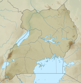
452:
28:
744:
739:
960:
749:
671:
656:
626:
606:
601:
586:
558:
467:
462:
784:
706:
591:
866:
779:
764:
881:
596:
442:
157:
124:
774:
754:
729:
836:
769:
759:
548:
543:
871:
856:
1002:
973:
553:
457:
846:
1007:
851:
533:
523:
513:
508:
447:
841:
538:
318:"NFA | National Forestry Authority - Mandated to manage all central forestry reserves by Government of Uganda"
721:
528:
518:
498:
477:
341:
493:
238:
910:
886:
437:
955:
925:
266:
950:
896:
258:
297:
250:
239:"Protected Area Planning in the Tropics: Uganda's National System of Forest Nature Reserves"
365:
945:
136:
996:
920:
254:
270:
940:
935:
905:
202:
194:
930:
262:
96:
83:
385:
302:
285:
284:
Kasangaki, Patrice; Akol, Anne M.; Basuta, Gilbert
Isabirye (2012-08-09).
201:
seeking for a place of relocation. Another threat are the wild fires and
197:
poses a great danger to such areas since its yields to a great number of
156:
dry
Combretum-Terminalia savanna and Butyrospermum savanna woodland. The
221:
198:
224:
from the World
Database on Protected Areas. Retrieved October 3, 2023.
140:
69:
232:
230:
152:
286:"Butterfly Species List for Selected West Albertine Rift Forests"
389:
366:"Mount Kei Forest Reserve, Uganda - KeyBiodiversityAreas.org"
31:
VI (protected area with sustainable use of natural resources)
317:
49:
342:"Best Hiking Trails in Mt. Kei Central Forest Reserve"
895:
829:
793:
720:
567:
486:
423:
120:
112:
75:
65:
21:
168:The reserve can broadly be classified into dry
401:
8:
408:
394:
386:
18:
979:National Environment Management Authority
301:
214:
7:
961:Sango Bay-Musambwa Island-Kagera Bay
222:Protected Area Profile for Mount Kei
794:Community wildlife management area
14:
255:10.1046/j.1523-1739.2000.99180.x
133:Mount Kei Central Forest Reserve
48:
41:
22:Mount Kei Central Forest Reserve
139:, in the extreme north-west of
135:is a protected area located in
64:
1:
899:Wetlands of Int'l Importance
370:www.keybiodiversityareas.org
158:National Forestry Authority
125:National Forestry Authority
1029:
180:Activities and attractions
1013:Forest reserves of Uganda
974:Uganda Wildlife Authority
969:
417:Protected areas of Uganda
290:Dataset Papers in Science
36:
26:
735:Central Karamoja (Napak)
722:Controlled Hunting Areas
569:Central Forest Reserves
193:The persistence war in
147:Location and structure
57:Location within Uganda
983:indicates degazetted
830:Wildlife sanctuaries
243:Conservation Biology
170:Combretum-Terminalia
916:Lake Mburo-Nakivali
433:Bwindi Impenetrable
303:10.7167/2013/451461
121:Governing body
93: /
956:Rwenzori Mountains
473:Rwenzori Mountains
990:
989:
487:Wildlife reserves
130:
129:
66:Nearest city
1020:
1003:IUCN Category VI
453:Mgahinga Gorilla
410:
403:
396:
387:
380:
379:
377:
376:
362:
356:
355:
353:
352:
338:
332:
331:
329:
328:
314:
308:
307:
305:
281:
275:
274:
234:
225:
219:
108:
107:
105:
104:
103:
98:
97:3.683°N 31.133°E
94:
91:
90:
89:
86:
52:
51:
45:
19:
16:Forest in Uganda
1028:
1027:
1023:
1022:
1021:
1019:
1018:
1017:
1008:Koboko District
993:
992:
991:
986:
965:
946:Murchison Falls
891:
825:
789:
716:
563:
504:Bokora Corridor
482:
468:Queen Elizabeth
463:Murchison Falls
419:
414:
384:
383:
374:
372:
364:
363:
359:
350:
348:
340:
339:
335:
326:
324:
316:
315:
311:
283:
282:
278:
236:
235:
228:
220:
216:
211:
191:
182:
166:
164:Flora and Fauna
149:
137:Koboko district
101:
99:
95:
92:
87:
84:
82:
80:
79:
61:
60:
59:
58:
55:
54:
53:
32:
17:
12:
11:
5:
1026:
1024:
1016:
1015:
1010:
1005:
995:
994:
988:
987:
985:
984:
981:
976:
970:
967:
966:
964:
963:
958:
953:
948:
943:
938:
933:
928:
923:
918:
913:
908:
902:
900:
893:
892:
890:
889:
884:
879:
874:
869:
867:Ntoroko-Kanara
864:
859:
854:
849:
844:
839:
833:
831:
827:
826:
824:
823:
818:
813:
808:
803:
797:
795:
791:
790:
788:
787:
782:
777:
772:
767:
762:
757:
752:
747:
745:South Karamoja
742:
740:North Karamoja
737:
732:
726:
724:
718:
717:
715:
714:
709:
704:
699:
694:
689:
684:
679:
674:
669:
664:
659:
654:
649:
644:
639:
637:Kashoya-Kitomi
634:
629:
624:
619:
614:
609:
604:
599:
594:
589:
584:
579:
573:
571:
565:
564:
562:
561:
556:
551:
546:
541:
536:
531:
526:
521:
516:
511:
506:
501:
496:
490:
488:
484:
483:
481:
480:
475:
470:
465:
460:
455:
450:
445:
440:
435:
429:
427:
425:National Parks
421:
420:
415:
413:
412:
405:
398:
390:
382:
381:
357:
333:
309:
276:
249:(3): 858–875.
226:
213:
212:
210:
207:
190:
187:
181:
178:
165:
162:
148:
145:
128:
127:
122:
118:
117:
114:
110:
109:
77:
73:
72:
67:
63:
62:
56:
47:
46:
40:
39:
38:
37:
34:
33:
27:
24:
23:
15:
13:
10:
9:
6:
4:
3:
2:
1025:
1014:
1011:
1009:
1006:
1004:
1001:
1000:
998:
982:
980:
977:
975:
972:
971:
968:
962:
959:
957:
954:
952:
949:
947:
944:
942:
939:
937:
934:
932:
929:
927:
924:
922:
921:Lake Nabugabo
919:
917:
914:
912:
909:
907:
904:
903:
901:
898:
894:
888:
885:
883:
880:
878:
875:
873:
870:
868:
865:
863:
860:
858:
855:
853:
850:
848:
845:
843:
840:
838:
835:
834:
832:
828:
822:
819:
817:
814:
812:
809:
807:
804:
802:
799:
798:
796:
792:
786:
783:
781:
778:
776:
773:
771:
768:
766:
763:
761:
758:
756:
753:
751:
748:
746:
743:
741:
738:
736:
733:
731:
728:
727:
725:
723:
719:
713:
710:
708:
705:
703:
700:
698:
695:
693:
690:
688:
685:
683:
680:
678:
675:
673:
670:
668:
665:
663:
660:
658:
655:
653:
650:
648:
645:
643:
640:
638:
635:
633:
630:
628:
625:
623:
620:
618:
615:
613:
610:
608:
605:
603:
600:
598:
595:
593:
590:
588:
585:
583:
580:
578:
575:
574:
572:
570:
566:
560:
557:
555:
552:
550:
547:
545:
542:
540:
537:
535:
532:
530:
527:
525:
522:
520:
517:
515:
512:
510:
507:
505:
502:
500:
497:
495:
492:
491:
489:
485:
479:
476:
474:
471:
469:
466:
464:
461:
459:
456:
454:
451:
449:
446:
444:
443:Kidepo Valley
441:
439:
436:
434:
431:
430:
428:
426:
422:
418:
411:
406:
404:
399:
397:
392:
391:
388:
371:
367:
361:
358:
347:
343:
337:
334:
323:
322:www.nfa.go.ug
319:
313:
310:
304:
299:
295:
291:
287:
280:
277:
272:
268:
264:
260:
256:
252:
248:
244:
240:
233:
231:
227:
223:
218:
215:
208:
206:
204:
200:
196:
188:
186:
179:
177:
175:
174:Butyrospermum
171:
163:
161:
159:
154:
146:
144:
142:
138:
134:
126:
123:
119:
115:
111:
106:
102:3.683; 31.133
78:
74:
71:
68:
44:
35:
30:
29:IUCN category
25:
20:
862:Ngama Island
750:Karuma Falls
661:
559:Toro-Semliki
373:. Retrieved
369:
360:
349:. Retrieved
345:
336:
325:. Retrieved
321:
312:
293:
289:
279:
246:
242:
217:
192:
183:
173:
172:savanna and
169:
167:
150:
132:
131:
941:Mabamba Bay
936:Lutembe Bay
926:Lake Nakuwa
911:Lake George
906:Lake Bisina
877:Otze Forest
811:Kaiso Tonya
458:Mount Elgon
346:GaiaGPS.com
296:: e451461.
203:agriculture
195:South Sudan
100: /
76:Coordinates
997:Categories
931:Lake Opeta
887:Ziwa Rhino
785:North Teso
702:Rwensambya
667:Mount Otzi
499:Aswa-Lolim
448:Lake Mburo
375:2023-06-15
351:2023-06-15
327:2023-06-15
209:References
189:Challenges
951:Nabajjuzi
872:Nyaburogo
857:Mount Kei
780:East Teso
765:West Madi
682:Nakindiba
662:Mount Kei
642:Kitechura
622:Kapimpini
549:Matheniko
544:East Madi
263:0888-8892
116:384 sq.km
821:Rwengara
712:Wambabya
697:Rwensama
692:Nyabyeya
652:Lutoboka
577:Bukaleba
554:Pian Upe
534:Kyambura
478:Semuliki
271:84897191
199:refugees
847:Kazinga
837:Entebbe
816:Karenga
775:Semliki
755:Katonga
687:Nyabiku
677:Muhunga
647:Kyewaga
632:Kasenyi
617:Kalinzu
612:Kagombe
582:Bugamba
539:Lomunga
524:Katonga
514:Kabwoya
509:Bugungu
88:31°08′E
897:Ramsar
852:Malawa
801:Amudat
730:Buhuka
672:Mpanga
657:Mafuga
627:Kasato
607:Itwara
602:Ihimbo
587:Bujawe
529:Kigezi
519:Karuma
438:Kibale
269:
261:
141:Uganda
85:3°41′N
70:Koboko
842:Jinja
806:Iriri
770:Sebei
760:Lipan
707:Rwoho
592:Gangu
267:S2CID
153:Sudan
882:UWEC
597:Gulu
494:Ajai
294:2013
259:ISSN
113:Area
298:doi
251:doi
999::
368:.
344:.
320:.
292:.
288:.
265:.
257:.
247:14
245:.
241:.
229:^
205:.
409:e
402:t
395:v
378:.
354:.
330:.
306:.
300::
273:.
253::
Text is available under the Creative Commons Attribution-ShareAlike License. Additional terms may apply.