387:
37:
236:. It closed on 5 June 1950 but the station remained open for goods traffic until 18 October 1958 when the line finally closed. The station was unusual in that the single platform was bisected by a road with a
462:
428:
457:
452:
467:
447:
111:
73:
421:
414:
268:
256:
The
Directory of Railway Stations: details every public and private passenger station, halt, platform and stopping place, past and present
168:
345:
221:
105:
148:
337:
372:
158:
394:
353:
386:
294:
274:
264:
398:
282:
229:
59:
237:
225:
55:
441:
367:
36:
250:
254:
88:
75:
286:
278:
260:
373:
North
Grimston station at The Yorkshire Wolds Railway Restoration Project
233:
402:
224:. It opened on 19 May 1853, and served the village of
463:
Former Malton and
Driffield Junction Railway stations
195:
187:
179:
174:
164:
154:
144:
139:
131:
126:
118:
104:
67:
51:
46:
23:
16:
Disused railway station in North
Yorkshire, England
368:North Grimston station on navigable 1947 O. S. map
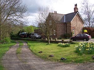
41:The former station at North Grimston in April 2007
458:Railway stations in Great Britain closed in 1950
453:Railway stations in Great Britain opened in 1853
468:Yorkshire and the Humber railway station stubs
422:
8:
448:Disused railway stations in North Yorkshire
429:
415:
35:
20:
316:
393:This article on a railway station in
301:. Subterranea Britannica. 2 July 2010
7:
383:
381:
401:. You can help Knowledge (XXG) by
14:
385:
169:London and North Eastern Railway
346:Malton & Driffield Railway
295:"Station Name: North Grimston"
222:Malton & Driffield Railway
218:North Grimston railway station
1:
220:was a railway station on the
149:Malton and Driffield Railway
484:
380:
352:
344:
336:
211:
207:
203:
34:
395:Yorkshire and the Humber
263:: Patrick Stephens Ltd.
89:54.097908°N 0.717774°W
191:Closed for passengers
159:North Eastern Railway
94:54.097908; -0.717774
85: /
47:General information
332:Following station
320:Preceding station
410:
409:
359:
358:
326:Disused railways
270:978-1-85260-508-7
215:
214:
127:Other information
475:
431:
424:
417:
389:
382:
317:
310:
308:
306:
299:Disused Stations
290:
259:(1st ed.).
253:(October 1995).
199:Closed for goods
145:Original company
114:
100:
99:
97:
96:
95:
90:
86:
83:
82:
81:
78:
39:
21:
483:
482:
478:
477:
476:
474:
473:
472:
438:
437:
436:
435:
378:
364:
314:
304:
302:
293:
271:
249:
246:
230:North Yorkshire
196:20 October 1958
110:
93:
91:
87:
84:
79:
76:
74:
72:
71:
62:
60:North Yorkshire
42:
30:
29:
28:
17:
12:
11:
5:
481:
479:
471:
470:
465:
460:
455:
450:
440:
439:
434:
433:
426:
419:
411:
408:
407:
390:
376:
375:
370:
363:
362:External links
360:
357:
356:
351:
348:
343:
340:
334:
333:
330:
327:
324:
321:
312:
311:
291:
269:
251:Butt, R. V. J.
245:
242:
238:level crossing
226:North Grimston
213:
212:
209:
208:
205:
204:
201:
200:
197:
193:
192:
189:
185:
184:
181:
177:
176:
172:
171:
166:
162:
161:
156:
152:
151:
146:
142:
141:
137:
136:
133:
129:
128:
124:
123:
120:
116:
115:
108:
106:Grid reference
102:
101:
69:
65:
64:
56:North Grimston
53:
49:
48:
44:
43:
40:
32:
31:
27:North Grimston
26:
25:
24:
15:
13:
10:
9:
6:
4:
3:
2:
480:
469:
466:
464:
461:
459:
456:
454:
451:
449:
446:
445:
443:
432:
427:
425:
420:
418:
413:
412:
406:
404:
400:
396:
391:
388:
384:
379:
374:
371:
369:
366:
365:
361:
355:
349:
347:
341:
339:
335:
331:
328:
325:
322:
319:
318:
315:
300:
296:
292:
288:
284:
280:
276:
272:
266:
262:
258:
257:
252:
248:
247:
243:
241:
239:
235:
231:
227:
223:
219:
210:
206:
202:
198:
194:
190:
186:
182:
178:
173:
170:
167:
165:Post-grouping
163:
160:
157:
153:
150:
147:
143:
138:
134:
130:
125:
121:
117:
113:
109:
107:
103:
98:
70:
66:
61:
57:
54:
50:
45:
38:
33:
22:
19:
403:expanding it
392:
377:
313:
303:. Retrieved
298:
255:
217:
216:
155:Pre-grouping
18:
338:Settrington
305:10 December
188:5 June 1950
180:19 May 1853
92: /
68:Coordinates
442:Categories
244:References
77:54°05′52″N
287:11956311M
261:Sparkford
175:Key dates
119:Platforms
80:0°43′04″W
279:60251199
112:SE839676
52:Location
354:Wharram
350:
342:
329:
323:
234:England
140:History
135:Disused
63:England
285:
277:
267:
183:Opened
132:Status
397:is a
399:stub
307:2011
275:OCLC
265:ISBN
444::
297:.
283:OL
281:.
273:.
240:.
232:,
228:,
58:,
430:e
423:t
416:v
405:.
309:.
289:.
122:1
Text is available under the Creative Commons Attribution-ShareAlike License. Additional terms may apply.