226:
large plain of gums, mulga, and spinifex, with watercourses running through it. The large gum creek that we crossed winds round this hill in a north-east direction; at about ten miles it is joined by another. After joining they take a course more north, and I lost sight of them in the far-distant plain. To the north-north-east is the termination of the hills; to the north-east, east and south-east are broken ranges, and to the north-north-west the ranges on the west side of the plain terminate. To the north-west are broken ranges; and to the west is a very high peak, between which and this place to the south-west are a number of isolated hills. Built a large cone of stones, in the centre of which I placed a pole with the
British flag nailed to it. Near the top of the cone I placed a small bottle, in which there is a slip of paper, with our signatures to it, stating by whom it was raised. We then gave three hearty cheers for the flag, the emblem of civil and religious liberty, and may it be a sign to the natives that the dawn of liberty, civilization, and Christianity is about to break upon them. We can see no water from the top. Descended, but did not reach the camp till after dark.
127:
134:
299:
231:
225:
Took
Kekwick and the flag, and went to the top of the mount, but found it to be much higher and more difficult of ascent than I anticipated. After a deal of labour, slips, and knocks, we at last arrived on the top. It is quite as high as Mount Serle, if not higher. The view to the north is over a
31:
217:. Stuart reached the area on 22 April 1860 and determined a point approximately 4 km (2.5 mi) south-southwest of the peak to be the centre of Australia, (This assessment is not supported by modern geographers—see
126:
496:
511:
314:
66:
388:
243:
159:
59:
262:
218:
470:
270:
278:
266:
52:
339:
274:
273:, built between 1878 and 1929. After the telegraph line had been completed and the first messages sent,
194:
that comprise the peak, referred to by geologists as
Central Mount Stuart Formation, form part of the
345:
214:
108:
190:, which at closest approach lies about 6 kilometres (3.7 mi) to the southeast. The dark red
179:
304:
362:
427:
440:
238:
Stuart originally named the peak
Central Mount Sturt, after his former expedition leader
195:
187:
230:
505:
239:
30:
334:
294:
203:
81:
68:
465:
191:
183:
163:
103:
474:. Vol. LVI, no. 17, 368. South Australia. 16 June 1914. p. 9
282:
258:
247:
210:
175:
415:
46:
229:
221:.) He climbed to the top the next day, writing in his journal:
254:
is the name that appeared in the published expedition journal.
234:
View looking north from the summit of
Central Mount Stuart
363:"Place Names Register Extract for "Central Mount Stuart""
186:. It is a prominent landmark easily seen from the nearby
242:. The name was changed (possibly at the instigation of
416:
Journals of John McDouall Stuart at
Project Gutenberg
155:
114:
102:
97:
58:
45:
40:
23:
16:Mountain peak in the Northern Territory, Australia
202:. It lies within the traditional lands of the
8:
497:Image of Central Mount Stuart on Google Maps
133:
411:
409:
315:List of mountains of the Northern Territory
482:– via National Library of Australia.
20:
389:"Central Mount Stuart Historical Reserve"
250:at the end of the expedition, such that
428:Northern Territory Place Names Register
357:
355:
326:
200:Central Mount Stuart Historical Reserve
7:
512:Mountains of the Northern Territory
257:Stuart's route was followed by the
209:The mountain is named in honour of
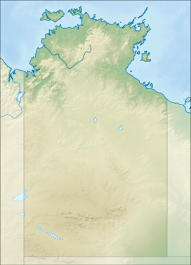
146:Location in the Northern Territory
14:
297:
246:) soon after Stuart's return at
132:
125:
29:
369:. Northern Territory Government
35:Central Mount Stuart after rain
178:peak situated in the southern
1:
269:, completed in 1872, and the
160:Anmatjere, Northern Territory
466:"Death of Mr. R. R. Knuckey"
285:from Central Mount Stuart.
528:
430:. Retrieved 1 October 2007
418:. Retrieved 4 January 2007
219:centre points of Australia
51:846 m (2,776 ft)
271:Central Australia Railway
119:
28:
491:Other external resources
348:, Australian Government.
82:21.906109°S 133.451482°E
367:NT Place Names Register
279:Richard Randall Knuckey
267:Overland Telegraph Line
441:"John McDouall Stuart"
340:Gazetteer of Australia
335:"Central Mount Stuart"
235:
228:
87:-21.906109; 133.451482
233:
223:
346:Geoscience Australia
252:Central Mount Stuart
215:John McDouall Stuart
172:Central Mount Stuart
140:Central Mount Stuart
109:John McDouall Stuart
24:Central Mount Stuart
198:. Around it is the
78: /
265:cross-continental
236:
180:Northern Territory
41:Highest point
169:
168:
519:
484:
483:
481:
479:
462:
456:
455:
453:
451:
437:
431:
425:
419:
413:
404:
403:
401:
399:
385:
379:
378:
376:
374:
359:
350:
349:
331:
307:
305:Mountains portal
302:
301:
300:
275:Sir Charles Todd
136:
135:
129:
93:
92:
90:
89:
88:
83:
79:
76:
75:
74:
71:
33:
21:
527:
526:
522:
521:
520:
518:
517:
516:
502:
501:
493:
488:
487:
477:
475:
464:
463:
459:
449:
447:
439:
438:
434:
426:
422:
414:
407:
397:
395:
387:
386:
382:
372:
370:
361:
360:
353:
333:
332:
328:
323:
311:
310:
303:
298:
296:
291:
151:
150:
149:
148:
147:
144:
143:
142:
141:
137:
86:
84:
80:
77:
72:
69:
67:
65:
64:
36:
17:
12:
11:
5:
525:
523:
515:
514:
504:
503:
500:
499:
492:
489:
486:
485:
471:The Advertiser
457:
432:
420:
405:
380:
351:
325:
324:
322:
319:
318:
317:
309:
308:
293:
292:
290:
287:
244:James Chambers
196:Georgina Basin
188:Stuart Highway
167:
166:
157:
153:
152:
145:
139:
138:
131:
130:
124:
123:
122:
121:
120:
117:
116:
112:
111:
106:
100:
99:
95:
94:
62:
56:
55:
49:
43:
42:
38:
37:
34:
26:
25:
15:
13:
10:
9:
6:
4:
3:
2:
524:
513:
510:
509:
507:
498:
495:
494:
490:
473:
472:
467:
461:
458:
446:
442:
436:
433:
429:
424:
421:
417:
412:
410:
406:
394:
390:
384:
381:
368:
364:
358:
356:
352:
347:
343:
341:
336:
330:
327:
320:
316:
313:
312:
306:
295:
288:
286:
284:
280:
277:and surveyor
276:
272:
268:
264:
260:
255:
253:
249:
245:
241:
240:Charles Sturt
232:
227:
222:
220:
216:
212:
207:
205:
201:
197:
193:
189:
185:
181:
177:
173:
165:
161:
158:
154:
128:
118:
113:
110:
107:
105:
101:
96:
91:
63:
61:
57:
54:
50:
48:
44:
39:
32:
27:
22:
19:
476:. Retrieved
469:
460:
448:. Retrieved
444:
435:
423:
396:. Retrieved
392:
383:
371:. Retrieved
366:
338:
329:
281:returned to
256:
251:
237:
224:
208:
199:
171:
170:
18:
85: /
73:133°27′05″E
60:Coordinates
321:References
204:Anmatyerre
70:21°54′22″S
445:Adelaidia
373:17 August
213:explorer
192:sandstone
184:Australia
164:Australia
115:Geography
104:Etymology
47:Elevation
506:Category
289:See also
283:Adelaide
259:Adelaide
248:Adelaide
211:Scottish
206:people.
176:mountain
156:Location
478:19 July
450:20 July
398:20 July
342:online
263:Darwin
98:Naming
174:is a
480:2019
452:2019
400:2019
375:2019
261:-to-
182:of
53:AHD
508::
468:.
443:.
408:^
393:NT
391:.
365:.
354:^
344:.
337:.
162:,
454:.
402:.
377:.
Text is available under the Creative Commons Attribution-ShareAlike License. Additional terms may apply.