29:
429:
417:
375:
387:
134:
399:
127:
292:. The Dreitorspitze marks the spot where the main chain of the Wetterstein mountains changes direction from its primary east–west orientation to run northwards for a short distance, before turning back again onto its main axis. East of the Dreitorspitze lies the karst plateau of the
374:
428:
416:
386:
481:
491:
285:
83:
28:
501:
496:
315:
runs up to the western summit of the
Partenkirchen Dreitorspitze, secured with cables, which is named after the famous explorer of the
398:
323:. All the other peaks are reserved for climbers. Climbing the peaks is usually part of a two-day tour with an overnight stop at the
471:
476:
126:
76:
316:
380:
View from the western peak of the
Dreitorspitze of the middle and northeastern summits and the Musterstein
355:
64:
54:
261:
178:
486:
359:
351:
190:
405:
320:
221:
214:
328:
257:
284:) at 2,682 metres (8,799 ft); each of which has several peaks. The main peak of the
171:
465:
336:
298:
288:
mountain massif in
Germany is the Leutasch Dreitorspitze, which is also known as the
163:
311:
243:
229:
205:
33:
The
Partenkirchen Dreitorspitze and Herrmann von Barth Way viewed from the south
344:
309:
The easiest route to the main peaks may be climbed at grades 1 and 2. An easy
69:
98:
85:
303:
210:
West peak of the
Partenkirchen Dreitorspitze: K. Kiendl, J. Grasegger (1854)
340:
265:
159:
44:
392:
The
Leutasch Dreitorspitze from the Partenkirchen Dreitorspitze
327:
hut. A one-day tour requires climbers to be in very good
434:
455:(1:500,000). Bayerisches Geologisches Landesamt, 1998.
228:
204:
199:
189:
184:
170:
155:
114:
75:
63:
53:
43:
38:
21:
422:Leutasch Dreitorspitze. Sketch by H. v. Barth 1873
453:Geologische Karte von Bayern mit Erläuterungen
8:
256:is a large and very prominent, multi-peak
18:
445:
412:
370:
276:) at 2,633 metres (8,638 ft) and
133:
7:
482:Mountains of Tyrol (federal state)
14:
492:Garmisch-Partenkirchen (district)
427:
415:
397:
385:
373:
132:
125:
27:
1:
274:Partenkirchener Dreitorspitze
49:2,682 m (8,799 ft)
270:Partenkirchen Dreitorspitze
260:in the eastern part of the
518:
502:Two-thousanders of Austria
497:Two-thousanders of Germany
59:346 m (1,135 ft)
16:Mountain massif in Germany
213:Crossing to middle peak:
119:
26:
282:Leutascher Dreitorspitze
220:Leutasch Dreitorspitze:
317:Northern Limestone Alps
356:Garmisch-Partenkirchen
278:Leutasch Dreitorspitze
195:Wetterstein Limestone.
472:Mountains of the Alps
268:. It is divided into
262:Wetterstein Mountains
179:Wetterstein Mountains
99:47.40000°N 11.12389°E
477:Mountains of Bavaria
335:Valley settlements:
296:, comparable to the
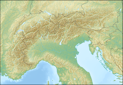
146:Location in the Alps
302:at the foot of the
95: /
360:German Alpine Club
104:47.40000; 11.12389
39:Highest point
406:Hermann von Barth
321:Hermann von Barth
250:
249:
222:Hermann von Barth
215:Hermann von Barth
509:
456:
450:
431:
419:
401:
389:
377:
232:
174:
136:
135:
129:
110:
109:
107:
106:
105:
100:
96:
93:
92:
91:
88:
31:
19:
517:
516:
512:
511:
510:
508:
507:
506:
462:
461:
460:
459:
451:
447:
442:
435:
432:
423:
420:
409:
402:
393:
390:
381:
378:
369:
358:Section of the
258:mountain massif
241:
236:Mountain walk (
230:
218:
211:
172:
151:
150:
149:
148:
147:
144:
143:
142:
141:
137:
103:
101:
97:
94:
89:
86:
84:
82:
81:
34:
17:
12:
11:
5:
515:
513:
505:
504:
499:
494:
489:
484:
479:
474:
464:
463:
458:
457:
444:
443:
441:
438:
437:
436:
433:
426:
424:
421:
414:
411:
410:
403:
396:
394:
391:
384:
382:
379:
372:
368:
365:
364:
363:
348:
294:Leutasch Platt
286:fourth highest
248:
247:
234:
226:
225:
208:
202:
201:
197:
196:
193:
187:
186:
182:
181:
176:
168:
167:
157:
153:
152:
145:
139:
138:
131:
130:
124:
123:
122:
121:
120:
117:
116:
112:
111:
79:
73:
72:
67:
61:
60:
57:
51:
50:
47:
41:
40:
36:
35:
32:
24:
23:
15:
13:
10:
9:
6:
4:
3:
2:
514:
503:
500:
498:
495:
493:
490:
488:
485:
483:
480:
478:
475:
473:
470:
469:
467:
454:
449:
446:
439:
430:
425:
418:
413:
407:
404:Start of the
400:
395:
388:
383:
376:
371:
366:
361:
357:
353:
349:
346:
342:
338:
337:Partenkirchen
334:
333:
332:
330:
326:
322:
318:
314:
313:
307:
305:
301:
300:
299:Zugspitzplatt
295:
291:
287:
283:
279:
275:
271:
267:
263:
259:
255:
254:Dreitorspitze
246:
245:
239:
235:
233:
231:Easiest route
227:
223:
219:
216:
209:
207:
203:
198:
194:
192:
188:
183:
180:
177:
175:
169:
165:
161:
158:
154:
140:Dreitorspitze
128:
118:
113:
108:
80:
78:
74:
71:
68:
66:
62:
58:
56:
52:
48:
46:
42:
37:
30:
25:
22:Dreitorspitze
20:
452:
448:
324:
312:Klettersteig
310:
308:
297:
293:
289:
281:
277:
273:
269:
264:in southern
253:
251:
244:Klettersteig
242:
237:
212:
206:First ascent
191:Type of rock
173:Parent range
487:Wetterstein
352:Meilerhütte
343:(Austria),
339:(Germany),
325:Meilerhütte
102: /
77:Coordinates
65:Parent peak
466:Categories
440:References
345:Mittenwald
290:Karlspitze
70:Hochwanner
55:Prominence
347:(Germany)
329:condition
304:Zugspitze
272:(German:
115:Geography
90:11°7′26″E
87:47°24′0″N
45:Elevation
341:Leutasch
280:(German:
238:Bergtour
200:Climbing
164:Tyrolian
160:Bavarian
156:Location
367:Gallery
350:Bases:
266:Germany
185:Geology
224:(1871)
217:(1870)
166:border
252:The
408:Way
468::
331:.
319:,
306:.
240:),
162:/
362:)
354:(
Text is available under the Creative Commons Attribution-ShareAlike License. Additional terms may apply.