205:
198:
191:
134:
168:. Downstream from there the canyon passes through a deep pool of water in a narrow slot canyon, merges with the main branch of Fortymile Gulch and two tributaries draining from the north, and then proceeds down to the Escalante River. Much of this lower section may now be under the surface of
143:
Willow Gulch (sometimes mapped as Sooner Gulch) is the southern section of
Fortymile Gulch, and it is here that the most scenic features can be found. At the head of one branch of the canyon are another group of sandstone domes, the
49:
98:
up to 500 feet (150 m) into sandstone layers before meeting the main channel of the
Escalante River. The northernmost branch is Fortymile Gulch, the historic location of the winter encampment of the
84:
83:, including high vertical canyon walls, water pools, narrow slot canyons, domes, and arches. Popular recreational destinations, they are located within the
90:
The headwaters of
Fortymile and Willow Gulches have their origins along a 7-mile (11 km) segment of the Straight Cliffs, the eastern edge of the
333:
48:
274:
157:
353:
303:
253:
18:
160:
artifact found nearby. The opening is estimated at 94 feet (29 m) wide and 100 feet (30 m) high, demonstrating the
79:. With a combined length of over 20 miles (30 km), they exhibit many of the geologic features found in the
80:
328:
358:
111:
230:
149:
122:. The lower section of Fortymile Gulch, before it merges with Willow Gulch, is a narrow channel of
99:
91:
299:
270:
249:
119:
68:
289:
Informational brochure and map distributed by the Grand
Staircase–Escalante National Monument
165:
173:
64:
314:
107:
347:
76:
94:. Intermittent streams merge to form larger branches, then combine to carve a deep
161:
338:
169:
127:
123:
148:. The bottom of Willow Gulch can be accessed via a trailhead just off of the
33:
20:
204:
197:
133:
190:
106:
in late 1879 while a smaller group prepared a perilous route down to the
95:
102:. Intent on founding a colony in southeastern Utah, they waited at
132:
72:
47:
248:"Canyons of the Escalante", Trails Illustrated Map (1994),
152:. Approximately one mile downstream is the spectacular
172:, depending on the level of the reservoir behind the
298:"Hiking the Escalante", by Rudi Lambrechtse (1985),
52:
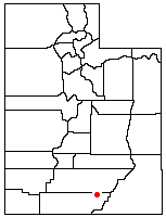
Location of
Fortymile and Willow Gulches within Utah
8:
329:Grand Staircase-Escalante National Monument
267:Canyon Hiking Guide to the Colorado Plateau
85:Grand Staircase–Escalante National Monument
241:
7:
14:
138:Broken Bow Arch, in Willow Gulch.
265:Michael R. Kelsey (1995-01-01).
203:
196:
189:
183:Other Pictures from Willow Gulch
1:
269:. Kelsey Publishing (Utah).
118:, a scenic dome formed from
354:Rivers of Kane County, Utah
237:Sources and further reading
202:
195:
188:
375:
181:
81:Canyons of the Escalante
63:are tributaries of the
231:List of rivers of Utah
140:
53:
150:Hole-in-the-Rock Road
136:
51:
164:-forming ability of
100:San Juan Expedition
92:Kaiparowits Plateau
30: /
141:
54:
34:37.333°N 110.991°W
315:NaturalArches.org
276:978-0-944510-11-7
222:
221:
120:Entrada sandstone
104:Fortymile Springs
75:, in the western
366:
317:
312:
306:
296:
290:
287:
281:
280:
262:
256:
246:
207:
200:
193:
179:
178:
166:Navajo sandstone
156:, named after a
112:Hole-in-the-Rock
45:
44:
42:
41:
40:
39:37.333; -110.991
35:
31:
28:
27:
26:
23:
374:
373:
369:
368:
367:
365:
364:
363:
344:
343:
325:
320:
313:
309:
297:
293:
288:
284:
277:
264:
263:
259:
247:
243:
239:
227:
174:Glen Canyon Dam
158:Native American
154:Broken Bow Arch
139:
116:Dance Hall Rock
65:Escalante River
57:Fortymile Gulch
38:
36:
32:
29:
24:
21:
19:
17:
16:
12:
11:
5:
372:
370:
362:
361:
359:Rivers of Utah
356:
346:
345:
342:
341:
339:UtahTrails.com
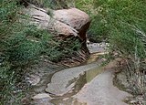
336:
331:
324:
323:External links
321:
319:
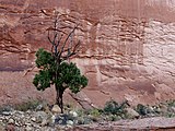
318:
307:
291:
282:
275:
257:
240:
238:
235:
234:
233:
226:
223:
220:
219:
216:
213:
209:
208:
201:
194:
186:
185:
137:
108:Colorado River
13:
10:
9:
6:
4:
3:
2:
371:
360:
357:
355:
352:
351:
349:
340:
337:
335:
334:TopoQuest Map
332:
330:
327:
326:
322:
316:
311:
308:
305:
304:0-915272-27-X
301:
295:
292:
286:
283:
278:
272:
268:
261:
258:
255:
254:0-925873-98-5
251:
245:
242:
236:
232:
229:
228:
224:
218:Canyon Walls
217:
215:Sooner Rocks
214:
211:
210:
206:
199:
192:
187:
184:
180:
177:
175:
171:
167:
163:
159:
155:
151:
147:
135:
131:
129:
125:
121:
117:
114:. Nearby is
113:
109:
105:
101:
97:
93:
88:
86:
82:
78:
77:United States
74:
70:
67:, located in
66:
62:
58:
50:
46:
43:
310:
294:
285:
266:
260:
244:
182:
153:
146:Sooner Rocks
145:
142:
124:slot canyons
115:
103:
89:
71:in southern
61:Willow Gulch
60:
56:
55:
15:
170:Lake Powell
128:water pools
69:Kane County
37: /
25:110°59′28″W
348:Categories
212:Streambed
22:37°19′59″N
225:See also
302:
273:
252:
96:canyon
300:ISBN
271:ISBN
250:ISBN
162:arch
126:and
73:Utah
59:and
110:at
350::
176:.
130:.
87:.
279:.
Text is available under the Creative Commons Attribution-ShareAlike License. Additional terms may apply.