47:
54:
34:
239:
in April 1976 at an Afar congress. Afterwards a number of ANLM members were appointed to local administrative positions, which weakened both the ALF's military activity and political influence amongst the Afar. The weekly newspaper
227:, who travelled through the area in 1928, described his stay of a couple of days in a village in Gewane, entertained by the local chief Abdul Momi, whom he described as "the Falstaff of Gewani". The
256:
in 2005, this town has an estimated total population of 11,032, of whom 6,304 are men and 4,728 are women. According to the 1996 national census this town had a population of 8,600.
371:
253:
340:
244:
reported in
January 1996 that three high ranking employees of the Water Resource and Development Authority had been killed near the town.
216:, an isolated peak of volcanic origin which rises almost 1,000m above the surrounding plains east of the town." The headquarters of the
159:
78:
46:
212:
Philip Briggs has described Gewane as "a somewhat unremarkable urban sprawl, distinguished only by the imposing presence of
325:
182:
139:
228:
217:
356:
The results of the 1994 census in the Afar Region were not satisfactory, so the census was repeated in 1996.
110:
232:
197:; the town was relocated astride the main, all-weather highway. It is the administrative center of
122:
224:
337:
164:
134:
173:
344:
198:
274:, UNDP Emergencies Unit for Ethiopia report, dated June 1996 (accessed 11 January 2009)
365:
271:
311:"Ethiopia, Revolution, and the Question of Nationalities: The Case of the Afar",
213:
189:, it has an elevation of 618 meters above sea level. Gewane is locally known as
186:
127:
93:
80:
178:
115:
272:
Awash river floods (Afar
Regional State): Helicopter Survey, 5 June 1996
310:
201:
33:
236:
328:
The Nordic Africa
Institute website (accessed 27 December 2007)
298:
Hell-Hole of
Creation: The Exploration of Abyssinian Danakil
231:(ANLM), run by young intellectuals who had split from the
193:, 2 kilometers east of the original settlement known as
287:, 3rd edition (Chalfont St Peters: Bradt, 2002), p. 342
158:
150:
145:
133:
121:
109:
21:
300:(New York: Alfred A. Knopf, 1935), pp. 141 - 149
8:
18:
264:
157:
144:
108:
73:
39:
30:
149:
132:
120:
7:
372:Populated places in the Afar Region
14:
313:Journal of Modern African Studies
229:Afar National Liberation Movement
285:Ethiopia: The Bradt Travel Guide
52:
45:
32:
235:(ALF), met in Gewane with the
53:
16:Place in Afar Region, Ethiopia
1:
338:CSA 2005 National Statistics
326:"Local History in Ethiopia"
218:Yangudi Rassa National Park
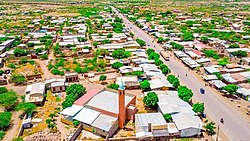
177:is a town in north-eastern
388:
343:November 23, 2006, at the
254:Central Statistical Agency
252:Based on figures from the
74:
40:
31:
220:are located in Gewane.
233:Afar Liberation Front
223:The British explorer
183:Administrative Zone 3
140:Administrative Zone 3
94:10.16639°N 40.64528°E
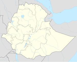
66:Location in Ethiopia
90: /
316:, 23 (1985),p. 346
151: • Total
99:10.16639; 40.64528
170:
169:
379:
357:
354:
348:
335:
329:
323:
317:
307:
301:
294:
288:
281:
275:
269:
105:
104:
102:
101:
100:
95:
91:
88:
87:
86:
83:
56:
55:
49:
36:
19:
387:
386:
382:
381:
380:
378:
377:
376:
362:
361:
360:
355:
351:
345:Wayback Machine
336:
332:
324:
320:
309:Kassim Shehim,
308:
304:
295:
291:
283:Philip Briggs,
282:
278:
270:
266:
262:
250:
210:
98:
96:
92:
89:
84:
81:
79:
77:
76:
70:
69:
68:
67:
64:
63:
62:
61:
57:
27:
24:
17:
12:
11:
5:
385:
383:
375:
374:
364:
363:
359:
358:
349:
330:
318:
302:
289:
276:
263:
261:
258:
249:
246:
209:
206:
168:
167:
162:
156:
155:
152:
148:
147:
143:
142:
137:
131:
130:
125:
119:
118:
113:
107:
106:
72:
71:
65:
59:
58:
51:
50:
44:
43:
42:
41:
38:
37:
29:
28:
25:
22:
15:
13:
10:
9:
6:
4:
3:
2:
384:
373:
370:
369:
367:
353:
350:
346:
342:
339:
334:
331:
327:
322:
319:
315:
314:
306:
303:
299:
293:
290:
286:
280:
277:
273:
268:
265:
259:
257:
255:
247:
245:
243:
238:
234:
230:
226:
221:
219:
215:
207:
205:
203:
200:
196:
192:
188:
184:
181:. Located in
180:
176:
175:
166:
163:
161:
153:
141:
138:
136:
129:
126:
124:
117:
114:
112:
103:
75:Coordinates:
48:
35:
20:
352:
333:
321:
312:
305:
297:
292:
284:
279:
267:
251:
248:Demographics
241:
225:L.M. Nesbitt
222:
211:
194:
190:
172:
171:
347:, Table B.4
214:Mount Azelu
187:Afar Region
154:2,000 (est)
128:Afar Region
97: /
260:References
195:Old Gewane
191:New Gewane
146:Population
85:40°38′43″E
296:Nesbitt,
82:10°9′59″N
366:Category
341:Archived
208:Overview
179:Ethiopia
116:Ethiopia
26:Gawwaani
185:of the
160:Climate
111:Country
242:Tobiya
202:woreda
199:Gewane
174:Gewane
123:Region
60:Gewane
23:Gewane
237:Derg
135:Zone
165:BSh
368::
204:.
Text is available under the Creative Commons Attribution-ShareAlike License. Additional terms may apply.