116:
123:
377:
28:
220:
Hanglip is situated in the 354 hectare
Hanglip Forest Reserve within the Hanglip State Forest. The state forest contains commercial pine plantations, protected natural forest and
272:
362:
252:. The ruins of the fort are currently off limits, being situated near graves of the Singos and the sacred site of vhaDzanani on the other side. The town of
418:
442:
115:
263:
Hikers can arrange to overnight in the
Hanglip trail hut east of the peak, and motorists can visit a picnic site against its southern slope.
72:
437:
312:
58:
452:
305:
Colonial Survey and Native
Landscapes in Rural South Africa, 1850 - 1913: The Politics of Divided Space in the Cape and Transvaal
411:
447:
342:
194:
65:
327:
208:. The peak with radar station, at 1,719 meters a.s.l., forms a conspicuous landmark visible from the town and the
404:
376:
291:
53:
308:
209:
228:
346:
253:
186:
388:
257:
205:
178:
155:
431:
232:
224:. The pine plantations are harvested in 30 to 40 year cycles for construction wood.
202:
190:
162:
339:
87:
74:
239:
221:
384:
198:
148:
248:
was established under
Hanglip some kilometers southwest of Mphephu's
43:
256:
was established after the conflict. The
Hanglip Forest Reserve is a
27:
249:
235:
227:
Geologically, the mountain consists of tilted layers of the
340:
Soutpansberg/Hanglip hiking trail, Department of
Forestry
392:
328:
Hanglip Forest
Reserve, Louis Trichardt, Soutpansberg
154:
144:
103:
64:
52:
42:
37:
20:
273:List of castles and fortifications in South Africa
412:
8:
419:
405:
238:deposits. Red quartzite deposits and grey
17:
307:(revised ed.). BRILL. p. 254.
284:
349:, places.co.za. Accessed 31 July 2023.
330:, showme.co.za. Accessed 31 July 2023.
7:
373:
371:
185:) is a prominent mountain peak near
183:Songozwi- thavha khulu ya VhaDzanani
242:lava intrusions are also present.
14:
59:List of mountains in South Africa
375:
292:Explore the Hanglip Hiking Trail
121:
114:
26:
122:
443:Climbing areas of South Africa
1:
363:The Soutspanberg Hiking Trail
260:in the zone of the mountain.
391:. You can help Knowledge by
48:1,719 m (5,640 ft)
469:
370:
303:Braun, Lindsay F. (2014).
32:Hanglip from the southeast
438:Mountains of South Africa
108:
25:
193:. It is situated in the
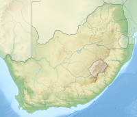
135:Location in South Africa
453:Limpopo geography stubs
345:21 January 2012 at the
387:location article is a
231:succession including
88:22.99583°S 29.88333°E
448:Landforms of Limpopo
93:-22.99583; 29.88333
84: /
38:Highest point
400:
399:
168:
167:
460:
421:
414:
407:
379:
372:
350:
337:
331:
325:
319:
318:
300:
294:
289:
158:
125:
124:
118:
99:
98:
96:
95:
94:
89:
85:
82:
81:
80:
77:
30:
18:
468:
467:
463:
462:
461:
459:
458:
457:
428:
427:
426:
425:
368:
359:
354:
353:
347:Wayback Machine
338:
334:
326:
322:
315:
302:
301:
297:
290:
286:
281:
269:
218:
212:national road.
201:in the central
195:Vhembe District
187:Louis Trichardt
173:(Afrikaans for
156:
140:
139:
138:
137:
136:
133:
132:
131:
130:
126:
92:
90:
86:
83:
78:
75:
73:
71:
70:
33:
12:
11:
5:
466:
464:
456:
455:
450:
445:
440:
430:
429:
424:
423:
416:
409:
401:
398:
397:
380:
366:
365:
358:
357:External links
355:
352:
351:
332:
320:
313:
295:
283:
282:
280:
277:
276:
275:
268:
265:
258:protected area
254:Trichardtsdorp
217:
214:
166:
165:
160:
152:
151:
146:
142:
141:
134:
128:
127:
120:
119:
113:
112:
111:
110:
109:
106:
105:
101:
100:
68:
62:
61:
56:
50:
49:
46:
40:
39:
35:
34:
31:
23:
22:
13:
10:
9:
6:
4:
3:
2:
465:
454:
451:
449:
446:
444:
441:
439:
436:
435:
433:
422:
417:
415:
410:
408:
403:
402:
396:
394:
390:
386:
381:
378:
374:
369:
364:
361:
360:
356:
348:
344:
341:
336:
333:
329:
324:
321:
316:
314:9789004282292
310:
306:
299:
296:
293:
288:
285:
278:
274:
271:
270:
266:
264:
261:
259:
255:
251:
247:
243:
241:
237:
234:
230:
225:
223:
215:
213:
211:
207:
204:
200:
196:
192:
188:
184:
180:
176:
172:
164:
161:
159:
153:
150:
147:
143:
117:
107:
102:
97:
69:
67:
63:
60:
57:
55:
51:
47:
45:
41:
36:
29:
24:
19:
16:
393:expanding it
382:
367:
335:
323:
304:
298:
287:
262:
245:
244:
226:
219:
203:Soutpansberg
191:South Africa
182:
174:
170:
169:
163:Soutpansberg
157:Parent range
15:
175:hanging lip
91: /
66:Coordinates
432:Categories
279:References
246:Fort Botha
76:22°59′45″S
104:Geography
79:29°53′0″E
44:Elevation
343:Archived
267:See also
240:andesite
222:bushveld
145:Location
385:Limpopo
233:glacial
216:History
199:Limpopo
171:Hanglip
149:Limpopo
129:Hanglip
54:Listing
21:Hanglip
311:
383:This
250:kraal
229:Karoo
206:range
179:Venda
389:stub
309:ISBN
236:till
197:of
434::
210:N1
189:,
181::
177:,
420:e
413:t
406:v
395:.
317:.
Text is available under the Creative Commons Attribution-ShareAlike License. Additional terms may apply.