174:
35:
758:
498:
42:
225:
The Loch of Houll is home to the
Whalsay Model Yacht Club, which has a boathouse on the shore. Members of the club sail yachts with a waterline length of 60 cm in twos throughout the winter, and stage an event on Christmas Day, known as the "Yule Dee model yacht race". Locals join in with the
212:
averaging 8-10 oz and some over 2 lbs." On the western side of the loch is Peerie Roonie House, a ruined stone house, which still has traces of the inner face of a drystone wall and drain. Archaeologists excavating at the site discovered stone tools dated to the
799:
34:
338:
304:
243:
515:
823:
379:
81:
792:
268:
785:
818:
701:
696:
173:
226:
festivities during which sailing is followed by
Christmas dinner, and a bonfire and fireworks are lit later.
732:
595:
520:
497:
372:
640:
585:
201:
442:
630:
625:
570:
560:
540:
427:
123:
757:
717:
645:
620:
452:
437:
334:
300:
294:
769:
328:
727:
615:
610:
565:
535:
402:
365:
197:
67:
722:
462:
247:
208:
passes into the western side of the loch. It is described as a "large shallow loch with
737:
665:
605:
205:
135:
812:
655:
545:
457:
145:
113:
635:
686:
681:
209:
660:
575:
530:
487:
407:
96:
83:
467:
432:
214:
765:
477:
472:
447:
417:
193:
141:
388:
189:
124:
63:
296:
Neolithic
Britain: New Stone Age Sites of England, Scotland, and Wales
482:
422:
330:
Whalsay: Symbol, Segment and
Boundary in a Shetland Island Community
555:
412:
172:
550:
185:
361:
357:
773:
196:
islands of
Scotland. It is located to the southeast of
710:
674:
505:
395:
163:
155:
151:
134:
122:
112:
73:
59:
23:
74:
288:
286:
793:
373:
8:
333:. Manchester University Press. p. 75.
800:
786:
380:
366:
358:
20:
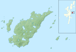
18:Natural loch in Whalsay, Shetland Islands
235:
327:Cohen, Anthony P. (1 December 1989).
41:
7:
754:
752:
244:"Scarfmoor Burn, HU 554 644 GB Grid"
516:List of coastal features of Whalsay
772:. You can help Knowledge (XXG) by
14:
756:
496:
40:
33:
162:
154:
204:. An eastern tributary of the
1:
58:
513:Bays, cliffs, and headlands:
200:and on the eastern side of
840:
751:
299:. Routledge. p. 335.
293:Castleden, Rodney (1992).
167:1,115 ft (340 m)
159:2,250 ft (690 m)
494:
28:
824:Shetland geography stubs
702:Standing Stones of Yoxie
697:Pettigarths Field Cairns
221:Whalsay Model Yacht Club
271:. Welcometoscotland.com
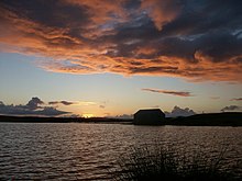
177:Loch of Houll at sunset
130:several burns (streams)
768:location article is a
178:
97:60.359242°N 0.993337°W
733:Whalsay Parish Church
217:period and peat ash.
176:
675:Archaeological sites
102:60.359242; -0.993337
692:Peerie Roonie House
93: /
631:Loch of Vats-houll
626:Loch of Stanefield
571:Skate of Marrister
561:Outer Holm of Skaw
541:Inner Holm of Skaw
179:
781:
780:
746:
745:
718:Pier House Museum
646:West Loch of Skaw
641:East Loch of Skaw
611:Loch of Isbister
536:Holm of Sandwick
340:978-0-7190-2340-8
306:978-0-415-05845-2
171:
170:
831:
819:Lochs of Whalsay
802:
795:
788:
760:
753:
728:Whalsay Airstrip
621:Loch of Sandwick
616:Loch of Livister
500:
382:
375:
368:
359:
352:
351:
349:
347:
324:
318:
317:
315:
313:
290:
281:
280:
278:
276:
265:
259:
258:
256:
254:
240:
126:
108:
107:
105:
104:
103:
98:
94:
91:
90:
89:
86:
76:
68:Shetland Islands
44:
43:
37:
21:
839:
838:
834:
833:
832:
830:
829:
828:
809:
808:
807:
806:
749:
747:
742:
723:Symbister House
706:
670:
501:
492:
391:
386:
356:
355:
345:
343:
341:
326:
325:
321:
311:
309:
307:
292:
291:
284:
274:
272:
269:"Loch of Houll"
267:
266:
262:
252:
250:
248:Ordnance Survey
242:
241:
237:
232:
223:
138: countries
125:Primary inflows
101:
99:
95:
92:
87:
84:
82:
80:
79:
55:
54:
53:
52:
51:
50:
49:
45:
19:
12:
11:
5:
837:
835:
827:
826:
821:
811:
810:
805:
804:
797:
790:
782:
779:
778:
761:
744:
743:
741:
740:
738:Whalsay School
735:
730:
725:
720:
714:
712:
708:
707:
705:
704:
699:
694:
689:
684:
678:
676:
672:
671:
669:
668:
666:Scarfmoor Burn
663:
658:
649:
648:
643:
638:
633:
628:
623:
618:
613:
608:
606:Loch of Huxter
603:
598:
589:
588:
579:
578:
573:
568:
563:
558:
553:
548:
543:
538:
533:
524:
523:
518:
509:
507:
503:
502:
495:
493:
491:
490:
485:
480:
475:
470:
465:
460:
455:
450:
445:
440:
435:
430:
425:
420:
415:
410:
405:
399:
397:
393:
392:
387:
385:
384:
377:
370:
362:
354:
353:
339:
319:
305:
282:
260:
234:
233:
231:
228:
222:
219:
206:Scarfmoor Burn
169:
168:
165:
161:
160:
157:
153:
152:
149:
148:
139:
132:
131:
128:
120:
119:
116:
110:
109:
77:
71:
70:
61:
57:
56:
47:
46:
39:
38:
32:
31:
30:
29:
26:
25:
17:
13:
10:
9:
6:
4:
3:
2:
836:
825:
822:
820:
817:
816:
814:
803:
798:
796:
791:
789:
784:
783:
777:
775:
771:
767:
762:
759:
755:
750:
739:
736:
734:
731:
729:
726:
724:
721:
719:
716:
715:
713:
709:
703:
700:
698:
695:
693:
690:
688:
685:
683:
680:
679:
677:
673:
667:
664:
662:
659:
657:
656:Breiwick Burn
654:
651:
650:
647:
644:
642:
639:
637:
634:
632:
629:
627:
624:
622:
619:
617:
614:
612:
609:
607:
604:
602:
601:Loch of Houll
599:
597:
594:
591:
590:
587:
584:
581:
580:
577:
574:
572:
569:
567:
564:
562:
559:
557:
554:
552:
549:
547:
546:Isbister Holm
544:
542:
539:
537:
534:
532:
529:
526:
525:
522:
519:
517:
514:
511:
510:
508:
504:
499:
489:
486:
484:
481:
479:
476:
474:
471:
469:
466:
464:
461:
459:
456:
454:
451:
449:
446:
444:
441:
439:
436:
434:
431:
429:
426:
424:
421:
419:
416:
414:
411:
409:
406:
404:
401:
400:
398:
394:
390:
383:
378:
376:
371:
369:
364:
363:
360:
342:
336:
332:
331:
323:
320:
308:
302:
298:
297:
289:
287:
283:
270:
264:
261:
249:
245:
239:
236:
229:
227:
220:
218:
216:
211:
207:
203:
199:
195:
192:, one of the
191:
187:
183:
182:Loch of Houll
175:
166:
158:
150:
147:
146:Great Britain
143:
140:
137:
133:
129:
127:
121:
117:
115:
111:
106:
78:
72:
69:
65:
62:
48:Loch of Houll
36:
27:
24:Loch of Houll
22:
16:
774:expanding it
763:
748:
691:
652:
636:Nuckro Water
600:
596:Little Water
592:
582:
527:
512:
344:. Retrieved
329:
322:
310:. Retrieved
295:
273:. Retrieved
263:
251:. Retrieved
238:
224:
181:
180:
118:natural loch
15:
687:Huxter Fort
682:Benie Hoose
586:Setter Hill
521:Linga Sound
396:Settlements
210:brown trout
202:Setter Hill
156:Max. length
100: /
75:Coordinates
813:Categories
661:Falsa Burn
576:West Linga
531:East Linga
488:Vats-houll
443:North Park
408:Challister
346:1 February
312:1 February
275:1 February
253:1 February
230:References
164:Max. width
85:60°21′33″N
711:Buildings
506:Geography
468:Symbister
433:Marrister
215:Neolithic
88:0°59′36″W
766:Shetland
653:Streams:
478:Tripwell
473:Treawick
453:Sandwick
448:Saltness
438:New Park
428:Isbister
418:Hamister
194:Shetland
142:Scotland
60:Location
528:Islets:
389:Whalsay
190:Whalsay
64:Whalsay
593:Lochs:
583:Hills:
566:Rumble
483:Vaivoe
423:Huxter
403:Brough
337:
303:
198:Brough
764:This
556:Nista
463:Sodom
413:Clate
184:is a
136:Basin
770:stub
551:Mooa
458:Skaw
348:2013
335:ISBN
314:2013
301:ISBN
277:2013
255:2013
186:loch
114:Type
188:on
815::
285:^
246:.
144:,
66:,
801:e
794:t
787:v
776:.
381:e
374:t
367:v
350:.
316:.
279:.
257:.
Text is available under the Creative Commons Attribution-ShareAlike License. Additional terms may apply.