316:
33:
343:
422:, and the adjacent Rangitōpuni Stream providing fresh water and a way to power the mill. The mill operated between 1845 and 1856, after which it was repurposed as the Waitemata Flour Mill, the largest provider of flour in the Auckland Region. John Brigham's flour mill was sold in 1859 to his employee, John Lamb, who helped Riverhead develop into a village around the flour mill.
613:. There were 864 households, comprising 1,422 males and 1,380 females, giving a sex ratio of 1.03 males per female. The median age was 35.2 years (compared with 37.4 years nationally), with 699 people (24.9%) aged under 15 years, 450 (16.1%) aged 15 to 29, 1,437 (51.3%) aged 30 to 64, and 219 (7.8%) aged 65 or older.
657:
Of those at least 15 years old, 603 (28.7%) people had a bachelor's or higher degree, and 225 (10.7%) people had no formal qualifications. The median income was $ 52,600, compared with $ 31,800 nationally. 759 people (36.1%) earned over $ 70,000 compared to 17.2% nationally. The employment status of
273:
mill was established at
Riverhead, and the settlement became an important port for reaching the Kaipara Harbour from the 1850s. Riverhead developed as a community in the 1860s around the mill, which had been converted into the largest flour mill in the wider Auckland area. In 1874, a
433:. The track was narrow and often difficult to navigate due to poor weather conditions, leading to goods and people to be bottlenecked at Riverhead. In 1865, the Government funded road improvements to the track, and the Riverhead Hotel was established in either 1870 or 1871.
2040:
1405:
Murdoch, Graeme (1990). "Nga Tohu o
Waitakere: the Maori Place Names of the Waitakere River Valley and its Environs; their Background History and an Explanation of their Meaning". In Northcote-Bade, James (ed.).
368:. The name commemorates a day of peace-making between Te Kawerau ā Maki and other tribes in the early 19th century, and refers to the act of gifting dog-skin cloaks (tōpuni) that marked this day. There were many
451:
In 1876 the flour mill was relocated to central
Auckland, and by the 1890s the Riverhead mill was repurposed a third time, as a paper mill. In the late 19th and early 20th centuries, Riverhead,
2033:
2413:
376:), including Taurangatira, Maraeroa, Ngongetepara, Te Rarawaru, Onekiritea, Tahingamanu and Pītoitoi. The harbour around Riverhead was a source of seasonal shark and snapper for various
666:
Riverhead School is a coeducational full primary (years 1–8) school with a roll of 474 students as at August 2024. The school was built in 1872, and substantially rebuilt in 1960.
2026:
480:
timber forest. The first tree planting began in 1927, with the majority of the forest planted by 1933. As the forest matured, Riverhead began to be known for timber processing.
448:
connected Kumeū with
Auckland via rail in 1881, the coastal shipping became unnecessary, and with no reason to continue operating, the railway to Riverhead was closed.
2408:
1508:"In the High Court of New Zealand: Auckland Registry CIV-2015-404-002033 Between Ngāti Whātua Ōrākei Trust and Attorney-General and Marutūāhu Rōpū Limited Partnership"
601:
Before the 2023 census, Riverhead had a larger boundary, covering 4.05 km (1.56 sq mi). Using that boundary, Riverhead had a population of 2,802 at the
444:
area. The line operated from 1875 to 1881 as a link from
Auckland to regions north, with Riverhead acting as the transition point from ferry to railway. When the
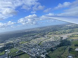
538:
Riverhead covers 2.16 km (0.83 sq mi) and had an estimated population of 3,770 as of June 2023, with a population density of 1,745 people per km.
1432:
1381:
54:
1465:
1864:
1480:
1571:
2418:
1708:
1997:
1978:
1774:
1671:
1415:
658:
those at least 15 was that 1,299 (61.8%) people were employed full-time, 321 (15.3%) were part-time, and 48 (2.3%) were unemployed.
1313:
470:
During the 1920s, the rural area north of
Riverhead was intended to be developed into farmland. Instead the government established
2403:
2253:
1521:
638:
Although some people chose not to answer the census's question about religious affiliation, 61.3% had no religion, 28.4% were
96:
2308:
1507:
32:
2290:
437:
426:
359:
275:
2297:
1739:
639:
2284:
2258:
1881:
493:
429:, which connected Riverhead and the Kumeū River, leading Riverhead to become known as the gateway to accessing the
373:
231:
2112:
2050:
1762:
1503:
508:
206:
86:
2233:
1902:
2347:
651:
647:
625:
610:
606:
602:
388:
384:
324:
320:
254:
250:
1341:
2381:
1704:
1377:
1345:
456:
2313:
2303:
1869:
492:, a large rural county north and west of the city of Auckland. After this, Riverhead became a part of
1373:
629:
523:
452:
419:
400:
355:
336:
266:
223:
142:
2018:
2223:
445:
2334:
2147:
512:
121:
2248:
2163:
377:
246:
2183:
1993:
1974:
1843:
1795:
1770:
1667:
1567:
1476:
1411:
643:
415:
270:
38:
2329:
2243:
2238:
2228:
2132:
1833:
1803:
1472:
1443:
501:
489:
471:
463:
digging trade. In 1914, the paper mill closed. After this time, Riverhead became known as a
304:
165:
1700:
1433:
North Shore heritage – North Shore area studies and scheduled items list: volume 2 parts 6+
2364:
2263:
2208:
2173:
497:
430:
396:
332:
262:
101:
621:
2213:
2193:
2188:
2168:
527:
408:
279:
147:
678:
Climate data for
Riverhead (Riverhead Forest) (1960–1987 normals, extremes 1928–1987)
245:
Traditionally known as Rangitōpuni, the area was an important transportation link for
2397:
2203:
2178:
1966:
1962:
1659:
1559:
476:
404:
299:
222:
is a small, historically predominantly working-class town located at the head of the
278:
along the route of the Te Tōangaroa portage, which helped develop
Riverhead and the
2198:
1914:
392:
328:
258:
617:
315:
1564:
A Field Guide to
Auckland: Exploring the Region's Natural and Historical Heritage
635:
The percentage of people born overseas was 24.6, compared with 27.1% nationally.
2339:
2218:
2122:
2087:
2077:
2058:
632:, and 2.6% other ethnicities. People may identify with more than one ethnicity.
516:
283:
111:
342:
2279:
1969:(1990). "Prehistoric Sites in West Auckland". In Northcote-Bade, James (ed.).
1847:
69:
56:
1807:
1799:
460:
372:(villages) and localities to the West of Te Wairoa-ō-Kahu (the name for the
294:
1838:
1821:
1731:
369:
297:
trade from the 1880s until the early 20th century, and in 1927, an exotic
2137:
2127:
2092:
2054:
441:
418:
mill was established at
Riverhead, due to the access the area had to the
287:
235:
227:
2142:
2117:
2102:
2097:
555:
467:
growing area. St Philip's Church was established at Riverhead in 1926.
464:
2082:
2072:
1822:"The planning framework for Auckland 'super city': an insider's view"
239:
2013:
341:
314:
351:
2022:
440:
was opened near the former dray road, which helped develop the
282:
valley areas, and closed in 1881 when a direct railway between
230:, New Zealand. It is located on the northwestern shores of the
1937:"CliFlo -The National Climate Database (Agent numbers: 1405)"
1936:
1336:
1334:
550:
1990:
Doing It Themselves: the Story of Kumeu, Huapai and Taupaki
425:
During the 1850s, a dray road was established primarily by
496:. In 1989, the county was abolished, and in its place the
1867:. Statistics New Zealand. March 2020. Riverhead (115900).
500:
was formed. Rodney District Council was amalgamated into
1566:(rev. ed.). Random House New Zealand. p. 158.
507:
Within the Auckland Council, Riverhead is a part of the
488:
From 1876 until 1974, Riverhead was administered by the
519:, which elects one councillor to the Auckland Council.
414:
European settlement of Riverhead began in 1844, when a
1466:
North Shore Heritage - Thematic Review Report Volume 1
609:, and an increase of 1,497 people (114.7%) since the
383:
The area was an important transportation node due to
1973:. West Auckland Historical Society. pp. 33–41.
2373:
2357:
2322:
2272:
2156:
2065:
1794:, Takapuna: Takapuna City Council, pp. 84–85,
1376:; The Trustees of Te Kawerau Iwi Settlement Trust;
346:
Riverhead Tavern was established in the early 1870s
205:
197:
189:
184:
176:
171:
161:
156:
135:
127:
117:
107:
95:
85:
23:
605:, an increase of 1,440 people (105.7%) since the
1553:
1551:
1549:
1547:
1545:
1543:
1410:. West Auckland Historical Society. p. 14.
1761:Reidy, Jade (2009). "How the West Was Run". In
1382:"Te Kawerau ā Maki Deed of Settlement Schedule"
1859:
1857:
1534:
362:, who referred to the wider area was known as
2414:Populated places around the Waitematā Harbour
2034:
1464:Heritage Consultancy Services (1 July 2011).
319:The Rangitōpuni Creek was the eastern end of
293:Riverhead became an important centre for the
8:
1865:"Statistical area 1 dataset for 2018 Census"
541:
436:In 1875 after four years of construction, a
1368:
1366:
1364:
1362:
522:For general elections, Riverhead is in the
363:
269:. European settlement began in 1844 when a
2041:
2027:
2019:
674:
540:
307:was established to the north of the town.
20:
1837:
1686:
1646:
1634:
1622:
1610:
1598:
1586:
2409:Populated places in the Auckland Region
1300:
204:
183:
170:
155:
134:
84:
49:
45:
29:
1342:"Population estimate tables - NZ.Stat"
1308:
1306:
1304:
511:local government area governed by the
2298:Helensville railway station (defunct)
196:
188:
175:
160:
126:
116:
106:
94:
18:Place in Auckland Region, New Zealand
7:
1870:2018 Census place summary: Riverhead
1742:from the original on 4 November 2021
1711:from the original on 20 January 2021
350:The area is traditionally a part of
1884:. New Zealand Ministry of Education
1730:McClure, Margaret (1 August 2016).
1431:Lutz, Heike; Chan, Theresa (2011).
438:railway between Kumeū and Riverhead
276:railway between Kumeū and Riverhead
180:2.16 km (0.83 sq mi)
1903:Education Counts: Riverhead School
1769:. Random House. pp. 238–239.
162: • Territorial Authority
14:
2348:Rodney District Council (defunct)
2291:Kumeu–Riverhead Section (defunct)
1971:West Auckland Remembers, Volume 1
1408:West Auckland Remembers, Volume 1
616:Ethnicities were 86.3% European/
31:
2254:Te Korowai-o-Te-Tonga Peninsula
1882:"New Zealand Schools Directory"
459:became major locations for the
1767:West: The History of Waitakere
654:and 1.5% had other religions.
1:
1790:Rounthwaite, Valerie (1989),
1666:. The Bush Press. p. 4.
1440:Heritage Consultancy Services
1217:Average rainfall mm (inches)
234:, north-east of the towns of
1915:"HISTORY - Riverhead School"
1792:The Story of Rural Glenfield
1701:"RIVERHEAD: AN URBAN FOREST"
1664:Kauri Gum and the Gumdiggers
395:could be hauled between the
331:could be hauled between the
261:could be hauled between the
2309:Te Rau Pūriri Regional Park
1992:. Huapai-Kumeu Lions Club.
1007:Mean daily minimum °C (°F)
867:Mean daily maximum °C (°F)
201:1,700/km (4,500/sq mi)
2435:
2419:West Auckland, New Zealand
2285:Goldie Bush Scenic Reserve
2273:Facilities and attractions
1988:Dunsford, Deborah (2002).
1562:; Murdoch, Graeme (2008).
1535:Diamond & Hayward 1990
1286:
677:
1504:High Court of New Zealand
1216:
1146:
1076:
1006:
936:
866:
796:
726:
721:
718:
715:
712:
709:
706:
703:
700:
697:
694:
691:
688:
685:
682:
594:
568:—
50:
46:
30:
2014:Riverhead School website
1820:Blakeley, Roger (2015).
1314:"ArcGIS Web Application"
2404:Rodney Local Board Area
2259:Upper Waitematā Harbour
1318:statsnz.maps.arcgis.com
644:Māori religious beliefs
603:2018 New Zealand census
374:Upper Waitematā Harbour
232:Upper Waitematā Harbour
2382:Veronica jovellanoides
1839:10.26686/pq.v11i4.4572
1705:New Zealand Geographic
1699:Lamb, Harriet (2001).
1346:Statistics New Zealand
515:. It is a part of the
364:
360:Ngāti Whātua o Kaipara
347:
339:
37:Riverhead seen from a
2314:West Auckland Airport
2304:Muriwai Regional Park
1765:; Kerr, Ruth (eds.).
1077:Mean minimum °C (°F)
797:Mean maximum °C (°F)
542:Historical population
345:
318:
226:in the north-west of
2049:Kumeū Subdivision –
1380:(22 February 2014).
727:Record high °C (°F)
524:Kaipara ki Mahurangi
290:bypassed Riverhead.
198: • Density
143:Kaipara ki Mahurangi
2157:Geographic features
1522:Ngāti Whātua Ōrākei
1506:(9 February 2021).
1147:Record low °C (°F)
937:Daily mean °C (°F)
543:
446:North Auckland Line
66: /
2335:Rodney Local Board
2234:Ōpāhekeheke Island
1917:. Riverhead School
513:Rodney Local Board
504:in November 2010.
348:
340:
303:forest called the
190: • Total
177: • Total
122:Rodney Local Board
70:36.758°S 174.592°E
2391:
2390:
2184:Kaukapakapa River
1967:Hayward, Bruce W.
1763:Macdonald, Finlay
1732:"Auckland places"
1660:Hayward, Bruce W.
1625:, pp. 31–32.
1601:, pp. 22–23.
1537:, pp. 38–39.
1482:978-1-927169-21-6
1374:Te Kawerau ā Maki
1291:
1290:
599:
598:
420:Waitematā Harbour
401:Waitematā Harbour
356:Te Kawerau ā Maki
337:Waitematā Harbour
267:Waitematā Harbour
224:Waitematā Harbour
217:
216:
131:Kumeū subdivision
2426:
2374:Related articles
2330:Auckland Council
2244:Riverhead Forest
2239:Ourauwhare River
2224:Ōkiritoto Stream
2133:Waikoukou Valley
2066:Populated places
2043:
2036:
2029:
2020:
2003:
1984:
1963:Diamond, John T.
1949:
1948:
1946:
1944:
1933:
1927:
1926:
1924:
1922:
1911:
1905:
1900:
1894:
1893:
1891:
1889:
1878:
1872:
1868:
1861:
1852:
1851:
1841:
1826:Policy Quarterly
1817:
1811:
1810:
1787:
1781:
1780:
1758:
1752:
1751:
1749:
1747:
1727:
1721:
1720:
1718:
1716:
1696:
1690:
1684:
1678:
1677:
1656:
1650:
1644:
1638:
1632:
1626:
1620:
1614:
1608:
1602:
1596:
1590:
1584:
1578:
1577:
1573:978-1-86962-1513
1555:
1538:
1532:
1526:
1525:
1519:
1517:
1512:
1500:
1494:
1493:
1491:
1489:
1473:Auckland Council
1470:
1461:
1455:
1454:
1452:
1450:
1444:Auckland Council
1437:
1428:
1422:
1421:
1402:
1396:
1395:
1393:
1391:
1386:
1370:
1357:
1356:
1354:
1352:
1338:
1329:
1328:
1326:
1324:
1310:
675:
557:
552:
544:
502:Auckland Council
490:Waitemata County
484:Local government
472:Riverhead Forest
367:
305:Riverhead Forest
166:Auckland Council
81:
80:
78:
77:
76:
75:-36.758; 174.592
71:
67:
64:
63:
62:
59:
35:
21:
2434:
2433:
2429:
2428:
2427:
2425:
2424:
2423:
2394:
2393:
2392:
2387:
2369:
2365:Kaipara College
2353:
2318:
2268:
2264:Woodhill Forest
2249:Tāhekeroa River
2209:Moturemu Island
2174:Kaipara Harbour
2164:Arapārera River
2152:
2061:
2047:
2010:
2000:
1987:
1981:
1961:
1958:
1953:
1952:
1942:
1940:
1935:
1934:
1930:
1920:
1918:
1913:
1912:
1908:
1901:
1897:
1887:
1885:
1880:
1879:
1875:
1863:
1862:
1855:
1819:
1818:
1814:
1789:
1788:
1784:
1777:
1760:
1759:
1755:
1745:
1743:
1729:
1728:
1724:
1714:
1712:
1698:
1697:
1693:
1685:
1681:
1674:
1658:
1657:
1653:
1645:
1641:
1633:
1629:
1621:
1617:
1609:
1605:
1597:
1593:
1585:
1581:
1574:
1558:Cameron, Ewen;
1557:
1556:
1541:
1533:
1529:
1515:
1513:
1510:
1502:
1501:
1497:
1487:
1485:
1483:
1468:
1463:
1462:
1458:
1448:
1446:
1435:
1430:
1429:
1425:
1418:
1404:
1403:
1399:
1389:
1387:
1384:
1372:
1371:
1360:
1350:
1348:
1340:
1339:
1332:
1322:
1320:
1312:
1311:
1302:
1297:
1292:
1281:
1276:
1271:
1266:
1261:
1256:
1251:
1246:
1241:
1236:
1231:
1226:
1221:
1211:
1206:
1201:
1196:
1191:
1186:
1181:
1176:
1171:
1166:
1161:
1156:
1151:
1141:
1136:
1131:
1126:
1121:
1116:
1111:
1106:
1101:
1096:
1091:
1086:
1081:
1071:
1066:
1061:
1056:
1051:
1046:
1041:
1036:
1031:
1026:
1021:
1016:
1011:
1001:
996:
991:
986:
981:
976:
971:
966:
961:
956:
951:
946:
941:
931:
926:
921:
916:
911:
906:
901:
896:
891:
886:
881:
876:
871:
861:
856:
851:
846:
841:
836:
831:
826:
821:
816:
811:
806:
801:
791:
786:
781:
776:
771:
766:
761:
756:
751:
746:
741:
736:
731:
672:
664:
626:Pacific peoples
536:
498:Rodney District
486:
431:Kaipara Harbour
397:Kaipara Harbour
333:Kaipara Harbour
313:
263:Kaipara Harbour
213:
152:
102:Auckland Region
74:
72:
68:
65:
60:
57:
55:
53:
52:
42:
26:
19:
12:
11:
5:
2432:
2430:
2422:
2421:
2416:
2411:
2406:
2396:
2395:
2389:
2388:
2386:
2385:
2377:
2375:
2371:
2370:
2368:
2367:
2361:
2359:
2355:
2354:
2352:
2351:
2344:
2343:
2342:
2337:
2326:
2324:
2320:
2319:
2317:
2316:
2311:
2306:
2301:
2294:
2287:
2282:
2276:
2274:
2270:
2269:
2267:
2266:
2261:
2256:
2251:
2246:
2241:
2236:
2231:
2226:
2221:
2216:
2214:Mount Auckland
2211:
2206:
2201:
2196:
2194:Lake Kuwakatai
2191:
2186:
2181:
2176:
2171:
2166:
2160:
2158:
2154:
2153:
2151:
2150:
2145:
2140:
2135:
2130:
2125:
2120:
2115:
2110:
2105:
2100:
2095:
2090:
2085:
2080:
2075:
2069:
2067:
2063:
2062:
2048:
2046:
2045:
2038:
2031:
2023:
2017:
2016:
2009:
2008:External links
2006:
2005:
2004:
1998:
1985:
1979:
1957:
1954:
1951:
1950:
1928:
1906:
1895:
1873:
1853:
1812:
1782:
1775:
1753:
1722:
1691:
1689:, pp. 91.
1679:
1672:
1651:
1649:, pp. 37.
1639:
1637:, pp. 33.
1627:
1615:
1613:, pp. 29.
1603:
1591:
1589:, pp. 23.
1579:
1572:
1560:Hayward, Bruce
1539:
1527:
1495:
1481:
1456:
1423:
1416:
1397:
1358:
1330:
1299:
1298:
1296:
1293:
1289:
1288:
1284:
1283:
1278:
1273:
1268:
1263:
1258:
1253:
1248:
1243:
1238:
1233:
1228:
1223:
1218:
1214:
1213:
1208:
1203:
1198:
1193:
1188:
1183:
1178:
1173:
1168:
1163:
1158:
1153:
1148:
1144:
1143:
1138:
1133:
1128:
1123:
1118:
1113:
1108:
1103:
1098:
1093:
1088:
1083:
1078:
1074:
1073:
1068:
1063:
1058:
1053:
1048:
1043:
1038:
1033:
1028:
1023:
1018:
1013:
1008:
1004:
1003:
998:
993:
988:
983:
978:
973:
968:
963:
958:
953:
948:
943:
938:
934:
933:
928:
923:
918:
913:
908:
903:
898:
893:
888:
883:
878:
873:
868:
864:
863:
858:
853:
848:
843:
838:
833:
828:
823:
818:
813:
808:
803:
798:
794:
793:
788:
783:
778:
773:
768:
763:
758:
753:
748:
743:
738:
733:
728:
724:
723:
720:
717:
714:
711:
708:
705:
702:
699:
696:
693:
690:
687:
684:
680:
679:
673:
671:
668:
663:
660:
597:
596:
592:
591:
588:
585:
581:
580:
577:
574:
570:
569:
566:
563:
559:
558:
553:
548:
535:
532:
528:Te Tai Tokerau
485:
482:
312:
309:
215:
214:
211:
209:
203:
202:
199:
195:
194:
191:
187:
186:
182:
181:
178:
174:
173:
169:
168:
163:
159:
158:
154:
153:
151:
150:
148:Te Tai Tokerau
145:
139:
137:
133:
132:
129:
125:
124:
119:
115:
114:
109:
105:
104:
99:
93:
92:
89:
83:
82:
48:
47:
44:
43:
36:
28:
27:
24:
17:
13:
10:
9:
6:
4:
3:
2:
2431:
2420:
2417:
2415:
2412:
2410:
2407:
2405:
2402:
2401:
2399:
2384:
2383:
2379:
2378:
2376:
2372:
2366:
2363:
2362:
2360:
2358:Organisations
2356:
2350:
2349:
2345:
2341:
2338:
2336:
2333:
2332:
2331:
2328:
2327:
2325:
2321:
2315:
2312:
2310:
2307:
2305:
2302:
2300:
2299:
2295:
2293:
2292:
2288:
2286:
2283:
2281:
2278:
2277:
2275:
2271:
2265:
2262:
2260:
2257:
2255:
2252:
2250:
2247:
2245:
2242:
2240:
2237:
2235:
2232:
2230:
2229:Ōmaumau River
2227:
2225:
2222:
2220:
2217:
2215:
2212:
2210:
2207:
2205:
2204:Makarau River
2202:
2200:
2197:
2195:
2192:
2190:
2187:
2185:
2182:
2180:
2179:Kaipara River
2177:
2175:
2172:
2170:
2167:
2165:
2162:
2161:
2159:
2155:
2149:
2146:
2144:
2141:
2139:
2136:
2134:
2131:
2129:
2126:
2124:
2121:
2119:
2116:
2114:
2111:
2109:
2106:
2104:
2101:
2099:
2096:
2094:
2091:
2089:
2086:
2084:
2081:
2079:
2076:
2074:
2071:
2070:
2068:
2064:
2060:
2056:
2052:
2044:
2039:
2037:
2032:
2030:
2025:
2024:
2021:
2015:
2012:
2011:
2007:
2001:
1999:0-473-08969-6
1995:
1991:
1986:
1982:
1980:0-473-00983-8
1976:
1972:
1968:
1964:
1960:
1959:
1955:
1938:
1932:
1929:
1916:
1910:
1907:
1904:
1899:
1896:
1883:
1877:
1874:
1871:
1866:
1860:
1858:
1854:
1849:
1845:
1840:
1835:
1831:
1827:
1823:
1816:
1813:
1809:
1805:
1801:
1797:
1793:
1786:
1783:
1778:
1776:9781869790080
1772:
1768:
1764:
1757:
1754:
1741:
1737:
1733:
1726:
1723:
1710:
1706:
1702:
1695:
1692:
1688:
1687:Dunsford 2002
1683:
1680:
1675:
1673:0-908608-39-X
1669:
1665:
1661:
1655:
1652:
1648:
1647:Dunsford 2002
1643:
1640:
1636:
1635:Dunsford 2002
1631:
1628:
1624:
1623:Dunsford 2002
1619:
1616:
1612:
1611:Dunsford 2002
1607:
1604:
1600:
1599:Dunsford 2002
1595:
1592:
1588:
1587:Dunsford 2002
1583:
1580:
1575:
1569:
1565:
1561:
1554:
1552:
1550:
1548:
1546:
1544:
1540:
1536:
1531:
1528:
1523:
1509:
1505:
1499:
1496:
1484:
1478:
1474:
1467:
1460:
1457:
1445:
1441:
1434:
1427:
1424:
1419:
1417:0-473-00983-8
1413:
1409:
1401:
1398:
1383:
1379:
1375:
1369:
1367:
1365:
1363:
1359:
1347:
1343:
1337:
1335:
1331:
1319:
1315:
1309:
1307:
1305:
1301:
1294:
1287:Source: NIWA
1285:
1279:
1274:
1269:
1264:
1259:
1254:
1249:
1244:
1239:
1234:
1229:
1224:
1219:
1215:
1209:
1204:
1199:
1194:
1189:
1184:
1179:
1174:
1169:
1164:
1159:
1154:
1149:
1145:
1139:
1134:
1129:
1124:
1119:
1114:
1109:
1104:
1099:
1094:
1089:
1084:
1079:
1075:
1069:
1064:
1059:
1054:
1049:
1044:
1039:
1034:
1029:
1024:
1019:
1014:
1009:
1005:
999:
994:
989:
984:
979:
974:
969:
964:
959:
954:
949:
944:
939:
935:
929:
924:
919:
914:
909:
904:
899:
894:
889:
884:
879:
874:
869:
865:
859:
854:
849:
844:
839:
834:
829:
824:
819:
814:
809:
804:
799:
795:
789:
784:
779:
774:
769:
764:
759:
754:
749:
744:
739:
734:
729:
725:
681:
676:
669:
667:
661:
659:
655:
653:
649:
645:
641:
636:
633:
631:
627:
623:
619:
614:
612:
608:
604:
593:
589:
586:
583:
582:
578:
575:
572:
571:
567:
564:
561:
560:
554:
549:
546:
545:
539:
533:
531:
530:electorates.
529:
525:
520:
518:
514:
510:
505:
503:
499:
495:
494:Rodney County
491:
483:
481:
479:
478:
477:Pinus radiata
473:
468:
466:
462:
458:
454:
449:
447:
443:
439:
434:
432:
428:
423:
421:
417:
412:
410:
406:
402:
398:
394:
390:
386:
381:
379:
375:
371:
366:
361:
357:
354:of the tribe
353:
344:
338:
334:
330:
326:
322:
317:
310:
308:
306:
302:
301:
300:Pinus radiata
296:
291:
289:
285:
281:
277:
272:
268:
264:
260:
256:
252:
248:
243:
241:
237:
233:
229:
225:
221:
210:
208:
200:
192:
179:
167:
164:
149:
146:
144:
141:
140:
138:
130:
123:
120:
113:
110:
103:
100:
98:
90:
88:
79:
51:Coordinates:
40:
34:
22:
16:
2380:
2346:
2296:
2289:
2199:Lake Rototoa
2113:Shelly Beach
2107:
1989:
1970:
1956:Bibliography
1941:. Retrieved
1931:
1919:. Retrieved
1909:
1898:
1888:17 September
1886:. Retrieved
1876:
1829:
1825:
1815:
1791:
1785:
1766:
1756:
1744:. Retrieved
1735:
1725:
1713:. Retrieved
1694:
1682:
1663:
1654:
1642:
1630:
1618:
1606:
1594:
1582:
1563:
1530:
1520:– via
1514:. Retrieved
1498:
1486:. Retrieved
1459:
1447:. Retrieved
1439:
1426:
1407:
1400:
1388:. Retrieved
1349:. Retrieved
1321:. Retrieved
1317:
665:
656:
650:, 0.4% were
646:, 2.1% were
637:
634:
615:
600:
537:
534:Demographics
521:
506:
487:
475:
474:, an exotic
469:
450:
435:
427:Ngāti Whātua
424:
413:
385:Te Tōangaroa
382:
378:Tāmaki Māori
349:
321:Te Tōangaroa
298:
292:
251:Te Tōangaroa
247:Tāmaki Māori
244:
219:
218:
41:at 1201 feet
15:
2340:Rodney ward
2219:Oaia Island
2189:Kumeū River
2169:Hōteo River
2123:Waipatukahu
2088:Kaukapakapa
2078:Helensville
2059:New Zealand
642:, 0.2% had
611:2006 census
607:2013 census
517:Rodney ward
365:Rangitōpuni
284:Helensville
280:Kumeū River
136:Electorates
128:Subdivision
118:Local board
112:Rodney ward
91:New Zealand
73: /
61:174°35′31″E
2398:Categories
2323:Government
2280:Gibbs Farm
1921:8 December
1808:Q123499466
1746:8 November
1471:(Report).
1442:(Report).
1351:25 October
1295:References
403:, via the
185:Population
157:Government
58:36°45′29″S
2108:Riverhead
1848:2324-1101
1378:The Crown
662:Education
640:Christian
461:kauri gum
457:Henderson
295:kauri gum
249:, due to
220:Riverhead
25:Riverhead
2148:Woodhill
2138:Waioneke
2128:Waimauku
2055:Auckland
1804:Wikidata
1800:37482407
1740:Archived
1715:11 March
1709:Archived
1662:(1989).
1323:18 March
1282:(55.12)
652:Buddhist
620:, 10.1%
595:Source:
411:rivers.
399:and the
380:groups.
335:and the
288:Auckland
265:and the
228:Auckland
207:Postcode
2143:Waitoki
2118:Taupaki
2103:Parakai
2098:Muriwai
1516:1 March
1488:29 June
1280:1,399.8
1277:(4.18)
1272:(3.86)
1267:(3.79)
1262:(4.93)
1257:(5.44)
1252:(6.09)
1247:(6.59)
1242:(4.93)
1237:(4.74)
1232:(3.74)
1227:(3.72)
1222:(3.11)
1212:(21.7)
1207:(30.9)
1202:(28.9)
1197:(30.0)
1192:(26.8)
1187:(24.1)
1182:(23.0)
1177:(21.7)
1172:(27.0)
1167:(28.6)
1162:(30.6)
1157:(36.0)
1152:(34.2)
1142:(27.3)
1137:(42.1)
1132:(37.9)
1127:(35.2)
1122:(32.9)
1117:(30.0)
1112:(28.2)
1107:(29.8)
1102:(32.7)
1097:(37.8)
1092:(41.5)
1087:(45.3)
1082:(45.1)
1072:(48.7)
1067:(53.1)
1062:(50.2)
1057:(47.5)
1052:(45.3)
1047:(42.4)
1042:(41.0)
1037:(42.8)
1032:(45.9)
1027:(50.2)
1022:(54.5)
1017:(55.9)
1012:(55.4)
1002:(57.4)
997:(62.1)
992:(58.8)
987:(55.8)
982:(53.2)
977:(50.7)
972:(49.5)
967:(51.3)
962:(54.7)
957:(59.2)
952:(63.7)
947:(65.3)
942:(64.9)
932:(66.2)
927:(71.1)
922:(67.6)
917:(64.0)
912:(61.2)
907:(59.2)
902:(58.1)
897:(59.5)
892:(63.5)
887:(68.2)
882:(72.7)
877:(74.7)
872:(74.3)
862:(81.9)
857:(78.1)
852:(74.3)
847:(70.3)
842:(66.9)
837:(64.4)
832:(63.9)
827:(65.5)
822:(69.3)
817:(74.5)
812:(78.6)
807:(80.6)
802:(80.4)
792:(86.4)
787:(82.2)
782:(79.7)
777:(78.4)
772:(72.9)
767:(69.1)
762:(68.2)
757:(70.9)
752:(77.2)
747:(78.8)
742:(82.0)
737:(86.4)
732:(84.6)
670:Climate
628:, 9.1%
624:, 3.4%
590:+15.52%
556:±% p.a.
465:tobacco
453:Swanson
405:Kaipara
389:portage
325:portage
311:History
255:portage
87:Country
2083:Huapai
2073:Glorit
2051:Rodney
1996:
1977:
1943:15 May
1939:. NIWA
1846:
1806:
1798:
1773:
1736:Te Ara
1670:
1570:
1479:
1449:7 July
1414:
1390:10 May
683:Month
618:Pākehā
579:+0.61%
509:Rodney
391:where
370:kāinga
327:where
257:where
240:Huapai
97:Region
39:glider
2093:Kumeū
1832:(4).
1511:(PDF)
1469:(PDF)
1436:(PDF)
1385:(PDF)
1275:106.1
1260:125.3
1255:138.1
1250:154.6
1245:167.4
1240:125.3
1235:120.4
722:Year
648:Hindu
630:Asian
622:Māori
587:2,802
576:1,362
565:1,305
442:Kumeū
416:kauri
409:Kumeū
271:kauri
236:Kumeū
193:3,770
1994:ISBN
1975:ISBN
1945:2024
1923:2010
1890:2024
1844:ISSN
1796:OCLC
1771:ISBN
1748:2021
1717:2022
1668:ISBN
1568:ISBN
1518:2022
1490:2023
1477:ISBN
1451:2023
1412:ISBN
1392:2022
1353:2023
1325:2024
1270:98.0
1265:96.2
1230:95.0
1225:94.5
1220:78.9
1210:−5.7
1205:−0.6
1200:−1.7
1195:−1.1
1190:−2.9
1185:−4.4
1180:−5.0
1175:−5.7
1170:−2.8
1165:−1.9
1160:−0.8
1140:−2.6
1115:−1.1
1110:−2.1
1105:−1.2
1065:11.7
1060:10.1
1025:10.1
1020:12.5
1015:13.3
1010:13.0
1000:14.1
995:16.7
990:14.9
985:13.2
980:11.8
975:10.4
965:10.7
960:12.6
955:15.1
950:17.6
945:18.5
940:18.3
930:19.0
925:21.7
920:19.8
915:17.8
910:16.2
905:15.1
900:14.5
895:15.3
890:17.5
885:20.1
880:22.6
875:23.7
870:23.5
860:27.7
855:25.6
850:23.5
845:21.3
840:19.4
835:18.0
830:17.7
825:18.6
820:20.7
815:23.6
810:25.9
805:27.0
800:26.9
790:30.2
785:27.9
780:26.5
775:25.8
770:22.7
765:20.6
760:20.1
755:21.6
750:25.1
745:26.0
740:27.8
735:30.2
730:29.2
719:Dec
716:Nov
713:Oct
710:Sep
707:Aug
704:Jul
701:Jun
698:May
695:Apr
692:Mar
689:Feb
686:Jan
584:2018
573:2013
562:2006
551:Pop.
547:Year
526:and
455:and
407:and
393:waka
387:, a
358:and
352:rohe
329:waka
323:, a
286:and
259:waka
253:, a
238:and
212:0820
172:Area
108:Ward
1834:doi
1155:2.2
1150:1.2
1135:5.6
1130:3.3
1125:1.8
1120:0.5
1100:0.4
1095:3.2
1090:5.3
1085:7.4
1080:7.3
1070:9.3
1055:8.6
1050:7.4
1045:5.8
1040:5.0
1035:6.0
1030:7.7
970:9.7
2400::
2057:,
2053:,
1965:;
1856:^
1842:.
1830:11
1828:.
1824:.
1802:,
1738:.
1734:.
1707:.
1703:.
1542:^
1475:.
1438:.
1361:^
1344:.
1333:^
1316:.
1303:^
242:.
2042:e
2035:t
2028:v
2002:.
1983:.
1947:.
1925:.
1892:.
1850:.
1836::
1779:.
1750:.
1719:.
1676:.
1576:.
1524:.
1492:.
1453:.
1420:.
1394:.
1355:.
1327:.
Text is available under the Creative Commons Attribution-ShareAlike License. Additional terms may apply.