54:
75:
212:
286:, NGA) during the conversion from physical charts to digital formats, and now used as a standard global coastline data set. Inconsistencies in this data set exist in some of the least explored parts of Earth, due to human digitizing errors and errors in original maps from which the digitizing took place. One of the most commonly used derived products of WVS is the Global Self-consistent, Hierarchical, High-resolution Shoreline Geography Database (
82:
273:
in 1974 after a flying recognition campaign and by AHS in 1985. The information about the status of the phantom island was passed on to other national hydrographic services around the world, but Sandy Island remained in global coastline and bathymetry compilations used by the scientific community and
382:
was applied to these data sets during pre-processing to differentiate between land and water. Since the World Vector
Shoreline Database (WVS) has become the standard global coastline data set used by the scientific community, errors that existed in WVS propagated into data sets that use a land mask.
365:
in the area. During the voyage, they noticed a discrepancy between different maps and decided to sail to the supposed location to investigate. The crew found no island; depths recorded were never less than 1,300 metres (4,300 feet). They found that "he ocean floor didn't ever get shallower than 1300
247:
s master reported two unusual features. The first was a series of "heavy breakers", the second some "Sandy Islets", or Sandy Island. Both then appeared in an
Australian maritime directory for 1879. It noted the islets extended north and south "along the meridian 159° 57' E" and "between
227:
charted a "Sandy I." snaking between latitudes 19° and 20° S and longitudes 163°50′ and 164°15′ E off the tip of New
Caledonia. The associated map, titled "Chart of Discoveries made in the South Pacific Ocean…", was published in 1776. The depiction is part of the existing Grand Terre
318:
that found that pumice sea rafts associated with that eruption traveled more than 3,000 kilometers (1,900 mi) westward. An analysis of the pumice trajectory revealed that pumice rafts passed within 20 kilometers (12 mi) of the location of Sandy Island, approximately 200 days after the
256:
Whether the fictitious Sandy Island was intended to be a correction to the position of Cook's islands of the same name is not clear. While at about the same latitudes, Cook's real "Sandy I." was four degrees of longitude—hundreds of miles—further east than the 160° E that became the usual
369:
The status of the purported island also became the subject of discussion on scientific mailing lists, such as GMT-HELP, in late
November 2012. Some scientists were initially skeptical that such an error could exist, since a signature was present in various global terrain data sets, such as the
260:
Hydrographic charts later placed the internationally recognized abbreviation "ED" ("existence doubtful") next to Sandy Island, in recognition of subsequent failures to spot the reported island at the expected location. Seafloor mapping in the area by the
281:
sailed toward the Coral Sea in
October 2012. The erroneously reported island persisted because it was included in the World Vector Shoreline Database (WVS), a data set originally developed by the U.S. National Imagery and Mapping Agency (now the
383:
Therefore, rather than providing independent evidence for the existence of an island, the appearance of Sandy Island in bathymetry and satellite imagery data sets originated from spurious digitized geometries derived from the WVS database.
252:
100 kilometres (55 nautical miles) westwards on the
Bellona Plateau. At the time when the chart was created, it was standard practice for all potential navigation hazards to be listed on such charts as a precaution.
323:
found pumice rafts to be the mode of transportation, with a predicted path consistent with the 2004 study. Wind and ocean surface currents in the area may combine to funnel pumice rafts through the area between
239:
reported the fictitious island in the year 1876, as was noted on various late-19th-century maps, including an 1881 German map and 1895 British
Admiralty chart. After returning from a voyage in the Pacific, the
314:
ejected from an underwater volcano) traversing the Sandy Island area in 1876 and mistakenly recorded them as an island. This explanation is supported by a 2004 study of an eruption of a volcano near
974:
188:
from as early as the late 19th century. It was removed from French hydrographic charts in 1974. The island gained wide media and public attention in
November 2012 when the
421:'s default view, the island area is covered by black pixels, but the program's historical imagery feature displays a satellite image of the southern portion taken by
257:
location of the fictitious Sandy Island on later charts and maps that were drafted after the development of the marine chronometer and accurate longitude reckoning.
195:, an Australian research ship, passed through the area and "undiscovered" it. The island was quickly removed from many maps and data sets, including those of the
551:
337:
269:. Due to a lack of appearance of an island or depths indicating a shallow reef, Sandy Island was removed from the official French hydrographic charts by the
110:
433:, Juan Valdes, said, "full evidence has finally been presented. 'Sandy Island' has now been officially stricken from all National Geographic map products".
283:
949:
74:
374:, which reported an elevation of 1 metre (3 feet) over the location of Sandy Island. Some data sets derived from satellite imagery indicated that
371:
265:(AHS) determined a minimum depth for the immediate area around and over the island ranging from 1,488 to 2,353 metres (4,882 to 7,720 feet) below
601:
31:
544:
248:
lat 19° 7' S and 19° 20' S". Until the appearance of "Sandy I." in 1876–79, the nearest charted land or reef was the
228:
reef encasing New
Caledonia, with coordinates of the area generally true to within 20 nautical miles (35 kilometres), despite Cook's use of
53:
294:(GMT) software. Although it is now an independent data set, an error in the original WVS data would have been present in this data set.
216:
1004:
984:
922:
466:, also known as Los Buenos Jardines, a group of phantom islands first reported in 1529 off the eastern coast of Papua New Guinea.
387:
262:
904:
354:, 10th Edition. A discovery of the island's absence was again made on 22 November 2012 by Australian scientists aboard the
872:
676:
426:
340:
removed the island on its nautical charts in 1974. Public claims that the island did not exist began in April 2000 by
196:
646:
672:
829:
698:
406:" on a map for the purpose of trapping potential copyright violators—would not have been standard practice with
999:
979:
410:, and that its appearance on many contemporary maps may have simply been (and partly were) due to human error.
350:
576:
375:
858:
211:
391:
291:
775:
378:
were absent in the location, suggesting the presence of land. However, it became apparent that a land
739:
355:
275:
249:
189:
173:
894:
621:
515:
1009:
320:
757:
458:
747:
448:
379:
156:
17:
429:
announced that it was officially striking Sandy Island from its maps. "The
Geographer" at
362:
215:
One of the earliest appearances of Sandy Island at this location was on late 19th century
147:
743:
615:
776:"Sandy 'Mary Celeste' Island undiscovered - again: Radio hams beat science by a decade"
407:
395:
229:
185:
177:
165:
993:
730:
341:
169:
463:
422:
418:
168:
that was charted for over a century as being located near the French territory of
489:
348:. They noted that it was shown on some maps, but not on others, such as the 1999
454:
414:
403:
399:
345:
307:
200:
224:
761:
125:
112:
266:
181:
633:
Chronometers were not regularly supplied to the Royal Navy until about 1825
451:, a phantom island that remained on many maps until the early 20th century.
950:"Sandy Island (Île de Sable or Île de Sables): The Island That Never Was"
752:
725:
650:
417:
Internet mapping service until 26 November 2012, when it was removed. On
442:
60:
545:"Sandy Island: le mystère de l'île fantôme dévoilé depuis déjà 33 ans"
311:
804:
516:"Southern Surveyor 2003-13 | Australia's Marine National Facility"
425:
on 3 March 2009, showing a darkened sea. On 29 November 2012, the
315:
287:
210:
724:
Seton, Maria; Williams, Simon; Zahirovic, Sabin (9 April 2013).
325:
270:
319:
initial eruption. A study of coral migration from Tonga to the
699:"Sandy Island: whaling ship behind land that proved not ahoy"
52:
457:, an Internet meme of a fictional European country in the
63:
satellite image showing the island's supposed location.
647:"Google's phantom island may have 19th-century roots"
985:
No Land Ho: Sandy Island and the Age of Un-Discovery
805:"TXØDX challenges National Geographic (Bulletin 16)"
104:
99:
44:
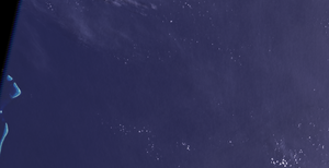
975:A full satellite image of the area by DigitalGlobe
490:"South Pacific Sandy Island 'proven not to exist'"
538:
536:
445:, a phantom island near the Yucatan peninsula.
219:nautical charts; a 1908 edition is shown here.
875:. The Sydney Morning Herald. 22 November 2012
731:Eos, Transactions, American Geophysical Union
617:Former Clock & Watchmakers and Their Work
328:and New Caledonia on their way to Australia.
159:
8:
853:
851:
620:. New York: Spon & Chamberlain. p.
150:
39:
824:
822:
673:"The mystery of an island that isn't there"
577:"Sandy Island does exist - on a 1908 chart"
184:. The island was included on many maps and
570:
568:
38:
861:. University of Sydney. 23 November 2012.
751:
799:
797:
923:"Scientists un-discover Pacific island"
859:"Scientists un-discover Pacific island"
476:
372:General Bathymetric Chart of the Oceans
284:National Geospatial‐Intelligence Agency
719:
717:
715:
602:David Rumsey Historical Map Collection
32:Great Sandy Island (Western Australia)
27:Non-existent island near New Caledonia
948:Juan José Valdes (29 November 2012).
726:"Obituary: Sandy Island (1876 –2012)"
575:Richard Chirgwin (25 November 2012).
484:
482:
480:
7:
543:Lecornu, Hélène (12 December 2012).
81:
873:"The mystery of the missing island"
830:"The Pacific island that never was"
394:, said that mapping an island as a
980:Sandy Island through nautical maps
671:Shaun Higgins (23 November 2012).
645:Eli MacKinnon (27 November 2012).
25:
911:(Mailing list). 26 November 2012.
901:(Mailing list). 22 November 2012.
697:Luke Harding (29 November 2012).
614:Britten, Frederick James (1894).
223:On 14–15 September 1774, Captain
413:The island was displayed on the
80:
73:
388:Australian Hydrographic Service
338:Naval and Oceanographic Service
263:Australian Hydrographic Service
1:
366:metres below the wave-base".
677:Auckland War Memorial Museum
18:Sandy Island (New Caledonia)
427:National Geographic Society
336:As noted above, the French
271:French Hydrographic Service
197:National Geographic Society
1026:
370:bathymetric data from the
29:
274:was still there when the
68:
51:
1005:Islands of New Caledonia
376:sea surface temperatures
351:Times Atlas of the World
290:), which is ported with
30:Not to be confused with
402:to place a fictitious "
146:(sometimes labelled in
807:. TXØDX. 10 April 2000
390:, a department of the
220:
217:UK Hydrographic Office
160:
151:
57:
952:. National Geographic
392:Royal Australian Navy
292:Generic Mapping Tools
214:
56:
753:10.1002/2013eo150001
310:(masses of floating
250:Chesterfield Islands
174:Chesterfield Islands
744:2013EOSTr..94..141S
431:National Geographic
122: /
41:
929:. 23 November 2012
836:. 22 November 2012
782:. 22 November 2012
496:. 22 November 2012
321:Great Barrier Reef
306:may have observed
221:
58:
459:Iberian Peninsula
358:Southern Surveyor
344:enthusiasts on a
278:Southern Surveyor
235:The whaling ship
192:Southern Surveyor
141:
140:
16:(Redirected from
1017:
962:
961:
959:
957:
945:
939:
938:
936:
934:
919:
913:
912:
902:
895:"we have it too"
891:
885:
884:
882:
880:
869:
863:
862:
855:
846:
845:
843:
841:
826:
817:
816:
814:
812:
801:
792:
791:
789:
787:
772:
766:
765:
755:
721:
710:
709:
707:
705:
694:
688:
687:
685:
683:
668:
662:
661:
659:
657:
642:
636:
635:
630:
628:
611:
605:
598:
592:
591:
589:
587:
572:
563:
562:
560:
558:
549:
540:
531:
530:
528:
526:
520:www.mnf.csiro.au
512:
506:
505:
503:
501:
486:
449:Dougherty Island
308:pumice sea rafts
298:Pumice sea rafts
246:
163:
154:
137:
136:
134:
133:
132:
127:
126:19.22°S 159.93°E
123:
120:
119:
118:
115:
84:
83:
77:
42:
21:
1025:
1024:
1020:
1019:
1018:
1016:
1015:
1014:
1000:Phantom islands
990:
989:
971:
966:
965:
955:
953:
947:
946:
942:
932:
930:
921:
920:
916:
903:
893:
892:
888:
878:
876:
871:
870:
866:
857:
856:
849:
839:
837:
828:
827:
820:
810:
808:
803:
802:
795:
785:
783:
774:
773:
769:
738:(15): 141–148.
723:
722:
713:
703:
701:
696:
695:
691:
681:
679:
670:
669:
665:
655:
653:
644:
643:
639:
626:
624:
613:
612:
608:
599:
595:
585:
583:
574:
573:
566:
556:
554:
547:
542:
541:
534:
524:
522:
514:
513:
509:
499:
497:
488:
487:
478:
473:
439:
408:nautical charts
398:—a practice in
363:plate tectonics
334:
300:
244:
209:
186:nautical charts
180:in the eastern
130:
128:
124:
121:
116:
113:
111:
109:
108:
95:
94:
93:
92:
91:
90:
89:
85:
64:
47:
35:
28:
23:
22:
15:
12:
11:
5:
1023:
1021:
1013:
1012:
1007:
1002:
992:
991:
988:
987:
982:
977:
970:
969:External links
967:
964:
963:
940:
914:
905:"Sandy Island"
886:
864:
847:
818:
793:
767:
711:
689:
663:
637:
606:
593:
564:
532:
507:
475:
474:
472:
469:
468:
467:
461:
452:
446:
438:
435:
396:copyright trap
333:
330:
299:
296:
230:dead reckoning
208:
205:
166:phantom island
139:
138:
131:-19.22; 159.93
106:
102:
101:
97:
96:
87:
86:
79:
78:
72:
71:
70:
69:
66:
65:
59:
49:
48:
45:
26:
24:
14:
13:
10:
9:
6:
4:
3:
2:
1022:
1011:
1008:
1006:
1003:
1001:
998:
997:
995:
986:
983:
981:
978:
976:
973:
972:
968:
951:
944:
941:
928:
924:
918:
915:
910:
906:
900:
896:
890:
887:
874:
868:
865:
860:
854:
852:
848:
835:
831:
825:
823:
819:
806:
800:
798:
794:
781:
777:
771:
768:
763:
759:
754:
749:
745:
741:
737:
733:
732:
727:
720:
718:
716:
712:
700:
693:
690:
678:
674:
667:
664:
652:
648:
641:
638:
634:
623:
619:
618:
610:
607:
603:
597:
594:
582:
578:
571:
569:
565:
553:
550:(in French).
546:
539:
537:
533:
521:
517:
511:
508:
495:
491:
485:
483:
481:
477:
470:
465:
462:
460:
456:
453:
450:
447:
444:
441:
440:
436:
434:
432:
428:
424:
420:
416:
411:
409:
405:
401:
397:
393:
389:
384:
381:
377:
373:
367:
364:
360:
359:
353:
352:
347:
343:
342:amateur radio
339:
332:"Undiscovery"
331:
329:
327:
322:
317:
313:
309:
305:
297:
295:
293:
289:
285:
280:
279:
272:
268:
264:
258:
254:
251:
243:
238:
233:
231:
226:
218:
213:
206:
204:
202:
198:
194:
193:
187:
183:
179:
175:
171:
170:New Caledonia
167:
162:
158:
153:
149:
145:
135:
107:
103:
98:
76:
67:
62:
55:
50:
43:
37:
33:
19:
954:. Retrieved
943:
931:. Retrieved
926:
917:
908:
898:
889:
877:. Retrieved
867:
838:. Retrieved
834:The Guardian
833:
809:. Retrieved
784:. Retrieved
780:The Register
779:
770:
735:
729:
702:. Retrieved
692:
680:. Retrieved
666:
654:. Retrieved
640:
632:
625:. Retrieved
616:
609:
596:
584:. Retrieved
581:The Register
580:
555:. Retrieved
523:. Retrieved
519:
510:
498:. Retrieved
493:
464:Los Jardines
430:
423:DigitalGlobe
419:Google Earth
412:
385:
368:
357:
349:
335:
303:
301:
277:
259:
255:
241:
236:
234:
222:
191:
172:between the
161:Isla Arenosa
152:Île de Sable
144:Sandy Island
143:
142:
88:Sandy Island
46:Île de Sable
40:Sandy Island
36:
956:30 November
933:23 November
879:22 November
840:22 November
811:22 November
786:22 November
704:30 November
682:28 November
656:28 November
586:28 November
500:22 November
455:Listenbourg
415:Google Maps
404:trap street
400:cartography
346:DX-pedition
201:Google Maps
178:Nereus Reef
129: /
105:Coordinates
994:Categories
471:References
225:James Cook
1010:Zealandia
927:3 News NZ
762:2324-9250
361:studying
267:sea level
182:Coral Sea
155:, and in
100:Geography
909:GMT-HELP
899:GMT-HELP
651:Fox News
627:8 August
494:BBC News
437:See also
304:Velocity
242:Velocity
237:Velocity
117:159°56′E
740:Bibcode
557:13 June
525:29 June
443:Bermeja
207:History
164:) is a
157:Spanish
114:19°13′S
61:Landsat
760:
548:(.doc)
312:pumice
148:French
316:Tonga
288:GSHHG
245:'
958:2012
935:2012
881:2012
842:2012
813:2012
788:2012
758:ISSN
706:2012
684:2012
658:2012
629:2007
600:See
588:2012
559:2013
552:SHOM
527:2018
502:2012
386:The
380:mask
356:R/V
326:Fiji
302:The
199:and
190:R/V
176:and
748:doi
622:230
276:RV
996::
925:.
907:.
897:.
850:^
832:.
821:^
796:^
778:.
756:.
746:.
736:94
734:.
728:.
714:^
675:.
649:.
631:.
579:.
567:^
535:^
518:.
492:.
479:^
232:.
203:.
960:.
937:.
883:.
844:.
815:.
790:.
764:.
750::
742::
708:.
686:.
660:.
604:.
590:.
561:.
529:.
504:.
34:.
20:)
Text is available under the Creative Commons Attribution-ShareAlike License. Additional terms may apply.