38:
63:
70:
45:
535:
530:
511:
352:
62:
457:
203:
148:
37:
428:
298:
The creek can be accessed from the Bently Bluff ramp. Approximately 14 miles downstream (7 miles as the crow flies) it meets up with the
448:
325:
Hydrology, vegetation, and soils of four north
Florida river flood plains with an evaluation of state and federal wetland determinations
504:
453:
258:
305:
The creek is windy, shuttling is necessary and there can be snags. Shorter warter craft are easier to maneuver along it.
545:
497:
540:
287:
418:
443:
117:
113:
273:
399:
323:
367:
266:
424:
329:
299:
254:
189:
276:
identified several species in the area of the creek during his travels in
Florida 1909–1910.
420:
On Harper's Trail: Roland
Mcmillan Harper, Pioneering Botanist of the Southern Coastal Plain
283:
262:
322:
Light, Helen M.; Florida Dept. of
Environmental Regulation; U.S. Geological Survey (1993).
381:
481:
524:
184:
218:
205:
163:
150:
333:
382:"USGS Current Conditions for USGS 02330100 TELOGIA CREEK NR BRISTOL, FLA"
250:
103:
290:, the Appalachicola Kingsnake, lives in the area. It is non-venomous.
400:"TELOGIA CREEK NR GREENSBORO, FLA. (USGS-02330050) site data in the"
302:. Huey P. Arnold County Park can be used as a takeout spot.
265:. The stream's water quality is monitored at a site near
485:
286:, a scouting Telogia Camp, and a Telogia Creek Road.
269:. Road crossings include the Telogia Creek Bridge.
234:
195:
183:
140:
132:
123:
109:
99:
91:
86:
21:
480:This article related to a river in Florida is a
279:The surrounding area includes horse properties.
505:
8:
423:. University of Georgia Press. p. 60.
536:Bodies of water of Gadsden County, Florida
531:Bodies of water of Liberty County, Florida
512:
498:
458:United States Department of the Interior
353:"Telogia Creek Paddle Information Sheet"
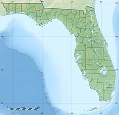
347:
345:
343:
314:
328:. U.S. Geological Survey. p. 20.
18:
358:. Florida Paddling Trails Association
69:
44:
16:River in the United States of America
7:
477:
475:
449:Geographic Names Information System
261:(USGS) monitors its discharge near
417:Shores, Elizabeth Findley (2010).
14:
253:. It is a major tributary of the
68:
61:
43:
36:
454:United States Geological Survey
259:United States Geological Survey
257:. It is used for canoeing. The
197: • coordinates
142: • coordinates
1:
124:Physical characteristics
77:Show map of the United States
484:. You can help Knowledge by
236: • elevation
562:
474:
288:Lampropeltis getula meansi
179:
128:
30:
282:There is a community of
404:www.waterqualitydata.us
274:Roland McMillan Harper
219:30.26833°N 84.73667°W
164:30.64472°N 84.68500°W
240:20 feet (6.1 m)
546:Florida river stubs
368:Amazon Web Services
224:30.26833; -84.73667
215: /
169:30.64472; -84.68500
160: /
52:Show map of Florida
386:waterdata.usgs.gov
541:Rivers of Florida
493:
492:
430:978-0-820-33522-3
300:Ochlockonee River
255:Ochlockonee River
249:is a waterway in
244:
243:
190:Ochlockonee River
553:
514:
507:
500:
476:
468:
466:
464:
435:
434:
414:
408:
407:
396:
390:
389:
378:
372:
371:
365:
363:
357:
349:
338:
337:
319:
230:
229:
227:
226:
225:
220:
216:
213:
212:
211:
208:
175:
174:
172:
171:
170:
165:
161:
158:
157:
156:
153:
143:
78:
72:
71:
65:
53:
47:
46:
40:
19:
561:
560:
556:
555:
554:
552:
551:
550:
521:
520:
519:
518:
472:
462:
460:
444:"Telogia Creek"
442:
439:
438:
431:
416:
415:
411:
398:
397:
393:
380:
379:
375:
361:
359:
355:
351:
350:
341:
321:
320:
316:
311:
296:
237:
223:
221:
217:
214:
209:
206:
204:
202:
201:
198:
168:
166:
162:
159:
154:
151:
149:
147:
146:
141:
116:
82:
81:
80:
79:
76:
75:
74:
73:
56:
55:
54:
51:
50:
49:
48:
26:
23:
17:
12:
11:
5:
559:
557:
549:
548:
543:
538:
533:
523:
522:
517:
516:
509:
502:
494:
491:
490:
470:
469:
437:
436:
429:
409:
391:
373:
339:
313:
312:
310:
307:
295:
292:
242:
241:
238:
235:
232:
231:
199:
196:
193:
192:
187:
181:
180:
177:
176:
144:
138:
137:
134:
130:
129:
126:
125:
121:
120:
111:
107:
106:
101:
97:
96:
93:
89:
88:
84:
83:
67:
66:
60:
59:
58:
57:
42:
41:
35:
34:
33:
32:
31:
28:
27:
24:
15:
13:
10:
9:
6:
4:
3:
2:
558:
547:
544:
542:
539:
537:
534:
532:
529:
528:
526:
515:
510:
508:
503:
501:
496:
495:
489:
487:
483:
478:
473:
459:
455:
451:
450:
445:
441:
440:
432:
426:
422:
421:
413:
410:
405:
401:
395:
392:
387:
383:
377:
374:
369:
354:
348:
346:
344:
340:
335:
331:
327:
326:
318:
315:
308:
306:
303:
301:
293:
291:
289:
285:
280:
277:
275:
270:
268:
264:
260:
256:
252:
248:
247:Telogia Creek
239:
233:
228:
200:
194:
191:
188:
186:
182:
178:
173:
145:
139:
135:
131:
127:
122:
119:
115:
112:
108:
105:
102:
98:
95:United States
94:
90:
85:
64:
39:
29:
25:Tologic River
22:Telogia Creek
20:
486:expanding it
479:
471:
463:December 25,
461:. Retrieved
447:
419:
412:
403:
394:
385:
376:
366:– via
362:December 29,
360:. Retrieved
324:
317:
304:
297:
281:
278:
271:
246:
245:
222: /
167: /
525:Categories
309:References
267:Greensboro
210:84°44′12″W
207:30°16′06″N
155:84°41′06″W
152:30°38′41″N
272:Botanist
334:29815036
294:Paddling
110:Counties
87:Location
284:Telogia
263:Bristol
251:Florida
118:Liberty
114:Gadsden
104:Florida
92:Country
427:
332:
136:
133:Source
356:(PDF)
185:Mouth
100:State
482:stub
465:2018
425:ISBN
364:2018
330:OCLC
527::
456:,
452:.
446:.
402:.
384:.
342:^
513:e
506:t
499:v
488:.
467:.
433:.
406:.
388:.
370:.
336:.
Text is available under the Creative Commons Attribution-ShareAlike License. Additional terms may apply.