322:
metres per second (110 cu ft/s) in the river downstream from the dam. The dam structure is concrete face rockfill using materials from the spillway excavations, with impermeability provided by the concrete face slab. This was an innovative choice for the Nordic environment with its large temperature variations and ice loads in winter. Submersible tiltmeters were installed along two cross-sectional lines on the dam and the south dike to measure slab deflection so that Hydro-Québec could confirm that any structural movement was within the acceptable range. Leakage is very low, at around 10–15 litres per second (0.35–0.53 cu ft/s).
28:
35:
292:
A dam and dyke were built to enlarge the existing 213 square kilometres (82 sq mi) Lake-Sainte-Anne reservoir for the use by the
Toulnustouc hydroelectric project. RSW of Montreal was selected as the prime consulting engineers. VINCI Construction Grands Projets undertook construction. The
330:
The south dyke is in a valley about 500 metres (1,600 ft) southwest of the main dam, and holds back the reservoir in that area. The dyke is 45 metres (148 ft) high. A tunnel from the end of the south dyke carries water to the hydroelectric plant, which is just below PK55 on the river. The
321:
The dam is 76 metres (249 ft) high, with an effective height of 72.3 metres (237 ft) and length of 570 metres (1,870 ft). A spillway with a capacity of 2,400 cubic metres per second (85,000 cu ft/s) is used to release excess inflow and to maintain a flow of at least 3 cubic
304:
Work started in
November 2001, and for the next four years the project employed 425 people on average, peaking at 1,200 workers in the summer of 2003. The average worker was aged over 50. Total cost was over CDN$ 800 million. The reservoir started to fill on 10 February 2005 and reached its maximum
293:
new dam and dyke are about 14 kilometres (8.7 mi) downstream of the former Lac-Sainte-Anne dam, and added 22 square kilometres (8.5 sq mi) to the reservoir. The development was carried out in partnership with the
350:
The discharge channel to the river is 1.2 kilometres (0.75 mi) long, and required excavation of 93,000 cubic metres (3,300,000 cu ft) of overburden and 67,000 cubic metres (2,400,000 cu ft) of rock. A
305:
operating level on 29 April 2005. The plant entered service four months ahead of schedule on 1 July 2005. The
Toulnustouc hydroelectric plant was officially inaugurated on 18 August 2005 by Quebec Premier
347:
watershed. It has an installed capacity of 526 MW from two generating units. The hydraulic head is 152 metres (499 ft). The plant produces 2,660 GW/h annually.
682:
27:
89:
298:
69:
656:
280:, Quebec, Canada. It has an installed capacity of 526 MW. The power station is fed by water from a dam and dyke that contain the
355:
covered by 35,000 cubic metres (1,200,000 cu ft) of stone stabilizes the slopes and bottom of the discharge channel.
64:
281:
519:
604:
536:
585:
638:
622:
569:
553:
587:
Rapport d'analyse environnementale, Projet d'aménagement hydroélectrique de la rivière
Toulnustouc
223:
344:
340:
273:
167:
259:
246:
450:
448:
269:
140:
396:
394:
392:
390:
377:
375:
373:
371:
369:
367:
310:
236:
203:
676:
502:
213:
157:
306:
277:
352:
423:
421:
412:
104:
91:
400:
478:
454:
381:
294:
229:
77:
73:
490:
427:
152:
535:
Holzhausen, Gary R; Thivierge, Stéphane-Éric (17 May 2005),
268:), is a hydroelectric power generating station managed by
555:
Hydroelectric
Generating Stations as at January 1st, 2019
503:
Hydroelectric
Generating Stations as at January 1st, 2019
439:
34:
331:
supply tunnel is 9.8 kilometres (6.1 mi) long.
605:"En bref - La centrale de Toulnustouc voit le jour"
466:
235:
222:
212:
202:
194:
189:
181:
173:
163:
151:
146:
136:
128:
120:
83:
60:
50:
593:(in French), Gouvernement du Québec, 18 June 2001
413:En bref - La centrale de Toulnustouc voit le jour
401:Toulnustouc hydroelectric power project, VINCI
521:Aménagement hydroélectrique de la Toulnustouc
479:Aménagement hydroélectrique de la Toulnustouc
455:Aménagement hydroélectrique de la Toulnustouc
382:Toulnustouc Dam, Canadian Consulting Engineer
339:The Toulnustouc generating station is on the
8:
18:
574:(in French), Radio-Canada, 18 August 2005
299:Manicouagan Regional County Municipality
658:Toulnustouc hydroelectric power project
363:
683:Hydroelectric power stations in Quebec
537:"Monitoring movements at Toulnustouc"
491:Rapport d’analyse environnementale...
7:
571:La centrale de Toulnustouc inaugurée
428:La centrale de Toulnustouc inaugurée
661:, VINCI Construction Grands Projets
14:
33:
26:
467:Holzhausen & Thivierge 2005
627:, Gouvernement du Québec, 2019
256:Toulnustouc generating station
1:
643:Canadian Consulting Engineer
611:(in French), 18 August 2005
699:
624:Toulnustouc, Barrage de la
440:Toulnustouc, Barrage de la
185:500 metres (1,600 ft)
245:
21:
524:, Hydro-Québec, May 2006
208:152 metres (499 ft)
313:, CEO of Hydro-Québec.
265:Centrale de Toulnustouc
224:Installed capacity
177:70 metres (230 ft)
105:49.970493°N 68.158973°W
55:Centrale de Toulnustouc
326:Dyke and supply tunnel
263:
237:Annual generation
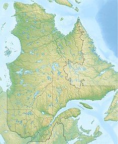
42:Location of in Quebec
153:Type of dam
110:49.970493; -68.158973
16:Dam in Quebec, Canada
276:in the territory of
195:Commission date
65:Rivière-aux-Outardes
101: /
218:2 Francis vertical
639:"Toulnustouc Dam"
341:Toulnustouc River
274:Toulnustouc River
252:
251:
168:Toulnustouc River
147:Dam and spillways
129:Opening date
690:
668:
667:
666:
652:
651:
650:
645:, 1 October 2006
634:
633:
632:
618:
617:
616:
600:
599:
598:
592:
581:
580:
579:
565:
564:
563:
549:
548:
547:
531:
530:
529:
506:
500:
494:
488:
482:
476:
470:
464:
458:
452:
443:
437:
431:
425:
416:
410:
404:
398:
385:
379:
297:Council and the
282:Lake-Sainte-Anne
116:
115:
113:
112:
111:
106:
102:
99:
98:
97:
94:
37:
36:
30:
19:
698:
697:
693:
692:
691:
689:
688:
687:
673:
672:
671:
664:
662:
655:
648:
646:
637:
630:
628:
621:
614:
612:
603:
596:
594:
590:
584:
577:
575:
568:
561:
559:
552:
545:
543:
534:
527:
525:
518:
514:
509:
501:
497:
489:
485:
477:
473:
465:
461:
453:
446:
438:
434:
426:
419:
411:
407:
399:
388:
380:
365:
361:
337:
328:
319:
290:
109:
107:
103:
100:
95:
92:
90:
88:
87:
76:
72:
70:Manicouagan RCM
68:
46:
45:
44:
43:
40:
39:
38:
17:
12:
11:
5:
696:
694:
686:
685:
675:
674:
670:
669:
653:
635:
619:
601:
582:
566:
558:, Hydro-Québec
550:
532:
515:
513:
510:
508:
507:
495:
483:
471:
459:
444:
432:
417:
405:
386:
362:
360:
357:
336:
333:
327:
324:
318:
315:
311:Thierry Vandal
289:
286:
250:
249:
243:
242:
239:
233:
232:
226:
220:
219:
216:
210:
209:
206:
204:Hydraulic head
200:
199:
198:18 August 2005
196:
192:
191:
187:
186:
183:
179:
178:
175:
171:
170:
165:
161:
160:
155:
149:
148:
144:
143:
138:
134:
133:
130:
126:
125:
122:
118:
117:
85:
81:
80:
62:
58:
57:
52:
48:
47:
41:
32:
31:
25:
24:
23:
22:
15:
13:
10:
9:
6:
4:
3:
2:
695:
684:
681:
680:
678:
660:
659:
654:
644:
640:
636:
626:
625:
620:
610:
606:
602:
589:
588:
583:
573:
572:
567:
557:
556:
551:
542:
538:
533:
523:
522:
517:
516:
511:
504:
499:
496:
492:
487:
484:
481:, p. 12.
480:
475:
472:
468:
463:
460:
457:, p. 11.
456:
451:
449:
445:
441:
436:
433:
429:
424:
422:
418:
414:
409:
406:
402:
397:
395:
393:
391:
387:
383:
378:
376:
374:
372:
370:
368:
364:
358:
356:
354:
348:
346:
342:
334:
332:
325:
323:
316:
314:
312:
308:
302:
300:
296:
287:
285:
283:
279:
275:
271:
267:
266:
261:
257:
248:
244:
240:
238:
234:
231:
227:
225:
221:
217:
215:
211:
207:
205:
201:
197:
193:
190:Power Station
188:
184:
180:
176:
172:
169:
166:
162:
159:
158:Rock-fill dam
156:
154:
150:
145:
142:
139:
135:
131:
127:
123:
119:
114:
86:
82:
79:
75:
71:
66:
63:
59:
56:
53:
51:Official name
49:
29:
20:
663:, retrieved
657:
647:, retrieved
642:
629:, retrieved
623:
613:, retrieved
608:
595:, retrieved
586:
576:, retrieved
570:
560:, retrieved
554:
544:, retrieved
540:
526:, retrieved
520:
498:
493:, p. 2.
486:
474:
462:
435:
408:
349:
338:
329:
320:
307:Jean Charest
303:
291:
270:Hydro-Québec
264:
255:
253:
141:Hydro-Québec
54:
541:Water Power
353:geomembrane
345:Manicouagan
284:reservoir.
124:Operational
108: /
84:Coordinates
665:2019-09-05
649:2019-09-05
631:2019-09-05
615:2019-09-05
597:2019-09-05
578:2019-09-05
562:2019-09-05
546:2019-09-05
528:2019-09-05
241:2,660 GW/h
96:68°09′32″W
93:49°58′14″N
609:Le Devoir
278:Côte-Nord
677:Category
295:Pessamit
214:Turbines
164:Impounds
137:Owner(s)
61:Location
512:Sources
343:in the
288:Project
272:on the
260:French
182:Length
174:Height
121:Status
78:Canada
74:Quebec
591:(PDF)
359:Notes
335:Plant
247:ESEAF
309:and
254:The
228:526
132:2005
317:Dam
679::
641:,
607:,
539:,
447:^
420:^
389:^
366:^
301:.
262::
230:MW
505:.
469:.
442:.
430:.
415:.
403:.
384:.
258:(
67:,
Text is available under the Creative Commons Attribution-ShareAlike License. Additional terms may apply.