43:
73:
350:
26:
613:
326:
338:
1256:
1232:
80:
50:
772:
310:
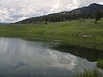
to access the deeper parts of the lake. Using a float tube on
Yellowstone lakes requires a park service boating permit. The lake opens for fishing on Memorial Day weekend. The inlet stream to the lake is permanently closed to protect spawning cutthroat trout. All cutthroat trout and hybrids caught
859:
765:
1326:
127:
242:
1316:
546:
776:
408:
42:
1297:
72:
707:
369:
231:. The lake is located approximately .33 miles (0.53 km) north of the Northeast Entrance Road near the confluence of Pebble Creek and
399:
374:
986:
879:
810:
612:
597:
495:
470:
431:
349:
849:
672:
404:
874:
539:
854:
1147:
1099:
869:
295:
1290:
1197:
592:
283:
1321:
976:
956:
900:
555:
228:
105:
1212:
1192:
1187:
1172:
1127:
1117:
1112:
532:
524:
394:
511:
325:
1167:
1162:
1157:
1152:
1137:
910:
732:
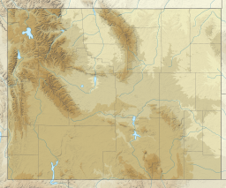
235:. The lake sits in a depression on a high bench above the Soda Butte Creek Canyon. A steep trail through a
1331:
1217:
1182:
1142:
1122:
1107:
930:
717:
1283:
1207:
1202:
1132:
1074:
803:
1177:
1029:
971:
966:
920:
712:
109:
1084:
935:
925:
895:
642:
587:
488:
The
Yellowstone Fly-Fishing Guide—An authoritative guide to the waters of Yellowstone National Park
337:
565:
Geography, historic structures and other attractions in the Tower
Roosevelt and Lamar Valley areas
1054:
915:
864:
458:
446:
1079:
1069:
1039:
1024:
1019:
1004:
833:
752:
747:
702:
637:
491:
466:
427:
25:
1267:
1089:
1064:
1049:
1034:
1014:
994:
905:
796:
722:
602:
232:
1059:
1044:
999:
632:
577:
1236:
727:
697:
687:
582:
168:
1310:
1009:
662:
657:
627:
299:
692:
227:, is a 12 acres (0.049 km) popular backcountry lake for hikers and anglers in
961:
951:
682:
677:
667:
236:
1255:
819:
737:
652:
307:
306:. The lake can be easily fished from the shoreline, but many anglers carry in
258:
244:
143:
129:
647:
1263:
823:
113:
303:
788:
792:
528:
294:
Trout Lake is popular with anglers for its large (14-20")
1271:
239:
forest leads to the lake. The trailhead is located at:
512:"2021 Yellowstone National Park Fishing Regulations"
1098:
985:
944:
888:
842:
620:
570:
206:
198:
190:
182:
178:
167:
119:
101:
18:
766:List of Yellowstone National Park related articles
426:. Niwot, Colorado: University of Colorado Press.
120:
1291:
804:
540:
447:Yellowstone National Park Boating Regulations
8:
1298:
1284:
811:
797:
789:
547:
533:
525:
486:Mathews, Craig; Molinero, Clayton (1997).
424:Yellowstone Place Names-Mirrors of History
15:
282:Trout Lake is a popular area for viewing
409:United States Department of the Interior
1327:Bodies of water of Park County, Wyoming
386:
321:
7:
1252:
1250:
771:
370:Angling in Yellowstone National Park
777:Nature of Yellowstone National Park
400:Geographic Names Information System
375:Fishes of Yellowstone National Park
1317:Lakes of Yellowstone National Park
1270:. You can help Knowledge (XXG) by
558:- Tower-Roosevelt and Lamar Valley
79:
49:
14:
598:Roosevelt Lodge Historic District
490:. Guilford, CT: The Lyons Press.
463:Fishing Yellowstone National Park
1254:
1230:
770:
611:
355:River Otter with Cutthroat Trout
348:
336:
324:
311:in Trout Lake must be released.
78:
71:
48:
41:
24:
673:Grand Canyon of the Yellowstone
405:United States Geological Survey
205:
197:
189:
181:
517:. nps.gov/yell. February 2022.
1:
100:
92:Show map of the United States
465:. Helena, MT: Falcon Press.
296:Yellowstone cutthroat trout
1348:
1249:
593:Northeast Entrance Station
422:Haines, Aubrey L. (1996).
284:North American river otter
1226:
830:
761:
609:
563:
556:Yellowstone National Park
304:rainbow/cutthroat hybrids
229:Yellowstone National Park
210:6,962 feet (2,122 m)
106:Yellowstone National Park
35:
23:
298:and very large (20-30")
202:12 acres (0.049 km)
194:250 yards (0.23 km)
186:250 yards (0.23 km)
1266:-related article is a
718:Slough Creek (Wyoming)
571:Structures and history
259:44.89917°N 110.12250°W
144:44.90056°N 110.13056°W
621:Geography and geology
30:Trout Lake, June 2019
967:Powder River Country
779:at Wikimedia Commons
743:Trout Lake (Wyoming)
713:Silver Gate, Montana
316:Images of Trout Lake
270:Trout Lake trailhead
264:44.89917; -110.12250
219:, formerly known as
149:44.90056; -110.13056
643:Cooke City, Montana
588:Lamar Buffalo Ranch
254: /
139: /
62:Show map of Wyoming
1237:Wyoming portal
1279:
1278:
1244:
1243:
786:
785:
775:Media related to
753:Yellowstone River
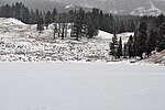
748:Yellowstone Falls
703:Overhanging Cliff
638:Beartooth Highway
214:
213:
207:Surface elevation
1339:
1322:Lakes of Wyoming
1300:
1293:
1286:
1258:
1251:
1235:
1234:
1233:
813:
806:
799:
790:
774:
773:
723:Soda Butte Creek
615:
603:Yanceys, Wyoming
549:
542:
535:
526:
519:
518:
516:
508:
502:
501:
483:
477:
476:
455:
449:
444:
438:
437:
419:
413:
412:
391:
352:
340:
331:Trout Lake, 2009
328:
278:
277:
275:
274:
273:
271:
266:
265:
260:
255:
252:
251:
250:
247:
233:Soda Butte Creek
163:
162:
160:
159:
158:
156:
151:
150:
145:
140:
137:
136:
135:
132:
122:
93:
82:
81:
75:
63:
52:
51:
45:
28:
16:
1347:
1346:
1342:
1341:
1340:
1338:
1337:
1336:
1307:
1306:
1305:
1304:
1247:
1245:
1240:
1231:
1229:
1222:
1094:
981:
940:
884:
838:
826:
817:
787:
782:
757:
633:Barronette Peak
616:
607:
578:Grand Loop Road
566:
559:
553:
523:
522:
514:
510:
509:
505:
498:
485:
484:
480:
473:
457:
456:
452:
445:
441:
434:
421:
420:
416:
393:
392:
388:
383:
366:
361:
360:
359:
356:
353:
344:
341:
332:
329:
318:
317:
292:
269:
267:
263:
261:
257:
256:
253:
248:
245:
243:
241:
240:
225:Soda Butte Lake
171: countries
154:
152:
148:
146:
142:
141:
138:
133:
130:
128:
126:
125:
97:
96:
95:
94:
91:
90:
89:
88:
87:
83:
66:
65:
64:
61:
60:
59:
58:
57:
53:
31:
12:
11:
5:
1345:
1343:
1335:
1334:
1329:
1324:
1319:
1309:
1308:
1303:
1302:
1295:
1288:
1280:
1277:
1276:
1259:
1242:
1241:
1227:
1224:
1223:
1221:
1220:
1215:
1210:
1205:
1200:
1195:
1190:
1185:
1180:
1175:
1170:
1165:
1160:
1155:
1150:
1145:
1140:
1135:
1130:
1125:
1120:
1115:
1110:
1104:
1102:
1096:
1095:
1093:
1092:
1087:
1082:
1077:
1072:
1067:
1062:
1057:
1052:
1047:
1042:
1037:
1032:
1027:
1022:
1017:
1012:
1007:
1002:
997:
991:
989:
983:
982:
980:
979:
974:
969:
964:
959:
954:
948:
946:
942:
941:
939:
938:
933:
928:
923:
918:
913:
908:
903:
901:Climate change
898:
892:
890:
886:
885:
883:
882:
880:Radio stations
877:
872:
867:
862:
857:
852:
846:
844:
840:
839:
831:
828:
827:
818:
816:
815:
808:
801:
793:
784:
783:
781:
780:
768:
762:
759:
758:
756:
755:
750:
745:
740:
735:
730:
728:Specimen Ridge
725:
720:
715:
710:
705:
700:
698:Mount Washburn
695:
690:
688:Mount Hornaday
685:
680:
675:
670:
665:
660:
655:
650:
645:
640:
635:
630:
624:
622:
618:
617:
610:
608:
606:
605:
600:
595:
590:
585:
583:John F. Yancey
580:
574:
572:
568:
567:
564:
561:
560:
554:
552:
551:
544:
537:
529:
521:
520:
503:
496:
478:
471:
459:Parks, Richard
450:
439:
432:
414:
385:
384:
382:
379:
378:
377:
372:
365:
362:
358:
357:
354:
347:
345:
342:
335:
333:
330:
323:
320:
319:
315:
314:
313:
291:
288:
212:
211:
208:
204:
203:
200:
196:
195:
192:
188:
187:
184:
180:
179:
176:
175:
172:
165:
164:
123:
117:
116:
103:
99:
98:
85:
84:
77:
76:
70:
69:
68:
67:
55:
54:
47:
46:
40:
39:
38:
37:
36:
33:
32:
29:
21:
20:
13:
10:
9:
6:
4:
3:
2:
1344:
1333:
1332:Wyoming stubs
1330:
1328:
1325:
1323:
1320:
1318:
1315:
1314:
1312:
1301:
1296:
1294:
1289:
1287:
1282:
1281:
1275:
1273:
1269:
1265:
1260:
1257:
1253:
1248:
1239:
1238:
1225:
1219:
1216:
1214:
1211:
1209:
1206:
1204:
1201:
1199:
1196:
1194:
1191:
1189:
1186:
1184:
1181:
1179:
1176:
1174:
1171:
1169:
1166:
1164:
1161:
1159:
1156:
1154:
1151:
1149:
1146:
1144:
1141:
1139:
1136:
1134:
1131:
1129:
1126:
1124:
1121:
1119:
1116:
1114:
1111:
1109:
1106:
1105:
1103:
1101:
1097:
1091:
1088:
1086:
1083:
1081:
1078:
1076:
1073:
1071:
1068:
1066:
1063:
1061:
1058:
1056:
1053:
1051:
1048:
1046:
1043:
1041:
1038:
1036:
1033:
1031:
1028:
1026:
1023:
1021:
1018:
1016:
1013:
1011:
1008:
1006:
1003:
1001:
998:
996:
993:
992:
990:
988:
984:
978:
975:
973:
970:
968:
965:
963:
960:
958:
955:
953:
950:
949:
947:
943:
937:
934:
932:
929:
927:
924:
922:
919:
917:
914:
912:
909:
907:
904:
902:
899:
897:
894:
893:
891:
887:
881:
878:
876:
875:State symbols
873:
871:
868:
866:
863:
861:
858:
856:
853:
851:
848:
847:
845:
841:
836:
835:
829:
825:
821:
814:
809:
807:
802:
800:
795:
794:
791:
778:
769:
767:
764:
763:
760:
754:
751:
749:
746:
744:
741:
739:
736:
734:
733:The Thunderer
731:
729:
726:
724:
721:
719:
716:
714:
711:
709:
708:Prospect Peak
706:
704:
701:
699:
696:
694:
691:
689:
686:
684:
681:
679:
676:
674:
671:
669:
666:
664:
663:Dunraven Peak
661:
659:
658:Dunraven Pass
656:
654:
651:
649:
646:
644:
641:
639:
636:
634:
631:
629:
628:Abiathar Peak
626:
625:
623:
619:
614:
604:
601:
599:
596:
594:
591:
589:
586:
584:
581:
579:
576:
575:
573:
569:
562:
557:
550:
545:
543:
538:
536:
531:
530:
527:
513:
507:
504:
499:
497:1-55821-545-X
493:
489:
482:
479:
474:
472:1-56044-625-0
468:
464:
460:
454:
451:
448:
443:
440:
435:
433:0-87081-383-8
429:
425:
418:
415:
410:
406:
402:
401:
396:
390:
387:
380:
376:
373:
371:
368:
367:
363:
351:
346:
339:
334:
327:
322:
312:
309:
305:
301:
300:rainbow trout
297:
289:
287:
285:
280:
276:
238:
234:
230:
226:
222:
218:
209:
201:
193:
185:
177:
174:United States
173:
170:
166:
161:
124:
118:
115:
111:
107:
104:
74:
44:
34:
27:
22:
17:
1272:expanding it
1261:
1246:
1228:
1075:Rock Springs
911:Demographics
850:Bibliography
832:
742:
693:Mount Norris
506:
487:
481:
462:
453:
442:
423:
417:
398:
395:"Trout Lake"
389:
293:
281:
224:
220:
216:
215:
199:Surface area
1148:Hot Springs
1030:Green River
977:Yellowstone
962:Great Basin
957:Grand Teton
952:Black Hills
931:LGBT rights
860:Delegations
683:Lamar River
678:Hedges Peak
668:Folsom Peak
343:Winter 2009
308:float tubes
262: /
237:Douglas fir
183:Max. length
147: /
134:110°07′50″W
121:Coordinates
114:Wyoming, US
110:Park County
1311:Categories
1198:Sweetwater
1085:Torrington
972:Red Desert
738:Tower Fall
653:Druid Peak
268: (
249:110°7′21″W
246:44°53′57″N
217:Trout Lake
191:Max. width
155:Trout Lake
153: (
131:44°54′02″N
86:Trout Lake
56:Trout Lake
19:Trout Lake
1055:Newcastle
921:Education
855:Governors
837:(capital)
648:Cook Peak
221:Fish Lake
1213:Washakie
1193:Sublette
1188:Sheridan
1173:Niobrara
1128:Converse
1118:Campbell
1113:Big Horn
1100:Counties
1080:Sheridan
1070:Riverton
1040:Kemmerer
1025:Gillette
1020:Evanston
1005:Cheyenne
936:Politics
926:Gun laws
896:Abortion
834:Cheyenne
461:(1998).
364:See also
102:Location
1264:Wyoming
1168:Natrona
1163:Lincoln
1158:Laramie
1153:Johnson
1138:Fremont
1090:Worland
1065:Rawlins
1050:Laramie
1035:Jackson
1015:Douglas
995:Buffalo
945:Regions
916:Economy
889:Society
865:History
824:Wyoming
290:Angling
1218:Weston
1183:Platte
1143:Goshen
1123:Carbon
1108:Albany
1060:Powell
1045:Lander
1000:Casper
987:Cities
870:People
843:Topics
494:
469:
430:
1262:This
1208:Uinta
1203:Teton
1133:Crook
906:Crime
820:State
515:(PDF)
381:Notes
169:Basin
1268:stub
1178:Park
1010:Cody
492:ISBN
467:ISBN
428:ISBN
302:and
223:and
822:of
1313::
407:,
403:.
397:.
286:.
279:.
112:,
108:,
1299:e
1292:t
1285:v
1274:.
812:e
805:t
798:v
548:e
541:t
534:v
500:.
475:.
436:.
411:.
272:)
157:)
Text is available under the Creative Commons Attribution-ShareAlike License. Additional terms may apply.