98:
91:
1825:
740:
26:
1707:
481:
Since the 19th century, the northern part of the
Kellerwald (since 2004, the Kellerwald-Edersee National Park), as hunting woods for the Princes of Waldeck, has been surrounded by gates. To be found here are some particularly pristine beech forests, although they have been damaged somewhat by the
494:. The main tree here is the beech, which is predominant here in acidic-soil (shale, greywacke, quartzite) woodrush-beech forest. Worthy of mention are the many special places on the steep slopes at the Edersee. Here are found the last remains of
288:
rocks, belongs to the
Rhenish Slate Mountains. Scenically, however, it is also grouped as a separate entity with the Hessian Basin, because the rivers Eder and Itter form a natural boundary. Important rock types include the so-called Kellerwald
398:
The
Kellerwald is subject to a special conservation status. Almost its whole unspoilt natural area belongs to the Kellerwald-Edersee Nature Park. The northern part, with an area of 57.24 km has been designated since 1 January 2004 as the
713:, a roughly 167 km-long loop joining mountains and places in the Kellerwald-Edersee Nature Park and the Kellerwald-Edersee National Park together. Round the Edersee has run since 2005 the 68 km-long
337:
The
Kellerwald is named after the mountain ridge called the Keller, mentioned above. Where the name Keller came from is interpreted two different ways: Beginning about 1600, the woodlands were in heavy use in
271:, a mountain ridge in the south of the Kellerwald) made up of, from southwest to northeast, Jeust (585 m above sea level), Wüstegarten (675 m), Hunsrück (636 m) and Sauklippe (584 m).
1738:
434:
in the southern part of the nature park and the Urff, a linear
Special Area of Conservation from the source to the river's mouth into the Schwalm. In small areas, there are also
736:
Among the
Kellerwald's and the two herein mentioned parks' best known – albeit not necessarily highest – mountains are (including the "Six Hundreders", and sorted by height):
240:
Valley. In the southwest, the range goes by way of the Wohra Valley into the
Burgwald range and in the west, beyond the river Eder, lies the Breite Struth (a range of hills).
986:
1869:
426:, a German designation for wooded wildernesses allowed to grow naturally without any human intervention. Further Special Areas of Conservation are, among others, the
1731:
138:
557:
In the
Kellerwald, parts of which are also a Special Protection Area (for birds), a number of bird species still or once again breed, among them the
1844:
1724:
457:
717:("Virgin Forest Trail") through the oak forests on the lake's north shore and through the Kellerwald-Edersee National Park south of the lake.
979:
244:
1647:
1319:
1864:
1854:
255:(the "Eder Heights", a mountainous region in the range's north), whose area roughly coincides with the aforesaid national park, the
90:
400:
210:
972:
1157:
919:"UNESCO World Heritage Centre - Document - Ancient and Primeval Beech Forests of the Carpathians and Other Regions of Europe"
1789:
1336:
415:
361:
131:
826:
729:, not far from, and below the water level of the Affolderner See (reservoir); the point is precisely 194 m above
464:) into the programme called the "Great Nature Conservation Project of Pan-Governmentally Representative Importance" (
1630:
1073:
678:
that live in Hesse, 14 have been noted in the
Kellerwald. Another characteristic animal of the Kellerwald is the
570:
546:
1769:
1480:
643:, were released into the wild in Germany on 12 April 1934 by Wilhelm Sittich Freiherr von Berlepsch (1881–1948;
1384:
1116:
1008:
772:
377:("bare forest" or "bald forest"), a name suggested by heavy clearing in some parts of the woods at one time.
1859:
1581:
1145:
1025:
954:
895:
812:
419:
1671:
1659:
1575:
1403:
1121:
594:
574:
1642:
1516:
1179:
733:. On the other hand, the Kellerwald's highest point is on the Wüstegarten (675 m above sea level).
1635:
1563:
1312:
1824:
294:
1849:
1468:
1360:
818:
805:
522:
359:
1504:
438:
and protected scenic areas. The conservation efforts have yielded, perhaps most importantly, one of
526:
217:
1492:
648:
1534:
1211:
1168:
598:
503:
315:
229:
1623:
1599:
766:
739:
1618:
1463:
1247:
1187:
1174:
1152:
602:
590:
43:
1804:
1606:
1545:
1475:
1331:
1324:
1271:
1216:
1140:
667:
617:
586:
1439:
1379:
1199:
1043:
1032:
995:
958:
899:
725:
The
Kellerwald's lowest point is found at the edge of the Eder Valley on the outskirts of
679:
542:
387:
1048:
1037:
486:. More than 30% of the trees are older than 140 years. The main human activity here was
25:
1799:
1748:
1348:
1276:
1264:
1103:
1068:
1013:
851:
751:
514:
450:
446:
439:
435:
380:
Either process could have yielded the name Kellerwald used today through sound shifts.
237:
190:
177:
170:
60:
39:
1838:
1716:
1487:
1427:
1391:
1367:
1204:
640:
495:
206:
1706:
1794:
1690:
1586:
1570:
1420:
1223:
1133:
1020:
843:
687:
683:
663:
562:
259:("Wildungen Highlands"), which makes up the middle part of the Kellerwald, and the
233:
1396:
1192:
243:
934:
1779:
1666:
1456:
1432:
1408:
1299:
1283:
1128:
778:
659:
613:
558:
534:
518:
499:
483:
411:
650:. Since that time, they have spread far beyond the confines of the Kellerwald.
1814:
1683:
1678:
1654:
1372:
1228:
1085:
1080:
940:
760:
578:
566:
285:
31:
964:
918:
153:
140:
1774:
1695:
1611:
1288:
1252:
1163:
1108:
1097:
730:
343:
302:
290:
1558:
585:(which here reach their highest population density anywhere in Hesse), the
1759:
1511:
1415:
1355:
1294:
1061:
870:
On the Kellerwald's northern edge lie these still, open bodies of water:
629:
621:
609:
582:
538:
507:
491:
339:
324:
830:
includes a much more exhaustive list of the Kellerwald's notable peaks.
1550:
1539:
1528:
1523:
1499:
1451:
1240:
1056:
874:
838:
The Kellerwald is crossed or touched by many watercourses, among them:
726:
636:
487:
306:
232:. Abutting the northeast, the Kellerwald's heights slope down into the
198:
124:
350:
that needed charcoal to fuel their furnaces, thus leading to the name
328:
1809:
1594:
1444:
706:
694:
655:
407:
347:
320:
214:
67:
693:
In the Kellerwald-Edersee National Park, almost a thousand kinds of
466:
Naturschutzgroßprojekt von gesamtstaatlich repräsentativer Bedeutung
366:
sound, rather than ; this is not very different from the sound of
1764:
1092:
799:
738:
682:, found here in its thousands. Further typical amphibians are the
671:
310:
298:
242:
236:
Valley, and towards the east and southeast they fall off into the
202:
194:
120:
35:
951:
537:. In cool and damp stream dales grows the rare, highly poisonous
1259:
1235:
625:
541:. In light beech and oak forests with limy subsoil is found the
193:
reaching heights of up to 675 m in the western part of northern
1720:
968:
456:
In 2005, the Kellerwald-Edersee Nature Park was brought by the
1307:
675:
651:
427:
442:'s last contiguous broadleaf forests of international grade.
946:
373:
The other interpretation holds that the name was originally
674:
are also to be found in the Kellerwald. Of the 19 kinds of
445:
The predominant woodland type is described as acidic-soil
430:
forests on the steep slopes at the Edersee, the aforesaid
30:
The Kellerwald on the horizon. The three peaks are: the
608:
One of the Kellerwald's characteristic animals is the
228:
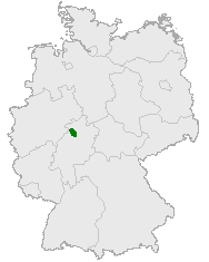
The Kellerwald lies in northern Hesse in the district
635:
In the area that is now the national park, the first
545:. In a few places are found great stands of the rare
790:
Kleine Aschkoppe (607 m) – foothill of Gr. Aschkoppe
612:. In the Kellerwald-Edersee National Park are found
309:. A regional peculiarity is the dark red Kellerwald
169:
130:
116:
78:
66:
56:
51:
18:
201:. Its assets include Germany's largest contiguous
354:("charcoal maker forest"), commonly pronounced
284:Geologically the Kellerwald, made up mainly of
815:(ca. 540 m / 507 m) – with two high reservoirs
784:Winterberg (617 m) – foothill of Gr. Aschkoppe
1732:
980:
943:, special purpose association's official page
8:
808:(566 m) – with nearby, former Quernst Church
697:from more than 80 families have been noted.
894:is also the name of a much smaller wood in
793:Ahornkopf (604 m) – foothill of Traddelkopf
1739:
1725:
1717:
987:
973:
965:
647:is a title, roughly equivalent to "Baron")
15:
406:Furthermore, a great area is part of the
506:, and the highest incidence in Hesse of
42:(675.3 m, right); in front are the
910:
533:near Odershausen are found a few rare
458:Federal Office for Nature Conservation
205:woodland and it contains Hesse's only
763:(657 m) – with television transmitter
7:
1870:Natural regions of the Süder Uplands
97:
14:
775:(636 m) – foothill of Wüstegarten
1823:
1705:
935:Kellerwald-Edersee National Park
705:Through the Kellerwald run many
401:Kellerwald-Edersee National Park
247:Kellerwald's location in Germany
211:Kellerwald-Edersee National Park
96:
89:
24:
323:that is turned opaque red with
73:675.3 m above NN
1845:Forests and woodlands of Hesse
941:Kellerwald-Edersee Nature Park
639:, whose natural habitat is in
251:Within the Kellerwald are the
1:
38:(ca. 585 m, centre) and
821:(518 m) – with lookout tower
416:Special Area of Conservation
1886:
1631:Thuringian Slate Mountains
521:, and in the valley areas
513:In the higher levels grow
1821:
1755:
1703:
1607:Teutoburg Forest (Osning)
1003:
947:Kellerwald-Edersee Region
571:middle spotted woodpecker
462:Bundesamt für Naturschutz
422:), as well as, in parts,
386:simply means "forest" in
83:
23:
1865:Mountain ranges of Hesse
1855:Protected areas of Hesse
1117:Elbe Sandstone Mountains
1009:Anterior Bavarian Forest
961:, excellent hiking trail
709:trails, among them the
420:Special Protection Area
1404:North Palatine Uplands
747:
575:grey-headed woodpecker
482:high concentration of
248:
34:(656.7 m, left),
1643:Upper Palatine Forest
1517:Geiersberg (Breitsol)
1086:(Prussian) Velmerstot
742:
721:Mountains and heights
628:are also common. The
569:(among them the rare
523:western marsh orchids
246:
1747:Subdivisions of the
1672:Paschenburg Mountain
1241:Brocken (Blocksberg)
527:early purple orchids
504:St. Bernard's lilies
342:making for the many
154:51.01639°N 9.08417°E
1122:Großer Zschirnstein
883:Both are man-made.
827:This German article
796:Dicker Kopf (604 m)
715:Urwaldsteig Edersee
394:Conservation status
263:(also known as the
218:World Heritage Site
150: /
1636:Großer Farmdenkopf
1535:Lusatian Mountains
1212:Gladenbach Uplands
1180:Sieben-Linden-Berg
957:2006-12-05 at the
748:
746:on the Wüstegarten
599:Eurasian eagle owl
257:Wildunger Bergland
249:
52:Highest point
44:Gilserberg Heights
1832:
1831:
1714:
1713:
1619:Thuringian Forest
1464:Rothaar Mountains
1313:Lauensteiner Kopf
1248:Hildesheim Forest
1188:Franconian Forest
1153:Fichtel Mountains
620:. Besides these,
603:great grey shrike
183:
182:
159:51.01639; 9.08417
132:Range coordinates
1877:
1827:
1741:
1734:
1727:
1718:
1709:
1546:Zittau Mountains
1476:Saalhausen Hills
1332:Kaufungen Forest
1141:Elster Mountains
989:
982:
975:
966:
923:
922:
915:
787:Auenberg (611 m)
618:European mouflon
587:peregrine falcon
539:common monkshood
365:
295:radiolarian rock
269:Hoher Kellerwald
173:
165:
164:
162:
161:
160:
155:
151:
148:
147:
146:
143:
100:
99:
93:
74:
28:
16:
1885:
1884:
1880:
1879:
1878:
1876:
1875:
1874:
1835:
1834:
1833:
1828:
1819:
1770:northern slopes
1751:
1745:
1715:
1710:
1701:
1624:Großer Beerberg
1600:Großer Feldberg
1440:Palatine Forest
1380:Lenne Mountains
1200:Franconian Jura
1044:Bavarian Forest
1033:Bohemian Forest
999:
996:Central Uplands
993:
959:Wayback Machine
952:Kellerwaldsteig
937:, official page
931:
926:
917:
916:
912:
908:
900:Upper Franconia
889:
879:Affolderner See
868:
836:
834:Bodies of water
767:Große Aschkoppe
754:(675 m) – with
723:
711:Kellerwaldsteig
703:
680:fire salamander
565:, six kinds of
555:
515:mountain arnica
479:
474:
472:Flora and fauna
436:nature reserves
396:
335:
282:
277:
226:
171:
158:
156:
152:
149:
144:
141:
139:
137:
136:
112:
111:
110:
109:
108:
107:
106:
105:
101:
72:
47:
12:
11:
5:
1883:
1881:
1873:
1872:
1867:
1862:
1860:Rhenish Massif
1857:
1852:
1847:
1837:
1836:
1830:
1829:
1822:
1820:
1818:
1817:
1812:
1807:
1802:
1800:Moselle Valley
1797:
1792:
1787:
1782:
1777:
1772:
1767:
1762:
1756:
1753:
1752:
1749:Rhenish Massif
1746:
1744:
1743:
1736:
1729:
1721:
1712:
1711:
1704:
1702:
1700:
1699:
1687:
1675:
1663:
1651:
1639:
1627:
1615:
1603:
1591:
1567:
1555:
1520:
1508:
1496:
1484:
1472:
1460:
1448:
1436:
1424:
1412:
1400:
1388:
1376:
1364:
1352:
1340:
1328:
1316:
1304:
1280:
1277:Kasseler Kuppe
1268:
1256:
1244:
1232:
1224:Goshawk Forest
1220:
1208:
1196:
1184:
1149:
1137:
1125:
1113:
1104:Volcanic Eifel
1089:
1081:Egge Mountains
1077:
1069:Ebbe Mountains
1065:
1053:
1029:
1017:
1004:
1001:
1000:
994:
992:
991:
984:
977:
969:
963:
962:
949:
944:
938:
930:
929:External links
927:
925:
924:
909:
907:
904:
888:
885:
881:
880:
877:
867:
866:
863:
860:
857:
854:
849:
846:
840:
835:
832:
823:
822:
816:
809:
803:
797:
794:
791:
788:
785:
782:
776:
770:
764:
758:
756:Kellerwaldturm
744:Kellerwaldturm
722:
719:
702:
699:
591:Tengmalm's owl
554:
551:
478:
475:
473:
470:
440:Central Europe
395:
392:
334:
331:
281:
278:
276:
273:
225:
222:
191:mountain range
181:
180:
178:Rhenish Massif
175:
167:
166:
134:
128:
127:
118:
114:
113:
103:
102:
95:
94:
88:
87:
86:
85:
84:
81:
80:
76:
75:
70:
64:
63:
58:
54:
53:
49:
48:
29:
21:
20:
13:
10:
9:
6:
4:
3:
2:
1882:
1871:
1868:
1866:
1863:
1861:
1858:
1856:
1853:
1851:
1848:
1846:
1843:
1842:
1840:
1826:
1816:
1813:
1811:
1808:
1806:
1805:Süder Uplands
1803:
1801:
1798:
1796:
1793:
1791:
1788:
1786:
1783:
1781:
1778:
1776:
1773:
1771:
1768:
1766:
1763:
1761:
1758:
1757:
1754:
1750:
1742:
1737:
1735:
1730:
1728:
1723:
1722:
1719:
1708:
1698:
1697:
1693:
1692:
1688:
1686:
1685:
1681:
1680:
1676:
1674:
1673:
1669:
1668:
1664:
1662:
1661:
1657:
1656:
1652:
1650:
1649:
1645:
1644:
1640:
1638:
1637:
1633:
1632:
1628:
1626:
1625:
1621:
1620:
1616:
1614:
1613:
1609:
1608:
1604:
1602:
1601:
1597:
1596:
1592:
1589:
1588:
1584:
1583:
1578:
1577:
1573:
1572:
1568:
1566:
1565:
1561:
1560:
1556:
1553:
1552:
1551:Lausche (Luž)
1548:
1547:
1542:
1541:
1540:Lausche (Luž)
1537:
1536:
1531:
1530:
1529:Lausche (Luž)
1526:
1525:
1521:
1519:
1518:
1514:
1513:
1509:
1507:
1506:
1502:
1501:
1497:
1495:
1494:
1493:Großer Ölberg
1490:
1489:
1488:Siebengebirge
1485:
1483:
1482:
1478:
1477:
1473:
1471:
1470:
1466:
1465:
1461:
1459:
1458:
1454:
1453:
1449:
1447:
1446:
1442:
1441:
1437:
1435:
1434:
1430:
1429:
1428:Ore Mountains
1425:
1423:
1422:
1418:
1417:
1413:
1411:
1410:
1406:
1405:
1401:
1399:
1398:
1394:
1393:
1392:Lippe Uplands
1389:
1387:
1386:
1382:
1381:
1377:
1375:
1374:
1370:
1369:
1365:
1363:
1362:
1358:
1357:
1353:
1351:
1350:
1346:
1345:
1341:
1339:
1338:
1334:
1333:
1329:
1327:
1326:
1322:
1321:
1317:
1315:
1314:
1310:
1309:
1305:
1302:
1301:
1297:
1296:
1291:
1290:
1286:
1285:
1281:
1279:
1278:
1274:
1273:
1272:Hoher Meißner
1269:
1267:
1266:
1262:
1261:
1257:
1255:
1254:
1250:
1249:
1245:
1243:
1242:
1238:
1237:
1233:
1231:
1230:
1226:
1225:
1221:
1219:
1218:
1214:
1213:
1209:
1207:
1206:
1202:
1201:
1197:
1195:
1194:
1190:
1189:
1185:
1182:
1181:
1177:
1176:
1171:
1170:
1166:
1165:
1160:
1159:
1155:
1154:
1150:
1148:
1147:
1143:
1142:
1138:
1136:
1135:
1131:
1130:
1126:
1124:
1123:
1119:
1118:
1114:
1111:
1110:
1106:
1105:
1100:
1099:
1095:
1094:
1090:
1088:
1087:
1083:
1082:
1078:
1076:
1075:
1071:
1070:
1066:
1064:
1063:
1059:
1058:
1054:
1051:
1050:
1046:
1045:
1040:
1039:
1035:
1034:
1030:
1028:
1027:
1023:
1022:
1018:
1016:
1015:
1011:
1010:
1006:
1005:
1002:
997:
990:
985:
983:
978:
976:
971:
970:
967:
960:
956:
953:
950:
948:
945:
942:
939:
936:
933:
932:
928:
920:
914:
911:
905:
903:
901:
897:
893:
886:
884:
878:
876:
873:
872:
871:
864:
861:
858:
855:
853:
850:
847:
845:
842:
841:
839:
833:
831:
829:
828:
820:
817:
814:
810:
807:
804:
801:
798:
795:
792:
789:
786:
783:
780:
777:
774:
771:
768:
765:
762:
759:
757:
753:
750:
749:
745:
741:
737:
734:
732:
728:
720:
718:
716:
712:
708:
700:
698:
696:
691:
689:
685:
681:
677:
673:
669:
665:
664:beech martens
661:
657:
653:
649:
646:
642:
641:North America
638:
633:
631:
627:
623:
619:
615:
611:
606:
604:
600:
596:
595:honey buzzard
592:
588:
584:
580:
576:
572:
568:
564:
560:
552:
550:
548:
547:wild daffodil
544:
543:martagon lily
540:
536:
535:dwarf beeches
532:
528:
524:
520:
516:
511:
509:
508:Cheddar pinks
505:
502:forests with
501:
497:
496:virgin forest
493:
489:
485:
476:
471:
469:
467:
463:
459:
454:
452:
448:
443:
441:
437:
433:
429:
425:
421:
417:
413:
409:
404:
402:
393:
391:
389:
385:
381:
378:
376:
371:
369:
363:
357:
353:
349:
345:
341:
332:
330:
329:
326:
322:
318:
317:
312:
308:
304:
300:
296:
292:
287:
279:
274:
272:
270:
266:
262:
258:
254:
245:
241:
239:
235:
231:
223:
221:
219:
216:
212:
208:
207:national park
204:
200:
196:
192:
188:
179:
176:
174:
168:
163:
135:
133:
129:
126:
122:
119:
115:
92:
82:
77:
71:
69:
65:
62:
59:
55:
50:
45:
41:
37:
33:
27:
22:
17:
1795:Middle Rhine
1784:
1694:
1691:Wiehen Hills
1689:
1682:
1677:
1670:
1665:
1658:
1653:
1646:
1641:
1634:
1629:
1622:
1617:
1610:
1605:
1598:
1593:
1587:Hoher Randen
1585:
1580:
1574:
1571:Swabian Jura
1569:
1562:
1557:
1549:
1544:
1538:
1533:
1527:
1522:
1515:
1510:
1503:
1498:
1491:
1486:
1479:
1474:
1467:
1462:
1455:
1450:
1443:
1438:
1431:
1426:
1421:Katzenbuckel
1419:
1414:
1407:
1402:
1395:
1390:
1383:
1378:
1371:
1366:
1359:
1354:
1347:
1343:
1342:
1335:
1330:
1323:
1318:
1311:
1306:
1298:
1293:
1287:
1282:
1275:
1270:
1263:
1258:
1251:
1246:
1239:
1234:
1227:
1222:
1215:
1210:
1203:
1198:
1191:
1186:
1178:
1173:
1167:
1162:
1156:
1151:
1146:Kapellenberg
1144:
1139:
1134:Eilumer Horn
1132:
1127:
1120:
1115:
1107:
1102:
1096:
1091:
1084:
1079:
1072:
1067:
1060:
1055:
1049:Großer Arber
1047:
1042:
1038:Großer Arber
1036:
1031:
1024:
1021:Black Forest
1019:
1012:
1007:
913:
891:
890:
882:
869:
837:
825:
824:
755:
743:
735:
724:
714:
710:
704:
692:
688:midwife toad
684:palmate newt
660:pine martens
644:
634:
607:
563:common raven
556:
530:
519:maiden pinks
512:
498:and gnarled
490:rather than
480:
465:
461:
455:
444:
431:
423:
405:
397:
383:
382:
379:
374:
372:
367:
355:
351:
336:
327:inclusions".
314:
283:
268:
265:Hoher Keller
264:
260:
256:
252:
250:
230:Schwalm-Eder
227:
186:
184:
172:Parent range
1850:North Hesse
1790:Lahn Valley
1667:Weser Hills
1648:Kreuzfelsen
1505:Große Blöße
1457:Wasserkuppe
1433:Fichtelberg
1409:Donnersberg
1349:Wüstegarten
1320:Kaiserstuhl
1300:Ellerspring
1265:Bloße Zelle
1014:Einödriegel
779:Traddelkopf
752:Wüstegarten
614:fallow deer
559:black stork
529:. Near the
500:sessile oak
412:Natura 2000
375:Kahler Wald
348:copperworks
333:Name origin
316:Eisenkiesel
157: /
61:Wüstegarten
40:Wüstegarten
1839:Categories
1815:Westerwald
1785:Kellerwald
1684:Fuchskaute
1679:Westerwald
1655:Vogelsberg
1469:Langenberg
1373:Kulpenberg
1368:Kyffhäuser
1344:Kellerwald
1337:Hirschberg
1229:Hohes Gras
1205:Dürrenberg
1158:Schneeberg
998:of Germany
906:References
892:Kellerwald
813:Peterskopf
811:Ermerod /
761:Hohes Lohr
645:"Freiherr"
567:woodpecker
531:Jägersburg
368:Kellerwald
356:Köllerwald
352:Köhlerwald
286:palaeozoic
213:. It is a
187:Kellerwald
142:51°00′59″N
104:Kellerwald
32:Hohes Lohr
19:Kellerwald
1775:High Fens
1696:Heidbrink
1660:Taufstein
1612:Barnacken
1564:Hohe Egge
1397:Köterberg
1361:Eisenberg
1325:Totenkopf
1289:Erbeskopf
1253:Griesberg
1217:Angelburg
1193:Döbraberg
1164:Steinwald
1109:Ernstberg
1098:Hohe Acht
1074:Nordhelle
896:Forchheim
731:sea level
727:Affoldern
632:is rare.
626:wild boar
410:network "
358:(with an
344:ironworks
303:greywacke
291:quartzite
253:Ederhöhen
224:Geography
189:is a low
145:9°05′03″E
79:Geography
68:Elevation
1780:Hunsrück
1760:Ardennes
1512:Spessart
1416:Odenwald
1295:Soonwald
1284:Hunsrück
1175:Kohlwald
1026:Feldberg
955:Archived
859:Wesebach
773:Hunsrück
686:and the
668:polecats
637:raccoons
622:roe deer
610:red deer
601:and the
583:red kite
581:and the
573:and the
492:forestry
453:forest.
447:woodrush
424:Bannwald
408:European
340:charcoal
325:hematite
1576:Lemberg
1524:Sudetes
1500:Solling
1481:Himberg
1057:Deister
875:Edersee
852:Schwalm
819:Homberg
806:Talgang
802:(585 m)
781:(626 m)
769:(640 m)
656:badgers
630:wildcat
577:), the
488:hunting
307:diabase
280:Geology
275:History
267:or the
238:Schwalm
199:Germany
125:Germany
1810:Taunus
1595:Taunus
1582:Randen
1559:Süntel
1445:Kalmit
1385:Homert
1169:Platte
887:Sundry
707:hiking
701:Hiking
695:beetle
672:stoats
597:, the
593:, the
589:, the
561:, the
432:Keller
388:German
321:quartz
261:Keller
215:UNESCO
209:, the
1765:Eifel
1356:Knüll
1093:Eifel
1062:Bröhn
865:Wohra
862:Wilde
848:Gilsa
800:Jeust
652:Foxes
579:black
553:Fauna
477:Flora
451:beech
364:]
360:[
319:, a "
313:, an
311:agate
299:shale
203:beech
195:Hesse
121:Hesse
117:State
36:Jeust
1452:Rhön
1260:Hils
1236:Harz
856:Urff
844:Eder
670:and
624:and
616:and
525:and
517:and
484:game
418:and
384:Wald
346:and
305:and
234:Eder
185:The
57:Peak
1308:Ith
1129:Elm
898:in
676:bat
468:).
428:oak
414:" (
370:).
1841::
1554:))
1172:,
902:.
690:.
666:,
662:,
658:,
654:,
605:.
549:.
510:.
403:.
390:.
301:,
297:,
293:,
220:.
197:,
123:,
1740:e
1733:t
1726:v
1590:)
1579:(
1543:(
1532:(
1303:)
1292:(
1183:)
1161:(
1112:)
1101:(
1052:)
1041:(
988:e
981:t
974:v
921:.
460:(
449:-
362:œ
46:.
Text is available under the Creative Commons Attribution-ShareAlike License. Additional terms may apply.