44:
110:
51:
310:
military commander, was born in
Huaynacuri de Píllaro, around 1482. Son of Huayna Cápac and Nary Ati. Down the maternal line his grandparents were Pillahuaso Ati, Cacique de Píllaro and the Queen Choasanguil. His name means "face of stone". El Congreso Nacional (the National Congress) in 1985,
858:
283:
plain, at an altitude of 2,800 metres above sea level and has an average temperature of around 13 degrees
Celsius. It is an agricultural centre, producing primarily
819:
312:
43:
72:
235:
322:
Píllaro was founded in 1570 by
Antonio Clavijo. Píllaro became a separate canton in 1851. The town was heavily damaged in the
351:
303:
347:
343:
786:
747:
323:
157:
122:
265:
134:
378:. Many in Pillaro encourage the story, insisting that the town is full of secrets and legends.
680:
363:
269:
227:
139:
256:
327:
273:
240:
852:
606:
370:. Rumiñahui, on learning that his king had been killed, sidetracked to the deserted
316:
416:
Climate data for
Pillaro, elevation 2,805 m (9,203 ft), (1971–2000)
127:
834:
821:
87:
74:
367:
355:
218:
772:
371:
311:
decided that 1 December be remembered as a commemoration of the country's
331:
284:
261:
206:
115:
288:
359:
307:
292:
280:
223:
152:
375:
315:
hero and a defender of the
Kingdom of Quito against the Spanish
811:
789:. Food and Agriculture Organization of United Nations
234:
217:
205:
197:
189:
184:
176:
168:
163:
150:
145:
133:
121:
103:
23:
295:). It is also known as a centre for wood-carving.
362:gold in the park. The gold was supposed to go to
366:to pay the ransom for the kidnapped Incan king,
326:that similarly devastated the nearby towns of
8:
50:
412:
358:to pay off the Spanish conquistadors, hid
20:
272:and stands about 19 km northeast of
773:http://www.pillaro.gov.ec/fundacion.aspx
346:. This is the site of the legend of the
859:Populated places in Tungurahua Province
740:
342:Pillaro is considered a gateway to the
233:
216:
204:
183:
175:
162:
144:
102:
67:
36:
381:Pillaro is divided into 7 districts:
255:
196:
188:
167:
149:
132:
120:
7:
762:New York: Columbia University, 1998.
776:Foundation of Pillaro 4 August 2009
172:5.31 km (2.05 sq mi)
374:of the Llanganates and buried the
14:
812:Municipality of Pillaro (Spanish)
108:
49:
42:
760:Columbia Gazetteer of the World
394:Presidente Urbina (Chagrapamba)
750:Population and area of Píllaro
388:Emilio María Terán (Rumipamba)
279:The town is located on a high
1:
264:, located in the province of
180:2,803 m (9,196 ft)
787:"CLIMWAT climatic database"
535:Mean daily minimum °C (°F)
465:Mean daily maximum °C (°F)
268:. It is the capital of the
201:1,800/km (4,800/sq mi)
18:Town in Tungurahua, Ecuador
875:
726:
415:
276:, the provincial capital.
678:
604:
534:
464:
459:
456:
453:
450:
447:
444:
441:
438:
435:
432:
429:
426:
423:
420:
344:Llanganates National Park
68:
37:
30:
391:Marcos Espinel (Chacata)
350:. The legends goes that
291:, and fruit (mainly
198: • Density
158:Dr. Patricio Sarabia
831: /
84: /
57:Santiago de Píllaro
25:Santiago de Píllaro
190: • Total
169: • Total
748:Citypopulation.de
731:
730:
681:relative humidity
400:San José de Poaló
364:Francisco Pizarro
257:[ˈpiʝaɾo]
246:
245:
866:
846:
845:
843:
842:
841:
836:
835:1.167°S 78.533°W
832:
829:
828:
827:
824:
799:
798:
796:
794:
783:
777:
769:
763:
757:
751:
745:
413:
385:Baquerizo Moreno
354:, on his way to
259:
254:
114:
112:
111:
99:
98:
96:
95:
94:
89:
88:1.167°S 78.533°W
85:
82:
81:
80:
77:
53:
52:
46:
21:
874:
873:
869:
868:
867:
865:
864:
863:
849:
848:
840:-1.167; -78.533
839:
837:
833:
830:
825:
822:
820:
818:
817:
808:
803:
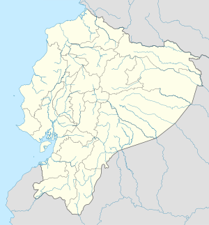
802:
792:
790:
785:
784:
780:
770:
766:
758:
754:
746:
742:
737:
732:
673:
668:
663:
658:
653:
648:
643:
638:
633:
628:
623:
618:
613:
599:
594:
589:
584:
579:
574:
569:
564:
559:
554:
549:
544:
539:
529:
524:
519:
514:
509:
504:
499:
494:
489:
484:
479:
474:
469:
410:
340:
324:1949 earthquake
301:
260:) is a town in
252:
109:
107:
93:-1.167; -78.533
92:
90:
86:
83:
78:
75:
73:
71:
70:
64:
63:
62:
61:
60:
59:
58:
54:
33:
26:
19:
12:
11:
5:
872:
870:
862:
861:
851:
850:
815:
814:
807:
806:External links
804:
801:
800:
778:
764:
752:
739:
738:
736:
733:
729:
728:
724:
723:
720:
717:
714:
711:
708:
705:
702:
699:
696:
693:
690:
687:
684:
676:
675:
670:
665:
660:
655:
650:
645:
640:
635:
630:
625:
620:
615:
610:
602:
601:
596:
591:
586:
581:
576:
571:
566:
561:
556:
551:
546:
541:
536:
532:
531:
526:
521:
516:
511:
506:
501:
496:
491:
486:
481:
476:
471:
466:
462:
461:
458:
455:
452:
449:
446:
443:
440:
437:
434:
431:
428:
425:
422:
418:
417:
411:
409:
406:
405:
404:
403:San Miguelito.
401:
398:
395:
392:
389:
386:
339:
336:
300:
297:
270:Píllaro Canton
244:
243:
238:
232:
231:
221:
215:
214:
209:
203:
202:
199:
195:
194:
191:
187:
186:
182:
181:
178:
174:
173:
170:
166:
165:
161:
160:
155:
148:
147:
143:
142:
137:
131:
130:
125:
119:
118:
105:
101:
100:
66:
65:
56:
55:
48:
47:
41:
40:
39:
38:
35:
34:
31:
28:
27:
24:
17:
13:
10:
9:
6:
4:
3:
2:
871:
860:
857:
856:
854:
847:
844:
813:
810:
809:
805:
788:
782:
779:
775:
774:
768:
765:
761:
756:
753:
749:
744:
741:
734:
725:
721:
718:
715:
712:
709:
706:
703:
700:
697:
694:
691:
688:
685:
682:
677:
671:
666:
661:
656:
651:
646:
641:
636:
631:
626:
621:
616:
611:
608:
607:precipitation
603:
597:
592:
587:
582:
577:
572:
567:
562:
557:
552:
547:
542:
537:
533:
527:
522:
517:
512:
507:
502:
497:
492:
487:
482:
477:
472:
467:
463:
419:
414:
407:
402:
399:
396:
393:
390:
387:
384:
383:
382:
379:
377:
373:
369:
365:
361:
357:
353:
349:
345:
337:
335:
333:
329:
325:
320:
318:
317:conquistadors
314:
309:
306:, the famous
305:
298:
296:
294:
290:
286:
282:
277:
275:
271:
267:
263:
258:
250:
242:
239:
237:
229:
225:
222:
220:
213:
210:
208:
200:
192:
179:
171:
159:
156:
154:
151: •
141:
138:
136:
129:
126:
124:
117:
106:
97:
69:Coordinates:
45:
29:
22:
16:
816:
791:. Retrieved
781:
771:
767:
759:
755:
743:
727:Source: FAO
609:mm (inches)
380:
341:
321:
302:
278:
248:
247:
211:
15:
838: /
91: /
735:References
397:San Andrés
348:Llangantes
313:indigenous
266:Tungurahua
212:Pillarenos
185:Population
146:Government
128:Tungurahua
368:Atahualpa
356:Cajamarca
352:Rumiñahui
338:Geography
304:Rumiñahui
219:Time zone
177:Elevation
853:Category
679:Average
674:(27.73)
605:Average
289:potatoes
253:Spanish:
123:Province
826:78°32′W
793:20 June
669:(1.73)
664:(2.83)
659:(2.44)
654:(2.24)
649:(1.61)
644:(1.73)
639:(2.24)
634:(2.40)
629:(2.87)
624:(3.31)
619:(2.48)
614:(1.85)
600:(46.2)
595:(46.4)
590:(45.5)
585:(46.0)
580:(45.5)
575:(44.8)
570:(45.5)
565:(46.0)
560:(47.3)
555:(47.3)
550:(46.9)
545:(46.8)
540:(46.4)
530:(65.8)
525:(67.6)
520:(69.1)
515:(67.5)
510:(65.1)
505:(63.5)
500:(62.4)
495:(63.1)
490:(65.5)
485:(65.8)
480:(65.8)
475:(67.3)
470:(66.9)
408:Climate
332:Pelileo
299:History
285:cereals
262:Ecuador
249:Píllaro
236:Climate
207:Demonym
140:Píllaro
116:Ecuador
104:Country
79:78°32′W
823:1°10′S
421:Month
372:páramo
328:Ambato
293:apples
281:Andean
274:Ambato
135:Canton
113:
76:1°10′S
460:Year
360:Incan
308:Incan
224:UTC-5
193:9,816
153:Mayor
795:2024
683:(%)
667:44.0
662:72.0
657:62.0
652:57.0
647:41.0
642:44.0
637:57.0
632:61.0
627:73.0
622:84.0
617:63.0
612:47.0
528:18.8
523:19.8
518:20.6
513:19.7
508:18.4
503:17.5
498:16.9
493:17.3
488:18.6
483:18.8
478:18.8
473:19.6
468:19.4
457:Dec
454:Nov
451:Oct
448:Sep
445:Aug
442:Jul
439:Jun
436:May
433:Apr
430:Mar
427:Feb
424:Jan
376:gold
330:and
164:Area
32:Town
722:76
719:73
716:73
713:75
710:76
707:76
704:81
701:79
698:78
695:76
692:78
689:76
686:75
672:705
598:7.9
593:8.0
588:7.5
583:7.8
578:7.5
573:7.1
568:7.5
563:7.8
558:8.5
553:8.5
548:8.3
543:8.2
538:8.0
241:Cfb
228:ECT
855::
334:.
319:.
287:,
797:.
251:(
230:)
226:(
Text is available under the Creative Commons Attribution-ShareAlike License. Additional terms may apply.