45:
75:
444:
598:
82:
52:
364:
Teliamura has a population of 19,605. Males constitute 51% of the population and females 49%. Teliamura has an average literacy rate of 81%, higher than the national average of 59.5%: male literacy is 85%, and female literacy is 78%. In
Teliamura, 10% of the population is under 6 years of age.
348:
In the Sub-Division of
Teliamura there is a total of 49573 hectors of forest land in which the Kalyanpur range sector constitutes 17744 hector, whereas Teliamura range sector constitutes 6168 hector and 25661 hector in Mungiakami range sector.
914:
385:
One
Inspectorate in the Sub-Division under which 15 H.S. Schools, 25 High Schools, 48 Sr. Basic Schools, 94 Junior Basic schools (Non-ADC - 36, ADC- 58) operate in Teliamura.
614:
767:
494:
919:
1062:
1043:
516:
904:
457:
is situated at
Trishabari, 3 km (1.9 mi) from Teliamura main Town. Regular auto service available from and to various part of Teliamura.
601:
374:
107:
894:
474:
777:
587:
44:
1067:
278:
147:
1036:
899:
797:
782:
772:
762:
654:
636:
628:
74:
289:
No. 08 of India. It is also the headquarters of the recently included sub-division of
Teliamura. It is 45 km from
924:
979:
663:
645:
286:
159:
1029:
454:
447:
438:
707:
465:
Teliamura is connected with Assam through
National Highway 8. It is also connected to Khowai, Amarpur by Road.
527:
640:
312:
830:
820:
201:
840:
754:
739:
717:
667:
649:
580:
597:
957:
886:
734:
254:
967:
825:
724:
565:
909:
729:
697:
947:
679:
267:
234:
179:
1013:
984:
974:
856:
835:
689:
573:
238:
230:
443:
942:
934:
815:
810:
805:
712:
271:
164:
787:
702:
1056:
952:
517:"Assembly Constituencies - Corresponding Districts and Parliamentary Constituencies"
361:
744:
658:
327:
314:
122:
109:
673:
250:
245:
962:
619:
290:
195:
1009:
876:
605:
298:
282:
152:
866:
861:
358:
294:
406:
Ananda Marga High School (English medium), with pre-primary section
1005:
442:
275:
560:
569:
555:
768:
Tripura Tribal Areas
Autonomous District Council (TTAADC)
1017:
933:
885:
849:
796:
753:
688:
627:
244:
226:
221:
213:
208:
193:
185:
175:
170:
158:
146:
138:
23:
392:Saradamayee Vidyapith High School (English Medium)
526:. Election Commission of India. Archived from
1037:
581:
8:
373:Teliamura assembly constituency is part of
1044:
1030:
1004:This article related to a location in the
588:
574:
566:
20:
905:National Institute of Technology Agartala
486:
243:
220:
207:
169:
137:
102:
36:
293:, Capital of Tripura, 35 km from
375:Tripura East (Lok Sabha constituency)
225:
212:
192:
184:
174:
157:
145:
7:
1001:
999:
1063:Cities and towns in Khowai district
895:Agartala Government Medical College
475:List of cities and towns in Tripura
453:It is well connected by Railways.
1016:. You can help Knowledge (XXG) by
495:"Yahoo maps location of Teliamura"
14:
81:
51:
596:
80:
73:
50:
43:
900:Maharaja Bir Bikram University
415:NICs Teliamura, Khowai Tripura
1:
189:Teliamura Municipal Council
1084:
998:
436:
612:
448:Teliamura railway station
439:Teliamura railway station
424:Assam rifles high school
395:Kabi Nazrul Bidya Bhabhan
103:
37:
30:
985:Tripuri calendar (Tring)
708:Tripura (princely state)
309:Teliamura is located at
1068:Tripura geography stubs
915:Tripura Medical College
412:Bloom Adventist school
409:Netajinagar High School
680:Butter catfish (Pabda)
450:
401:Vivekanada High School
18:Town in Tripura, India
650:Green imperial pigeon
561:West Tripura District
556:Government of Tripura
446:
420:Kalyanpur H.S. School
398:Teliamura H.S. School
227: • Official
763:Legislative Assembly
659:Indian rose chestnut
641:Phayre's leaf monkey
297:and 42 km from
980:Musical instruments
968:Kokborok literature
324: /
119: /
64:Show map of Tripura
910:Tripura University
533:on 8 November 2005
451:
214: • Total
1025:
1024:
993:
992:
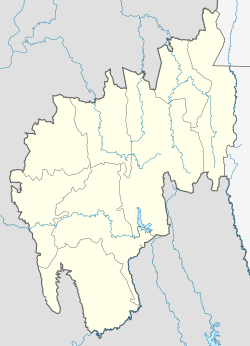
963:Kokborok language
783:Political parties
357:As of 2011 India
268:Municipal Council
261:
260:
186: • Body
180:Municipal Council
176: • Type
94:Show map of India
1075:
1046:
1039:
1032:
1000:
857:Amarpur, Tripura
850:Cities and towns
600:
590:
583:
576:
567:
543:
542:
540:
538:
532:
521:
513:
507:
506:
504:
502:
491:
339:
338:
336:
335:
334:
329:
325:
322:
321:
320:
317:
287:National Highway
266:is a town and a
134:
133:
131:
130:
129:
124:
120:
117:
116:
115:
112:
95:
84:
83:
77:
65:
54:
53:
47:
21:
1083:
1082:
1078:
1077:
1076:
1074:
1073:
1072:
1053:
1052:
1051:
1050:
996:
994:
989:
929:
881:
845:
792:
778:Chief Ministers
749:
713:Manikya dynasty
684:
623:
608:
594:
552:
547:
546:
536:
534:
530:
519:
515:
514:
510:
500:
498:
493:
492:
488:
483:
471:
463:
441:
435:
430:
383:
371:
355:
346:
332:
330:
328:23.72°N 91.74°E
326:
323:
318:
315:
313:
311:
310:
307:
272:Khowai district
127:
125:
123:23.72°N 91.74°E
121:
118:
113:
110:
108:
106:
105:
99:
98:
97:
96:
93:
92:
91:
90:
89:
85:
68:
67:
66:
63:
62:
61:
60:
59:
55:
33:
26:
19:
12:
11:
5:
1081:
1079:
1071:
1070:
1065:
1055:
1054:
1049:
1048:
1041:
1034:
1026:
1023:
1022:
991:
990:
988:
987:
982:
977:
972:
971:
970:
965:
955:
950:
945:
939:
937:
931:
930:
928:
927:
922:
917:
912:
907:
902:
897:
891:
889:
883:
882:
880:
879:
874:
869:
864:
859:
853:
851:
847:
846:
844:
843:
838:
833:
828:
823:
818:
813:
808:
802:
800:
794:
793:
791:
790:
788:Tripura Police
785:
780:
775:
770:
765:
759:
757:
751:
750:
748:
747:
742:
737:
732:
727:
722:
721:
720:
715:
710:
705:
703:Twipra Kingdom
694:
692:
686:
685:
683:
682:
676:
670:
661:
652:
643:
633:
631:
625:
624:
613:
610:
609:
595:
593:
592:
585:
578:
570:
564:
563:
558:
551:
550:External links
548:
545:
544:
508:
485:
484:
482:
479:
478:
477:
470:
467:
462:
459:
437:Main article:
434:
431:
429:
426:
422:
421:
417:
416:
413:
410:
407:
404:
402:
399:
396:
393:
382:
379:
370:
367:
354:
351:
345:
342:
306:
303:
259:
258:
248:
242:
241:
228:
224:
223:
219:
218:
215:
211:
210:
206:
205:
200:Rupak Sarkar (
198:
191:
190:
187:
183:
182:
177:
173:
172:
168:
167:
162:
156:
155:
150:
144:
143:
140:
136:
135:
101:
100:
87:
86:
79:
78:
72:
71:
70:
69:
57:
56:
49:
48:
42:
41:
40:
39:
38:
35:
34:
31:
28:
27:
24:
17:
13:
10:
9:
6:
4:
3:
2:
1080:
1069:
1066:
1064:
1061:
1060:
1058:
1047:
1042:
1040:
1035:
1033:
1028:
1027:
1021:
1019:
1015:
1011:
1007:
1002:
997:
986:
983:
981:
978:
976:
973:
969:
966:
964:
961:
960:
959:
956:
954:
951:
949:
946:
944:
941:
940:
938:
936:
932:
926:
923:
921:
918:
916:
913:
911:
908:
906:
903:
901:
898:
896:
893:
892:
890:
888:
884:
878:
875:
873:
870:
868:
865:
863:
860:
858:
855:
854:
852:
848:
842:
839:
837:
834:
832:
831:South Tripura
829:
827:
824:
822:
821:North Tripura
819:
817:
814:
812:
809:
807:
804:
803:
801:
799:
795:
789:
786:
784:
781:
779:
776:
774:
771:
769:
766:
764:
761:
760:
758:
756:
752:
746:
745:Highest point
743:
741:
738:
736:
733:
731:
728:
726:
723:
719:
716:
714:
711:
709:
706:
704:
701:
700:
699:
696:
695:
693:
691:
687:
681:
677:
675:
671:
669:
665:
662:
660:
656:
653:
651:
647:
644:
642:
638:
635:
634:
632:
630:
629:State symbols
626:
622:
621:
616:
611:
607:
603:
599:
591:
586:
584:
579:
577:
572:
571:
568:
562:
559:
557:
554:
553:
549:
529:
525:
518:
512:
509:
496:
490:
487:
480:
476:
473:
472:
468:
466:
460:
458:
456:
449:
445:
440:
432:
427:
425:
419:
418:
414:
411:
408:
405:
403:
400:
397:
394:
391:
390:
389:
388:
380:
378:
376:
368:
366:
363:
360:
352:
350:
343:
341:
337:
304:
302:
300:
296:
292:
288:
284:
280:
277:
273:
269:
265:
256:
252:
249:
247:
240:
236:
232:
229:
216:
203:
199:
197:
194: •
188:
181:
178:
166:
163:
161:
154:
151:
149:
141:
132:
104:Coordinates:
76:
46:
29:
22:
16:
1018:expanding it
1003:
995:
871:
841:West Tripura
618:
535:. Retrieved
528:the original
523:
511:
499:. Retrieved
497:. Yahoo maps
489:
464:
452:
423:
386:
384:
372:
356:
353:Demographics
347:
333:23.72; 91.74
308:
263:
262:
128:23.72; 91.74
15:
501:31 December
331: /
285:. It is on
126: /
1057:Categories
826:Sipahijala
755:Government
740:Healthcare
481:References
209:Population
171:Government
1008:state of
958:Languages
887:Education
872:Teliamura
798:Districts
773:Governors
735:Education
674:Pineapple
537:8 October
455:Teliamura
428:Transport
381:Education
305:Geography
264:Teliamura
246:Time zone
222:Languages
88:Teliamura
58:Teliamura
25:Teliamura
920:Colleges
725:Politics
668:Agarwood
620:Agartala
469:See also
369:Politics
291:Agartala
251:UTC+5:30
235:Kokborok
196:Chairman
160:District
1010:Tripura
943:Cuisine
935:Culture
925:Schools
877:Unakoti
836:Unakoti
730:Tourism
698:History
672:Fruit:
615:Capital
606:Tripura
524:Tripura
387:Schools
319:91°44′E
316:23°43′N
299:Ambassa
283:Tripura
274:in the
239:English
231:Bengali
153:Tripura
139:Country
114:91°44′E
111:23°43′N
1006:Indian
867:Khowai
862:Dhalai
816:Khowai
811:Gomati
806:Dhalai
690:Topics
678:Fish:
655:Flower
637:Animal
359:census
344:Forest
295:Khowai
276:Indian
217:21,679
165:Khowai
1012:is a
975:Music
953:Dress
948:Dance
718:Kings
602:State
531:(PDF)
520:(PDF)
433:Train
279:state
148:State
142:India
1014:stub
664:Tree
646:Bird
539:2008
503:2008
461:Road
32:Town
604:of
362:GOI
281:of
270:in
255:IST
202:BJP
1059::
666::
657::
648::
639::
617::
522:.
377:.
340:.
301:.
237:,
233:,
1045:e
1038:t
1031:v
1020:.
589:e
582:t
575:v
541:.
505:.
257:)
253:(
204:)
Text is available under the Creative Commons Attribution-ShareAlike License. Additional terms may apply.