474:
33:
392:
864:
800:
848:
832:
816:
407:. Drew and his men then returned to Camp Alvord, arriving there on September 22. At Camp Alvord, Drew received orders to return immediately to Fort Klamath to participate in treaty negotiations with Indian tribes that had been skirmishing with settlers in the Klamath Valley and attacking wagon trains along the Applegate Trail.
493:. Elevation at the gap is 5,306 feet (1,617 m). Drews Valley is 2 miles (3.2 km) west of Drews Gap. Drews Creek flows southeast through Drews Valley into Goose Lake. Drews Reservoir is created by an irrigation dam on upper Drews Creek. The reservoir covers the eastern end of Drews Valley.
410:
Drew's return route was a direct line of march from Camp Alvord to the Warner Valley. Instead of heading south to the
Surprise Valley and Fandango Pass, Drew found a new pass through the Warner Mountains leading directly to the north end of the Goose Lake Valley. This new route was over one hundred
709:
36th
Congress 1st Session – Senate – Mis. Doc. No. 59, Communication from C. S. Drew, Late Adjutant of the Second Regiment of Oregon Mounted Volunteers, giving an account of the origin and early prosecution of the Indian war in Oregon. Order to be printed May 2, 1860. Forty-eight pages, Washington,
340:
In the summer of 1864, Drew was order to organize and lead an Army expedition to size up the Indian situation in southeastern Oregon and determine if additional outposts were needed to protect immigrants. Drew left Fort
Klamath on July 1 on what became known as the Owyhee Reconnaissance. His
604:(Superintendent Indian Affairs O.T.W.T.) to J. W. Denver (Commissioner of Indian Affairs), September 24, 1857; United States Office of Indian Affairs, Letters Received by the Office of Indian Affairs, 1824–1880, National Archives Microcopy 234, Roll 610, NADP Document D52.
441:, approved Drew's released from active duty as soon as his Owyhee Reconnaissance report was completed. McDowell also authorized Drew to return to Jacksonville to write his report. His resignation become effective on January 31, 1865. Drew's report was published in the
313:. On November 6, 1861, Drew was commissioned as a major in the 1st Oregon Cavalry. He entered active duty on December 21, 1861, and was assigned as commander at Camp Baker, near Jacksonville. He was promoted to lieutenant colonel in April 1863.
524:, identifying and mapping many geographic features for the first time. It also records the day-to-day details of a major Civil War era military reconnaissance operation in the western United States. In addition, Drew's route was followed by the
289:
for the southern Oregon militia volunteer companies under
Colonel John E. Ross. Beginning that summer, the southern Oregon militia was expanded because of the tense relations between Rogue River tribes and local settlers. By October, when the
203:
regiment. He eventually reached the rank of lieutenant colonel. In 1864, he led an Army reconnaissance party into southeastern Oregon. The expedition, known as the Owyhee
Reconnaissance, traveled through uncharted country from
763:
Official Report of the Owyhee
Reconnaissance, made by Lieutenant Colonel C.S. Drew, 1st Oregon cavalry, in the summer of 1864, Pursuant to the Orders of Brigadier General George Wright, Commanding Department of the
501:
Official Report of the Owyhee
Reconnaissance, made by Lieutenant Colonel C.S. Drew, 1st Oregon cavalry, in the summer of 1864, Pursuant to the Orders of Brigadier General George Wright, Commanding Department of the
418:
Drew successfully completed his mission, returning to Fort
Klamath on October 18, 1864. However, he did not arrive in time to take part in the treaty negotiations. The peace council with the
255:
were drafted. The proceedings of the convention were published in leading west coast newspapers, but the project received no encouragement from legislators and interest in the idea waned.
411:
miles shorter than his outbound track. Combined with the route he charted from Camp Alvord to Fort Boise, Drew cut almost three hundred miles from the original
Applegate Trail route from
525:
433:
After returning from the reconnaissance, Drew submitted his resignation from the 1st Oregon
Cavalry. The reason for his resignation is unknown. On November 21, 1864, Major General
1062:
299:
Communication from C. S. Drew: late adjutant of the Second regiment of Oregon Mounted Volunteers, giving an account of the origin and early prosecution of the Indian war in Oregon
316:
Drew remained at Camp Baker until June 1863, when he was ordered to abandon the camp and establish a new post in the Klamath Valley. Drew selected a site fifteen miles north of
225:
64:
880:
294:
began, there were fifteen militia companies in the field. The local Indians kept the militia busy until June 1856, when the Indians surrendered and were sent to reservations.
1077:
368:. At that point, Drew met several immigrant parties. Fearing Indian attacks, the civilian parties decide to follow Drew's troops. The expanded company took
496:
In addition, Drew named and recorded the location of a number of Oregon geographical features including the Sprague River, Warner Valley, and Beatys Butte.
1107:
1102:
1082:
1067:
377:
324:
were unhappy that the fort was not closer to existing settlements. However, the site selected by Drew was approved in October 1863 by United States Army
243:
Drew became a leader in the movement to join southern Oregon and northern California to create a new territory. In January 1854, a meeting was held in
341:
reconnaissance party was made up of 39 enlisted troops, a medical officer, and eight support personnel, including scouts, teamsters, and a blacksmith.
1087:
453:
After leaving the Army, Drew invested $ 1,200 in a gold mine near Jacksonville. He operated the Occidental Quartz Mill until 1868. In May 1869, The
461:
of February 5, 1876, lists him among the incorporators of a gold and silver mining company in Elko County, Nevada. Drew died in a veterans home in
247:, to discuss forming a new territory. Attendees elected Drew as one of two secretaries to record the proceedings. At the meeting, letters to the
403:
to the river's headwaters. Instead, Drew along with nineteen troops escorted the immigrant wagon train through the Jordon Creek Valley and on to
508:
newspaper between January 28 and March 11, 1865. Original copies of the pamphlet are extremely rare. Copies are in archival collections at the
504:. It was published in Jacksonville, Oregon in 1865 by the Oregon Sentinel Printing office. The report was also published in serial form by the
1092:
509:
999:
297:
In 1860, Drew sent a report to the United States Congress that documented Indian attacks in the Oregon Territory. The report was titled
212:
and back. Drew was the author of two historically important military reports; one documented Indian attacks on American settlers in the
445:
in serial form from January 28 to March 11, 1865. It was also published as a 32-page pamphlet, which was printed in Jacksonville.
927:
309:
Drew served as an officer in the 1st Oregon Cavalry regiment during the American Civil War, after volunteering for service in the
384:. Drew's party left the Warner Valley, moving east to the Pueblo Valley, and then north to the Army post at Camp Alvord east of
259:
735:
531:
A hardcover version of Drew's report of Indian attacks on settlers in the Oregon Territory was published by Ye Galleon Press of
271:
1022:
361:
184:
352:, following the river to its source. Drew led his party over the low mountains into what in now Drews Valley and then over
680:
630:
614:
575:"Official Report of the Owyhee Reconnaissance Made by Lieut. Colonel C. S. Drew, 1st Oregon Cavalry, in the Summer of 1864"
380:. They then traveled northwest, passing around the north end of Cowhead Lake and over broken high desert country into the
649:
329:
664:
Territorial Government Legislators and Staff, 1854 Regular Session (6th Territorial): December 4, 1854 – February 1, 1855
1072:
274:
from December 4, 1854, until February 1, 1855. However, Drew left the Democratic Party in 1855, becoming active in the
930:, United States Geological Survey, United States Department of Interior, Reston, Virginia; displayed via ACME mapper,
581:(Vol. 2, No. 2), American Society for Ethnohistory, Duke University Press, Durham, North Carolina, 1955, pp. 146–182.
473:
100:
1097:
597:
438:
345:
499:
The record of Drew's 1864 reconnaissance through southeastern Oregon is recorded in a 32-page pamphlet titled
457:
reported that Drew was "traveling with a splendid outfit" in the employ of San Francisco businessmen. The
517:
462:
349:
267:
252:
248:
164:
85:
1037:
761:
982:
895:
532:
663:
399:
Because escort duty had slowed down their pace of travel, Drew had to cancels plans for exploring the
1057:
1052:
320:
and supervised the construction of Fort Klamath during the summer of 1863. Local settlers including
244:
620:, The History Company, San Francisco, California, 1888, pp. 254–255 (including footnote on P. 255).
482:
391:
536:
513:
430:
Indians had begun on October 9 and the treaty was signed on October 15, 1864, near Fort Klamath.
310:
237:
233:
200:
192:
168:
143:
133:
700:, "The Rogue River War", Northwest Digital Archives, University of Oregon, Eugene, Oregon, 2010.
989:, Oregon State Archives Division, Office of the Oregon Secretary of State, Salem, Oregon, 2011.
670:, Oregon State Archives Division, Office of the Oregon Secretary of State, Salem, Oregon, 2011.
258:
In April 1854, Drew was appointed quartermaster general of the territorial militia by Oregon's
32:
1018:
357:
325:
321:
263:
695:
490:
486:
481:
There are at least four geographic features in Oregon that bear Drew's name, all located in
373:
328:. The inspector general also cleared Drew of charges that he had awarded Army contracts to
291:
279:
213:
960:(Seventh Edition), Oregon Historical Society Press, Portland, Oregon, 2003, pp. 1010–1011.
601:
385:
365:
332:
sympathizers. Drew served as commander of Fort Klamath from June 1863 through June 1864.
789:
364:
and then south along the east side of the lake for 21 miles until their path crossed the
434:
419:
270:
elected Drew as their representative in the territorial legislature. He served in the
1046:
590:
381:
369:
188:
918:(Seventh Edition), Oregon Historical Society Press, Portland, Oregon, 2003, p. 303.
520:. It is important because it is one of the earliest records of southeast Oregon's
423:
400:
275:
205:
154:
973:(Seventh Edition), Oregon Historical Society Press, Portland, Oregon, 2003, p. 64.
947:(Seventh Edition) Oregon Historical Society Press, Portland, Oregon, 2003, p. 476.
317:
1004:, The History Company Publishers, San Francisco, California, 1888, pp. 551–552.
740:, The History Company Publishers, San Francisco, California, 1888, pp. 503–506.
521:
404:
209:
196:
113:
89:
427:
412:
353:
1015:
An account of the origin and early prosecution of the Indian War in Oregon
541:
An Account of the Origin and Early Prosecution of the Indian War in Oregon
286:
998:
Bancroft, Herbert Howe, The Works of Herbert Howe Bancroft, Volume XXX,
780:(Third Edition), Binford & Mort, Portland, Oregon, 1965, pp. 49–50.
594:
229:
68:
636:, The History Company, San Francisco, California, 1888, pp. 324–325.
1017:, Fairfield, Wash., Ye Galleon Press, Fairfield, Washington, 1973 (
574:
697:
Guide to the Cayuse, Yakima, and Rogue River Wars Papers 1847–1858
654:, University of Oklahoma Press, Norman, Oklahoma, 1997, pp. 75–78.
472:
390:
686:, The History Company, San Francisco, California, 1888, p. 279.
388:. The last immigrant wagon reached Camp Alvord on August 31.
344:
After leaving Fort Klamath, Drew and his men proceeded to the
767:, Oregon Sentinel Printing Office, Jacksonville, Oregon, 1865
956:
McArthur, Lewis A. and Lewis L. McArthur, "Warner Valley",
216:
and the other was his report of the Owyhee Reconnaissance.
969:
McArthur, Lewis A. and Lewis L. McArthur, "Beatys Butte",
943:
McArthur, Lewis A. and Lewis L. McArthur, "Honey Creek",
914:
McArthur, Lewis A. and Lewis L. McArthur, "Drews Creek",
185:
legislature of the Oregon Territory of the United States
485:. Drews Gap is located 14 miles (23 km) west of
282:
removed Drew from the quartermaster general position.
516:, and several private library collections, including
191:
of the territorial militia in the 1850s. During the
651:
Rogue River Indian War and its aftermath, 1850–1880
360:. The expedition traveled around the north end of
160:
149:
139:
129:
119:
107:
95:
75:
50:
42:
23:
886:, Sacramento, California, February 5, 1876, p. 5.
839:, Jacksonville, Oregon, January 11, 1868, p. 3.
823:, Jacksonville, Oregon, December 7, 1867, p. 3.
807:, Jacksonville, Oregon, December 2, 1865, p. 2.
477:Drews Creek in Oregon's Fremont National Forest
1063:Members of the Oregon Territorial Legislature
236:. By 1853, Drew was selling supplies to the
8:
1038:Official Report of the Owyhee Reconnaissance
871:, Jacksonville, Oregon, May 22, 1869, p. 2.
855:, Jacksonville, Oregon, May 23, 1868, p. 3.
278:political movement. As a result, Governor
224:Drew was born on April 2, 1825, in Bolton,
1078:People of Oregon in the American Civil War
31:
20:
551:
16:American Union Army officer (1825–1886)
756:
754:
752:
750:
748:
746:
726:
724:
722:
720:
718:
716:
983:"Oregon History: Civil War in Oregon"
644:
642:
595:Official letter from James W. Nesmith
569:
567:
565:
563:
561:
559:
557:
555:
7:
510:University of California at Berkeley
232:in the early 1850s, settling in the
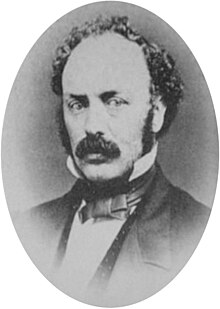
37:Civil War veteran C. S. Drew in 1865
395:Drew's Owyhee Reconnaissance report
228:, Quebec, Canada. He emigrated to
1108:Military personnel from California
1103:People from Yountville, California
1083:American people of the Indian Wars
732:The Works of Herbert Howe Bancroft
526:Oregon Central Military Wagon Road
266:. Later that year, the voters of
14:
1068:19th-century American legislators
760:Drew, C.S. (Lieutenant Colonel),
1088:People from Jacksonville, Oregon
183:, was a representative in the
1:
179:(1825 – 1886), also known as
1001:History of Oregon: 1848–1888
737:History of Oregon: 1848–1888
285:In 1855, Drew was appointed
1124:
437:, commander of the Army's
123:1854–1857 (Oregon militia)
99:United States of America (
439:Department of the Pacific
238:Rogue River Indian people
30:
902:, 27 October 1886, p. 1.
730:Bancroft, Herbert Howe,
600:August 29, 2008, at the
539:in 1973. It was titled
199:officer, serving in the
971:Oregon Geographic Names
958:Oregon Geographic Names
945:Oregon Geographic Names
916:Oregon Geographic Names
904:(subscription required)
900:San Francisco Chronicle
896:"Death of Colonel Drew"
679:Bancroft, Hubert Howe,
629:Bancroft, Hubert Howe,
613:Bancroft, Hubert Howe,
253:California legislatures
1093:People from Montérégie
928:Oregon topographic map
884:Sacramento Daily Union
684:(Volume II: 1848–1888)
634:(Volume II: 1848–1888)
618:(Volume II: 1848–1888)
518:The Huntington Library
478:
465:, on 25 October 1886.
463:Yountville, California
459:Sacramento Daily Union
396:
292:Rogue River Indian war
249:United States Congress
165:Rogue River Indian War
476:
443:Jacksonville Sentinel
394:
348:, and then along the
336:Owyhee Reconnaissance
189:quartermaster general
153:Camp Baker (Oregon);
125:1861–1865 (U.S. Army)
120:Years of service
778:East of the Cascades
573:Introduction to the
415:to southern Oregon.
245:Jacksonville, Oregon
177:Charles Stewart Drew
1073:Union Army officers
251:and the Oregon and
1013:Drew, Charles S.,
934:, August 29, 2010.
833:"On Jackson Creek"
648:Schwartz, E. A.,
514:Indiana University
479:
397:
311:United States Army
234:Rogue River Valley
201:1st Oregon Cavalry
193:American Civil War
169:American Civil War
144:1st Oregon Cavalry
134:Lieutenant colonel
776:Brogan, Phil F.,
682:History of Oregon
632:History of Oregon
616:History of Oregon
591:Nesmith, James W.
358:Goose Lake Valley
326:inspector general
322:Lindsay Applegate
305:Civil War service
174:
173:
1115:
1098:Rogue River Wars
1026:
1011:
1005:
996:
990:
987:Oregon Blue Book
980:
974:
967:
961:
954:
948:
941:
935:
925:
919:
912:
906:
905:
893:
887:
878:
872:
862:
856:
846:
840:
830:
824:
814:
808:
798:
792:
787:
781:
774:
768:
758:
741:
734:, (Volume XXX),
728:
711:
707:
701:
693:
687:
677:
671:
668:Oregon Blue Book
661:
655:
646:
637:
627:
621:
611:
605:
588:
582:
571:
491:Oregon Route 140
487:Lakeview, Oregon
374:Warner Mountains
346:Williamson River
214:Oregon Territory
109:
82:
79:October 25, 1886
60:
58:
35:
21:
1123:
1122:
1118:
1117:
1116:
1114:
1113:
1112:
1043:
1042:
1034:
1029:
1012:
1008:
997:
993:
981:
977:
968:
964:
955:
951:
942:
938:
926:
922:
913:
909:
903:
894:
890:
879:
875:
869:Oregon Sentinel
863:
859:
853:Oregon Sentinel
847:
843:
837:Oregon Sentinel
831:
827:
821:Oregon Sentinel
815:
811:
805:Oregon Sentinel
799:
795:
788:
784:
775:
771:
759:
744:
729:
714:
708:
704:
694:
690:
678:
674:
662:
658:
647:
640:
628:
624:
612:
608:
602:Wayback Machine
589:
585:
572:
553:
549:
506:Oregon Sentinel
471:
455:Oregon Sentinel
451:
386:Steens Mountain
378:Surprise Valley
366:Applegate Trail
338:
307:
280:George L. Curry
222:
124:
84:
80:
62:
56:
54:
38:
26:
25:Charles S. Drew
17:
12:
11:
5:
1121:
1119:
1111:
1110:
1105:
1100:
1095:
1090:
1085:
1080:
1075:
1070:
1065:
1060:
1055:
1045:
1044:
1041:
1040:
1033:
1032:External links
1030:
1028:
1027:
1006:
991:
975:
962:
949:
936:
920:
907:
888:
873:
857:
841:
825:
809:
793:
782:
769:
742:
712:
702:
688:
672:
656:
638:
622:
606:
583:
550:
548:
545:
470:
467:
450:
447:
435:Irvin McDowell
401:Owyhee country
337:
334:
306:
303:
268:Jackson County
221:
218:
172:
171:
162:
158:
157:
151:
147:
146:
141:
137:
136:
131:
127:
126:
121:
117:
116:
111:
105:
104:
97:
93:
92:
83:(aged 61)
77:
73:
72:
52:
48:
47:
44:
40:
39:
36:
28:
27:
24:
15:
13:
10:
9:
6:
4:
3:
2:
1120:
1109:
1106:
1104:
1101:
1099:
1096:
1094:
1091:
1089:
1086:
1084:
1081:
1079:
1076:
1074:
1071:
1069:
1066:
1064:
1061:
1059:
1056:
1054:
1051:
1050:
1048:
1039:
1036:
1035:
1031:
1024:
1020:
1016:
1010:
1007:
1003:
1002:
995:
992:
988:
984:
979:
976:
972:
966:
963:
959:
953:
950:
946:
940:
937:
933:
929:
924:
921:
917:
911:
908:
901:
897:
892:
889:
885:
881:
877:
874:
870:
866:
861:
858:
854:
850:
849:"Quartz Mill"
845:
842:
838:
834:
829:
826:
822:
818:
817:"Still at It"
813:
810:
806:
802:
797:
794:
791:
786:
783:
779:
773:
770:
766:
765:
757:
755:
753:
751:
749:
747:
743:
739:
738:
733:
727:
725:
723:
721:
719:
717:
713:
706:
703:
699:
698:
692:
689:
685:
683:
676:
673:
669:
665:
660:
657:
653:
652:
645:
643:
639:
635:
633:
626:
623:
619:
617:
610:
607:
603:
599:
596:
592:
587:
584:
580:
576:
570:
568:
566:
564:
562:
560:
558:
556:
552:
546:
544:
542:
538:
534:
529:
527:
523:
519:
515:
511:
507:
503:
497:
494:
492:
488:
484:
475:
468:
466:
464:
460:
456:
448:
446:
444:
440:
436:
431:
429:
425:
421:
416:
414:
408:
406:
402:
393:
389:
387:
383:
382:Warner Valley
379:
375:
371:
370:Fandango Pass
367:
363:
359:
355:
351:
350:Sprague River
347:
342:
335:
333:
331:
327:
323:
319:
314:
312:
304:
302:
300:
295:
293:
288:
283:
281:
277:
273:
269:
265:
264:John W. Davis
261:
256:
254:
250:
246:
241:
239:
235:
231:
227:
219:
217:
215:
211:
207:
202:
198:
194:
190:
186:
182:
178:
170:
166:
163:
159:
156:
152:
148:
145:
142:
138:
135:
132:
128:
122:
118:
115:
112:
106:
102:
98:
94:
91:
87:
78:
74:
70:
66:
61:April 2, 1825
53:
49:
45:
41:
34:
29:
22:
19:
1014:
1009:
1000:
994:
986:
978:
970:
965:
957:
952:
944:
939:
932:www.acme.com
931:
923:
915:
910:
899:
891:
883:
876:
868:
865:"Col. Drew…"
860:
852:
844:
836:
828:
820:
812:
804:
796:
785:
777:
772:
762:
736:
731:
705:
696:
691:
681:
675:
667:
659:
650:
631:
625:
615:
609:
586:
579:Ethnohistory
578:
540:
530:
505:
500:
498:
495:
480:
458:
454:
452:
442:
432:
417:
409:
398:
343:
339:
315:
308:
298:
296:
284:
276:Know-Nothing
272:Oregon House
257:
242:
223:
206:Fort Klamath
180:
176:
175:
161:Battles/wars
155:Fort Klamath
81:(1886-10-25)
18:
1058:1886 deaths
1053:1825 births
483:Lake County
330:confederate
318:Agency Lake
195:, he was a
43:Nickname(s)
1047:Categories
1023:087770046X
547:References
537:Washington
522:topography
449:Later life
405:Fort Boise
362:Goose Lake
262:governor,
260:Democratic
220:Early life
210:Fort Boise
197:Union Army
114:Union Army
96:Allegiance
90:California
86:Yountville
57:1825-04-02
790:full text
533:Fairfield
428:Yahooskin
413:Fort Hall
372:over the
356:into the
354:Drews Gap
181:C.S. Drew
46:C.S. Drew
801:"Mining"
598:Archived
287:adjutant
150:Commands
108:Service/
71:, Canada
63:Bolton,
764:Pacific
502:Pacific
420:Klamath
1021:
469:Legacy
426:, and
230:Oregon
110:branch
69:Quebec
489:, on
424:Modoc
376:into
226:Brome
101:Union
65:Brome
1019:ISBN
710:D.C.
187:and
140:Unit
130:Rank
76:Died
51:Born
577:,
208:to
1049::
1025:).
985:,
898:,
882:,
867:,
851:,
835:,
819:,
803:,
745:^
715:^
666:,
641:^
593:,
554:^
543:.
535:,
528:.
512:,
422:,
301:.
240:.
167:;
88:,
67:,
103:)
59:)
55:(
Text is available under the Creative Commons Attribution-ShareAlike License. Additional terms may apply.