29:
187:. Charles and Frank Mason built a blacksmith shop across the Turnpike from the mill. Frank ran the mill while Charles built chairs, shingles, sleds, and wagons, manufacturing wheel rims and other parts. Frank Mason died in 1928 and Charles in 1929. Charles Mason's sons-in-law, Hibbard Parker and Henry Knowlton, operated the sawmill sporadically thereafter and ceased operations by the mid-1930s. A hurricane washed out the dam in 1938, and attempts by Mason Parker, grandson of Charles Mason, to restore it were unsuccessful. The mill was demolished in the mid-1960s and the smithy around 1975.
42:
49:
190:
The Masons also owned the Mason-Knowlton Place, consisting of a historic farmhouse and two barns, which is listed on the
Connecticut State Register of Historic Places. The last Mason to own the mill property was Eva Belle Mason Knowlton, who died in 1983.
182:
The sawmill was built by
Zebulon Gurley no later than 1778. It stayed in continuous operation through owners Joseph Tinney, John Grant, John Fitch, and Jillson Darling. In 1864 the Masons purchased the property and added a
426:
431:
416:
235:
167:
301:
217:, thereby reducing the water flow for these mills operating downstream. The plaintiffs won the lawsuit, which is still cited as a precedent in cases involving
28:
87:
41:
411:
213:
In 1885, Charles Mason, along with
Gurleyville millers Emory B. Smith and William Williams, sued James Hoyle, who had dammed the Fenton River in
421:
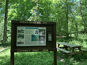
166:. The mill was built around 1778, shut down around 1935, and demolished in the mid-1960s. The 2.31-acre site and ruins have been conserved by
277:
373:
406:
240:
171:
202:
For over 150 years, the mill operated with an up-and-down saw. Although most mills in the United States had switched to
323:
214:
207:
163:
71:
218:
295:
283:
273:
138:
349:
206:
by 1840, the Mason Mill continued its use until the mill ceased operations around 1935. The
350:"National Register of Historic Places Nomination Form - Gurleyville Historic District"
400:
194:
The mill property was donated to Joshua's Trust by Leonid and Beth
Azaroff in 2000.
230:
159:
75:
57:
348:
United States
Department of the Interior, National Park Service (1975-10-08).
266:
Favretti, Rudy J; Mansfield 300th Four
Corners Neighborhood Committee (2003).
203:
269:
Mansfield Four
Corners: what it used to be & George Washington didn't see
102:
89:
287:
184:
155:
327:
267:
151:
322:
Joshua's Trust
Conservation and Historic Trust (2019-12-28).
272:. Storrs, Conn.: Bibliopola Press of the UConn Co-op.
134:
126:
118:
81:
67:
21:
427:Demolished buildings and structures in Connecticut
432:Buildings and structures demolished in the 1960s
16:Sawmill built in 1778 in Mansfield, Connecticut
417:Protected areas of Tolland County, Connecticut
168:Joshua's Tract Conservation and Historic Trust
8:
300:: CS1 maint: numeric names: authors list (
162:on the north side of Old Turnpike Road in
18:
48:
251:
210:purchased the saw and other equipment.
293:
7:
317:
315:
313:
311:
261:
259:
257:
255:
66:
14:
47:
40:
27:
412:Watermills in the United States
125:
1:
422:Sawmills in the United States
381:Historic Barns of Connecticut
241:Gurleyville Historic District
172:Gurleyville Historic District
448:
174:lies two miles downriver.
122:2.31 acres (0.93 ha)
35:
26:
208:Smithsonian Institution
103:41.833342°N 72.242907°W
407:Mansfield, Connecticut
374:"Mason-Knowlton Place"
164:Mansfield, Connecticut
354:National Park Service
219:riparian water rights
108:41.833342; -72.242907
324:"Mason's Mill Site"
135:Governing body
99: /
158:located along the
279:978-0-939883-12-7
148:Gurley-Mason Mill
144:
143:
22:Gurley-Mason Mill
439:
392:
391:
389:
388:
378:
370:
364:
363:
361:
360:
345:
339:
338:
336:
335:
326:. Archived from
319:
306:
305:
299:
291:
263:
170:since 2000. The
114:
113:
111:
110:
109:
104:
100:
97:
96:
95:
92:
51:
50:
44:
31:
19:
447:
446:
442:
441:
440:
438:
437:
436:
397:
396:
395:
386:
384:
376:
372:
371:
367:
358:
356:
347:
346:
342:
333:
331:
321:
320:
309:
292:
280:
265:
264:
253:
249:
227:
200:
180:
150:was a historic
107:
105:
101:
98:
93:
90:
88:
86:
85:
63:
62:
61:
60:
54:
53:
52:
17:
12:
11:
5:
445:
443:
435:
434:
429:
424:
419:
414:
409:
399:
398:
394:
393:
365:
340:
307:
278:
250:
248:
245:
244:
243:
238:
236:Joshua's Trust
233:
226:
223:
199:
196:
179:
176:
142:
141:
139:Joshua's Trust
136:
132:
131:
128:
124:
123:
120:
116:
115:
83:
79:
78:
69:
65:
64:
55:
46:
45:
39:
38:
37:
36:
33:
32:
24:
23:
15:
13:
10:
9:
6:
4:
3:
2:
444:
433:
430:
428:
425:
423:
420:
418:
415:
413:
410:
408:
405:
404:
402:
382:
375:
369:
366:
355:
351:
344:
341:
330:on 2019-12-28
329:
325:
318:
316:
314:
312:
308:
303:
297:
289:
285:
281:
275:
271:
270:
262:
260:
258:
256:
252:
246:
242:
239:
237:
234:
232:
229:
228:
224:
222:
220:
216:
211:
209:
205:
197:
195:
192:
188:
186:
177:
175:
173:
169:
165:
161:
157:
153:
149:
140:
137:
133:
129:
121:
117:
112:
84:
80:
77:
73:
70:
59:
43:
34:
30:
25:
20:
385:. Retrieved
380:
368:
357:. Retrieved
353:
343:
332:. Retrieved
328:the original
268:
231:Fenton River
212:
201:
198:Significance
193:
189:
181:
160:Fenton River
147:
145:
204:rotary saws
127:Established
106: /
82:Coordinates
76:Connecticut
58:Connecticut
401:Categories
387:2020-08-02
359:2020-08-02
334:2020-08-03
247:References
215:Willington
94:72°14′34″W
91:41°50′00″N
296:cite book
185:gristmill
156:gristmill
72:Mansfield
288:53032563
225:See also
68:Location
178:History
152:sawmill
56:Map of
383:. 2013
286:
276:
377:(PDF)
302:link
284:OCLC
274:ISBN
154:and
146:The
130:2000
119:Area
403::
379:.
352:.
310:^
298:}}
294:{{
282:.
254:^
221:.
74:,
390:.
362:.
337:.
304:)
290:.
Text is available under the Creative Commons Attribution-ShareAlike License. Additional terms may apply.