26:
189:
221:
on 26 December 1999. Visitors are led along an 800-metre-long educational and experience trail, which takes them over steps, bridges and boardwalks through the 10 hectares of devastated forest, and enables them to observe how the forces of nature operate and how such areas recover naturally after
200:
which was opened on 1 January 2014. The
Ruhestein Nature Conservation Centre at the top of the pass has exhibitions and events about conservation. In addition, the head office of the national park and the
315:
25:
300:
305:
75:
202:
272:
171:. It is a popular day trip and recreation destination and a well known winter sports resort with ski lifts on the Ruhesteinberg, ski jumps (
310:
181:. The winding road between Baiersbronn-Obertal and the Ruhestein was used once, on 21 July 1946, for a mountain motor race, the
117:
68:
197:
182:
156:). The Ruhestein is a rest area for all those who want to cross the mountain ridge from one valley to the other.
133:
172:
160:
145:
125:
218:
188:
129:
49:
248:
36:
140:
marking the former border. Today it forms the provincial, county and municipal boundary between
268:
229:
149:
137:
56:
294:
285:
224:
168:
153:
61:
210:
206:
164:
141:
90:
77:
214:
265:
Ruhestein-Bergrennen 1946. Der
Neubeginn des deutschen Motorsports.
187:
177:
121:
263:
Frank Eberle, Hubert Huber, Roger Orlik, Martin Walter:
67:
55:
45:
35:
18:
196:Around Ruhestein lies one of the two parts of the
185:, during which 3 participants lost their lives.
222:storm devastation. West of Ruhestein the only
8:
15:
228:in the Northern Black Forest runs up the
241:
203:Central/North Black Forest Nature Park
192:Ruhestein Nature Conservation Station
136:ran over the pass, a large sandstone
7:
316:Mountain passes of Baden-Württemberg
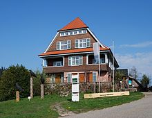
286:Ruhestein Nature Conservation Centre
301:Mountain passes of the Black Forest
14:
306:Ski areas and resorts in Germany
213:mountain was laid on an area of
24:
205:are based here. The so-called
1:
128:. The border between the old
114:915 m above NN
183:Bergrennen Obertal-Ruhestein
267:SP-Verlag, Albstadt, 2011,
332:
198:Black Forest National Park
249:Ruhestein-Bergrennen 1946
217:following the passage of
23:
311:Freudenstadt (district)
193:
173:Große Ruhesteinschanze
161:Black Forest High Road
159:Ruhestein lies on the
146:county of Freudenstadt
134:Kingdom of Württemberg
191:
126:Northern Black Forest
91:48.56111°N 08.22139°E
130:Grand Duchy of Baden
112:is a mountain pass (
87: /
194:
96:48.56111; 08.22139
273:978-3-9812106-0-6
106:
105:
50:Baden-Württemberg
323:
251:
246:
219:Hurricane Lothar
115:
102:
101:
99:
98:
97:
92:
88:
85:
84:
83:
80:
28:
16:
331:
330:
326:
325:
324:
322:
321:
320:
291:
290:
282:
260:
255:
254:
247:
243:
238:
230:Karlsruher Grat
113:
95:
93:
89:
86:
81:
78:
76:
74:
73:
31:
12:
11:
5:
329:
327:
319:
318:
313:
308:
303:
293:
292:
289:
288:
281:
280:External links
278:
277:
276:
259:
256:
253:
252:
240:
239:
237:
234:
163:, which links
124:valley in the
116:) between the
104:
103:
71:
65:
64:
59:
53:
52:
47:
43:
42:
39:
33:
32:
29:
21:
20:
13:
10:
9:
6:
4:
3:
2:
328:
317:
314:
312:
309:
307:
304:
302:
299:
298:
296:
287:
284:
283:
279:
274:
270:
266:
262:
261:
257:
250:
245:
242:
235:
233:
231:
227:
226:
220:
216:
212:
208:
204:
199:
190:
186:
184:
180:
179:
174:
170:
166:
162:
157:
155:
151:
147:
143:
139:
135:
131:
127:
123:
119:
111:
100:
72:
70:
66:
63:
60:
58:
54:
51:
48:
44:
40:
38:
34:
27:
22:
17:
264:
244:
225:klettersteig
223:
195:
176:
169:Freudenstadt
158:
154:Ortenaukreis
109:
107:
62:Black Forest
211:Schliffkopf
207:Lothar Path
165:Baden-Baden
142:Baiersbronn
118:Murg valley
94: /
69:Coordinates
295:Categories
258:Literature
236:References
79:48°33′40″N
215:windthrow
110:Ruhestein
82:8°13′17″E
37:Elevation
30:Ruhestein
19:Ruhestein
132:and the
120:and the
46:Location
41:915DE-NN
209:on the
150:Seebach
138:erratic
271:
178:loipes
175:) and
148:) and
122:Acher
57:Range
269:ISBN
167:and
108:The
297::
232:.
275:.
152:(
144:(
Text is available under the Creative Commons Attribution-ShareAlike License. Additional terms may apply.