134:
28:
83:
173:, built in 1996, was 32 metres (105 ft) high and held a maximum of 71,000,000 cubic metres (93,000,000 cu yd) of water; it failed in June 2002, leading to the deaths of 22 people and the displacement of over 2,000 as a large hole opened in the embankment and flooded 80 square kilometres (31 sq mi) of the countryside downstream.
176:
Other advantages of the Ghab project were the improvements in the systems of communication through the building of road and rail networks, previously not possible due to the swamps. In addition,
90:
The valley was flooded for centuries by the waters of the
Orontes River, which rendered it a swamp. The "Ghab project", beginning in the 1950s, drained the valley to make it habitable,
234:
169:, built in 1961, is 40 metres (130 ft) high, and 200 metres (660 ft) long and holds 65,000,000 cubic metres (85,000,000 cu yd) of water. The
397:
377:
357:
337:
133:
145:
The Ghab project began in 1953 and made the area suitable for agriculture, by deploying new irrigation systems. The system included
231:
462:
408:
105:
and the plateau region to the east. It is 63 kilometres (39 mi) long and 12.1 kilometres (7.5 mi) wide.
457:
452:
367:
347:
60:
387:
327:
447:
98:
49:
189:
389:
The World Bank Policy for
Projects on International Waterways: An Historical and Legal Analysis
393:
373:
353:
333:
238:
102:
40:
114:
153:
networks for irrigation and canal networks for drainage. Large barrages were built in
441:
146:
138:
68:
166:
262:
South, Coleman. Syria. Tarrytown, N.Y.: Marshall
Cavendish Benchmark, 2006. Print.
94:, providing an extra 41,000 hectares (160 sq mi) of irrigated farmland.
193:
170:
91:
310:
423:
410:
27:
82:
17:
154:
196:. This is an agriculturally prosperous enclave just west of the town of
177:
72:
59:, literally: Forest Plain) is a fertile depression lying mainly in the
188:
Northeast of the Ghab Plain is found another smaller plain, known as
162:
158:
294:
J. Gaulmier, "Notes sur la pêche du silure dans la vallée du Ĝāb",
197:
150:
132:
81:
64:
26:
76:
113:
Before its drainage, the Ghab was the center of the catfish (
369:
Water architecture in the lands of Syria: the water-wheels
349:
Rivers of fire: the conflict over water in the Middle East
192:(Rouj basin). It is located between the Ghab Plain, and
137:
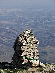
Al-Ghab Plain and Syrian coastal mountains as seen from
200:. Many ancient archaeological sites are located there.
180:
decreased because there was no longer stagnant water.
227:
225:
54:
232:Topography and Hydrology Map of the Orontes valley
8:
272:
270:
268:
296:Mélanges de l'Institut Français de Damas
249:
247:
219:Federal Research Division, 2004, p. 74.
215:
213:
209:
71:, flowing north, enters the Plain near
7:
125:) fisheries of the Orontes valley.
44:
326:Federal Research Division (2004),
75:, around 25 km north-west of
25:
31:Al-Ghab Plain in northwest Syria
1:
386:Salman, Salman M. A. (2009),
366:de Miranda, Adriana (2007),
352:, Rowman & Littlefield,
392:, World Bank Publications,
372:, L'ERMA di BRETSCHNEIDER,
55:
479:
276:de Miranda, 2007, p. 267.
97:The valley separates the
332:, Kessinger Publishing,
165:and other villages. The
61:Al-Suqaylabiyah District
142:
103:Zawiyah mountain range
99:al-Ansariyah mountains
87:
32:
346:Sofer, Arnon (1999),
329:Syria a Country Study
136:
101:in the west from the
85:
30:
285:Salman, 2009, p. 28.
253:Sofer, 1999, p. 205.
420: /
311:Wikimapia location
241:water-security.org
237:2017-04-13 at the
143:
88:
33:
463:Idlib Governorate
424:35.587°N 36.356°E
399:978-0-8213-7953-0
379:978-88-8265-433-7
359:978-0-8476-8511-0
339:978-1-4191-5022-7
53:
16:(Redirected from
470:
458:Hama Governorate
435:
434:
432:
431:
430:
425:
421:
418:
417:
416:
413:
402:
382:
362:
342:
313:
308:
302:
301:(1929), p. 19-25
292:
286:
283:
277:
274:
263:
260:
254:
251:
242:
229:
220:
217:
58:
48:
46:
21:
478:
477:
473:
472:
471:
469:
468:
467:
453:Plains of Syria
438:
437:
428:
426:
422:
419:
414:
411:
409:
407:
406:
400:
385:
380:
365:
360:
345:
340:
325:
322:
317:
316:
309:
305:
293:
289:
284:
280:
275:
266:
261:
257:
252:
245:
239:Wayback Machine
230:
223:
218:
211:
206:
186:
167:dam at Mahardah
131:
111:
45:سَهْلُ ٱلْغَابِ
23:
22:
15:
12:
11:
5:
476:
474:
466:
465:
460:
455:
450:
440:
439:
429:35.587; 36.356
404:
403:
398:
383:
378:
363:
358:
343:
338:
321:
318:
315:
314:
303:
287:
278:
264:
255:
243:
221:
208:
207:
205:
202:
185:
182:
130:
127:
115:Silurus glanis
110:
107:
24:
14:
13:
10:
9:
6:
4:
3:
2:
475:
464:
461:
459:
456:
454:
451:
449:
448:Al-Ghab Plain
446:
445:
443:
436:
433:
401:
395:
391:
390:
384:
381:
375:
371:
370:
364:
361:
355:
351:
350:
344:
341:
335:
331:
330:
324:
323:
319:
312:
307:
304:
300:
297:
291:
288:
282:
279:
273:
271:
269:
265:
259:
256:
250:
248:
244:
240:
236:
233:
228:
226:
222:
216:
214:
210:
203:
201:
199:
195:
191:
183:
181:
179:
174:
172:
168:
164:
160:
156:
152:
148:
140:
139:Apamea, Syria
135:
128:
126:
124:
120:
116:
108:
106:
104:
100:
95:
93:
84:
80:
78:
74:
70:
69:Orontes River
66:
63:in northwest
62:
57:
51:
42:
38:
29:
19:
405:
388:
368:
348:
328:
320:Bibliography
306:
298:
295:
290:
281:
258:
190:al-Ruj Plain
187:
184:Al-Ruj Plain
175:
144:
129:Ghab project
122:
118:
112:
96:
89:
86:Sahl el Ghab
36:
34:
427: /
194:Amouk Plain
171:Zeyzoun Dam
123:samak aswad
92:arable land
56:Sahl al-Ġāb
442:Categories
415:36°21′22″E
412:35°35′13″N
204:References
37:Ghab Plain
18:Ghab plain
109:Fisheries
50:romanized
235:Archived
155:Mahardah
147:barrages
73:Muhradah
178:malaria
52::
396:
376:
356:
336:
163:Qarqur
159:Zayzun
119:sallōr
67:. The
41:Arabic
198:Idlib
151:canal
65:Syria
394:ISBN
374:ISBN
354:ISBN
334:ISBN
77:Hama
35:The
121:or
117:) (
444::
267:^
246:^
224:^
212:^
161:,
157:,
149:,
79:.
47:,
43::
299:1
141:.
39:(
20:)
Text is available under the Creative Commons Attribution-ShareAlike License. Additional terms may apply.