751:
1497:
736:
47:
763:
1005:
302:
823:. A massive mountain ridge, 20 nautical miles (37 km; 23 mi) long and 6 nautical miles (11 km; 6.9 mi) wide, forming the divide between Dugdale Glacier and Murray Glacier. First charted by the BrAE, 1898-1900, under C.E. Borchgrevink, who named the high land between these glaciers Geikie Land, after Sir Archibald Geikie. The generic "Land" has been changed to "Ridge," since it was not appropriate for so small a feature, but Borchgrevink's intent in naming the whole mass has been respected.
67:
1408:. An arm of Robertson Bay, about 5 nautical miles (9.3 km; 5.8 mi) wide, lying between Islands Point and Penelope Point. First visited on Oct. 4, 1911 by the Northern Party, led by Victor Campbell, of the British Antarctic Expedition, 1910-13. So named because they found it necessary to relay their sledges owing to the heavy pressure ridges encountered here. The Nielsen, Ommanney, Crume and Reusch Glaciers flowing into the bay contribute to these pressures.
285:. A glacier, 25 nautical miles (46 km; 29 mi) long, in the north-central Admiralty Mountains. The glacier drains the northern slopes of Mount Adam and flows along the east wall of DuBridge Range to Pressure Bay. Some of the glacier bypasses Pressure Bay and reaches the sea west of Flat Island. The seaward end of the glacier was first mapped by the Northern Party, led by Victor Campbell, of the British Antarctic Expedition, 1910-13. Named by Campbell for Sir
218:
1214:. An arm of Robertson Bay, 3 nautical miles (5.6 km; 3.5 mi) wide, lying between Cape Wood and Birthday Point. Charted and named in 1911 by the Northern Party, led by Campbell, of the British Antarctic Expedition, 1910-13. The Northern Party experienced great difficulty in sledging across the pressure ice fringing the shore of Robertson Bay. This pressure was caused by the adjacent Shipley Glacier descending to the sea ice.
991:. A glacier descending sharply on the west side of Adare Peninsula to discharge into Robertson Bay 4 nautical miles (7.4 km; 4.6 mi) north of Nameless Glacier. First charted by the British Antarctic Expedition, 1898-1900, under C.E. Borchgrevink. The feature was so named by Borchgrevink because southerly gales at Cape Adare were always heralded by a cloud of snow sweeping over this glacier into Robertson Bay.
953:. A glacier that descends westward from Adare Peninsula and discharges into Protection Cove, Robertson Bay, 2 nautical miles (3.7 km; 2.3 mi) north of Newnes Glacier. It was charted and named by the Northern Party of the British Antarctic Expedition, 1910-13. This was the only one of the Robertson Bay glaciers that was left unnamed by C.E. Borchgrevink, who headed the British Antarctic Expedition, 1898-1900.
729:. A glacier about 25 nautical miles (46 km; 29 mi) long, draining northeast from the Admiralty Mountains into Robertson Bay. It flows along the west side of Geikie Ridge before coalescing with Murray Glacier just west of Duke of York Island. Charted by the British Antarctic Expedition, 1898-1900, under C.E. Borchgrevink, who named it for Frank Dugdale, Esq., of Snitterfield, Stratford-on-Avon.
528:
869:. A valley glacier, 20 nautical miles (37 km; 23 mi) long, draining seaward along the east side of Geikie Ridge in the Admiralty Mountains. Its terminus coalesces with that of Dugdale Glacier where both glaciers discharge into Robertson Bay. First charted by the British Antarctic Expedition, 1898-1900, under C.E. Borchgrevink, who named this feature for Sir
74:
1131:
778:
2208:
2164:
1084:. A 480 metres (1,570 ft) high flat-topped island, 3 nautical miles (5.6 km; 3.5 mi) long, lying at the terminus of Shipley Glacier. Its northeast tip, Cape Barrow, marks the west side of the entrance to Robertson Bay. First charted and given this descriptive name by the British Antarctic Expedition, 1910-13.
1696:. A bay, 3 nautical miles (5.6 km; 3.5 mi) wide, lying at the east side of Cape Klovstad where it forms the head of Robertson Bay. First charted by British Antarctic Expedition, 1898-1900, under C.E. Borchgrevink, and so named because the expedition ship Southern Cross found protection here during a gale.
1122:. A small bay formed by the configuration of the ice at the terminus of Shipley Glacier and the northwest side of Flat Island. Charted by the Northern Party, led by Campbell, of the British Antarctic Expedition, 1910-13, and so named by them because they heard a noise like a ship's siren while mapping this area.
1370:. A high rock point separating Berg Bay and Relay Bay, lying along the west shore of Robertson Bay. Charted by the Northern Party of British Antarctic Expedition, 1910-13, under Capt. Robert Scott. Probably named with reference to the small island (Sphinx Rock) which lies just north of the point.
229:
in the east. Protection Cove in the south is the head of the bay. Cape Barrow is on Flat Island, east of Siren Bay and north of Cape Wood. Shipley
Glacier divides and enters Robertson Bay to the west and to the south of the island, where it flows into Pressure Bay. Frank Newnes Glacier also flows
233:
Reusch
Glacier, Crume Glacier, Ommanney Glacier and Nielsen Glacier drain into Relay Bay, the last entering beside Calf Point to the west of Penelope Point and the Scott Keltie Glacier. Southwest of this the Egeberg Glacier enters the bay just north of the Dugdale Glacier and the Murray Glacier,
565:. Valley glacier, 20 nautical miles (37 km; 23 mi) long, meandering northward in the Admiralty Mountains to discharge into Relay Bay, on the west side of Robertson Bay. Charted by the British Antarctic Expedition, 1898-1900, under C.E. Borchgrevink, who named it for Admiral Sir
339:. A peak over 1,800 metres (5,900 ft) in the north part of the Admiralty Mountains, Victoria Land. It rises between Shipley Glacier and Crume Glacier, 8 nautical miles (15 km; 9.2 mi) southwest of Birthday Point. The feature was named by the BrAE, 1910-13, after
1446:. A point between the terminus of Nielsen Glacier and Penelope Point on the west shore of Robertson Bay. Charted and named in 1911 by the Northern Party, led by Campbell, of the British Antarctic Expedition 1910-13. Named because of the great number of young seals seen here.
691:. A small glacier between Scott Keltie Glacier and Dugdale Glacier, flowing into the west side of Robertson Bay. First charted by the British Antarctic Expedition, 1898-1900, under C.E. Borchgrevink, who named it for Consul Wye Egeberg of Christiania (now Oslo), Norway.
1658:. A rugged rock point between Colbeck Bay and Protection Cove in the south part of Robertson Bay. First charted by British Antarctic Expedition, 1898-1900, under C.E. Borchgrevink, who named the feature for Dr. Herlof Klovstad, Medical Officer of the expedition.
1620:. A cove between Duke of York Island and Cape Klovstad in the south part of Robertson Bay. First charted by British Antarctic Expedition, 1898-1900, under C.E. Borchgrevink, who named it for Lieutenant William Colbeck, RNR, magnetic observer of the expedition.
507:. A tributary glacier, 5 nautical miles (9.3 km; 5.8 mi) long, flowing east to enter Ommanney Glacier near the north coast of Victoria Land. Mapped by the USGS from surveys and United States Navy air photos, 1960-63. Named by the United States
607:. Glacier, 4 nautical miles (7.4 km; 4.6 mi) long, discharging into the west side of Robertson Bay just west of Calf Point. First charted by the British Antarctic Expedition, 1898-1900, under C.E. Borchgrevink, who named it for Prof.
1582:. A cove in the northeast side of Duke of York Island in Robertson Bay. Charted and so named because of its shape by the British Antarctic Expedition, 1898-1900, under C.E. Borchgrevink. The feature is the site of an Adélie penguin rookery.
1484:. A bold rock headland between Nielsen Glacier and Scott Keltie Glacier. First charted by the Northern Party, led by Campbell, of the British Antarctic Expedition, 1910-13. Named by them after the nickname "Penelope" given to Lieutenant
750:
1540:. A mountainous ice-free island, 2.5 nautical miles (4.6 km; 2.9 mi) long, lying in the south part of Robertson Bay. First charted in 1899 by the British Antarctic Expedition under C.E. Borchgrevink, who named it for the
2212:
2168:
911:. A glacier that drops sharply from the Adare Saddle to empty into Protection Cove at the head of Robertson Bay. Charted by the British Antarctic Expedition, 1898-1900, under C.E. Borchgrevink, who named it for Sir
1332:. A high rock (or island) lying in front of Islands Point in the west part of Robertson Bay. Charted by the Northern Party, led by Campbell, of British Antarctic Expedition, 1910-13, who named it for its shape.
381:. A short glacier discharging into the head of Pressure Bay. First charted by the British Antarctic Expedition, 1898-1900, which named the feature for Frank Newnes, the only son of the expedition sponsor, Sir
735:
649:. A very small glacier discharging into Robertson Bay between Penelope Point and Egeberg Glacier. First charted by the British Antarctic Expedition, 1898-1900, under C.E. Borchgrevink. He named it for Sir
465:. A very small glacier descending into Relay Bay immediately east of Islands Point. First charted by British Antarctic Expedition, 1898-1900, under C.E. Borchgrevink, who named this feature for Professor
1046:, founder of the Royal Geographic Society, 1830, and Secretary of the Admiralty, 1807-45. The feature was mapped as a point on Flat Island by the British Antarctic Expedition, 1910-13, led by Scott.
238:
rookery. Southeast of this are
Colbeck Bay, Cape Klovstad and Protection Cove, which receives the Newnes Glacier and the Nameless Glacier. Warning Glacier flows into the bay from further north on the
1042:. The high, northern point of Flat Island, marking the west side of the entrance to Robertson Bay. Capt. James Ross, in January 1840, applied this name to a cape of the mainland, honoring Sir
762:
230:
into
Pressure Bay, which is divided by Birthday Point from Berg Bay. Haffner Glacier empties into Berg Bay. The Sphinx Rock and Islands Point separate Berg Bay from Relay Bay.
1294:
of the
British Antarctic Expedition, 1910-13, because icebergs appear to gravitate there. Haffner Glacier which flows into this bay may also contribute icebergs.
1252:. A bold rock point between Pressure Bay and Berg Bay. Charted and named by the Northern Party, led by Campbell, of the British Antarctic Expedition, 1910-13.
115:
777:
2172:
1290:. Small bay between Birthday Point and Islands Point in the west side of Robertson Bay. Charted and named in 1911 by the Northern Party led by
508:
832:
1173:
1168:. A point marking the east extremity of Flat Island at the western entrance to Robertson Bay. Discovered in January 1841 by Captain
66:
1496:
1505:
2216:
290:
2231:
1043:
511:(US-ACAN) for William R. Crume, AS1, United States Navy, Support Equipment Maintenance Supervisor with Squadron VX-6 at
289:, master of Christ's College, Cambridge, England, at the suggestion of Priestley. The entire glacier was mapped by the
870:
46:
423:. A small glacier discharging into Berg Bay. First charted by the British Antarctic Expedition, 1898-1900, under
1668:
1630:
1592:
1554:
1512:
1456:
1418:
1380:
1342:
1304:
1262:
1224:
1186:
1140:
1094:
1056:
1014:
963:
925:
883:
841:
795:
701:
663:
621:
579:
537:
479:
437:
395:
353:
311:
257:
154:
1004:
301:
2236:
1291:
516:
769:
742:
424:
2182:
First on the
Antarctic continent: Being an account of the British Antarctic expedition, 1898-1900
466:
650:
235:
217:
203:
1169:
566:
195:
512:
239:
31:
608:
286:
2189:
2225:
1485:
912:
382:
187:
101:
2180:
17:
2146:
756:
Termination of
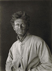
Moraine at Dugdale Glacier ca November 1899, by Carsten Borchgrevink
527:
340:
1130:
427:, who named it for Colonel Haffner, Director of the Government Survey of Norway.
831:
226:
199:
191:
87:
1683:
1670:
1645:
1632:
1607:
1594:
1569:
1556:
1527:
1514:
1471:
1458:
1433:
1420:
1395:
1382:
1357:
1344:
1319:
1306:
1277:
1264:
1239:
1226:
1201:
1188:
1155:
1142:
1109:
1096:
1071:
1058:
1029:
1016:
978:
965:
940:
927:
898:
885:
856:
843:
810:
797:
716:
703:
678:
665:
636:
623:
594:
581:
552:
539:
494:
481:
452:
439:
410:
397:
368:
355:
326:
313:
272:
259:
169:
156:
130:
117:
234:
which enters the bay west of Duke of York Island, home of the
Crescent Bay
242:, which defines the east coast of the bay, extending north to Cape Adare.
1541:
1495:
1129:
1003:
830:
526:
300:
216:
183:
1872:
1870:
225:
Robertson Bay extends between Cape Barrow in the west and
1857:
1855:
1722:
1720:
469:, then president of the Norwegian Geographical Society.
2154:(2 ed.), United States Board on Geographic Names
569:, who had served in the Arctic Expedition of 1850.
107:
97:
39:
202:, who named it for Dr. John Robertson, surgeon on
741:Moraine at Dugdale Glacier, ca November 1899 by
108:
1488:, commander of the expedition ship Terra Nova.
653:, Secretary of the Royal Geographical Society.
8:
1876:
343:(1887-1975), physicist with the expedition.
1726:
36:
2194:, USGS: United States Geological Survey
2173:United States Board on Geographic Names
2128:
2116:
2104:
2092:
2080:
2068:
2056:
2044:
2032:
2020:
2008:
1996:
1984:
1972:
1960:
1948:
1936:
1924:
1912:
1900:
1888:
1861:
1846:
1834:
1822:
1810:
1798:
1786:
1774:
1762:
1750:
1738:
1711:
1704:
873:of the Challenger expedition, 1872-76.
731:
509:Advisory Committee on Antarctic Names
73:
7:
1176:, First Secretary to the Admiralty.
768:Murray Glacier ca. November 1899 by
1172:, Royal Navy, and named by him for
611:of Christiania University, Norway.
2215:from websites or documents of the
2171:from websites or documents of the
1134:Charles Wood, 1st Viscount Halifax
25:
2148:Geographic Names of the Antarctic
182:) is a large, roughly triangular
2211: This article incorporates
2206:
2167: This article incorporates
2162:
1506:Duke of York Island (Antarctica)
776:
761:
749:
734:
194:. Discovered in 1841 by Captain
186:that indents the north coast of
72:
65:
53:First on the Antarctic continent
45:
2217:United States Geological Survey
291:United States Geological Survey
2179:Borchgrevink, Carsten (1901),
2145:Alberts, Fred G., ed. (1995),
221:Robertson Bay in center of map
30:For the bay in Greenland, see
1:
915:, sponsor of the expedition.
96:
1008:Sir John Barrow, 1st Baronet
425:Carsten Egeberg Borchgrevink
305:Charles Seymour Wright, 1912
2253:
1503:
29:
60:
44:
190:between Cape Barrow and
1486:Harry Lewin Lee Pennell
2213:public domain material
2169:public domain material
1501:
1135:
1009:
836:
783:Murray Glacier c. 1900
532:
306:
222:
51:Map of Robertson Bay,
2232:Bays of Victoria Land
1499:
1133:
1007:
834:
530:
517:Operation Deep Freeze
304:
220:
770:Carsten Borchgrevink
743:Carsten Borchgrevink
615:Scott Keltie Glacier
347:Frank Newnes Glacier
18:Scott Keltie Glacier
1927:, pp. 515–516.
1825:, pp. 525–526.
1680: /
1642: /
1604: /
1566: /
1524: /
1500:Duke of York Island
1492:Duke of York Island
1468: /
1430: /
1392: /
1354: /
1316: /
1274: /
1236: /
1198: /
1152: /
1106: /
1068: /
1026: /
975: /
937: /
895: /
853: /
807: /
713: /
675: /
633: /
591: /
549: /
491: /
449: /
407: /
365: /
323: /
293:(USGS) in 1960-63.
269: /
166: /
127: /
1684:71.650°S 170.200°E
1646:71.650°S 170.100°E
1608:71.633°S 170.083°E
1570:71.617°S 170.067°E
1528:71.633°S 170.067°E
1502:
1472:71.500°S 169.783°E
1434:71.500°S 169.750°E
1396:71.500°S 169.533°E
1358:71.467°S 169.517°E
1320:71.450°S 169.500°E
1278:71.450°S 169.450°E
1240:71.433°S 169.400°E
1202:71.417°S 169.333°E
1156:71.400°S 169.300°E
1136:
1110:71.367°S 169.250°E
1072:71.400°S 169.300°E
1030:71.367°S 169.283°E
1010:
979:71.533°S 170.350°E
941:71.633°S 170.300°E
899:71.683°S 170.233°E
857:71.650°S 170.000°E
837:
811:71.733°S 169.600°E
717:71.633°S 169.833°E
679:71.567°S 169.833°E
637:71.533°S 169.817°E
595:71.517°S 169.683°E
553:71.533°S 169.483°E
533:
495:71.550°S 169.350°E
467:Hans Henrik Reusch
453:71.483°S 169.483°E
411:71.467°S 169.400°E
369:71.467°S 169.317°E
327:71.550°S 169.167°E
307:
273:71.433°S 169.200°E
223:
170:71.417°S 170.000°E
131:71.417°S 170.000°E
1877:Borchgrevink 1901
651:John Scott Keltie
341:Charles S. Wright
146:
145:
27:Bay in Antarctica
16:(Redirected from
2244:
2210:
2209:
2201:
2200:
2199:
2185:
2166:
2165:
2161:
2160:
2159:
2153:
2132:
2126:
2120:
2114:
2108:
2102:
2096:
2090:
2084:
2078:
2072:
2066:
2060:
2054:
2048:
2042:
2036:
2030:
2024:
2018:
2012:
2006:
2000:
1994:
1988:
1982:
1976:
1970:
1964:
1958:
1952:
1946:
1940:
1934:
1928:
1922:
1916:
1910:
1904:
1898:
1892:
1886:
1880:
1874:
1865:
1859:
1850:
1844:
1838:
1832:
1826:
1820:
1814:
1808:
1802:
1796:
1790:
1784:
1778:
1772:
1766:
1760:
1754:
1748:
1742:
1736:
1730:
1724:
1715:
1709:
1695:
1694:
1692:
1691:
1690:
1689:-71.650; 170.200
1685:
1681:
1678:
1677:
1676:
1673:
1657:
1656:
1654:
1653:
1652:
1651:-71.650; 170.100
1647:
1643:
1640:
1639:
1638:
1635:
1619:
1618:
1616:
1615:
1614:
1613:-71.633; 170.083
1609:
1605:
1602:
1601:
1600:
1597:
1581:
1580:
1578:
1577:
1576:
1575:-71.617; 170.067
1571:
1567:
1564:
1563:
1562:
1559:
1539:
1538:
1536:
1535:
1534:
1533:-71.633; 170.067
1529:
1525:
1522:
1521:
1520:
1517:
1483:
1482:
1480:
1479:
1478:
1477:-71.500; 169.783
1473:
1469:
1466:
1465:
1464:
1461:
1445:
1444:
1442:
1441:
1440:
1439:-71.500; 169.750
1435:
1431:
1428:
1427:
1426:
1423:
1407:
1406:
1404:
1403:
1402:
1401:-71.500; 169.533
1397:
1393:
1390:
1389:
1388:
1385:
1369:
1368:
1366:
1365:
1364:
1363:-71.467; 169.517
1359:
1355:
1352:
1351:
1350:
1347:
1331:
1330:
1328:
1327:
1326:
1325:-71.450; 169.500
1321:
1317:
1314:
1313:
1312:
1309:
1289:
1288:
1286:
1285:
1284:
1283:-71.450; 169.450
1279:
1275:
1272:
1271:
1270:
1267:
1251:
1250:
1248:
1247:
1246:
1245:-71.433; 169.400
1241:
1237:
1234:
1233:
1232:
1229:
1213:
1212:
1210:
1209:
1208:
1207:-71.417; 169.333
1203:
1199:
1196:
1195:
1194:
1191:
1167:
1166:
1164:
1163:
1162:
1161:-71.400; 169.300
1157:
1153:
1150:
1149:
1148:
1145:
1121:
1120:
1118:
1117:
1116:
1115:-71.367; 169.250
1111:
1107:
1104:
1103:
1102:
1099:
1083:
1082:
1080:
1079:
1078:
1077:-71.400; 169.300
1073:
1069:
1066:
1065:
1064:
1061:
1041:
1040:
1038:
1037:
1036:
1035:-71.367; 169.283
1031:
1027:
1024:
1023:
1022:
1019:
990:
989:
987:
986:
985:
984:-71.533; 170.350
980:
976:
973:
972:
971:
968:
952:
951:
949:
948:
947:
946:-71.633; 170.300
942:
938:
935:
934:
933:
930:
919:Nameless Glacier
910:
909:
907:
906:
905:
904:-71.683; 170.233
900:
896:
893:
892:
891:
888:
868:
867:
865:
864:
863:
862:-71.650; 170.000
858:
854:
851:
850:
849:
846:
822:
821:
819:
818:
817:
816:-71.733; 169.600
812:
808:
805:
804:
803:
800:
780:
765:
753:
738:
728:
727:
725:
724:
723:
722:-71.633; 169.833
718:
714:
711:
710:
709:
706:
690:
689:
687:
686:
685:
684:-71.567; 169.833
680:
676:
673:
672:
671:
668:
648:
647:
645:
644:
643:
642:-71.533; 169.817
638:
634:
631:
630:
629:
626:
606:
605:
603:
602:
601:
600:-71.517; 169.683
596:
592:
589:
588:
587:
584:
567:Erasmus Ommanney
564:
563:
561:
560:
559:
558:-71.533; 169.483
554:
550:
547:
546:
545:
542:
531:Adare Peninsula
523:Ommanney Glacier
506:
505:
503:
502:
501:
500:-71.550; 169.350
496:
492:
489:
488:
487:
484:
464:
463:
461:
460:
459:
458:-71.483; 169.483
454:
450:
447:
446:
445:
442:
422:
421:
419:
418:
417:
416:-71.467; 169.400
412:
408:
405:
404:
403:
400:
380:
379:
377:
376:
375:
374:-71.467; 169.317
370:
366:
363:
362:
361:
358:
338:
337:
335:
334:
333:
332:-71.550; 169.167
328:
324:
321:
320:
319:
316:
284:
283:
281:
280:
279:
278:-71.433; 169.200
274:
270:
267:
266:
265:
262:
196:James Clark Ross
181:
180:
178:
177:
176:
175:-71.417; 170.000
171:
167:
164:
163:
162:
159:
142:
141:
139:
138:
137:
136:-71.417; 170.000
132:
128:
125:
124:
123:
120:
110:
76:
75:
69:
49:
37:
21:
2252:
2251:
2247:
2246:
2245:
2243:
2242:
2241:
2222:
2221:
2207:
2204:
2197:
2195:
2188:
2178:
2163:
2157:
2155:
2151:
2144:
2140:
2135:
2127:
2123:
2115:
2111:
2103:
2099:
2091:
2087:
2079:
2075:
2067:
2063:
2055:
2051:
2043:
2039:
2031:
2027:
2019:
2015:
2007:
2003:
1995:
1991:
1983:
1979:
1971:
1967:
1959:
1955:
1947:
1943:
1935:
1931:
1923:
1919:
1911:
1907:
1899:
1895:
1887:
1883:
1875:
1868:
1860:
1853:
1845:
1841:
1833:
1829:
1821:
1817:
1809:
1805:
1797:
1793:
1785:
1781:
1773:
1769:
1761:
1757:
1749:
1745:
1737:
1733:
1727:Cape Adare USGS
1725:
1718:
1710:
1706:
1702:
1688:
1686:
1682:
1679:
1674:
1671:
1669:
1667:
1666:
1664:
1662:Protection Cove
1650:
1648:
1644:
1641:
1636:
1633:
1631:
1629:
1628:
1626:
1612:
1610:
1606:
1603:
1598:
1595:
1593:
1591:
1590:
1588:
1574:
1572:
1568:
1565:
1560:
1557:
1555:
1553:
1552:
1550:
1532:
1530:
1526:
1523:
1518:
1515:
1513:
1511:
1510:
1508:
1494:
1476:
1474:
1470:
1467:
1462:
1459:
1457:
1455:
1454:
1452:
1438:
1436:
1432:
1429:
1424:
1421:
1419:
1417:
1416:
1414:
1400:
1398:
1394:
1391:
1386:
1383:
1381:
1379:
1378:
1376:
1362:
1360:
1356:
1353:
1348:
1345:
1343:
1341:
1340:
1338:
1324:
1322:
1318:
1315:
1310:
1307:
1305:
1303:
1302:
1300:
1292:Victor Campbell
1282:
1280:
1276:
1273:
1268:
1265:
1263:
1261:
1260:
1258:
1244:
1242:
1238:
1235:
1230:
1227:
1225:
1223:
1222:
1220:
1206:
1204:
1200:
1197:
1192:
1189:
1187:
1185:
1184:
1182:
1160:
1158:
1154:
1151:
1146:
1143:
1141:
1139:
1138:
1128:
1114:
1112:
1108:
1105:
1100:
1097:
1095:
1093:
1092:
1090:
1076:
1074:
1070:
1067:
1062:
1059:
1057:
1055:
1054:
1052:
1034:
1032:
1028:
1025:
1020:
1017:
1015:
1013:
1012:
1002:
997:
983:
981:
977:
974:
969:
966:
964:
962:
961:
959:
957:Warning Glacier
945:
943:
939:
936:
931:
928:
926:
924:
923:
921:
903:
901:
897:
894:
889:
886:
884:
882:
881:
879:
861:
859:
855:
852:
847:
844:
842:
840:
839:
835:Sir John Murray
829:
815:
813:
809:
806:
801:
798:
796:
794:
793:
791:
784:
781:
772:
766:
757:
754:
745:
739:
721:
719:
715:
712:
707:
704:
702:
700:
699:
697:
695:Dugdale Glacier
683:
681:
677:
674:
669:
666:
664:
662:
661:
659:
657:Egeberg Glacier
641:
639:
635:
632:
627:
624:
622:
620:
619:
617:
599:
597:
593:
590:
585:
582:
580:
578:
577:
575:
573:Nielsen Glacier
557:
555:
551:
548:
543:
540:
538:
536:
535:
525:
513:McMurdo Station
499:
497:
493:
490:
485:
482:
480:
478:
477:
475:
457:
455:
451:
448:
443:
440:
438:
436:
435:
433:
415:
413:
409:
406:
401:
398:
396:
394:
393:
391:
389:Haffner Glacier
373:
371:
367:
364:
359:
356:
354:
352:
351:
349:
331:
329:
325:
322:
317:
314:
312:
310:
309:
299:
277:
275:
271:
268:
263:
260:
258:
256:
255:
253:
251:Shipley Glacier
248:
240:Adare Peninsula
215:
174:
172:
168:
165:
160:
157:
155:
153:
152:
135:
133:
129:
126:
121:
118:
116:
114:
113:
93:
92:
91:
90:
84:
83:
82:
81:
77:
56:
35:
32:Robertson Fjord
28:
23:
22:
15:
12:
11:
5:
2250:
2248:
2240:
2239:
2234:
2224:
2223:
2203:
2202:
2186:
2176:
2141:
2139:
2136:
2134:
2133:
2131:, p. 593.
2121:
2119:, p. 397.
2109:
2107:, p. 144.
2097:
2095:, p. 161.
2085:
2083:, p. 566.
2073:
2071:, p. 112.
2061:
2059:, p. 612.
2049:
2047:, p. 364.
2037:
2035:, p. 701.
2025:
2013:
2001:
1999:, p. 589.
1989:
1987:, p. 822.
1977:
1975:, p. 678.
1965:
1963:, p. 244.
1953:
1941:
1939:, p. 796.
1929:
1917:
1915:, p. 524.
1905:
1903:, p. 513.
1893:
1891:, p. 272.
1881:
1866:
1864:, p. 203.
1851:
1849:, p. 213.
1839:
1837:, p. 657.
1827:
1815:
1813:, p. 544.
1803:
1801:, p. 164.
1791:
1789:, p. 614.
1779:
1777:, p. 304.
1767:
1765:, p. 258.
1755:
1753:, p. 824.
1743:
1741:, p. 671.
1731:
1716:
1714:, p. 623.
1703:
1701:
1698:
1663:
1660:
1625:
1622:
1587:
1584:
1549:
1546:
1504:Main article:
1493:
1490:
1451:
1450:Penelope Point
1448:
1413:
1410:
1375:
1372:
1337:
1334:
1299:
1296:
1257:
1254:
1219:
1218:Birthday Point
1216:
1181:
1178:
1127:
1124:
1089:
1086:
1051:
1048:
1001:
998:
996:
995:Other features
993:
958:
955:
920:
917:
878:
877:Newnes Glacier
875:
828:
827:Murray Glacier
825:
790:
787:
786:
785:
782:
775:
773:
767:
760:
758:
755:
748:
746:
740:
733:
696:
693:
658:
655:
616:
613:
609:Yngvar Nielsen
574:
571:
524:
521:
474:
471:
432:
431:Reusch Glacier
429:
390:
387:
348:
345:
298:
295:
287:Arthur Shipley
252:
249:
247:
244:
236:Adélie penguin
214:
211:
144:
143:
111:
105:
104:
99:
95:
94:
85:
79:
78:
71:
70:
64:
63:
62:
61:
58:
57:
50:
42:
41:
26:
24:
14:
13:
10:
9:
6:
4:
3:
2:
2249:
2238:
2237:Pennell Coast
2235:
2233:
2230:
2229:
2227:
2220:
2218:
2214:
2193:
2192:
2187:
2184:
2183:
2177:
2174:
2170:
2150:
2149:
2143:
2142:
2137:
2130:
2125:
2122:
2118:
2113:
2110:
2106:
2101:
2098:
2094:
2089:
2086:
2082:
2077:
2074:
2070:
2065:
2062:
2058:
2053:
2050:
2046:
2041:
2038:
2034:
2029:
2026:
2023:, p. 60.
2022:
2017:
2014:
2011:, p. 68.
2010:
2005:
2002:
1998:
1993:
1990:
1986:
1981:
1978:
1974:
1969:
1966:
1962:
1957:
1954:
1951:, p. 48.
1950:
1945:
1942:
1938:
1933:
1930:
1926:
1921:
1918:
1914:
1909:
1906:
1902:
1897:
1894:
1890:
1885:
1882:
1878:
1873:
1871:
1867:
1863:
1858:
1856:
1852:
1848:
1843:
1840:
1836:
1831:
1828:
1824:
1819:
1816:
1812:
1807:
1804:
1800:
1795:
1792:
1788:
1783:
1780:
1776:
1771:
1768:
1764:
1759:
1756:
1752:
1747:
1744:
1740:
1735:
1732:
1728:
1723:
1721:
1717:
1713:
1708:
1705:
1699:
1697:
1693:
1661:
1659:
1655:
1624:Cape Klövstad
1623:
1621:
1617:
1585:
1583:
1579:
1547:
1545:
1543:
1537:
1507:
1498:
1491:
1489:
1487:
1481:
1449:
1447:
1443:
1411:
1409:
1405:
1373:
1371:
1367:
1336:Islands Point
1335:
1333:
1329:
1297:
1295:
1293:
1287:
1255:
1253:
1249:
1217:
1215:
1211:
1179:
1177:
1175:
1171:
1165:
1132:
1125:
1123:
1119:
1087:
1085:
1081:
1049:
1047:
1045:
1039:
1006:
999:
994:
992:
988:
956:
954:
950:
918:
916:
914:
913:George Newnes
908:
876:
874:
872:
866:
833:
826:
824:
820:
788:
779:
774:
771:
764:
759:
752:
747:
744:
737:
732:
730:
726:
694:
692:
688:
656:
654:
652:
646:
614:
612:
610:
604:
572:
570:
568:
562:
529:
522:
520:
518:
514:
510:
504:
473:Crume Glacier
472:
470:
468:
462:
430:
428:
426:
420:
388:
386:
384:
383:George Newnes
378:
346:
344:
342:
336:
303:
296:
294:
292:
288:
282:
250:
245:
243:
241:
237:
231:
228:
219:
212:
210:
208:
207:
201:
197:
193:
189:
188:Victoria Land
185:
179:
150:
149:Robertson Bay
140:
112:
106:
103:
102:Victoria Land
100:
89:
80:Robertson Bay
68:
59:
54:
48:
43:
40:Robertson Bay
38:
33:
19:
2205:
2196:, retrieved
2190:
2181:
2156:, retrieved
2147:
2129:Alberts 1995
2124:
2117:Alberts 1995
2112:
2105:Alberts 1995
2100:
2093:Alberts 1995
2088:
2081:Alberts 1995
2076:
2069:Alberts 1995
2064:
2057:Alberts 1995
2052:
2045:Alberts 1995
2040:
2033:Alberts 1995
2028:
2021:Alberts 1995
2016:
2009:Alberts 1995
2004:
1997:Alberts 1995
1992:
1985:Alberts 1995
1980:
1973:Alberts 1995
1968:
1961:Alberts 1995
1956:
1949:Alberts 1995
1944:
1937:Alberts 1995
1932:
1925:Alberts 1995
1920:
1913:Alberts 1995
1908:
1901:Alberts 1995
1896:
1889:Alberts 1995
1884:
1862:Alberts 1995
1847:Alberts 1995
1842:
1835:Alberts 1995
1830:
1823:Alberts 1995
1818:
1811:Alberts 1995
1806:
1799:Alberts 1995
1794:
1787:Alberts 1995
1782:
1775:Alberts 1995
1770:
1763:Alberts 1995
1758:
1751:Alberts 1995
1746:
1739:Alberts 1995
1734:
1712:Alberts 1995
1707:
1665:
1627:
1589:
1551:
1548:Crescent Bay
1542:Duke of York
1509:
1453:
1415:
1377:
1339:
1301:
1259:
1221:
1183:
1180:Pressure Bay
1174:Charles Wood
1137:
1091:
1053:
1011:
960:
922:
880:
838:
792:
789:Geikie Ridge
698:
660:
618:
576:
534:
476:
434:
392:
350:
308:
297:Mount Wright
254:
232:
224:
205:
148:
147:
86:Location in
52:
1687: /
1649: /
1611: /
1586:Colbeck Bay
1573: /
1531: /
1475: /
1437: /
1399: /
1361: /
1323: /
1298:Sphinx Rock
1281: /
1243: /
1205: /
1159: /
1113: /
1075: /
1050:Flat Island
1044:John Barrow
1033: /
1000:Cape Barrow
982: /
944: /
902: /
871:John Murray
860: /
814: /
720: /
682: /
640: /
598: /
556: /
498: /
456: /
414: /
372: /
330: /
276: /
173: /
134: /
109:Coordinates
2226:Categories
2198:2024-01-23
2191:Cape Adare
2158:2024-01-21
1700:References
1412:Calf Point
1170:James Ross
227:Cape Adare
200:Royal Navy
192:Cape Adare
88:Antarctica
1374:Relay Bay
1126:Cape Wood
1088:Siren Bay
1675:170°12′E
1637:170°06′E
1599:170°05′E
1561:170°04′E
1519:170°04′E
1463:169°47′E
1425:169°45′E
1387:169°32′E
1349:169°31′E
1311:169°30′E
1269:169°27′E
1256:Berg Bay
1231:169°24′E
1193:169°20′E
1147:169°18′E
1101:169°15′E
1063:169°18′E
1021:169°17′E
970:170°21′E
932:170°18′E
890:170°14′E
848:170°00′E
802:169°36′E
708:169°50′E
670:169°50′E
628:169°49′E
586:169°41′E
544:169°29′E
486:169°21′E
444:169°29′E
402:169°24′E
360:169°19′E
318:169°10′E
264:169°12′E
246:Glaciers
213:Features
161:170°00′E
98:Location
2138:Sources
1672:71°39′S
1634:71°39′S
1596:71°38′S
1558:71°37′S
1516:71°38′S
1460:71°30′S
1422:71°30′S
1384:71°30′S
1346:71°28′S
1308:71°27′S
1266:71°27′S
1228:71°26′S
1190:71°25′S
1144:71°24′S
1098:71°22′S
1060:71°24′S
1018:71°22′S
967:71°32′S
929:71°38′S
887:71°41′S
845:71°39′S
799:71°44′S
705:71°38′S
667:71°34′S
625:71°32′S
583:71°31′S
541:71°32′S
515:during
483:71°33′S
441:71°29′S
399:71°28′S
357:71°28′S
315:71°33′S
261:71°26′S
158:71°25′S
122:170°0′E
119:71°25′S
519:1968.
206:Terror
55:, 1901
2152:(PDF)
204:HMS
184:bay
2228::
2219:.
1869:^
1854:^
1719:^
1544:.
385:.
209:.
198:,
2175:.
1879:.
1729:.
151:(
34:.
20:)
Text is available under the Creative Commons Attribution-ShareAlike License. Additional terms may apply.