33:
61:
366:
68:
40:
197:, flows beyond the western end of the Soutpansberg Conservancy. The Waterpoort, the deep gorge cut by the Sand River across the range is located in the central part of the protected area.
32:
60:
431:
117:
407:
426:
346:
436:
241:
400:
271:
185:. The reserve has an area of about 90,000 Ha and consists mostly in the mountainous terrain of the western part of the
296:"Population dynamics and threats to an apex predator outside protected areas: implications for carnivore management"
282:
393:
351:
260:
194:
272:
Major vegetation types of the
Soutpansberg Conservancy and the Blouberg Nature Reserve, South Africa
365:
217:
294:
Williams, Samual T.; Williams, Kathryn S.; Lewis, Bradley P.; Hill, Russell A. (19 April 2017).
325:
200:
The
Soutpansberg or “Tha vhani ya muno” (mountain of salt) is in the traditional area of the
315:
307:
105:
377:
320:
295:
174:
420:
229:
201:
186:
182:
95:
225:
213:
205:
190:
132:
119:
329:
311:
373:
178:
91:
221:
209:
232:
and large mammals such as leopards are found in some areas.
381:
156:
148:
111:
101:
87:
47:
20:
67:
39:
347:Soutpansberg Conservancy and surrounding areas
401:
8:
408:
394:
17:
319:
253:
75:Soutpansberg Conservancy (South Africa)
352:Soutpansberg Conservancy Accommodation
204:. It is rich in plant diversity with
177:situated in the northern part of the
7:
362:
360:
228:. The rocky summits are a haven for
86:
432:Nature conservation in South Africa
14:
364:
171:Western Soutpansberg Conservancy
66:
59:
38:
31:
242:Protected areas of South Africa
100:
1:
160:Limpopo Provincial Government
380:. You can help Knowledge by
453:
427:Protected areas of Limpopo
359:
300:Royal Society Open Science
25:
167:Soutpansberg Conservancy
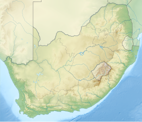
78:Show map of South Africa
21:Soutpansberg Conservancy
437:Limpopo geography stubs
376:location article is a
193:, a tributary of the
133:22.97500°S 29.56667°E
312:10.1098/rsos.161090
218:giant cabbage trees
212:species, including
157:Governing body
138:-22.97500; 29.56667
129: /
50:Show map of Limpopo
261:Venda Village Tour
389:
388:
164:
163:
102:Nearest city
444:
410:
403:
396:
368:
361:
334:
333:
323:
291:
285:
280:
274:
269:
263:
258:
169:, also known as
144:
143:
141:
140:
139:
134:
130:
127:
126:
125:
122:
79:
70:
69:
63:
51:
42:
41:
35:
18:
452:
451:
447:
446:
445:
443:
442:
441:
417:
416:
415:
414:
357:
343:
338:
337:
293:
292:
288:
283:Fauna and Flora
281:
277:
270:
266:
259:
255:
250:
238:
137:
135:
131:
128:
123:
120:
118:
116:
115:
106:Louis Trichardt
83:
82:
81:
80:
77:
76:
73:
72:
71:
54:
53:
52:
49:
48:
45:
44:
43:
12:
11:
5:
450:
448:
440:
439:
434:
429:
419:
418:
413:
412:
405:
398:
390:
387:
386:
369:
355:
354:
349:
342:
341:External links
339:
336:
335:
286:
275:
264:
252:
251:
249:
246:
245:
244:
237:
234:
208:trees, twelve
175:protected area
162:
161:
158:
154:
153:
150:
146:
145:
113:
109:
108:
103:
99:
98:
89:
85:
84:
74:
65:
64:
58:
57:
56:
55:
46:
37:
36:
30:
29:
28:
27:
26:
23:
22:
13:
10:
9:
6:
4:
3:
2:
449:
438:
435:
433:
430:
428:
425:
424:
422:
411:
406:
404:
399:
397:
392:
391:
385:
383:
379:
375:
370:
367:
363:
358:
353:
350:
348:
345:
344:
340:
331:
327:
322:
317:
313:
309:
306:(4): 161090.
305:
301:
297:
290:
287:
284:
279:
276:
273:
268:
265:
262:
257:
254:
247:
243:
240:
239:
235:
233:
231:
230:birds of prey
227:
223:
219:
215:
211:
207:
203:
198:
196:
192:
188:
184:
180:
176:
172:
168:
159:
155:
151:
147:
142:
114:
110:
107:
104:
97:
93:
90:
62:
34:
24:
19:
16:
382:expanding it
371:
356:
303:
299:
289:
278:
267:
256:
224:and ancient
202:Venda people
199:
187:Soutpansberg
183:South Africa
181:province of
170:
166:
165:
96:South Africa
15:
214:fever trees
189:Range. The
136: /
112:Coordinates
421:Categories
248:References
226:tree ferns
206:yellowwood
195:Sand River
191:Brak River
121:22°58′30″S
152:90,000 ha
124:29°34′0″E
330:28484625
236:See also
88:Location
374:Limpopo
321:5414262
222:proteas
179:Limpopo
173:, is a
92:Limpopo
328:
318:
210:acacia
372:This
378:stub
326:PMID
149:Area
316:PMC
308:doi
423::
324:.
314:.
302:.
298:.
220:,
216:,
94:,
409:e
402:t
395:v
384:.
332:.
310::
304:4
Text is available under the Creative Commons Attribution-ShareAlike License. Additional terms may apply.